Apa itu ilmu geografi ? Geografi Kelas 10 | EDURAYA MENGAJAR
Summary
TLDRThis video explores the fascinating development of geography, starting from ancient Greek contributions by Eratosthenes and Aristotle to the role of explorers like Ibn Battuta and Marco Polo. It traces the history of map-making, highlighting key figures and discoveries, including Alfred Russel Wallace's work in the Malay Archipelago. The script emphasizes the reciprocal relationship between humans and the environment, and how geography studies this interaction through both physical and cultural lenses. It also touches on the technological advancements, such as satellites and aerial photography, that have transformed geographical understanding.
Takeaways
- 😀 Geography is the science of studying places and the relationship between humans and their environment.
- 😀 The word 'geography' comes from Greek, where 'Geo' means Earth and 'Graphia' means picture, thus meaning the study of the Earth’s surface.
- 😀 Geography began as a discipline in the 3rd century BC with figures like Eratosthenes, who introduced geography as a picture of the Earth's surface.
- 😀 Key historical figures in geography include Aristotle, Herodotus, and Claudius Ptolemy, who all contributed to its development.
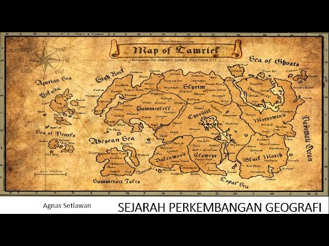
- 😀 The first person to introduce maps was the mathematician and astronomer Claudius Ptolemy.
- 😀 Geography is a dynamic field, evolving alongside human history, and helps understand both the environment and human societies.
- 😀 Geography experts study physical properties of the Earth, human societies, and how culture interacts with the natural environment.
- 😀 Ibn Battuta and Marco Polo are notable for their extensive travels, which contributed significantly to geographical knowledge in the Middle Ages.
- 😀 The study of geography also includes the work of Alfred Russel Wallace, who documented the biodiversity of the Malay Archipelago in the 19th century.
- 😀 Wallace's theory of the Wallace Line divided flora and fauna into distinct regions in Indonesia, contributing to the understanding of biodiversity.
- 😀 Technological advancements like aerial photography, distance sensors, computers, and satellites have significantly enhanced human understanding of maps and geography.
Q & A
What types of destinations are mentioned in the script for a nutritious holiday?
-The destinations mentioned are a beach, reservoir, mountain, pine forest, crater, and waterfall.
Why are these places chosen as holiday destinations?
-These places are chosen for their beauty or uniqueness.
What role does geography play in understanding locations?
-Geography helps in understanding the space and place where an object is found, the reasons for its existence in that place, and its development and changes over time.
What is the origin of the term 'geography'?
-The term 'geography' comes from Greek, where 'Geo' means earth, and 'graphia' means picture.
Who were the early figures that contributed to the development of geography?
-Early figures include Aristotle, Stable Tolemius, Herodotus, and Lemieux, who also introduced the concept of maps.
How did Eratosthenes contribute to geography?
-Eratosthenes is credited with introducing geography as a picture or writing of the earth's surface.
What is the significance of Ibn Battuta and Marco Polo in the history of geography?
-Ibn Battuta and Marco Polo contributed by traveling to various parts of the world and documenting their experiences, which fueled interest in geography and the study of distant regions.
How did Alfred Russel Wallace contribute to geography in the archipelago?
-Alfred Russel Wallace explored several regions in the Malay Archipelago between 1854 and 1862, documenting biodiversity and introducing the theory of the Wallace Line, which groups flora and fauna based on regional boundaries.
What technological advancements have contributed to the development of geography?
-Technological advancements such as aerial photography, distance sensors, computers, and satellites have significantly contributed to the development and understanding of geography and mapping.
How do geographers describe the relationship between nature and humans?
-Geographers describe geography as the science that studies the reciprocal relationship between nature and humans on the earth's surface, explaining natural phenomena and human interactions with the environment.
Outlines

This section is available to paid users only. Please upgrade to access this part.
Upgrade NowMindmap

This section is available to paid users only. Please upgrade to access this part.
Upgrade NowKeywords

This section is available to paid users only. Please upgrade to access this part.
Upgrade NowHighlights

This section is available to paid users only. Please upgrade to access this part.
Upgrade NowTranscripts

This section is available to paid users only. Please upgrade to access this part.
Upgrade NowBrowse More Related Video

Pengertian Geografi dan Sejarah Perkembangan Ilmu Geografi/ Geografi Kelas X (10) SMA

Definisi geografi dan perkembangannya

Perkembangan Ilmu Geografi - Kurikulum Merdeka Klas X Fase E

SIAPAKAH PALING HEBAT??? Ini 6 Tokoh Legendaris Penjelajah Dunia dalam Sejarah Manusia

Perkembangan Ilmu Geografi di Dunia Islam
5 Fase Sejarah Perkembangan Geografi
5.0 / 5 (0 votes)