Koreksi Geometri Peta - SIG
Summary
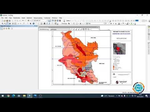
TLDRThis video tutorial guides viewers through the process of correcting map coordinates using ArcGIS. It covers selecting data, adjusting coordinate systems, and working with control points to ensure map accuracy. Key steps include zooming in on specific points, adjusting coordinates, and verifying data through four control points. Once corrections are complete, the data is exported for further use. This practical guide is ideal for users seeking to improve the accuracy of their geographical data and enhance map precision in ArcGIS.
Takeaways
- 😀 The speaker introduces themselves as Dedes Magentos, and their task is to discuss map version corrections as part of their mid-term exam.
- 😀 The focus of the discussion is on correcting data points and ensuring map accuracy using ArcGIS software.
- 😀 The process begins with opening ArcGIS, selecting data, and checking the map for accurate coordinates.
- 😀 The speaker demonstrates the correction of map data by aligning coordinates using control points, which are examined one by one on the map.
- 😀 The first step is to zoom into key points on the map, particularly focusing on the upper left of the Indonesian map for data correction.
- 😀 Control points are verified using a method involving zooming and adjusting coordinates through a specific interface in ArcGIS.
- 😀 The speaker explains how to input corrected coordinates to improve accuracy, ensuring they align correctly with the map’s coordinate system.
- 😀 Throughout the process, the speaker stresses the importance of checking every control point meticulously to ensure accuracy.
- 😀 After completing the correction of four points on the map, the speaker imports the data and exports the corrected map file for further use.
- 😀 The video ends with the speaker confirming that the map corrections have been successfully made, making the map ready for further testing and use in the field.
Q & A
What is the main purpose of the script in the video?
-The main purpose of the video is to demonstrate how to correct map data using ArcGIS software, focusing on the accuracy of coordinates and map projections.
What is the first step in correcting map data using ArcGIS?
-The first step is to open the ArcGIS application and load the relevant map data, selecting the appropriate dataset for correction.
What role do the control points play in map correction?
-Control points are used to verify and adjust the accuracy of the map’s coordinates. The script mentions using four control points to check the accuracy of the map data.
How do you check the accuracy of the control points?
-The accuracy is checked by zooming in on the control points and verifying their coordinates. Any discrepancies are corrected by adjusting the map's coordinates accordingly.
What happens if the control point's coordinates are incorrect?
-If the control point's coordinates are incorrect, adjustments are made by re-entering the correct coordinates for each point to ensure the map is accurate.
What tools or features in ArcGIS are mentioned for performing corrections?
-The script mentions using the 'Layer' properties, the 'Zoom' feature, and the 'Control Points' table for adjusting and verifying the coordinates of the map data.
What is the significance of the four points mentioned in the script?
-The four points are used as reference markers to check the alignment and accuracy of the map's data. Each point is verified for its correct coordinates, and the map is adjusted accordingly.
How do you input the corrected coordinates in ArcGIS?
-Corrected coordinates are input manually into the system by adjusting the 'X' and 'Y' values for each control point. The new values are then applied to update the map.
What is the final step after all corrections are made?
-The final step is to export the corrected data from ArcGIS, saving it with a new name or title, and ensuring the map is updated and accurate for further use.
Why is it important to verify the accuracy of the map data?
-Verifying the accuracy of the map data is crucial because incorrect map data can lead to flawed analyses and decisions, especially in geographic and spatial research.
Outlines

This section is available to paid users only. Please upgrade to access this part.
Upgrade NowMindmap

This section is available to paid users only. Please upgrade to access this part.
Upgrade NowKeywords

This section is available to paid users only. Please upgrade to access this part.
Upgrade NowHighlights

This section is available to paid users only. Please upgrade to access this part.
Upgrade NowTranscripts

This section is available to paid users only. Please upgrade to access this part.
Upgrade NowBrowse More Related Video
5.0 / 5 (0 votes)


