Praktikum Sistem Informasi Geografi - Pembuatan Peta Kemiringan Lereng Demnas
Summary
TLDRThis tutorial walks through the process of creating a slope map using DEMNAS data in a GIS environment. The video covers essential steps such as importing data, defining projections, reclassifying slope data, eliminating small polygons, and applying clipping techniques based on region boundaries. It also guides users through symbology adjustments and the final steps to visualize and complete the slope map. With clear instructions on using various tools within ArcGIS, this video offers a comprehensive overview for creating accurate slope maps to assist in geographical analysis.
Takeaways
- 😀 Open RIS and load DEMNAS data related to slope from the appropriate folder.
- 😀 Use the **Define Projection** tool in ArcGIS to set the correct coordinate system (GCS WGS).
- 😀 Project the DEMNAS data by choosing the WGS 1984 Zone 49S coordinate system.
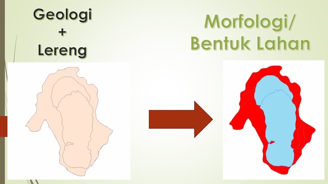
- 😀 Use the **Slope** tool in the **Spatial Analysis** menu to calculate the slope of the area.
- 😀 Reclassify the slope data into five categories, adjusting the break values for slope percentages (8%, 15%, 25%, 45%, and 100%).
- 😀 Convert raster data to polygons using the **Raster to Polygon** tool for better analysis and visualization.
- 😀 Eliminate small polygons with an area less than 20,000 m² using the **Eliminate** tool, and repeat as necessary.
- 😀 Use the **Dissolve** tool to combine polygons based on grid code to streamline the data.
- 😀 Apply appropriate symbology to the final data to categorize the slope into distinct color-coded classes.
- 😀 Clip the DEMNAS data using the defined region boundary to focus on the relevant area for analysis.
- 😀 After completing all steps, the resulting map will display categorized slope data within the selected region of interest.
Q & A
What is the first step in creating the slope map using DEMNAS data?
-The first step is to open the software and load the DEMNAS data from the 'Kemiringan Lereng' folder into the system.
What is the function of the 'Define Projection' tool in this process?
-The 'Define Projection' tool is used to assign the correct geographic coordinate system (GCS), in this case, WGS 1984, to the DEMNAS data.
Which coordinate system is chosen during the projection process?
-The WGS 1984 coordinate system is chosen, specifically the WGS 1984 Zone 49S.
How is the slope calculated from the DEMNAS data?
-The slope is calculated using the 'Slope' tool in the Spatial Analysis toolbox, and the output measurement is set to percentage.
Why is the 'Reclassify' tool used in the process?
-The 'Reclassify' tool is used to categorize the slope values into different classes, which helps in visualizing and analyzing the variations in slope.
How are the slope classes set during the reclassification?
-The slope classes are set to five ranges using manual classification, with specific slope percentage values such as 8, 15, 25, 45, and 100.
What is the purpose of the 'Raster to Polygon' tool?
-The 'Raster to Polygon' tool is used to convert the reclassified raster data into polygon features, making it easier to work with in vector format.
How is the elimination of small polygons handled?
-Small polygons with an area less than 20,000 square meters are eliminated using the 'Eliminate' tool, which can be applied multiple times if necessary.
What is the 'Dissolve' tool used for in this process?
-The 'Dissolve' tool is used to merge adjacent polygons with the same value, which simplifies the data by reducing the number of separate features.
What is the function of the 'Clip' tool in the final stages?
-The 'Clip' tool is used to trim the DEMNAS data to a specific boundary or region, defined by a polygon layer, ensuring that only the relevant area is retained.
Outlines

This section is available to paid users only. Please upgrade to access this part.
Upgrade NowMindmap

This section is available to paid users only. Please upgrade to access this part.
Upgrade NowKeywords

This section is available to paid users only. Please upgrade to access this part.
Upgrade NowHighlights

This section is available to paid users only. Please upgrade to access this part.
Upgrade NowTranscripts

This section is available to paid users only. Please upgrade to access this part.
Upgrade NowBrowse More Related Video

TUTORIAL MEMBUAT PETA KEMIRINGAN LERENG | ARCGIS
Peta Morfologi menggunakan ArcGis
How to Prepare Slope Map from DEM #shorts #youtubeshorts #gis
Tutorial Membuat Peta Erosi Secara Spasial Menggunakan Arcgis dengan rumus USLE

Digitasi Peta Melalui Arcview 3.3

Slope Analysis using ArcGIS Pro | With DEM Data
5.0 / 5 (0 votes)