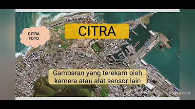
Jenis Jenis Citra Penginderaan Jauh
Summary
TLDRThis video discusses different types of imagery, specifically photographic and non-photographic imagery, captured by various sensors. It explains the differences between photo-based imagery, which uses cameras, and non-photo imagery, which uses other sensors like scanners. The video explores several classifications of photographic imagery based on factors such as color, camera angle, and the vehicle used to capture the images. It also covers non-photographic imagery and its use in detecting environmental elements, such as temperature or topography, through sensors like radar and thermal infrared.
Takeaways
- 📸 The term 'Citra' refers to images captured by sensors, which can be either visual data or image data.
- 📷 Citra is classified into two types: photo imagery using photographic sensors and non-photo imagery using non-camera sensors like scanners.
- 🎨 Photo imagery is categorized into five groups based on color, camera axis, type of camera, platform (vehicle), and electromagnetic spectrum.
- 🌍 Photo imagery based on color includes 'true color,' which accurately represents the field conditions, and 'false color,' which requires interpretation.
- 📐 Vertical photos are captured perpendicular to the object, while oblique photos are taken at an angle and can show objects in 3D.
- 📹 Photos can be taken using single cameras or multi-camera systems, such as those used in Google Street View.
- 🚁 Photo platforms include airborne vehicles like planes and helicopters or space-based platforms like satellites.
- 🌈 Photo imagery based on the electromagnetic spectrum includes ultraviolet, orthochromatic, panchromatic, infrared, and modified infrared images.
- 🔥 Non-photo imagery includes radar, thermal infrared, and microwave images, which are useful for temperature analysis and topographic mapping.
- 🚀 Non-photo platforms and sensors are similar to those used in photo imagery but are designed for non-camera sensors like radar or thermal detectors.
Q & A
What is the main difference between photo imagery and non-photo imagery?
-Photo imagery uses a photographic sensor (camera) to capture visual data, while non-photo imagery uses non-camera sensors, such as scanners, to capture different types of data.
How are photo images classified based on camera axis position?
-Photo images are classified into vertical and oblique photos. Vertical photos are taken perpendicularly to the object, while oblique photos are taken at an angle, either slightly or strongly inclined.
What are the five categories used to classify photo imagery?
-Photo imagery can be classified by color, camera axis position, type of camera, the vehicle (platform) used, and the electromagnetic spectrum used for capturing the image.
What is true-color imagery, and how does it differ from false-color imagery?
-True-color imagery shows objects in colors that match their real-world appearance, such as green vegetation and blue rivers. False-color imagery shows objects in colors that don't match reality, requiring interpretation to understand the objects.
What are the advantages of oblique photos compared to vertical photos?
-Oblique photos provide a three-dimensional perspective of objects, allowing features like buildings or islands to appear more three-dimensional, while vertical photos show objects in a flat, two-dimensional view.
How is multi-camera photography different from single-camera photography?
-Multi-camera photography uses several cameras to capture images from different angles or with different sensors, while single-camera photography uses just one camera. Multi-camera setups are often used for tasks like Google Street View.
What is the significance of infrared imagery in vegetation mapping?
-Infrared imagery is useful for identifying the health of vegetation. Healthy plants reflect infrared light differently than unhealthy ones, allowing for easy identification of diseased or stressed plants.
How are satellite images different from aerial images?
-Satellite images are captured using sensors on satellites in outer space, while aerial images are taken by cameras on aircraft, such as planes or drones, flying in the Earth's atmosphere.
What is thermal infrared imagery used for?
-Thermal infrared imagery is used to detect heat patterns, making it useful for applications like monitoring urban heat islands, studying plant temperatures, and exploring oil and gas resources.
How does radar imagery help in mapping topography and weather phenomena?
-Radar imagery is excellent for mapping elevation and topographic features as it uses radar signals to detect surface variations. It's also used to observe and track weather patterns, such as cloud movements.
Outlines

Cette section est réservée aux utilisateurs payants. Améliorez votre compte pour accéder à cette section.
Améliorer maintenantMindmap

Cette section est réservée aux utilisateurs payants. Améliorez votre compte pour accéder à cette section.
Améliorer maintenantKeywords

Cette section est réservée aux utilisateurs payants. Améliorez votre compte pour accéder à cette section.
Améliorer maintenantHighlights

Cette section est réservée aux utilisateurs payants. Améliorez votre compte pour accéder à cette section.
Améliorer maintenantTranscripts

Cette section est réservée aux utilisateurs payants. Améliorez votre compte pour accéder à cette section.
Améliorer maintenant5.0 / 5 (0 votes)


