Lecture 46: Introduction to QGIS and Data Import (Hands on By: Chandan M C)
Summary
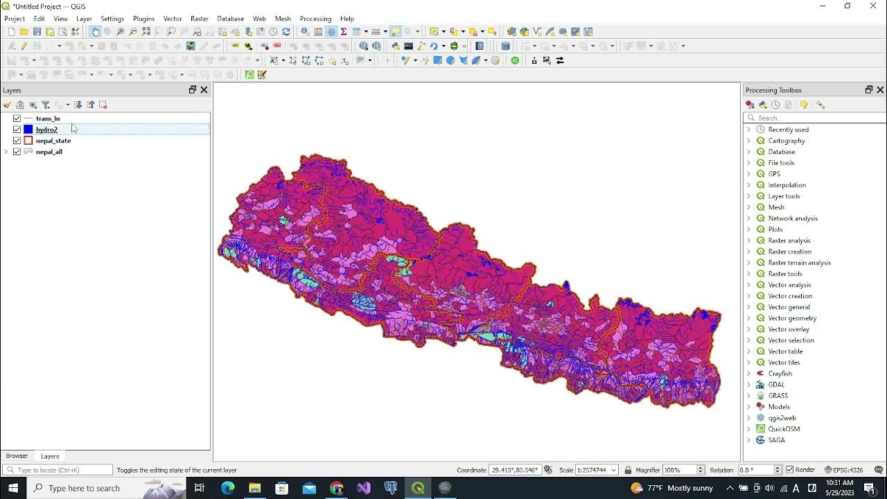
TLDRThis video tutorial introduces viewers to the QGIS interface and essential functionalities for spatial analysis. It covers importing various data types, including vector (rainfall and district shapefiles), tabular (CSV files), and raster data. The tutorial emphasizes how to inspect datasets, select features, view metadata, and export shapefiles while modifying coordinate systems. Additionally, it explains navigation tools like zooming and previews upcoming lessons on geo-referencing images. This comprehensive overview equips users with foundational skills in QGIS, enhancing their ability to manage and analyze geographic information.
Takeaways
- 😀 QGIS is a powerful open-source Geographic Information System that allows users to visualize, manage, and analyze spatial data.
- 📊 The tutorial covered the installation process of QGIS, highlighting compatibility with different operating systems like Windows, Mac, and Linux.
- 🌍 Users learned how to navigate the QGIS interface, including understanding the menu bar, toolbars, and panel arrangements.
- 📥 Importing various data types is essential in QGIS, with demonstrations on how to bring in vector data (shapefiles), tabular data (CSV files), and raster data.
- 🔍 Data inspection features were discussed, including how to identify and select specific attributes within datasets.
- 📈 Users can visualize data layers in QGIS, adjusting their visibility and understanding how to interpret the displayed information.
- 💻 The tutorial emphasized the importance of metadata in spatial data, guiding users on how to view and interpret this information.
- 🗺️ Users learned how to export shapefiles with relevant data, including details like coordinates and data extent.
- 🔄 Future sessions will cover additional topics, including how to geo-reference images for accurate spatial representation.
- ✅ The session concluded with a summary of QGIS functionalities, encouraging users to practice the skills learned in importing, inspecting, and exporting data.
Q & A
What is the main focus of the QGIS tutorial covered in the video?
-The main focus of the tutorial is to provide an introduction to the QGIS interface and demonstrate how to import and manage various types of spatial data.
What types of data are discussed for import in QGIS?
-The tutorial discusses importing vector data (shapefiles), tabular data (CSV files), and raster data.
What are the key components of the QGIS interface mentioned in the transcript?
-The key components include the menu bar, toolbar, browser panel, layer panel, map display area, and status bar.
How can users view metadata for their datasets in QGIS?
-Users can view metadata by inspecting the dataset, which provides information on the attributes and features contained in the data.
What function does the status bar serve in the QGIS interface?
-The status bar displays coordinates and other details relevant to the current view and operations being performed in QGIS.
What steps are involved in exporting a shapefile from QGIS?
-The steps include selecting the shapefile, accessing the export option, and choosing the desired format and settings for the output.
What is meant by geo-referencing a plain image, as mentioned for the next session?
-Geo-referencing a plain image involves aligning the image with geographical coordinates so that it can be used for spatial analysis within QGIS.
What methods are demonstrated for navigating the map in QGIS?
-The methods demonstrated for navigation include zooming in and out to view different areas of the map.
Why is it important to understand the QGIS interface for spatial data analysis?
-Understanding the QGIS interface is crucial as it enables users to efficiently manage, analyze, and visualize spatial data, facilitating better decision-making.
What specific example of vector data is provided in the video?
-An example of vector data provided in the video is a shapefile representing rainfall data.
Outlines

Esta sección está disponible solo para usuarios con suscripción. Por favor, mejora tu plan para acceder a esta parte.
Mejorar ahoraMindmap

Esta sección está disponible solo para usuarios con suscripción. Por favor, mejora tu plan para acceder a esta parte.
Mejorar ahoraKeywords

Esta sección está disponible solo para usuarios con suscripción. Por favor, mejora tu plan para acceder a esta parte.
Mejorar ahoraHighlights

Esta sección está disponible solo para usuarios con suscripción. Por favor, mejora tu plan para acceder a esta parte.
Mejorar ahoraTranscripts

Esta sección está disponible solo para usuarios con suscripción. Por favor, mejora tu plan para acceder a esta parte.
Mejorar ahoraVer Más Videos Relacionados

02_Pengenalan Menu dan Perintah Dasar QGIS

Vector GIS Data Symbology - Part 1

Tutorial Qgis | Cara Mendownload dan Menginstal Qgis | Terbaru 2022

QGIS User Interface Part 1 (Course: QGIS Level 1, Lecture: 7) | Quantum GIS Tutorial | Shahriar |

[TUTORIAL DASAR PHOTOSHOP] Pengenalan Dan Penjelasan Bagian-Bagian Photoshop (Part 1)

Glide Apps Tutorial for Beginners | How to Use glideapps.com (2024)
5.0 / 5 (0 votes)
