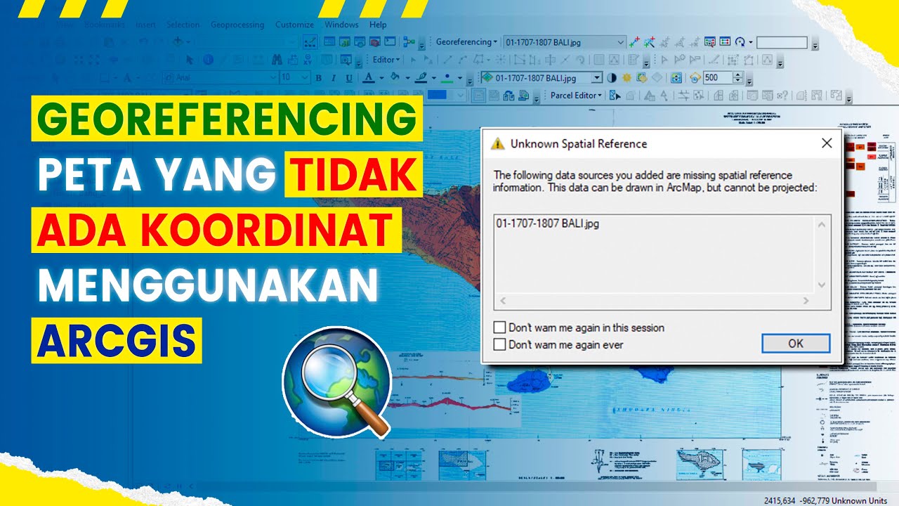
Cara Setting dan Pengambilan Titik Kordinat Menggunakan Offline Maps tanpa jaringan internet.
Summary
TLDRThis tutorial demonstrates how to use the Offline Maps application to capture coordinate points in forest areas, both with and without internet access. The video guides viewers through settings such as distance units, coordinate formats, and satellite image selection. It explains how to activate key features like signal strength and compass positioning, as well as how to calculate area sizes and coordinates for specific locations. The tutorial also provides helpful tips for ensuring accurate results while using the application for geolocation tasks.
Takeaways
- 😀 The tutorial explains how to set up and use offline Maps for collecting coordinate points in a forested area.
- 😀 Offline Maps can be used in both areas with and without network coverage.
- 😀 The first step is to access the 'Offline Maps' and adjust the settings according to your preferences.
- 😀 In the settings, you can choose the 'Distance Unit' and select 'Matrix'.
- 😀 You can choose from various coordinate systems, with 'WGS84' being one of the options.
- 😀 For displaying coordinates, you can select 'Decimal Degrees' or 'Degrees Minutes Seconds'.
- 😀 To enhance map details, you can enable the satellite image feature and select 'Google Satellite'.
- 😀 Activating the compass and positioning feature helps in navigation within the map.
- 😀 The app shows additional details such as elevation, signal strength, and coordinates when you zoom in on a location.
- 😀 You can calculate areas and distances by marking points on the map, and the app will provide area size in square meters or hectares.
- 😀 The tutorial concludes by encouraging users to leave comments for any assistance needed and reminds viewers to subscribe to the channel.
Q & A
What is the main purpose of the tutorial in the transcript?
-The tutorial explains how to use an offline map app to collect coordinates in a forest area, providing step-by-step guidance on the setup, operation, and calculation of areas.
Does the offline map app work in areas with no network connection?
-Yes, the offline map app works in areas with or without a network connection.
What is the first step in setting up the offline map app?
-The first step is to open the Offline Maps app and go to the settings section to configure the app.
Which units should be selected for distance measurement in the settings?
-In the settings, you should choose 'Matrix' for distance units.
How do you select the coordinate system format in the app?
-You can choose the coordinate system format (e.g., WGS84) in the 'Location on Format' section of the settings.
What should be activated in the app to ensure accurate positioning?
-You should activate the 'Compass' and the 'Positioning' feature to ensure accurate GPS data.
What does the signal strength indicate in the app?
-The signal strength indicates how close you are to your desired position. A higher signal strength, especially above 130, ensures better GPS accuracy.
How can you mark a specific point in the map?
-You can mark a point by creating a waypoint (e.g., 'T1'), which allows you to track and view information like coordinates and elevation.
What feature allows you to calculate the area of a specific location?
-You can calculate the area by selecting the 'Area' icon and clicking on multiple waypoints to outline the region.
What is the approximate area of the sample location in the tutorial?
-The area of the sample location calculated in the tutorial is approximately 48,690 m² or 4 hectares.
Outlines

Esta sección está disponible solo para usuarios con suscripción. Por favor, mejora tu plan para acceder a esta parte.
Mejorar ahoraMindmap

Esta sección está disponible solo para usuarios con suscripción. Por favor, mejora tu plan para acceder a esta parte.
Mejorar ahoraKeywords

Esta sección está disponible solo para usuarios con suscripción. Por favor, mejora tu plan para acceder a esta parte.
Mejorar ahoraHighlights

Esta sección está disponible solo para usuarios con suscripción. Por favor, mejora tu plan para acceder a esta parte.
Mejorar ahoraTranscripts

Esta sección está disponible solo para usuarios con suscripción. Por favor, mejora tu plan para acceder a esta parte.
Mejorar ahoraVer Más Videos Relacionados

5.0 / 5 (0 votes)
