Geography and Development of Ancient Civilizations

History with Audrey D
15 Oct 202108:52

Summary

TLDRIn this episode of 'Bite Size History', host Audrey Durham explores the geographical patterns of ancient civilizations through a historical map. She discusses how the proximity to major bodies of water, like the Nile and the rivers in Mesopotamia, played a crucial role in the development and sustenance of these civilizations. The video emphasizes the importance of water for agriculture and population growth, highlighting the common thread among these ancient societies. The episode concludes with a call to action for viewers to engage with the content and a teaser for a future segment on a 15th-century map.

Takeaways

  • 🌍 The video focuses on ancient civilizations and their geographical patterns that contributed to their growth.
  • 📍 The learning goal is to differentiate between continents, regions, countries, and cities to understand the complexities of regions created by civilizations.
  • 🌊 The learning target is to identify the locations of major civilizations and explain how major bodies of water impacted their development.
  • ❓ The critical thinking question is how geography impacted the development of early civilizations.
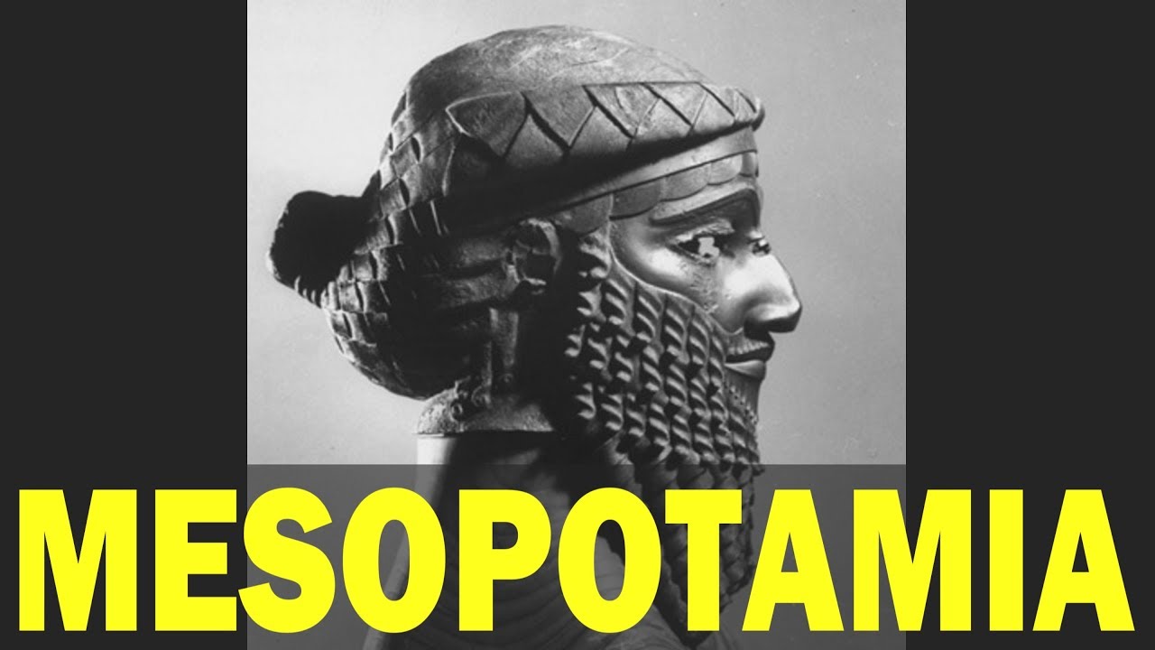
  • 🏛️ Ancient Mesopotamia, the Indus Valley, Ancient Egypt, and the Huanghe Valley are highlighted as the four primary early civilizations.
  • 🏞️ Civilizations such as Ancient Greece and Rome came later, roughly 2000 years after the older civilizations.
  • 🗺️ The map used in the video, 'Ancient Civilizations Map and Timeline,' shows the locations and timelines of various civilizations.
  • 🌾 Most ancient cities were located along rivers because of the need for water for agriculture, which is essential for sustaining civilization.
  • 💧 The Nile River was crucial for Ancient Egypt, providing fertile land for agriculture through seasonal silt deposition.
  • 🏙️ Ancient Mesopotamia's cities were situated along the Tigris and Euphrates rivers, indicating the importance of waterways for civilization growth.
  • 🌱 The pattern of higher populations along waterways is a consistent theme across all civilizations, highlighting the necessity of fresh water and waterways for development.

Q & A

  • What is the main focus of the 'Bite Size History' episode discussed in the script?

    -The main focus of the episode is to examine ancient civilizations and their geographical patterns, specifically how major bodies of water impacted their development.

  • What are the learning goals and targets outlined for this episode?

    -The learning goal is to differentiate between continents, regions, countries, and cities to understand the complexities of regions created by civilizations. The learning target is to identify the locations of major civilizations and explain how major bodies of water may have impacted their development.

  • What critical thinking question is posed in relation to the development of early civilizations?

    -The critical thinking question is 'How did geography impact the development of early civilizations?'

  • Which ancient civilizations are mentioned as the oldest in the script?

    -The oldest civilizations mentioned are Ancient Mesopotamia, the Indus Valley, Ancient Egypt, and the Huanghe Valley.

  • What is the significance of the time frame 3500 to 2000 BCE in the context of the discussed civilizations?

    -The time frame 3500 to 2000 BCE is significant as it represents the period when Ancient Mesopotamia existed, which is one of the earliest civilizations discussed.

  • How does the script explain the importance of rivers for the development of the Indus Valley civilization?

    -The script explains that the Indus Valley civilization developed along the Indus River, which provided fertile land for agriculture and was essential for sustaining the civilization.

  • What role did the Nile River play in the development of Ancient Egypt according to the script?

    -The Nile River was crucial for Ancient Egypt as it provided fertile land through seasonal deposits of silt, which was used for agriculture, allowing the civilization to grow and prosper.

  • Why were the Tigris and Euphrates rivers important to the Ancient Mesopotamians?

    -The Tigris and Euphrates rivers were important to the Ancient Mesopotamians because they provided waterways and fertile areas for agriculture, which were necessary for sustaining their civilization.

  • What pattern does the script identify as consistent among ancient civilizations?

    -The script identifies a pattern of higher populations and civilization development along waterways, as these provided the necessary resources for agriculture and sustenance.

  • What is the connection between the Aztec and Inca civilizations mentioned in the script?

    -The connection mentioned is that both the Aztec and Inca civilizations ended around the same time, during the period of Spanish exploration, due to factors such as disease and slavery.

  • How does the script suggest historians use maps to study ancient civilizations?

    -The script suggests that historians use maps to identify the locations of major civilizations and to understand how geography, particularly access to water and fertile land, influenced their development.

Outlines

00:00

🎬 Welcome to Bite Size History: Exploring Ancient Maps

In this introductory section, Audrey Durham welcomes viewers to another episode of Bite Size History. She announces that the episode will focus on ancient civilizations through the lens of maps. Audrey encourages viewers to like and subscribe to her channel and sets the stage for the educational goals, which include understanding geographic representations and how water bodies influenced the development of early civilizations.

05:00

🧭 Learning Goals: Understanding Geography and Civilizations

Audrey outlines the learning goals and targets for the episode. The goal is to differentiate between continents, regions, countries, and cities, helping viewers grasp the complex relationship between geography and ancient civilizations. By the end of the lesson, viewers should be able to identify the locations of major civilizations and explain how large bodies of water impacted their growth. A critical thinking question asks how geography influenced early civilizations, prompting reflection on historical development.

📜 Ancient Civilizations and Their Timelines

The focus shifts to an ancient civilizations map and timeline, showcasing early civilizations such as Mesopotamia, the Indus Valley, Egypt, and the Huanghe Valley. Audrey highlights their respective timeframes, beginning with the oldest civilizations and moving forward in history. She then introduces later civilizations such as Ancient Greece and Rome, contrasting them with older societies to explore their progression over time.

🌎 Pre-Columbian Civilizations in the Americas

In this section, Audrey discusses early civilizations in the Americas, particularly the Olmec, Zapotec, and Toltec, which predate the Maya, Aztec, and Inca. She provides a timeline for these civilizations and hints at a deeper exploration in future lessons. Audrey also notes the impact of Spanish exploration, disease, and slavery on the downfall of the Aztec and Inca civilizations.

🏞️ The Importance of Rivers for Ancient Civilizations

The lesson now examines the geographic locations of ancient civilizations, emphasizing the role of rivers. Audrey starts with the Indus Valley civilization, pointing out how the Indus River facilitated fertile agricultural land. She also discusses Egypt's reliance on the Nile for seasonal flooding and Mesopotamia's strategic location between the Tigris and Euphrates. This section underscores the critical role water played in sustaining populations and growing civilizations.

🌊 Civilization Growth Along Waterways

Audrey discusses how civilizations throughout history thrived along waterways. She highlights that fertile areas along rivers like the Indus, Nile, and Euphrates, as well as the Mediterranean coast, were pivotal for agriculture. This availability of water and fertile land allowed these societies to develop large populations and sustain themselves. The enduring pattern of high population density near water sources is identified as a key takeaway for understanding ancient civilization development.

📺 Closing Remarks: Patterns in Civilization Development

In this conclusion, Audrey summarizes the patterns found in the growth of ancient civilizations, particularly their reliance on water sources. She thanks her audience for watching and encourages viewers to engage with her content by liking, subscribing, and sharing thoughts on an upcoming map from the 15th century. Audrey signs off by promoting her presence on Patreon and Instagram, before concluding the episode.

Mindmap

Keywords

💡Maps

Maps are graphical representations of geographical areas, used to navigate and understand spatial relationships. In the video, maps are central to exploring how ancient civilizations developed, with a focus on how waterways and fertile lands were depicted on these maps to show where civilizations could thrive. The script mentions an 'ancient civilizations map and timeline,' indicating that maps were used to visualize the chronological and geographical spread of civilizations.

💡Ancient Civilizations

Ancient civilizations refer to complex societies that existed in the past, often characterized by urban development, social stratification, and writing systems. The video discusses several such civilizations, including Mesopotamia, the Indus Valley, Ancient Egypt, and the Huanghe Valley, highlighting their significance in the study of human history and their reliance on geographical features for growth.

💡Geography

Geography is the study of the Earth's landscapes, peoples, places, and environments. The video uses geography as a benchmark to understand how ancient civilizations utilized their environments, particularly in relation to water sources and fertile lands, which were crucial for agriculture and population growth. The script mentions a 'geography benchmark' to guide the learning objectives.

💡Mesopotamia

Mesopotamia, often referred to as the 'Cradle of Civilization,' was an ancient civilization located in the region of the Tigris and Euphrates rivers. The video discusses Mesopotamia as one of the oldest civilizations, existing from 3500 to 2000 BCE, and notes its strategic location between two major rivers, which provided fertile land for agriculture and contributed to its development.

💡Indus Valley

The Indus Valley Civilization was a Bronze Age civilization that flourished in the Indus River basin. The video points out that this civilization existed from 2500 to 1700 BCE, and like others, its cities were located along the Indus River, indicating the importance of water for agriculture and civilization sustainability.

💡Ancient Egypt

Ancient Egypt is known for its pyramids, pharaohs, and the Nile River. The video emphasizes that Ancient Egyptian cities were situated along the Nile, which provided the necessary water and fertile land for agriculture. The Nile's seasonal flooding and deposition of silt were crucial for the civilization's agricultural success.

💡Agriculture

Agriculture is the practice of cultivating plants and livestock for food, fiber, and other products. The video underscores the importance of agriculture for ancient civilizations, as it was the foundation for sustaining large populations. The availability of water for irrigation, as provided by rivers, was a key factor in the growth and success of these civilizations.

💡Fertile Land

Fertile land is soil that is rich in nutrients and ideal for growing crops. The video explains that fertile lands, often found along rivers, were essential for the development of ancient civilizations because they allowed for successful agriculture, which in turn supported larger populations and urban development.

💡Waterways

Waterways are natural or artificial channels through which water flows, such as rivers, lakes, and canals. The video highlights that waterways were critical for ancient civilizations, providing not only water for agriculture but also facilitating transportation and trade. The script mentions how major cities of these civilizations were located along waterways.

💡Critical Thinking

Critical thinking involves analyzing and evaluating information to form judgments. In the video, the critical thinking question is 'how did geography impact the development of early civilizations?' This question encourages viewers to consider the role of geographical features in shaping the growth and development of ancient societies.

💡Patterns

Patterns in this context refer to recurring themes or trends observed in the development of ancient civilizations. The video identifies a pattern where civilizations tended to develop along waterways due to the availability of water for agriculture and the fertile lands that supported large populations. This pattern is evident in the locations of cities in Mesopotamia, the Indus Valley, and Ancient Egypt.

Highlights

Introduction to the episode focusing on ancient civilizations and their geographical patterns.

Emphasis on the importance of understanding how to use maps and geographic tools to report information.

Learning goal to differentiate between continents, regions, countries, and cities for understanding civilization complexities.

Learning target to identify locations of major civilizations and explain the impact of water bodies on their development.

Critical thinking question: How did geography impact the development of early civilizations?

Discussion on the ancient Mesopotamia civilization and its time frame from 3500 to 2000 BCE.

Mention of the Indus Valley civilization and its existence from 2500 to 1700 BCE.

Exploration of Ancient Egypt's timeline from 3100 to 1070 BCE and its significance.

Introduction to the Huanghe Valley civilization and its period from 1700 to 1122 BCE.

Question posed about which civilizations existed before the Aztec, Maya, and Inca in the Americas.

Timeline of the Olmec civilization from 1500 to 400 BCE in ancient cultures of Mexico.

Discussion on the Zapotec civilization's existence from 500 BCE to 900 CE.

Timeline of the Toltec civilization from 100 BCE to 800 CE.

Introduction to the Ancient Maya civilization and its period from 250 to 900 CE.

Timeline of the Inca civilization from 1200 to 1532 CE and the Aztec civilization from 1350 to 1521 CE.

Pattern recognition of civilizations ending around the time of Spanish exploration due to disease and slavery.

Commonality among civilizations: the necessity of rivers for agriculture and sustaining civilization.

Example of the Indus Valley civilization's reliance on the Indus River for fertility and agriculture.

Ancient Egypt's utilization of the Nile River for agriculture and civilization sustenance.

Mesopotamia's advantage with two rivers, the Tigris and the Euphrates, for civilization development.

Conclusion on the pattern of higher populations along waterways in ancient civilizations.

Encouragement for viewers to like, subscribe, and engage with the content.

Transcripts

play00:02

greetings everyone and welcome back to

play00:04

another episode of bite size history

play00:07

i'll be your host audrey durham and in

play00:09

today's episode we are going to be

play00:11

looking at maps again but not just any

play00:13

map we're going to be focusing on a map

play00:15

of ancient civilizations

play00:18

and we will be looking for some of those

play00:20

patterns that may have helped them grow

play00:23

if you like this channel so far please

play00:24

make sure that you hit that like and

play00:26

subscribe button

play00:29

[Music]

play00:42

all right let's go ahead take a quick

play00:43

look at our benchmark learning goal and

play00:45

learning target for today

play00:49

we are starting out with the same

play00:50

geography benchmark that we had for our

play00:52

last video which is to understand how to

play00:55

use maps and other geographic

play00:57

representations tools and technology to

play01:00

report information

play01:02

our learning goal for today is going to

play01:04

be to differentiate between continents

play01:07

regions countries and cities in order to

play01:10

understand the complexities of regions

play01:12

created by civilizations

play01:14

and our learning target is that by the

play01:17

end of this lesson you should be able to

play01:19

identify the locations of major

play01:21

civilizations and explain how

play01:24

major bodies of water may have impacted

play01:26

their development

play01:29

our critical thinking question for today

play01:31

is going to be how did geography impact

play01:34

the development of early civilizations

play01:40

our map we're looking at today is

play01:42

ancient civilizations map and timeline

play01:44

now on this map we can see that there

play01:46

are a lot of different civilizations

play01:48

listed

play01:49

we're going to start with the oldest and

play01:51

work our way forward

play01:53

so first up we have ancient mesopotamia

play01:55

which existed from 3 500 to 2000 bce

play02:00

we also had the indus valley which was

play02:03

there from 2500 to 1700 bce ancient

play02:08

egypt which existed from 3100 to 1070

play02:11

bce and the huangha valley which existed

play02:15

from 1700 to 1122 bce

play02:20

so these are the four primary

play02:21

civilizations that started first

play02:25

next we move into ancient greece which

play02:28

existed from 800 to 338 bce and we can

play02:32

see that that and ancient rome from 509

play02:35

bce to 476 ce or common era

play02:40

they are

play02:41

roughly 2 000 years off from the older

play02:45

civilizations

play02:47

so our first question that we have is

play02:49

what civilizations existed before the

play02:51

aztec maya and the inca so in the

play02:54

americas there were also some ancient

play02:56

civilizations that cropped up

play02:59

in our ancient cultures of mexico map we

play03:01

can see that the olmec

play03:04

existed from 1500 to 400 bce followed by

play03:08

the zapotec

play03:10

which were there from 500 bce to 900 ce

play03:14

and the toltec which were there from 100

play03:17

bce to 800 ce

play03:20

so these are the primary civilizations

play03:22

or cultures that existed before the maya

play03:25

aztec and the inca

play03:27

now the second oldest

play03:30

of

play03:31

these civilizations is going to lead

play03:34

into the mayan civilization so the

play03:36

ancient maya would come after

play03:39

the toltec and

play03:42

looking at those we have the ancient

play03:44

maya which existed from 250 to 900 ce or

play03:49

common era

play03:51

we have the inca which existed from 1200

play03:54

to 1532 ce and the aztec which existed

play03:59

from 1350 to 1521 ce and we can see our

play04:03

little pattern here with the aztec and

play04:05

inca which was the time of spanish

play04:08

exploration and when those two

play04:11

civilizations ended due to disease

play04:14

and slavery so we'll talk about those in

play04:17

later lessons but i did want to just

play04:19

show you that or actually point it out

play04:20

since we have some similar end dates

play04:24

for the aztec and the inca

play04:26

now moving forward what do these

play04:28

civilizations have in common

play04:32

so

play04:33

first up we're going to look at the

play04:34

indus valley and in this valley

play04:37

was roughly 3300 to 2600 bce in its

play04:42

early phases

play04:43

and we already noticed that most of the

play04:46

cities are popping up along the rivers

play04:51

now our primary river for the indus

play04:53

valley is the indus river and we can see

play04:55

that by its squiggly blue line and the

play04:57

blue indus r denoting that it is the

play05:00

indus river

play05:02

but this was also the most fertile area

play05:04

and what they needed for sustaining

play05:07

civilization

play05:08

was water for agriculture

play05:11

because you can't sustain a civilization

play05:13

without food

play05:15

that is the first example that i'm going

play05:17

to show you next example is going to be

play05:20

ancient egypt

play05:22

and in ancient egypt all of our cities

play05:26

are along the nile so we don't have any

play05:29

in the eastern or western deserts really

play05:31

they all show up along the nile because

play05:33

that's where they would have one been

play05:35

able to grow food and two been able to

play05:38

actually build up a population

play05:41

so the ancient egyptians utilized the

play05:45

nile as their fertile river because it

play05:48

would

play05:49

seasonally dispense silts along its

play05:52

banks which was then used for

play05:54

agriculture

play05:55

so that is why the ancient egyptians

play05:58

were successful in their location

play06:01

and finally we get to

play06:05

mesopotamia now the ancient

play06:07

mesopotamians had two rivers they had

play06:10

the tigris

play06:11

and the euphrates

play06:13

and we can see again that

play06:16

the major cities here all show up along

play06:20

waterways

play06:21

so we have the persian gulf

play06:23

we have the tigris and the euphrates

play06:26

and then our

play06:28

map is giving us a key here which is

play06:30

showing us that fertile area of early

play06:33

agriculture is denoted by that green

play06:35

shading

play06:36

so along these rivers

play06:38

and along the mediterranean sea and even

play06:41

over here where it shows the nile

play06:44

they're all the fertile locations that

play06:46

people are able to actually produce

play06:49

agriculture and produce food

play06:52

this is the main reason why we look at

play06:54

these maps and why we study ancient

play06:56

civilizations understand how they

play06:58

developed

play07:00

because they all have patterns and

play07:03

one of the patterns that consist to this

play07:05

day

play07:06

is higher populations along waterways

play07:10

so that is something that we will study

play07:12

in later lessons but for today's lesson

play07:15

the big takeaways are we do have a

play07:18

pattern that exists with all

play07:20

civilizations and especially these

play07:21

ancient ones they needed fresh water and

play07:24

they needed waterways in order to

play07:27

become higher in populations and to

play07:30

exist for as long as they did

play07:33

thank you again for watching another

play07:35

episode of bite size history

play07:38

i hope you enjoyed learning a little bit

play07:40

more about civilizations and where they

play07:42

may have grown as well as why

play07:45

and understanding a little bit more

play07:47

about how historians might use maps

play07:51

if you like this episode please make

play07:52

sure that you hit that like and

play07:54

subscribe button

play07:56

stay tuned at the end of this video

play07:58

because we're going to be looking at a

play08:00

map from the 15th century

play08:04

if you have any comments i want you to

play08:05

go ahead and leave those down below

play08:07

about the image of the map let me know

play08:09

what you think let me know what you

play08:11

thought those people are thinking when

play08:13

they are creating it what you think some

play08:14

of the imagery might represent

play08:17

all right that's it for me guys have a

play08:19

fantastic day

play08:23

as always please make sure to like and

play08:26

subscribe you can also find me on

play08:28

patreon as bite size history with audrey

play08:30

durham and on instagram at bite size

play08:33

history with audrey d

play08:35

thank you so much for watching this show

play08:37

was written and produced by me audrey

play08:40

durham i look forward to sharing more

play08:42

episodes of bite size history with you

play08:44

soon

play08:45

[Music]

Rate This

5.0 / 5 (0 votes)

相关标签
Ancient CivilizationsGeographyMapsHistoryMesopotamiaIndus ValleyEgyptAgricultureRiversCultural Development
您是否需要英文摘要?