El Reno: Lessons From the Most Dangerous Tornado in Storm Observing History
Summary
TLDROn May 31, 2013, a massive tornado struck El Reno, Oklahoma, with unprecedented diameter and wind speeds. Its erratic movement and high precipitation made observation treacherous, leading to the tragic loss of storm chasers and observers. The event underscores tornado unpredictability, the danger of close approaches, and the risk of satellite tornadoes. It emphasizes the importance of maintaining distance, being vigilant, and prioritizing safety over documentation.
Takeaways
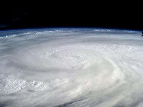
- 🌪️ The El Reno tornado of May 31st, 2013 was a massive and powerful event, with a diameter of up to 2.6 miles and wind speeds nearing 300 mph, making it one of the most intense tornadoes in history.
- ⚠️ The tornado exhibited unpredictable behavior, frequently changing speed and direction, which made safe observation extremely difficult, even for experienced storm chasers.
- 👥 Tragically, the tornado claimed the lives of eight people, including well-known storm chasers Tim Samaras, Paul Samaras, and Carl Young.
- 🌩️ The tornado formed under a potent combination of atmospheric conditions, including extreme instability, strong vertical wind shear, and a powerful low-pressure system.
- 🌀 The tornado had a high precipitation character, making it difficult to see, and was accompanied by multiple satellite tornadoes and an anticyclonic tornado, increasing the danger for those nearby.
- 🚗 Several storm chasers, including a Weather Channel crew and the Twistex team, were caught in the tornado’s path, with some surviving close encounters, while others did not.
- 🌧️ The tornado was difficult to track visually due to rain and debris, and its unpredictable movement made it challenging for chasers to avoid.
- 🌪️ The El Reno tornado expanded rapidly, doubling in width in just a few minutes, making it even more dangerous for those trying to escape its path.
- 🚷 The event highlighted the dangers of storm chasing, particularly in volatile weather conditions, and emphasized the need for greater caution and distance from tornadoes.
- 🔄 The El Reno tornado serves as a sobering reminder of the unpredictable nature of tornadoes and the importance of respecting their power and potential for rapid, life-threatening changes.
Q & A
What made the El Reno tornado on May 31st, 2013 particularly dangerous?
-The El Reno tornado was exceptionally large, reaching up to 2.6 miles in diameter, and had unpredictable speed and directional changes. Its winds reached nearly 300 mph, making it one of the most powerful tornadoes in history. Additionally, its high precipitation and looping movement made it difficult for storm chasers to observe safely.
What were some challenges storm chasers faced during the El Reno tornado?
-Storm chasers faced challenges such as the tornado’s unpredictable changes in direction and speed, limited visibility due to the high precipitation in the storm, and sudden expansion of the tornado’s windfield, which made close observation dangerous and often forced them to flee.
How did the El Reno tornado cause the deaths of notable storm chasers?
-The tornado’s rapid expansion and unpredictable movements contributed to the deaths of renowned storm chasers Tim Samaras, Paul Samaras, and Carl Young. They were overtaken by a sub-vortex within the larger tornado, which tumbled their vehicle several times, leading to their tragic deaths.
Outlines
🌪️ The Deadly El Reno Tornado of May 31, 2013
On May 31, 2013, a massive tornado formed near El Reno, Oklahoma, reaching an unprecedented 2.6 miles in diameter and producing winds near 300 mph. This tornado was notorious for its unpredictable changes in speed and direction, making it extremely dangerous for storm chasers. Among the eight fatalities were well-known storm chasers Tim Samaras, Paul Samaras, and Carl Young. This tragedy highlighted the critical need to document the lessons learned to prevent future loss of life in the storm chasing community.
⛈️ Atmospheric Conditions Leading to the El Reno Tornado
On May 31st, severe weather was predicted over Central Oklahoma due to a potent combination of atmospheric ingredients, similar to those that caused a devastating EF5 tornado in Moore, Oklahoma, just days earlier. A slow-moving upper tropospheric trough, intense low-level flow, and strong mid-tropospheric winds created extreme instability in the region. This instability was measured using weather balloon data, revealing significant convective available potential energy (CAPE). The cap, a warm dry air layer, delayed thunderstorm development until peak heating, setting the stage for explosive storm formation.
🌩️ The Formation and Rapid Expansion of the El Reno Tornado
As the atmosphere became primed for severe storms, thunderstorms began forming around 4:30 PM, about 50 miles west of Oklahoma City. A storm near El Reno quickly developed mid-level rotation, leading to the formation of a large, rapidly rotating wall cloud. By 6:00 PM, the El Reno tornado had begun, initially showing a strong multiple vortex structure. Storm chasers in the area, including the Tempest Tour Group, narrowly escaped as the tornado expanded rapidly, increasing in forward speed and width, making it far more dangerous than initially perceived.
🚨 Close Calls and Fatal Consequences During the Tornado
The El Reno tornado's rapid expansion and unpredictable movement caught many storm chasers off guard. As it grew in size and speed, it became increasingly difficult to see due to rain and debris. Several storm chasers, including Brandon Sullivan and Brett Wright, were almost overtaken by the tornado's outer edge but managed to escape. Others, like the Twistex team led by Tim Samaras, were not as fortunate. Their vehicle was struck by a powerful sub-vortex, resulting in their tragic deaths. The tornado's complex structure and erratic behavior made it a formidable and deadly force.
⚠️ Lessons from the El Reno Tornado Tragedy
The El Reno tornado taught several crucial lessons for storm chasers. Tornadoes, especially large ones, can change direction and speed unexpectedly, making them highly dangerous. The tornado's rapid expansion and hidden wind fields caught many chasers by surprise, leading to fatal consequences. The event also highlighted the dangers of satellite tornadoes and anticyclonic tornadoes, which can form near the main tornado. The tragic deaths of the Twistex team and others underscore the need for storm chasers to maintain a greater distance from tornadoes and remain vigilant about the rapidly changing conditions during severe weather events.
🌪️ The Unpredictable Nature of Tornadoes
The El Reno tornado was a reminder of the unpredictable and deadly nature of tornadoes. Large tornadoes can be accompanied by satellite and anticyclonic tornadoes, further complicating efforts to observe them safely. The event also demonstrated the limitations of radar in accurately tracking tornadoes, as the El Reno tornado moved rapidly, often faster than radar updates could track. Storm chasers are advised to place more distance between themselves and tornadoes, especially when atmospheric conditions are particularly volatile, to avoid tragic outcomes like those seen on May 31, 2013.
Mindmap
Keywords
💡El Reno Tornado
💡Multiple Vortex Structure
💡High Precipitation Supercell
💡Convective Available Potential Energy (CAPE)
💡Vertical Wind Shear
💡Tornado Warning
💡Storm Chasers
💡Satellite Tornadoes
💡Anticyclonic Tornado
💡Capping Inversion
Highlights
An exceptionally large and powerful tornado formed near El Reno, Oklahoma on May 31, 2013, reaching a record width of 2.6 miles and producing winds near 300 mph.
The tornado exhibited unusual behavior, frequently changing both speed and direction, making it nearly impossible to predict and observe safely.
Storm chasers, including well-known figures like Tim Samaras, Paul Samaras, and Carl Young, were among the eight victims of the tornado, highlighting the severe dangers of chasing.
The tornado was shrouded in rain and exhibited multiple vortices, making it difficult for storm spotters and chasers to see and assess the danger, leading to tragic outcomes.
The storm’s rapid changes in speed and direction, along with its immense size, made close-range observation incredibly dangerous.
Radar data and visual observation confirmed that the tornado reached a maximum width of 2.6 miles, the widest ever recorded.
Despite its massive size, the tornado's outer wind field was much larger than its visible condensation funnel, which was only about a third of its total width.
The tornado's rapid expansion and acceleration caught many off guard, doubling its width and speed within minutes.
The tornado's unpredictable movement, including a 360-degree turn, highlighted the challenges of forecasting and evading such storms.
The tornado was accompanied by satellite tornadoes and an anticyclonic tornado, further complicating the situation for those in its path.
The tornado's high precipitation character made it particularly dangerous, as it was difficult to visually track and estimate its proximity.
Lessons learned from this event emphasize the importance of maintaining greater distance from tornadoes, especially under volatile weather conditions.
The event underscored that even experienced storm chasers are vulnerable to the unpredictable nature of large, powerful tornadoes.
Increased storm chasing activity has led to more close encounters, raising the risk of deadly interactions with tornado sub-vortices.
The tornado tragically demonstrated that no data, footage, or report is worth risking one’s life, reinforcing the need for safety in storm observation.
Transcripts
on May 31st 2013 an exceptionally large
and powerful tornado formed near eleno
Oklahoma up to 2.6 mil in diameter This
Tornado produced Winds near 300 mph
ranking with some of the most intense
tornadoes in
history
This Tornado exhibited an unusual pinent
for changing both speed and direction
forward speeds ranged from nearly
stationary to over 50 mph while the
direction of movement spanned over
360° looping over Interstate 40 this
made safe observing at close range
almost
impossible the high precipitation
character of the parent thunderstorm
made viewing very difficult for storm
spotters and Chasers all of these
factors combined to produce an
incredibly dangerous situation in which
many storm observers were forced to flee
for their lives unfortunately not
everyone Made It
Out Among the eight victims this storm
claimed were well-known stormchasers Tim
samis Paul samis and Carl Young as well
as at least one other storm observ
in view of this tragedy we deem it
important to document the lessons that
this storm has pressed upon the chasing
and spotting Community we hope that this
documentation will reduce the risk of
another such
tragedy Friday May 31st severe weather
has been in the forecast for days
but where and would a tornado threat
exist it is early morning forecasters
are convinced that a potent combination
of atmospheric ingredients will set up
over Central
Oklahoma tornadoes look likely in an
area that has already seen more than its
fair share of wicked
weather on May 20th a rare EF5 tornado
ravaged Moore Oklahoma a suburb of
Oklahoma City
This Tornado took the lives of over 20
people and left hundreds
injured similar to the 20th a large
slow-moving upper tropospheric trough is
positioned over the
plains the southern periphery of this
trough features an intense mid to uper
tropospheric jet which has initiated
strong southerly low-level flow very
rich moisture is moving toward the plan
ples in the middle troposphere strong
Westerly winds are transporting a cool
dry layer of air over the warm moist
layer to the
east the overlap of these two air masses
is creating a zone of conditionally
unstable air over the Southern Plains
and the Upper
Midwest conceptually conditional
instability is similar to the hot air
balloon hot air is less dense than cold
air at the same pressure level so the
balloon Rises this force is known as
buoyancy gravity acts in the opposite
direction if buoyancy is greater than
gravity an upward force is
created instability can be measured from
weather balloon data these balloons rise
through the troposphere creating a
vertical profile of temperature humidity
and
winds during the early even evening a
weather balloon is launched from Norman
Oklahoma revealing a vertical profile of
the troposphere the environmental
temperature with height is in red the
parcel temperature analogous to the hot
air balloon is the dotted line notice
that the parcel temperature is much
greater than the environmental
temperature this means that air
originating from the ground will rise
with great force once the environmental
temperature is cool enough the total
difference in the two temperature traces
is known as the convective available
potential energy or Cape the area
between the two temperature traces
determines the value of Cape all of this
energy is contained by a warm dry layer
of air known as the cap this layer of
air originates in the desert Southwest
it prevents thunderstorm development
through most of the day generally until
Peak heating when it breaks it breaks
explosively similar to the effect of
removing a lid from a Boiling Pot of
water the combination of Rich GF
moisture with cool dry air above has led
to the development of extreme
instability Cape values reach as high as
6,000 Jew per kilogram in Southwest
Oklahoma a surface low pressure has
formed over Southwestern Oklahoma
backing the flow in central Oklahoma
from South to
Southeast in addition to strengthening
convergence in Southwestern Oklahoma
that may lead to the initiation of
thunderstorms this is also increasing
the Turning with height in the
troposphere leading to Stronger vertical
wind
shear in the middle troposphere winds
are from the west and southwest
generally above 40 knots over the
Southern
Plains combined with the backed surface
flow this has led to the development of
deep layer Shear more than 40 knots
given the extreme instability conditions
have become more than sufficient for
rotating thunderstorms to illustrate
we turn to the Paddle
Wheel if water at the top of a Paddle
Wheel is Flowing quickly and water at
the bottom is Flowing slowly the Paddle
Wheel will tend to
rotate this effect also occurs in the
atmosphere since air is a fluid here is
an image from a developing thunderstorm
on a day when tornadoes occurred
nearby the winds at the top of this
towering cumulus are much stronger than
at the bottom this causes the developing
storm to lean down sheer unseen by the
eye are numerous horizontal
circulations the formation of supercell
thunderstorms from which tornadoes
develop begins with these horizontal
circulations created by differences in
wind speed and direction with height
when a developing thunderstorm updraft
encounters a circulation the circulation
is tilted upward by the updraft into the
the shape of a
horseshoe this creates circulations
spinning opposite directions the
northern circulation spins clockwise and
the southern spins
counterclockwise the wind pattern often
favors strengthening of the Southern
circulation while the northern
circulation tends to dissipate the
southern updraft continues to strengthen
as an adjacent downdraft forms created
in part by precip
ation this precipitation is wrapped
around the updraft creating the
characteristic hook Echo a supercell is
Born the stage is set for intense
supercells a stationary boundary
generated by previous convection is
positioned over Interstate 40 in central
Oklahoma it is adding fuel to the
proverbial fire it is simultaneously
enhancing the low-l shear while creating
a focus Focus for convective initiation
at its intersection with the dry
line visible satellite imagery shows
partly cloudy skies in central Oklahoma
warming the air near the stationary
boundary providing power for explosive
updrafts it is 400 p.m. the atmosphere
is primed for the development of intense
thunderstorms radar shows a number of
attempts at thunderstorm initiation west
of Oklahoma City but as of yet nothing
has developed
however on the ground cumulus are seen
towering High just west of Oklahoma City
indicating that thunderstorms will
initiate
soon stormchasers are beginning to
converge in the small town of eleno as
the location of key boundaries strongly
hints that it will be Ground
Zero around 4:30 the capping inversion
the layer of B A that often suppresses
storm development in the plains breaks
in a Northeast to Southwest line line
about 50 Mi west of Oklahoma
City several storms rapidly form
reaching Heights well above 50,000 ft
still considerable uncertainty remains
concerning which storm or storms will
dominate this storm approximately 15 Mi
west southwest of Calumet quickly
develops mid-level
rotation radial velocity shows a weak
but classic rotational signature about
10 miles west of
eleno at the ground storm observers note
a rapidly rotating wall cloud just south
of the interstate the National Weather
Service issues a tornado warning
unconfirmed reports of a large tornado
are hitting the TV
Airways just as this storm is
approaching maturity another storm
develops to its South merges and begins
to rotate
shortly after 6: p.m. a vigorous
circulation develops rapidly 10 miles
Southwest of elino from the ground this
circulation is seen as another large
rapidly rotating wall cloud within 2
minutes of its development a ground
circulation develops the alino tornado
has
begun the tornado immediately shows
strong multiple vortex structure
The Tempest tour Group is located
southeast of the tornado a traditionally
safe spot if a tornado is moving
Northeast the tornado does not initially
appear to deviate from the expected
motion to the east it also doesn't
appear very close an illusion created by
the low hanging Cloud base sub vortices
appear as well but instead of moving
left to right they appear to move closer
to the photographer the tour leader
begins to sense danger and signals his
tour members to come back to the vehicle
the tornado does not appear very large
but the entire circulation is almost a
half mile across the tourists
frantically make their way back to the
vehicle as the tornado rapidly closes on
their location the two are Center their
vehicle and are barely able to escape
the widening tornado can be seen from a
rear view
camera it is about 6:06 p.m. The Tempest
tour group is making their escape just
south of the tornado meanwhile Brandon
Sullivan and Brett Wright are stopped
along child's Road just south of Reno
Street filming the developing tornado to
their
West the tornado appears to be a half
mile away away which should leave enough
time for a safe Escape what they don't
realize is that the tornado has expanded
to 3/4 of a mile wide and the forward
speed has increased to 35 mph the edge
of the ttic Windfield is close and
closing realizing the danger Sullivan
and Wright begin to pack up their gear I
got it get in the car then get in the
car Sullivan and Wright head south they
realize the tornado is much closer and
they make a frantic Escape they are
overtaken by the outer edge of the
tornado they survive without
injury meanwhile Dave dmco and Heidi
Ferrar are observing the tornado a few
miles to the
north dmco and Ferrar are in the notch
the space in between the large Hail to
the North and the tornado to the South
the storm is high precipitation in
character and so it is difficult to see
the tornado especially from the north
not knowing the exact size and movement
of the tornado they begin to worry about
where to go they agree to bail
West while dimco and Ferrar are
observing the widening Tornado from the
north Skip talit and Jen Brindley are
observing the approaching Tornado from
the
East the time is 6:13 p.m. from their
location the tornado is difficult to see
because of the rain talbet notices very
fast moving rain Cur
very close and decides it's time to bail
East from talit and brinley's location
the condensation funnel is faintly
visible and occupies the area seen here
in blue the visible funnel is
approximately. 3 Mi wide the tornado
width based on mobile radar data is
about 1.6 mil in diameter noted by the
red circle thus the area occupied by the
full tornadic Windfield is is more than
10 times larger than its condensation
funnel in this modified version of
Talbot's video you can see how large the
tornado Windfield is compared to the
condensation
funnel now realizing the imminent threat
talbet and brenley Retreat East on 15th
Street the tornado keeping Pace at a
blistering 45
mph
while they are fleeing Ray bohack and
his crew are following the tornado on
Reno just a few miles Northwest of
talbat in
Brinley they watch as the large tornado
intensifies in front of them it is
615 the tornado was difficult to see and
shrouded by rain and debris suddenly two
more tornadoes appear
satellites these tornadoes are 1/4 to 1/
half mile from from the edge of the main
tornado these tornadoes spin about the
main funnel in a counterclockwise
orbit it is 618 a Weather Channel crew
led by Mike Bettis is racing South down
Highway 81 meanwhile Richard Henderson
is trying to beat the tornado to the
east his progress delayed by a chaser
traffic
jam near the intersection of 15th Street
with Highway 81 the tornado appears as a
wallet
condensation Mikey Gribble shoots video
to the West along 15th Street as The
Weather Channel crew is frantically
attempting to get past the tornado a
mile to his West they do not make
it while the weather channel is
attempting to outrace the tornado
Richard Henderson continues East on Reno
hoping to beat the tornado to the east
hindered by the blinding rain and
powerful winds Henderson stops
with brutal force the tornado overtakes
him he does not
survive the lead car of The Weather
Channel crew is hit by a sub Vortex
within the larger tornado and their
vehicle is rolled almost 200 yards the
car is badly damaged and all airbags are
deployed amazingly all of the team's
crew members have
survived as The Weather Channel crew is
getting hit Dan Robinson is heading East
on Road just west of Highway 81 he
briefly considers heading south but
realizes there isn't enough time the
tornado is moving fast much faster than
expected Robinson decides to continue
heading East on
ruter unknown to Robinson at the time a
white Chevy Cobalt is following him in
it are Tim samaris Paul samaris and Carl
Young though the main condensation
funnel is still a mile away Robinson is
overtaken by the invisible edge of the
tornado Robinson's four-cylinder vehicle
struggles to go Eastward against strong
East and northeasterly winds the wind
slows down Robinson's attempt to escape
the approaching
tornado less than a half mile behind
Robinson a powerful sub Vortex is
swinging Northwest toward Rutter in the
direct path the twistex crew is riding
out the storm alongside the river Ro
near a creek The Vortex briefly stalls
over their Chevy Cobalt it tumbles over
five times they do not
survive the tornado continues to head
north the forward speed of the tornado
slows down to less than 10 mph the
tornado becomes increasingly wrapped in
Rain meanwhile at 6:41 skip talot spots
another tornado approximately 5 miles to
the southeast of the main tornado
This Tornado though is spinning
clockwise or
anticyclonically though only a couple
yards in diameter This Tornado is
powerful with Peak winds approaching 150
mph finally at 6:43 p.m. the tornado
dissipates near the intersection of I40
and banner
road several lessons have reemerged from
this tragic event it is our hope that
these will lower the probability of
another chasing or spotting
tragedy first tornado motion is always
unpredictable even for big tornadoes
they don't move in straight lines or at
constant speed and it's often difficult
to tell where a tornado is moving the
eleno tornado changed directions over
360° thus if you were close there was no
safe spot regardless of what direction
the tornado had been moving Additionally
the range of speeds in the alen tornado
was enormous from nearly stationary to
over 55
mph near Highway 81 the tornado doubled
its speed from 25 to 50 mph in 5 minutes
if you can't see the tornado as was the
case with Dan Robinson and the twistex
chase team north of the tornado you may
be in Mortal danger sudden turns can and
do
happen tornadoes can expand rapidly from
605 to 610 when Brandon Sullivan and
Brett Wright stopped to shoot video
along child's Road the width of the
tornado doubled from 6 mil to 1.2 mil
wide making a close approach to a
tornado can be very dangerous and
potentially deadly a tornado is often
larger than its condensation funnel in
some cases much larger skip Talbot's
view of the tornado at 613 demonstrates
this quite well the tornado appeared to
be 1/3 of a mile wide but the tornadic
Windfield was well over a mile wide in
the case of the twist X group it is
quite likely that they thought they had
more time to escape the tornado than
they actually had since the outer edges
of the tornado were not visible however
the easterly winds inside the
uncondensed tnic circulation were
powerful enough to hinder their escape
on Rutter resulting in
tragedy when big tornadoes occur they
are often accompanied by other tornadoes
these additional tornadoes present a big
problem for those trying to observe
storm safely the first type is the
satellite tornado at 6:15 p.m. multiple
satellite tornadoes were observed on the
west and south side of the alino tornado
these tornadoes generally occur within a
mile of the main tornado in any
direction close observers are
particularly vulnerable to this type of
tornado the second type is the
anticyclonic tornado this type of
tornado spins in the opposite direction
of the main tornado while the REO
tornado was wrapped in rain near I40 a
powerful anticyclonic tornado with winds
up to 150 mph developed to the southeast
of the main tornado typically these
tornadoes form to the right of the hook
Eko a fair distance away from the main
cyclonic
tornado the final type of danger comes
from new tornadoes forming in new
circulations within the parent
thunderstorm they generally form
Downstream of the existing
tornado the notch of a high
precipitation super cell is extremely
dangerous it is why core punching
approaching the Tornado from the rain
and hail Is So
perilous this is the area of the storm
immediately to the left of the tornado
and just to the right of the large hail
those in the notch are in danger of the
sharp left turns that tornadoes often
make when they are dissipating if the
tornado can be seen successful escapes
can be made however heavy rain May hide
the tornado in that case radar updates
may be the only way of knowing where the
tornado is located but in the case of
the ELO storm the tornado moved 2 miles
north in less than 5 minutes less than
the interval of a wsr88d volume scan
Additionally the radar cannot pinpoint
the exact location of the tornado with
certainty so you should not depend on
radar to know where the tornado is and
even if the position of a tornado is
known strong INF winds may hinder a
quick escape this almost certainly was
the case for the twistex team on Rudder
Road as mentioned previously new
tornadoes are always a danger in the
Notch and of course there's the Lesser
thread of very large glass-breaking hail
in the core of the storm in the path of
an approaching tornado a Quick Escape
may not be possible a lack of good road
options poor road conditions or even TR
traffic may hinder a safe escape and in
the case of the eleno tornado numerous
traffic jams were reported it appears
that these traffic jams may have
resulted in the deaths of at least three
people in three different cars based on
these lessons we suggest that storm
spotters and Chasers Place more distance
between themselves in the tornado
especially on days when parameters are
particularly volatile when the
instability and sheer combination is
high the storm Evolution may occur more
quickly decreasing the margin for error
moreover given the Rarity of the
ingredients that produced the alino
tornado storm Behavior May differ
greatly from more normal tornado days
for example on June 8th 1995 a very
large tornado accelerated to nearly 60
MPH near Allison Texas before slowing
down to nearly stationary you may have
seen videos of people who escaped death
and serious injury when their vehicles
were hit by the eleno tornado
but it's critical to remember that in
most of these cases the vehicles were
not impacted by the strongest winds in
the tornado it is possible that this has
resulted in a false sense of security
within the storm observing Community the
most powerful winds in a tornado are
located in sub vortices which are
smaller tornadoes within the larger
circulation these are the vortices
responsible for leveling one house but
leaving a house next door unscathed
given the small area they occupy the
probability of being hit is actually
rather low however as the number of
Close Encounters increase the odds
increase that more Chasers will
encounter these deadly winds this is
especially true now given the growing
trend of extreme
chasing remember that no footage report
or data is worth your life of the eight
deaths in the tornado at least four were
Chasers there will always be more storms
e
for
Browse More Related Video
5.0 / 5 (0 votes)