What Did Pangaea Look like?
Summary
TLDRThis script explores the ancient supercontinent Pangaea, hypothesizing its geography around 100-90 million years ago. It discusses the formation of mountain ranges like the Central Pangaean Range and the impact of oceans on climate and ecology. The video also delves into the ancient ocean currents and their effects on rainfall, leading to a reconstruction of the land cover with forests, deserts, and savannas. The summary concludes with the acknowledgment of the limitations of the reconstruction and the need for further collaborative research.
Takeaways
- 🧩 Alfred Wegener noticed that the continents fit together like a puzzle, leading to his theory of continental drift.
- 📚 Wegener published 'The Origin of Continents and Oceans' in 1915, introducing the concept of a supercontinent he called 'Pangaea'.
- 🌐 Pangaea existed for about 160 million years, forming around 335 million years ago and breaking apart about 175 million years ago.
- 🏞 The script attempts to estimate the geography of Pangaea around 100 to 90 million years ago, during the Triassic-Jurassic extinction event.
- 🏞️ Major mountain ranges like the Himalayas had not yet formed during Pangaea's existence, with older ranges such as the Appalachians and Scottish Highlands being prominent.
- ⛰️ The central Pangaea mountain range was formed by the convergence of older mountain ranges across the supercontinent.
- 🌊 The Panthalassa Ocean surrounded most of Pangaea, with the Tethys Sea being a significant water body within it.
- 🌡️ Carbon dioxide levels were significantly higher 200 million years ago, resulting in a warmer global climate with no glaciers at the poles.
- 🌳 The environment of Pangaea was likely a mix of forests in wet areas and deserts in dry areas, with savannas as transitional zones.
- 🌍 Ocean currents and wind patterns would have influenced the climate and ecology of Pangaea, with warm currents fostering forests and cold currents creating deserts.
- 🗺️ The video script concludes with a hypothetical map of Pangaea's geography based on the discussed factors, acknowledging the need for further research and collaboration.
Q & A
What did Alfred Wegener notice about the continents in the early 20th century?
-Alfred Wegener noticed that the eastern coast of South America and the western coast of Africa fit together nicely, almost like two pieces of a puzzle, suggesting the concept of continental drift.
What did Wegener call the supercontinent in his 1915 book?
-Wegener called the supercontinent 'Urkontinent' in German in his 1915 book 'The Origin of the Continents and Oceans'.
What term did Wegener coin for the supercontinent in the 1920 edition of his book?
-In the 1920 edition of his book, Wegener coined the term 'Pangaea' from the Greek words 'pan' meaning all and 'Gaia' meaning earth.
What is the significance of the Central Pangaean Range in the context of Pangaea?
-The Central Pangaean Range refers to a single continuous mountain range that would have existed across the supercontinent Pangaea, formed by the Appalachian Mountains, the Little Atlas Mountains, and the Scottish Highlands.
How did the breakup of Pangaea contribute to the formation of today's major mountain ranges?
-The breakup of Pangaea led to the formation of many of today's major mountain ranges as the continents moved apart and collided, causing uplift and the creation of mountains like the Himalayas.
What was the Panthalassa Ocean and how did it relate to the world's climate during Pangaea's existence?
-The Panthalassa Ocean was the ocean that encompassed most of the world during Pangaea's existence. Its size and the ocean currents influenced the climate and ecology of the supercontinent, affecting rainfall and creating arid and humid regions.
How did the ocean currents during Pangaea's time potentially impact the climate?
-Ocean currents during Pangaea's time would have influenced the climate by affecting rainfall patterns. Warm water currents would have increased evaporation and rainfall near the coasts, while cold currents would have resulted in less evaporation and drier climates inland.
What was the Virgin Orogeny and its impact on the mountain ranges of Pangaea?
-The Virgin Orogeny was a substantial mountain-building event that led to the growth of the Alps, Pyrenees, Ural Mountains, and Tian Shan Mountains, placing mountains along significant lines on the map of Pangaea.
How did the high levels of carbon dioxide during Pangaea's time affect the global climate?
-The high levels of carbon dioxide, about 5 times greater than today's levels, resulted in global temperatures averaging roughly 3 degrees Celsius warmer than modern times, creating a greenhouse earth with subtropical and tropical climates even at the North Pole.
What were the primary determining factors for the environment in Pangaea based on the script?
-The primary determining factors for the environment in Pangaea were moisture levels, influenced by ocean currents and proximity to the sea, which resulted in forests in wet areas and deserts in dry areas, with savannas as transitional zones.
What method does the script suggest for improving the map of Pangaea's geography?
-The script suggests collecting and analyzing plant fossils from the Pangaea era to determine the type of environment they grew in, which could be used to reconstruct the landscape more accurately.
Outlines

This section is available to paid users only. Please upgrade to access this part.
Upgrade NowMindmap

This section is available to paid users only. Please upgrade to access this part.
Upgrade NowKeywords

This section is available to paid users only. Please upgrade to access this part.
Upgrade NowHighlights

This section is available to paid users only. Please upgrade to access this part.
Upgrade NowTranscripts

This section is available to paid users only. Please upgrade to access this part.
Upgrade NowBrowse More Related Video
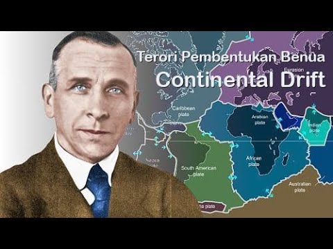
teori pembentukan benua Alfred Wegener

Mengerikannya Tabrakan Maut India: Melahirkan Pegunungan Himalaya Sang Pengubah Dunia!
O último litoral de Minas

What Is Pangaea & Plate Tectonic? | CONTINENTAL DRIFT | The Dr Binocs Show | Peekaboo Kidz

Fakta menakjubkan tentang Benua yang perlu kita ketahui!

Why was continental drift theory rejected?
5.0 / 5 (0 votes)