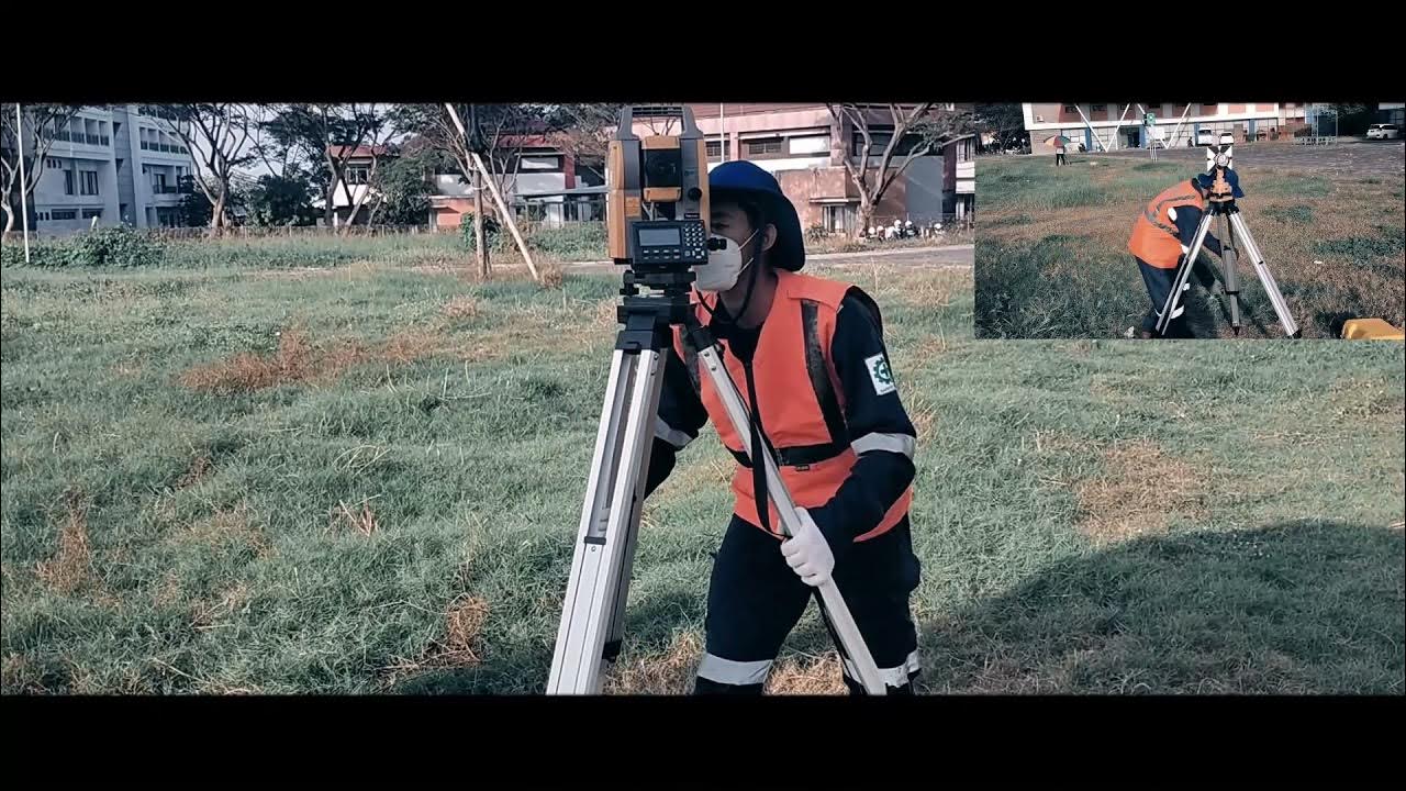
iPhone 16 Pro LiDAR and Camera vs Survey Total Station Accuracy
Summary
TLDRIn this video, the speaker explores the use of an iPhone 16 Pro in surveying tasks, comparing its accuracy with traditional equipment like total stations. They measure both horizontal and vertical distances across various points, such as building corners and curbs, revealing that the iPhone achieves about 2 feet of accuracy over distances of up to 100 feet. Despite some errors in the X and Y directions, the iPhone performs impressively well in the vertical dimension. The video highlights how mobile devices can be used for research in surveying, showcasing their potential for practical applications in the field.
Takeaways
- 😀 The iPhone 16 Pro’s camera and LiDAR sensors are evaluated for their accuracy in surveying and building 3D models.
- 😀 Pix 4D Catch app is used to create 3D models and point clouds for comparison with data from a traditional Total Station.
- 😀 The accuracy of the iPhone's GPS positioning is less reliable than a Total Station, especially for absolute measurements.
- 😀 Ground features like curbs and gutters show smaller errors (around 2-3 cm), while building measurements yield larger errors.
- 😀 Vertical measurements (Z values) show a slight discrepancy of about 6 hundredths of a foot, equating to approximately 2 cm of error.
- 😀 For larger distances (such as between point 3 and point 17), the iPhone shows a more significant error of around 4 feet due to the 2D measurement errors.
- 😀 Despite some discrepancies, the iPhone 16 Pro can achieve an accuracy of about 2 feet over a span of 100 feet for ground features.
- 😀 The experiment highlights the iPhone's potential as a research tool for mobile surveying applications, even though it's not designed for professional surveying.
- 😀 When measuring building corners, the iPhone shows higher error margins compared to ground feature measurements.
- 😀 Overall, the test demonstrates that mobile devices like the iPhone 16 Pro could complement traditional surveying tools for certain tasks, particularly in research and small-scale projects.
Q & A
What is the main goal of the experiment in the video?
-The main goal is to assess the accuracy of the iPhone 16 Pro's camera and LiDAR sensors in comparison to a professional surveying tool (Total Station) by measuring various points on a building and surrounding features.
How does the iPhone 16 Pro compare to the Total Station in terms of accuracy?
-The iPhone 16 Pro achieves relatively good accuracy for a consumer-grade device, with 2D accuracy within a few feet and 3D accuracy as precise as 2-3 cm. However, it still falls short of the Total Station's high precision, which is expected for large-scale surveying.
What type of points were measured in the experiment?
-The experiment measured both building corners and ground features such as curbs and gutters. The differences in measurements between the iPhone and Total Station were analyzed for these points.
What error was observed when measuring building corners with the iPhone?
-The error observed in measuring building corners was relatively higher, particularly in the Y-direction, compared to measuring ground features like curbs and gutters.
How does the iPhone 16 Pro perform when measuring ground features like curbs and gutters?
-The iPhone 16 Pro performed better in terms of accuracy when measuring ground features, with smaller errors observed compared to building measurements, particularly in the X and Y directions.
What was the vertical accuracy of the iPhone 16 Pro during the experiment?
-The vertical accuracy of the iPhone 16 Pro was impressive, with differences of only about 1 to 2 cm (less than an inch), even in longer measurements.
What was the longest distance measured in the experiment, and how accurate was the iPhone over that distance?
-The longest distance measured was between points 3 and 17, spanning approximately 100 feet. The iPhone showed an error of about 3 feet in the X and Y directions but only a 10th of a foot in the vertical direction.
What were the observed errors when comparing the iPhone's measurements to the Total Station at different distances?
-At shorter distances, the iPhone showed less error, but at longer distances, the errors increased, especially in the 2D measurements (horizontal). The vertical error remained small at around 1 inch (2.5 cm).
What is the significance of the 2D and 3D RMSE values in the analysis?
-The 2D and 3D Root Mean Square Errors (RMSE) help quantify the accuracy of the iPhone's measurements compared to the Total Station. Smaller RMSE values indicate higher accuracy, with the iPhone achieving about 2-3 cm in vertical accuracy and around 0.08 feet in 2D accuracy in some tests.
What is the general conclusion about the use of the iPhone 16 Pro for surveying tasks?
-The iPhone 16 Pro, while not designed for precise surveying, is capable of achieving decent accuracy, especially for short to medium distances. It can be a useful tool for certain applications, but it cannot replace high-precision equipment like Total Stations for large-scale or critical surveys.
Outlines

This section is available to paid users only. Please upgrade to access this part.
Upgrade NowMindmap

This section is available to paid users only. Please upgrade to access this part.
Upgrade NowKeywords

This section is available to paid users only. Please upgrade to access this part.
Upgrade NowHighlights

This section is available to paid users only. Please upgrade to access this part.
Upgrade NowTranscripts

This section is available to paid users only. Please upgrade to access this part.
Upgrade NowBrowse More Related Video

How to setup RTK on Mavic 3E, M300, & M350 with Emlid RS2/RS3 and NO internet. 4 Different Scenarios
Cara Pematokan (Stake Out) dengan Alat Total Station Topcon GM-55

Traverse Surveying Tutorial
Ilmu Ukur Tanah Basic (Part 2)

iPhone 16 Pro Max Setelah 3 Bulan

iPhone 16 Pro Battery Test! (Apple Finally Listened!)
5.0 / 5 (0 votes)