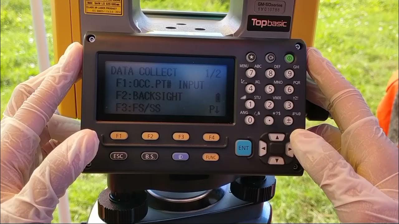
Cara Pematokan (Stake Out) dengan Alat Total Station Topcon GM-55
Summary
TLDRThis video provides a detailed guide to the process of staking out coordinates using a Total Station in surveying. It covers the necessary equipment, such as tripods, total stations, and target stickers, as well as personal protective gear for safety. The video outlines the step-by-step procedure for setting up the Total Station, inputting coordinates, and accurately marking points on the ground. Emphasizing precision and safety, it offers useful tips for both beginners and professionals involved in land surveying or construction layout tasks.
Takeaways
- 😀 Staking out involves transferring coordinate data from a design or blueprint to a specific point in the field.
- 😀 The primary equipment used for staking out includes an electronic total station, tripod, and prism polygon.
- 😀 Unlike field data collection, staking out 'returns' coordinates from a design to the field for construction or layout purposes.
- 😀 A key tool for staking out is the electronic total station, which ensures precise measurements of angles and distances.
- 😀 Essential safety equipment includes high-visibility vests, gloves, hats, and face masks to ensure worker safety during the process.
- 😀 Proper setup of the tripod involves aligning it with shoulder height, securing it in place, and ensuring it is level on the benchmark.
- 😀 When setting up the total station, it must be calibrated for maximum precision (around 0.05 accuracy).
- 😀 For accurate target identification, a sticker set target or prisma yalon is used, and points are marked using spray paint.
- 😀 After marking the points, chalk powder is used to connect the marked points on the ground, creating a layout that matches the design.
- 😀 The total station allows for precise aiming and measurement of angles, ensuring accuracy in marking the desired points on the ground.
Q & A
What is the main purpose of staking out in surveying?
-The main purpose of staking out is to determine the position of a point in the field based on the coordinates obtained from the work plan. It involves transferring the design coordinates onto the actual site for construction or other surveying purposes.
How does staking out differ from data collection in the field?
-While data collection involves measuring or gathering coordinates from the field, staking out is the reverse process. It involves transferring design coordinates from a blueprint or work plan back onto the site to mark specific points.
What are the primary tools required for staking out?
-The primary tools required for staking out include the electronic total station, tripod, Prisma Polygon (or sticker set target), umbrella, tape measure, spray paint, chalk powder, and a radio communication device (HD).
What role does the electronic total station play in the staking out process?
-The electronic total station is used for precise measurements and for transferring coordinates to the field. It helps in aligning and measuring the exact positions of points to be staked out based on the design.
Why is the tripod essential for setting up the total station?
-The tripod provides a stable base for the total station, ensuring that the measurements taken by the instrument are accurate. Proper setup of the tripod is crucial for the precision of the entire staking out process.
What is the purpose of using a Prisma Polygon or sticker set target in staking out?
-The Prisma Polygon (or sticker set target) serves as a reflective target that the total station uses to measure angles and distances. It helps in pinpointing the exact locations of the coordinates on the field during the staking out process.
Why is safety equipment like high-visibility vests and gloves important in staking out?
-Safety equipment such as high-visibility vests, gloves, and hats are important to ensure the safety of workers in the field. High-visibility gear makes workers more visible to others, reducing the risk of accidents, while gloves protect hands from potential hazards.
What are the steps involved in setting up the total station for staking out?
-The steps include positioning the tripod on the benchmark point, leveling the tripod, attaching the total station and Prisma Polygon, centering the instruments, and aligning them properly before starting the measurement process.
How do you perform backsighting with the total station?
-To perform backsighting, you point the total station at a known benchmark (BM2) where the Prisma Polygon is located. This alignment ensures that the total station is correctly oriented for accurate measurements.
What should you do once the correct point is located during staking out?
-Once the correct point is located, the target holder adjusts the sticker set target until the total station gives a precise reading. After this, the point is marked on the ground using spray paint or chalk powder to indicate the location.
What is the final step after completing the staking out process?
-After staking out all the points, the next step is to connect them using chalk powder, outlining the foundation layout as per the work plan. Then, the total station is turned off, and the equipment is cleaned and returned to its storage place.
Outlines

This section is available to paid users only. Please upgrade to access this part.
Upgrade NowMindmap

This section is available to paid users only. Please upgrade to access this part.
Upgrade NowKeywords

This section is available to paid users only. Please upgrade to access this part.
Upgrade NowHighlights

This section is available to paid users only. Please upgrade to access this part.
Upgrade NowTranscripts

This section is available to paid users only. Please upgrade to access this part.
Upgrade NowBrowse More Related Video

Cara Pengukuran Detail Situasi dengan Alat Total Station Topcon GM-55

TUTORIAL PENGOPRASIAN TOTAL STATION LEICA TS06 INDONESIA

TOTAL STATION : Si Kuning Alat Ukur

Tutorial Set Up Total Station Leica TS16 R1000 Dengan Leica Captivate V.7.0

ILMU UKUR TANAH MENGHITUNG KOORDINAT

PRAKTIK ILMU UKUR LAHAN (Pembuatan Profil atau Pelurusan) FAKULTAS KEHUTANAN ULM 2020
5.0 / 5 (0 votes)