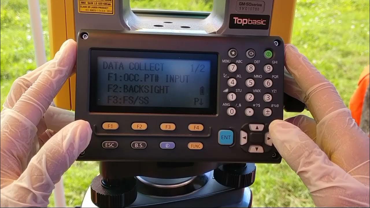
[TUTORIAL] Dasar Menggunakan Total Station South NTS 365 | CV.BNT BANDUNG
Summary
TLDRThis tutorial guides users through the step-by-step process of using the NTFS 365 Station South device for surveying. From setting up the equipment and adjusting the tripod to entering coordinates and measuring instrument height, the video covers the essentials of using the device for topographic and situational measurements. Key features such as the Nivo leveling tool, data collection layout, and measuring angles with the Visir tool are explained. The video emphasizes accurate data input and validation, making it a practical resource for beginners and professionals looking to master surveying techniques with the NTFS 365.
Takeaways
- 😀 The first step in using the surveying equipment is inserting the battery and ensuring the device is properly leveled using the built-in bubble level.
- 😀 The tripod or stand needs to be adjusted for stability before starting the calibration process.
- 😀 Calibration involves inputting the coordinates of the instrument’s position and base station, followed by measuring the instrument’s height from the reference point.
- 😀 In the Data Collection menu, users can create a new job and select between numeric or alphabetical input formats for the job data.
- 😀 Setting the coordinates for both the instrument and the base station is essential before taking any measurements.
- 😀 The device’s sighting tool (visir) helps aim at the target accurately for precise measurements.
- 😀 Users can take various types of measurements, including angles, distances, and coordinates for tasks like topography and layout.
- 😀 Each point being measured should be labeled and categorized with predefined codes to distinguish between different types of measurements (e.g., road, river).
- 😀 The equipment allows for both coordinate-based measurements and angle-based measurements, depending on the survey task at hand.
- 😀 After completing measurements, users can save and download the data for further processing or analysis in future steps.
- 😀 The tutorial assumes users have basic knowledge of surveying concepts and focuses on the technical aspects of operating the device efficiently.
Q & A
What is the main topic of the video script?
-The main topic of the video script is the usage and setup of the NTFS 365 station and its different types, including the laser and non-laser versions.
How do you start using the NTFS 365 device?
-To start using the NTFS 365 device, first insert the battery, then mount the Nivo tube onto the device, ensuring it is centered and leveled using a stative.
What should you do after inserting the Nivo tube?
-After inserting the Nivo tube, ensure the device is properly leveled and centered. This is important before proceeding with measurements to ensure accuracy.
How do you set the display brightness on the device?
-To adjust the display brightness, press the star button and use the 'I, ll' button to increase the brightness if needed.
What are the main functions available in the device menu?
-The main functions in the device menu include data collection layout, memory manager, program options for topography measurements, and other features for measuring height, area, and more.
What must be done before starting a topography measurement?
-Before starting a topography measurement, you must input the coordinates for the instrument and the base point using the appropriate options in the device menu.
How do you input coordinates for the instrument?
-To input coordinates for the instrument, select the 'OCBC' option, input the instrument height, and then enter the coordinates using the designated buttons on the device.
What is the significance of the 'backsight' in the measurement process?
-The 'backsight' refers to the coordinate of the reference point used for measurements. It is important to input these coordinates correctly to ensure accurate measurements.
What role does the 'visor' play in the measurement process?
-The visor helps the operator easily aim at the target during measurements. It features a white line for precise targeting.
What is the function of the 'SD' and 'NSZ' modes?
-'SD' mode is used for measuring distances and angles, while 'NSZ' is used when only the angle needs to be measured without calculating the distance or coordinates.
Outlines

This section is available to paid users only. Please upgrade to access this part.
Upgrade NowMindmap

This section is available to paid users only. Please upgrade to access this part.
Upgrade NowKeywords

This section is available to paid users only. Please upgrade to access this part.
Upgrade NowHighlights

This section is available to paid users only. Please upgrade to access this part.
Upgrade NowTranscripts

This section is available to paid users only. Please upgrade to access this part.
Upgrade NowBrowse More Related Video

Cara Pengukuran Detail Situasi dengan Alat Total Station Topcon GM-55

[TUTORIAL 1] DASAR MENGGUNAKAN TOTAL STATION TOPCON GM-101 SERIES | ANAK TEKNIK

Tutorial Set Up Total Station Leica TS16 R1000 Dengan Leica Captivate V.7.0

How to create Partition on Windows 10 | Partition Hard Drives

How to Repair PST & OST file Outlook 365

How To Create a Realistic Talking AI Avatar with Hand Movements for FREE | Full Step-by-Step Guide
5.0 / 5 (0 votes)