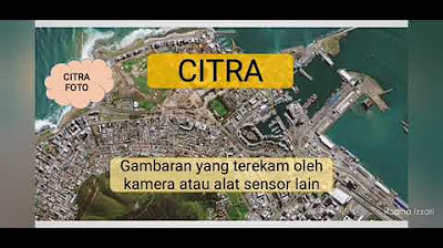
Geografi Kelas X "Interpretasi Citra Penginderaan Jauh" bersama Ustazah Della Vinta Asprilla, S.Pd.
Summary
TLDRIn this engaging geography lesson, Ustadzah Bella introduces the concept of remote sensing and its practical applications, such as Google Maps and drones. Students learn to interpret remote sensing imagery through eight key elements: form, color, size, texture, shadows, pattern, site, and association. The lesson combines theoretical knowledge with hands-on activities, empowering students to analyze geographical data effectively. By integrating religious context, the lesson emphasizes the divine creation of the Earth, enriching students' understanding and appreciation of geography. Overall, the session fosters critical thinking and encourages active learning through practical engagement.
Takeaways
- 🌍 Understanding remote sensing is crucial for interpreting geographical data and identifying objects without direct contact.
- 📚 The lesson focuses on the interpretation of remote sensing imagery based on specific criteria.
- 🕌 The Earth is described as being created by Allah in layers, similar to the seven heavens, emphasizing its complexity.
- 🗺️ Tools like Google Maps and drones serve as practical examples of remote sensing applications in everyday life.
- 🔍 Image interpretation involves detecting, identifying, and analyzing objects visible in the imagery.
- ⚙️ There are eight key elements of image interpretation: shape, tone, size, texture, shadow, pattern, site, and association.
- 🔺 Shape helps identify objects based on their clear geometric forms, like buildings and natural features.
- 🌈 Tone indicates the brightness of objects, helping differentiate between materials like water and vegetation.
- 📏 Size allows for comparisons between objects and their surroundings, aiding in scale interpretation.
- 🖼️ Texture reveals the roughness or smoothness of an object, impacting how it is perceived in the imagery.
Q & A
What is the main topic of Ustadzah Bella's lesson?
-The main topic is interpreting remote sensing images in geography.
What does remote sensing allow us to do?
-Remote sensing allows us to understand phenomena or objects in a particular area without direct contact.
Can you name the eight elements of image interpretation mentioned in the lesson?
-The eight elements are form, tone, size, texture, shadow, pattern, site, and association.
How does the 'form' element contribute to image interpretation?
-The 'form' element helps recognize objects based on their shapes, such as identifying buildings by their rectangular shapes.
What is the significance of the 'tone' element in interpreting images?
-The 'tone' element indicates the brightness of objects in an image, which helps differentiate materials based on their light absorption.
How can size be used in image interpretation?
-Size can be assessed by comparing the dimensions of objects with their surroundings, providing context and scale.
What does texture refer to in the context of remote sensing?
-Texture refers to the surface quality of objects, which can be categorized as fine, medium, or coarse based on the image details.
What role do shadows play in image interpretation?
-Shadows can indicate the direction of sunlight, the height of objects, and provide additional details about the features in the image.
What is the importance of understanding 'site' when interpreting images?
-Understanding 'site' refers to knowing an object's location relative to its environment, which aids in contextually interpreting its function.
How does the 'association' element enhance our understanding of objects?
-The 'association' element explores relationships between objects, such as recognizing a train station due to its proximity to railway tracks.
Outlines

This section is available to paid users only. Please upgrade to access this part.
Upgrade NowMindmap

This section is available to paid users only. Please upgrade to access this part.
Upgrade NowKeywords

This section is available to paid users only. Please upgrade to access this part.
Upgrade NowHighlights

This section is available to paid users only. Please upgrade to access this part.
Upgrade NowTranscripts

This section is available to paid users only. Please upgrade to access this part.
Upgrade NowBrowse More Related Video

Penginderaan Jauh (Part-1)

Rangkuman Materi: Penginderaan Jauh

Pengindraan Jauh atau Remote Sensing #geography #education #kurikulummerdeka #remotesensing

Penginderaan Jauh: Pengertian dan Komponen | Geografi Kelas 10 - KHATULISTIWA MENGAJAR

Definisi dan Komponen Penginderaan Jauh (PJ)/ Geografi Kelas X/ Kurikulum Merdeka

What is Remote Sensing and GIS?
5.0 / 5 (0 votes)