Penginderaan Jauh: Pengertian dan Komponen | Geografi Kelas 10 - KHATULISTIWA MENGAJAR
Summary
TLDRThe video explains the concept of remote sensing using Google Maps as an example. It highlights how this technology allows users to navigate easily by providing real-time directions based on digital maps. The process of remote sensing involves using energy sources—either solar for passive sensing or artificial for active sensing—along with sensors and platforms like satellites to collect data. This data plays a crucial role in various applications, including weather monitoring, land use analysis, and border protection. Overall, the video emphasizes the importance of remote sensing in both daily life and scientific research.
Takeaways
- 🗺️ Google Maps simplifies navigation by allowing users to type a destination and receive a digital map with directions.
- 🔄 The system can automatically redirect users if they take a wrong turn, demonstrating its real-time adaptability.
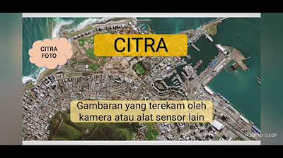
- 🌍 Remote sensing, or 'indrajaa,' is a technology that collects information about the Earth's surface without direct contact.
- ⚡ Energy sources are crucial for remote sensing, which can be active (artificial) or passive (natural sunlight).
- 📡 Sensors capture data by recording energy that reflects off objects on the Earth's surface.
- 🚀 Various platforms, such as balloons, aircraft, and satellites, are used in remote sensing to gather information.
- 📊 Collected data can be divided into visual (images) and digital (numerical) formats for analysis.
- 🌦️ Remote sensing is valuable in monitoring and predicting weather and climate changes.
- 🏞️ The technology assists in analyzing land use on a macro scale and contributes to environmental research.
- 🛡️ Remote sensing also plays a role in national security by monitoring borders and territory.
Q & A
What is Google Maps, and how does it assist users?
-Google Maps is a digital mapping service that allows users to search for locations and provides directions. It helps users navigate by recalculating routes if they take a wrong turn.
What is remote sensing, and how is it related to Google Maps?
-Remote sensing is a technology used to gather information about objects or areas on the Earth's surface without direct contact. It plays a key role in how Google Maps collects and processes geographical data.
What are the two types of energy sources used in remote sensing?
-Remote sensing uses two types of energy sources: active energy sources, which are artificial and used at night, and passive energy sources, which utilize sunlight during the day.
What role do sensors play in remote sensing?
-Sensors are crucial in remote sensing as they capture data from the Earth's surface. This data can be in the form of images or numerical values.
What types of platforms (vehicles) are commonly used in remote sensing?
-Common platforms for remote sensing include balloons, airplanes, space shuttles, and satellites.
How is data from remote sensing utilized?
-Data obtained from remote sensing is analyzed and used by individuals or institutions for various applications, such as monitoring environmental changes and land use.
What are the two main types of data produced by remote sensing?
-The two main types of data produced by remote sensing are visual data (images) and digital data (numerical values).
In what fields can remote sensing be applied?
-Remote sensing can be applied in various fields, including geography, environmental monitoring, climate change prediction, and scientific research.
What are the benefits of remote sensing in monitoring weather and climate?
-Remote sensing provides critical information for monitoring and predicting weather patterns, climate changes, and land usage on a macro scale.
What is the importance of the final users of remote sensing data?
-The final users of remote sensing data play a vital role in interpreting and utilizing the data for specific activities, such as research and policy-making.
Outlines

This section is available to paid users only. Please upgrade to access this part.
Upgrade NowMindmap

This section is available to paid users only. Please upgrade to access this part.
Upgrade NowKeywords

This section is available to paid users only. Please upgrade to access this part.
Upgrade NowHighlights

This section is available to paid users only. Please upgrade to access this part.
Upgrade NowTranscripts

This section is available to paid users only. Please upgrade to access this part.
Upgrade NowBrowse More Related Video
5.0 / 5 (0 votes)


