BELAJAR ARCGIS UNTUK PEMULA #PART1 || DASAR DASAR DATA SPATIAL, IMPORT DATA, BUKA & SIMPAN PROJECT.
Summary
TLDRThis tutorial introduces beginners to spatial data and how to use GIS (Geographical Information Systems) software, focusing on shapefiles (SHP) and their associated files. The speaker explains how to add and manage spatial data in the GIS application, covering essential concepts like point, line, and polygon data. The video also demonstrates basic navigation within the software, including file management, creating new projects, and understanding the Data View and Layout View. Aimed at newcomers, the tutorial provides a solid foundation for working with GIS, setting the stage for more advanced lessons in future videos.
Takeaways
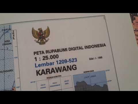
- 😀 Spatial data is essential for GIS programs, often stored in various file types like SHP, DBF, SBN, and SBX.
- 😀 Missing or misplaced files in a spatial data set can cause issues, as the GIS application requires all related files to function properly.
- 😀 The required files for a functioning spatial data set include SHP, DBF, and SBN, while others like CPG are optional.
- 😀 GIS software like ArcGIS has a default interface with basic tools for data management, and it is similar to other applications in terms of features.
- 😀 Users can add spatial data to ArcGIS by navigating through the 'File' menu and selecting 'Add Data' to connect the software to the data folder.
- 😀 Spatial data in ArcGIS can be represented in three formats: Point (for locations), Line (for roads or rivers), and Polygon (for areas like districts or fields).
- 😀 When adding spatial data to ArcGIS, it's important to ensure that all files are in the same directory for proper functionality.
- 😀 ArcGIS users can create new projects or open existing ones through the 'File' menu, and save projects for future use.
- 😀 In ArcGIS, there are two main views: Data View (for editing and managing data) and Layout View (for creating map layouts with legends and other map details).
- 😀 A beginner should first focus on understanding spatial data, how to import it into ArcGIS, and the basic functions of the software before delving deeper into complex features.
- 😀 This tutorial is aimed at GIS beginners, explaining the software in simple terms without technical jargon, ideal for those starting from scratch.
Q & A
What is the primary focus of this tutorial?
-The primary focus of this tutorial is introducing beginners to GIS (Geographic Information System) software, specifically how to work with spatial data and use the ArcGIS software.
What is spatial data, and why is it important in GIS applications?
-Spatial data refers to data that represents the location, shape, and attributes of geographic features. It is important in GIS applications because it allows users to map, analyze, and visualize geographical information.
What are the common types of spatial data formats mentioned in the video?
-The common spatial data formats mentioned in the video include SHP (shapefiles), DBF (attribute data), JPG (images), and files such as SBN and SBX which are part of the shapefile format.
What happens if one of the spatial data files is missing or located in a different folder?
-If one of the spatial data files is missing or located in a different folder, the data will not be readable in the GIS application, meaning the project won't work correctly.
Which files are mandatory for a shapefile to be properly recognized in ArcGIS?
-The mandatory files for a shapefile to be properly recognized in ArcGIS are the SHP file, SBN file, and SBX file. Other files like CPG or DBF are usually supportive.
How can users add spatial data into the ArcGIS software?
-Users can add spatial data into ArcGIS by navigating to the 'File' menu, selecting 'Add Data,' and then choosing the desired spatial data file. Alternatively, users can connect to the folder where the data is stored.
What are the three basic types of geometric objects in spatial data?
-The three basic types of geometric objects in spatial data are Point (used for specific locations like offices or monuments), Line (used for linear features like roads or rivers), and Polygon (used for areas like land plots or administrative boundaries).
What is the difference between 'Data View' and 'Layout View' in ArcGIS?
-The 'Data View' in ArcGIS is used for editing and analyzing spatial data, while the 'Layout View' is used for creating map layouts, including elements like legends, scales, and labels, without altering the underlying data.
What can the 'New' option in the 'File' menu do in ArcGIS?
-The 'New' option in the 'File' menu allows users to create a new project or open a blank map to start a fresh spatial data analysis project in ArcGIS.
What is the importance of understanding spatial data and software tools for GIS beginners?
-For GIS beginners, understanding spatial data and the tools in GIS software is crucial to effectively analyze and visualize geographic information, which is the foundation of working with GIS systems.
Outlines

This section is available to paid users only. Please upgrade to access this part.
Upgrade NowMindmap

This section is available to paid users only. Please upgrade to access this part.
Upgrade NowKeywords

This section is available to paid users only. Please upgrade to access this part.
Upgrade NowHighlights

This section is available to paid users only. Please upgrade to access this part.
Upgrade NowTranscripts

This section is available to paid users only. Please upgrade to access this part.
Upgrade Now


5.0 / 5 (0 votes)