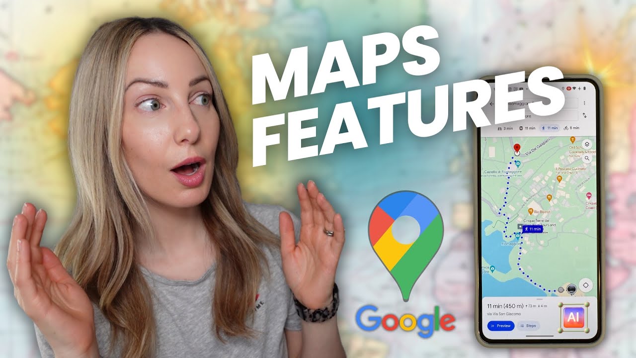
Top 20 Google Maps Tips & Tricks: All the best features you should know!

Kevin Stratvert
9 Mar 202211:29

Summary

TLDRDiscover the top 20 Google Maps tips and tricks to enhance your navigation experience. Learn how to zoom with one finger, save your parking spot, explore your location history, and even time travel with Street View history. Interact using voice commands, customize your vehicle icon, and create labels for easy navigation. Save locations for future visits, download offline maps, measure distances and areas, share your real-time location, and navigate public transit with ease. Google Maps offers a wealth of features to make your travel planning and journey more efficient and enjoyable.

Takeaways

  • 🔍 One-finger zoom: Easily zoom in and out on Google Maps by double-tapping with one finger and sliding up or down.
  • 🚗 Parking reminder: Save your parking location with a tap on the blue dot, or enable automatic saving via Google Maps settings for a convenient way to find your car.
  • 📍 Location history: Access your location history and timeline to review your past visits and overlaid photos, creating an automated diary of your life's travels.
  • 🕰️ Street View history: Explore past images of a location in Street View by going back in time, observing changes and development over the years.
  • 🗣️ Voice commands: Use voice commands during navigation by saying 'OK Google' followed by your request, such as finding gas stations or setting navigation to a specific destination.
  • 🚲 Vehicle icon customization: Personalize your navigation experience by changing the vehicle icon that represents you on the map.
  • 🏷️ Custom labels: Create custom labels for frequently visited places to easily navigate to them in the future by typing the label into the search bar.
  • 📌 Save locations: Save points of interest for future reference and even share these saved lists with others for collaborative planning.
  • 🌐 Offline maps: Download offline maps for areas you plan to visit, saving on data usage and allowing access when an internet connection is not available.
  • 📐 Measure distance and area: Use the measure tool to calculate distances between points or the area of a specific location, such as a stadium field.
  • 📍 Share real-time location: Share your current location with others for a set period or until a certain destination is reached, providing a live map update.

Q & A

  • How can you zoom in and out on Google Maps using one finger?

    -You can double tap with one finger and then slide your finger up or down to zoom in and out.

  • What is the feature that allows Google Maps to remember your parking location?

    -You can tap on the blue dot indicating your current location to save your parking location, or enable the automatic parking location reminder in the settings under navigation.

  • How does Google Maps' location history feature work?

    -With location tracking turned on, you can access your timeline to see a map with red dots indicating the places you've been, along with your photos and daily activities.

  • What is Street View history and how can you access it?

    -Street View history allows you to see past photos of a location by clicking on the yellow person icon, selecting a blue street, and then clicking on the date in the top left-hand corner to go back in time.

  • How can you use voice commands with Google Maps?

    -Click on the microphone icon during navigation or set up voice commands through your profile settings by saying 'OK Google' followed by your question.

  • How can you change your vehicle icon in Google Maps?

    -Tap on the arrow icon next to your navigation route to choose a different vehicle for your journey.

  • What are custom labels in Google Maps and how do you use them?

    -Custom labels are personalized names you can assign to frequently visited locations, making it easier to navigate to them by simply typing the label in the search bar.

  • How do you save a location in Google Maps?

    -Click on the save button for a location, then access your saved items through the hamburger menu under 'Your places'.

  • What is the purpose of downloading offline maps in Google Maps?

    -Downloading offline maps allows you to use Google Maps without an internet connection, which can be helpful for saving bandwidth or when no internet is available.

  • How can you measure distance and area using Google Maps?

    -Right-click on the map and select 'measure distance' to connect points and calculate the distance or area between them.

  • How does Google Maps help with real-time location sharing?

    -You can tap on your blue dot and select 'share location' to let others see your real-time location on a map for a defined period or until you choose to stop sharing.

Outlines

00:00

🌍 Essential Google Maps Tips and Tricks

This paragraph introduces a series of Google Maps tips and tricks, highlighting the ability to zoom with one finger, save your parking location, view location history, and use Street View history for time-traveling on various roads and waterways. It also mentions the integration of photos and the convenience of voice commands for navigation.

05:02

📍 Customizing and Saving Your Maps Experience

The second paragraph focuses on personalizing Google Maps by changing the vehicle icon, creating custom labels for easy navigation, saving locations for future reference, downloading offline maps for areas with limited internet access, and measuring distances and areas on the map. It also touches on sharing real-time location with others and configuring route options to avoid highways, ferries, and tolls.

10:05

🚉 Exploring Indoor Maps and Advanced Navigation Features

This paragraph delves into the capabilities of Google Maps for indoor navigation within select buildings and its advanced features such as adding multiple stops to a route, setting reminders for arrival times, modifying routes by drag-and-drop, utilizing public transportation options, and viewing traffic patterns at different times of the day.

🌴 Comparing Vacation Destinations and Uncovering Secrets

The final paragraph discusses using Google Maps to compare flight prices for different vacation destinations, setting arrival reminders for specific times, and a humorous exploration of Area 51 through Street View, concluding with an invitation for viewers to share their own tips and a prompt to subscribe for more content.

Mindmap

Keywords

💡Google Maps

Google Maps is a web-based service that provides real-time GPS navigation, street maps, and route planning. In the video, it's the central platform through which various tips and tricks are demonstrated, such as zooming, parking location memory, and Street View history.

💡Zooming

Zooming refers to the action of adjusting the scale or magnification level of a map to see more or less of the area. In the context of the video, it's mentioned that instead of the traditional two-finger pinch to zoom, users can double tap with one finger and slide up or down to zoom in and out on Google Maps.

💡Parking Location Memory

This feature allows Google Maps to save the location where a user has parked their car. It's particularly useful for remembering where you've parked, especially in unfamiliar areas. The video describes how to manually save a parking location or enable an automatic parking detection feature in the app's settings.

💡Location History

Location History is a feature that records a user's movements when certain location services are enabled. It creates a timeline of visited places, allowing users to review their past travels. The video highlights how to access this feature and use it to revisit past trips or view overlaid photos on the map.

💡Street View

Street View is a feature of Google Maps that provides panoramic, 360-degree views of streets and other locations around the world. It allows users to explore locations as if they were there in person. The video explains how to access Street View and use it to see the history of a location by looking at past images.

💡Voice Interaction

Voice Interaction refers to the ability to control and communicate with a device using spoken commands. In the context of Google Maps, it means users can give navigation commands without touching the screen. The video shows how to enable voice commands and use phrases like 'OK Google' to ask questions or give directions.

💡Vehicle Icon

The Vehicle Icon in Google Maps represents the user's mode of transportation, which can be customized to reflect the type of vehicle being used. This adds a personal touch to the navigation experience and can also help in identifying the route on the map. The video explains how to change the vehicle icon by tapping on the arrow icon and selecting a different vehicle.

💡Custom Labels

Custom Labels are user-defined tags that can be added to saved locations in Google Maps to make them easily identifiable and accessible. This feature is particularly helpful for remembering places that are frequently visited but whose addresses are hard to recall. The video describes how to create custom labels for locations and how they can be used in navigation.

💡Offline Maps

Offline Maps is a feature that allows users to download maps for specific areas so they can be used without an internet connection. This can be beneficial in areas with limited or no internet access or when users want to save on data usage. The video explains how to create and download offline maps for later use.

💡Distance and Area Measurement

This feature in Google Maps enables users to measure the distance between two points or calculate the area of a specific region on the map. It's useful for getting an approximate measure of distances or the size of an area without needing additional tools. The video demonstrates how to use this feature to measure the distance from Johnston Ridge Observatory to the crater of Mount Saint Helens and to calculate the area of a football stadium field.

💡Real Time Location Sharing

Real Time Location Sharing is a feature that allows users to share their current location with others in real time. This can be useful for coordinating meetups, ensuring safety, or simply letting others know your whereabouts. The video explains how to share your location for a set period of time with chosen contacts.

Highlights

Zoom in and out with one finger by double tapping and sliding up or down.

Google Maps can remember your parking location with a pin on the map.

Access your location history to see where you've been, with red dots marking different places.

Street View history allows you to travel back in time to see past images of locations.

Control Google Maps with voice commands by saying 'OK Google' followed by your request.

Change your vehicle icon for a personalized Maps experience.

Create custom labels for easy navigation to important places like 'Dentist'.

Save locations for future visits, like planning a business trip or marking points of interest.

Download offline maps for areas you plan to visit without internet or to save on bandwidth.

Measure distance and area on maps, useful for planning and estimation purposes.

Share your real-time location with others for a defined period or until a certain destination is reached.

Customize route options to avoid highways, ferries, tolls, and more.

Explore the inside of select buildings, like malls, and switch between different floors.

Add multiple stops to your route and reorder them as needed.

Set reminders to arrive at your destination at a specific time, accounting for traffic.

Modify your route by dragging and dropping points on the map.

Navigate public transportation by viewing train, bus, or subway routes on Maps.

View traffic layers to see current traffic or predict traffic at different times of the day.

Quickly evaluate pricing for different vacation destinations by moving the destination marker on the map.

Explore Area 51 in Street View and discover what's hidden from the public.

Transcripts

play00:00

Hi everyone, Kevin here.

play00:02

Today we are going to look at the best Google Maps, tips and tricks.

play00:07

To jump around this video, feel free to use the time stamps down below.

play00:11

All right let's check these out.

play00:13

At #1, you can zoom in and out just by using one finger.

play00:18

Typically to zoom in and out, you need two fingers, and you can either pinch or expand,

play00:23

but you can also just double tap with one finger and then slide your finger up or down

play00:28

to zoom in and out.

play00:30

At #2.

play00:31

You can have Google Maps remember your parking location.

play00:34

I always seem to forget where I park my car, but now I'll always know where my car is.

play00:40

Unless of course I park in Oklahoma City.

play00:43

Within Google Maps, simply tap on the blue dot that indicates where you currently are,

play00:48

and then you can save your parking location.

play00:51

On the map, you'll now see a pin that shows you where your car is.

play00:55

Once you return, you can click on that pin and you can clear it out.

play00:58

If you would rather have Google Maps remember automatically where your car is, click on

play01:03

your profile picture.

play01:04

Then go to settings, navigation and here you can toggle it on so Google Maps remembers

play01:10

your parking location.

play01:11

At #3, you can see where you've been using location history.

play01:17

Now to be fair, this one is a little bit creepy, but also really cool.

play01:22

To be able to use this, you have to make sure to turn on location tracking.

play01:27

Click on the hamburger menu and then select your timeline.

play01:31

Here I see a map of the world with red dots indicating all of the different places I've

play01:35

been.

play01:37

Let's say I want to revisit my trip to Orlando, FL.

play01:40

Here I'll click on the dot in Orlando.

play01:43

And here I can see that I flew to Orlando through Dallas and down below I see day by

play01:48

day that I was on this trip so I can click through and see every single thing that I

play01:52

did.

play01:53

If I move to the 9th, here I can see that I went on a trip to the Kennedy Space Center.

play01:58

And what's really neat is it also overlays your photos on your map data.

play02:03

So here I can see a photo of myself in front of the NASA sign and here if I go down I could

play02:08

also see the Space Shuttle Atlantis.

play02:11

It's pretty much like an automated diary of your life.

play02:14

At #4, you can time travel using something called Street View history.

play02:20

To access Street View, you click on the little yellow person icon in the bottom right-hand

play02:26

corner and then all of the different roads will highlight in blue indicating where Street

play02:30

View is available.

play02:32

And it's truly mind boggling how many different roads Google has covered.

play02:37

Here when I zoom out, you start to get a sense for the massive scope of their coverage.

play02:42

And it's not just roads that they've covered.

play02:44

They've even covered some waterways as well.

play02:47

To use Street View, I simply select the person icon in the bottom right, and then I can drag

play02:52

it onto one of the blue streets and this will show me the most current picture of this location.

play02:59

In the top left-hand corner, I can see the date of the photo, but if I click on that,

play03:04

I can also go back in time and access past photos.

play03:08

So here you see that in this current photo there are some large condo buildings at this

play03:12

intersection.

play03:13

But now if I go back in time just a few years ago, these were all parking lots.

play03:18

It really shows you the massive construction growth going on in the City of Seattle right

play03:22

now.

play03:23

At #5, you can interact with Google Maps simply by using your voice.

play03:28

The easiest way to do that is to simply click on the microphone icon when you're navigating,

play03:33

but an even easier way to do that is to click on your profile picture.

play03:38

Then click on settings.

play03:39

Then click on navigation and set it so you simply say OK Google and then you can ask

play03:44

your question.

play03:45

So here I am navigating, and I can say OK Google show me all gas stations along my route.

play03:52

Here now I see all of the gas stations and the associated price.

play03:56

If I don't care about price, I could also say OK Google, route me to the nearest gas

play04:02

station and there it is.

play04:04

At #6, and this is a quick one, you can change your vehicle icon.

play04:10

Simply tap on the arrow icon and then you can choose a different vehicle.

play04:14

At #7, you can create custom labels to make it easier to get back to the places that you

play04:20

care about.

play04:21

I always use my phone to navigate to my dentist, but I never remember what the address is,

play04:26

so here I can simply type in the address and then I can add a label for this, and here

play04:31

I'll type in Dentist.

play04:33

Now in the future when I'm navigating, all I need to do is type in dentist and Google

play04:38

Maps will know exactly where that is.

play04:41

At #8, you can also save a location.

play04:45

I'm currently pulling together a plan for a business trip at the Kevin Cookie Company

play04:50

and I've always wanted to visit Hershey's Chocolate World in Pennsylvania.

play04:56

This will be a great opportunity to try to get some of their trade secrets... inspiration

play05:01

for the Kevin Cookie Company.

play05:04

Here I'll click on save.

play05:06

Now I can go up to the hamburger menu, click on your places, and when I click into this

play05:11

list, here I see my saved item.

play05:13

I can even share this list with others so we can collaborate on pulling together the

play05:18

plan for this trip.

play05:19

At #9 you can download offline maps.

play05:23

This way, if let's say you don't have Internet, or maybe you want to save on bandwidth, you

play05:28

can use offline maps.

play05:31

Simply click on your profile picture, then click on offline maps.

play05:35

You can now create your own map and here you can highlight the area that you want to make

play05:41

available offline.

play05:43

The larger the area, the more space the map will take and the smaller the area, the less

play05:48

space the map will take.

play05:49

Then simply click on download when you're ready to get your offline map.

play05:53

At #10, you can also measure distance and area.

play05:58

Here we are at Mount Saint Helens, the site of the deadliest US volcano.

play06:04

Here I am at Johnston Ridge Observatory.

play06:07

Here I can right click and then select measure distance.

play06:10

Next, I will click into the crater, and it looks like the observatory is about 5 miles

play06:16

away from the crator.

play06:17

So if there were another eruption and you were at the observatory, with eruption moving

play06:23

at 300 miles per hour, you would have about one minute to find your way to safety.

play06:29

Good luck.

play06:31

You can also calculate area.

play06:33

Here we are at Michigan Stadium.

play06:35

This is the largest US football stadium with over 110,000 seats.

play06:41

Let's say I want to know how much grass seed do I need to buy to cover the entire field.

play06:47

Here I'll go to the corner of the field and then once again select measure distance.

play06:51

Then I can click in each corner of the field and once I connect all of the points, I can

play06:56

now see the area.

play06:58

And it looks like 6,300 square meters.

play07:02

That's a lot of grass seed.

play07:04

At #11, you can share your real time location with others.

play07:09

Simply tap on your blue dot and then click on share location.

play07:13

You can then define how long you want to share your location for, and then who you want to

play07:18

share it with.

play07:19

The other person will then be able to see your real time location on a map.

play07:24

At #12, you can configure various route options like avoiding highways, ferries and also tolls.

play07:31

To access this, click on your profile picture, then select settings, navigation and here

play07:36

you have various route options that you can adjust.

play07:40

At #13, Google Maps isn't just for the outside world.

play07:44

You can also see inside certain select buildings.

play07:48

Here I am at Bellevue Square mall.

play07:50

And when I zoom in enough, I can see where each retailer is within the mall.

play07:55

In the bottom right-hand corner, I could even switch between the different floors within

play07:59

the building.

play08:00

At #14, and this one is not entirely obvious on mobile.

play08:05

You can add multiple stops.

play08:07

Here for instance, I have two stops that are already entered.

play08:11

I can click on the ellipsis, and I can now add another stop.

play08:15

Once I add this stop, I can press and hold to reorder them.

play08:18

At #15, Google Maps can ensure that you are always on time.

play08:23

I want to visit the original Girardelli Ice Cream and Chocolate Shop and they open right

play08:29

at 11:00 AM and that's also right when I want to arrive.

play08:34

Instead of departing right now, if I scroll all the way to the bottom, there's the option

play08:38

to remind me.

play08:40

I can have it remind me to depart at a certain time, or I could set it to arrive by a certain

play08:46

time.

play08:47

I'm going to select arrive by and then set it to 11:00 AM.

play08:51

This will now give me a reminder that factors in traffic when I need to leave.

play08:56

And at #16, I can modify my route simply by dragging and dropping.

play09:02

Here for instance, I have my route already set up.

play09:05

Here, I'll drag it over and this now modifies my route to go through that point that I selected.

play09:10

I did if I want to undo this, I can simply double click on that point, and it'll go back

play09:15

to the original version.

play09:17

At #17, you can use Google Maps to help you navigate public transportation.

play09:23

When you select a start point and an end point instead of leaving it set to the vehicle,

play09:28

switch it to the public transit icon.

play09:31

And this will show you what trains or buses or subways you need to take to get to your

play09:35

destination.

play09:37

This has saved me so many times in so many different cities.

play09:41

At #18 you can view what traffic looks like at different parts of the day.

play09:47

In the bottom left-hand corner, I'm going to change the layer to the traffic layer and

play09:51

here I see traffic right now, but I can also change this so I can see traffic at any point

play09:58

during the day.

play09:59

So if I want to know what does traffic typically look like on say, Tuesday mornings, I can

play10:04

see which routes get the most congested.

play10:06

At #19, you can use Google Maps to very quickly evaluate pricing for different vacation destinations.

play10:15

Simply select your start point and then select a destination and click on the flight icon.

play10:20

You can now move your destination to different locations on the map and it'll update to show

play10:25

what the pricing looks like.

play10:27

So here I could look at a few different destinations and I don't know, maybe a vacation in Hawaii

play10:32

looks really nice.

play10:34

This brings us to #20, our very last tip of the day.

play10:39

I've always wondered what is at Area 51?

play10:43

Here I am over the base in Nevada.

play10:45

Has Street View been able to penetrate the base.

play10:49

Here I'll click on the Street View icon and pull it over the base.

play10:53

And look at that, it shows a UFO.

play10:56

I knew it.

play10:57

We are not alone.

play10:58

All right, let me know down below in the comments, are there any other tips that you would recommend?

play11:05

To watch more videos like this one, please consider subscribing and I’ll see you in

play11:10

the next video.

Rate This

5.0 / 5 (0 votes)

Related Tags
GoogleMapsNavigationTipsParkingReminderLocationHistoryStreetViewVoiceCommandsCustomLabelsOfflineMapsRouteOptionsPublicTransit