Mapping the Invisible: Introduction to Spectral Remote Sensing
Summary
TLDRThis script explains the concept of spectral remote sensing, which involves measuring properties of objects using reflected light energy across the electromagnetic spectrum. It distinguishes between regular cameras that capture visible light and imaging spectrometers that record both visible and non-visible light, aiding in environmental monitoring. The script details how spectral signatures, influenced by an object's chemical and physical properties, enable scientists to identify and map different surfaces and objects, such as vegetation, using multi and hyperspectral data.
Takeaways
- 📷 Spectral remote sensing involves measuring properties of objects using light from the electromagnetic spectrum, including both visible and invisible light.
- 🌐 A typical camera captures visible light reflected by objects, while imaging spectrometers are used by scientists to measure more detailed environmental changes.
- 🌳 Imaging spectrometers mounted on aircraft and satellites help create detailed maps, such as vegetation cover across the United States.
- 🌈 The electromagnetic spectrum is composed of thousands of wavelengths, with visible light being just a small part of it.
- 🔍 Imaging spectrometers divide the spectrum into specific groups of wavelengths called bands, which are used to detect different features of the environment.
- 🌿 Different objects have unique spectral signatures based on how they reflect, absorb, and transmit light, which is influenced by their chemical and structural properties.
- 🐕 Examples like plant leaves reflecting more green light and a dog reflecting more red light illustrate how spectral signatures vary between objects.
- 🖼️ RGB images are created from the red, green, and blue bands of the electromagnetic spectrum, with each pixel representing a combination of these colors.
- 📊 Spectral signatures can be plotted to show the amount of energy reflected at different wavelengths, helping to distinguish between different types of surfaces and objects.
- 🌱 Multi and hyperspectral remote sensing data, recorded by imaging spectrometers, allow for the measurement of light in both visible and non-visible parts of the spectrum, aiding in environmental monitoring.
Q & A
What is spectral remote sensing?
-Spectral remote sensing involves measuring the properties of objects without directly touching them by capturing both visible and invisible light within the electromagnetic spectrum.
How do imaging spectrometers differ from typical cameras?
-Imaging spectrometers are high-powered cameras that measure changes in environmental factors like water quality or vegetation cover and health, using both visible and non-visible light in the electromagnetic spectrum.
What is the significance of the electromagnetic spectrum in remote sensing?
-The electromagnetic spectrum is crucial in remote sensing as it contains thousands of wavelengths of energy that can be detected and recorded to analyze the properties of objects on Earth's surface.
What is the role of spectral resolution in imaging spectrometers?
-Spectral resolution refers to the width and number of bands in the spectrum that an imaging spectrometer can capture. Higher spectral resolution means more, spectrally narrow bands, allowing for more detailed analysis.
Why are different objects' spectral signatures important in remote sensing?
-Different objects' spectral signatures are important because they represent the unique physical and chemical properties of the objects, which can be used to identify and classify them in remote sensing imagery.
How does the color of an object, like a plant leaf, relate to its spectral signature?
-The color of an object, such as a plant leaf being green, is due to its reflection of more green light than blue or red light, which is reflected in its spectral signature as a higher intensity in the green band of the spectrum.
What is an RGB image and how is it created?
-An RGB image is a color image created by combining red, green, and blue light bands. Each pixel in the image contains values representing the amount of red, green, and blue light reflected, forming a composite image.
How do imaging spectrometers capture multi and hyperspectral data?
-Imaging spectrometers capture multi and hyperspectral data by recording light in many narrow bands across both visible and non-visible parts of the electromagnetic spectrum, providing detailed information about the objects' properties.
What is the practical application of spectral signatures in mapping vegetation?
-Spectral signatures are used in mapping vegetation by identifying areas with high near-infrared light reflection, which is a characteristic of healthy vegetation, allowing for detailed vegetation cover maps.
How can spectral remote sensing help measure changes in the environment?
-Spectral remote sensing helps measure changes in the environment by analyzing the spectral signatures of objects over time, detecting variations in properties such as water quality, vegetation health, and land use changes.
Outlines

This section is available to paid users only. Please upgrade to access this part.
Upgrade NowMindmap

This section is available to paid users only. Please upgrade to access this part.
Upgrade NowKeywords

This section is available to paid users only. Please upgrade to access this part.
Upgrade NowHighlights

This section is available to paid users only. Please upgrade to access this part.
Upgrade NowTranscripts

This section is available to paid users only. Please upgrade to access this part.
Upgrade NowBrowse More Related Video

Penginderaan Jauh

Komponen Penginderaan Jauh I
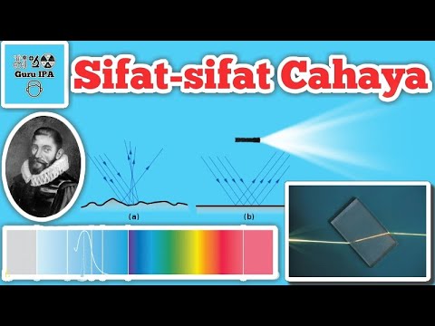
Sifat - sifat Cahaya : Perambatan, Pemantulan, Pembiasan & Gelombang Elektromagnetik Cahaya

Definisi dan Komponen Penginderaan Jauh (Remote Sensing)
Presentasi | Pendekatan dalam Penelitian Geologi : Penginderaan Jauh | - Kelompok 2 (ManRisGeo)

Pengindraan Jauh | Kelas X SMA
5.0 / 5 (0 votes)