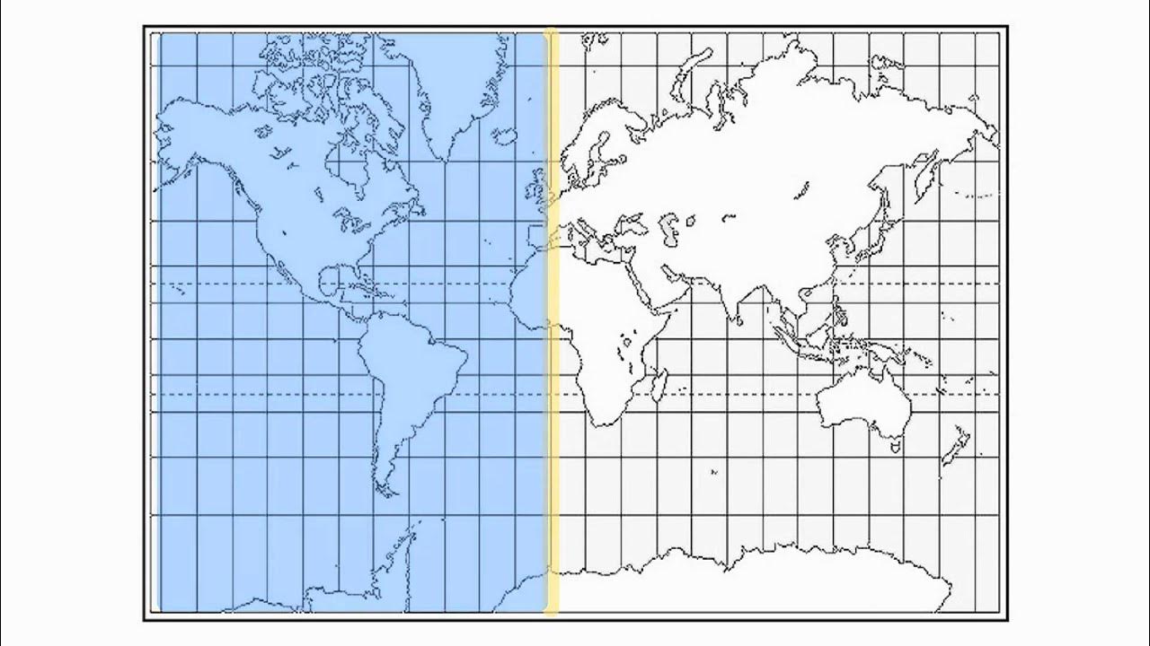
Latitude and Longitude
Summary
TLDRThe video script explores the concept of locating places on Earth using a grid system of latitude and longitude. It explains how latitude lines, or parallels, circle the globe at equal intervals of about 69 miles, and are further divided into minutes and seconds. The script also discusses significant lines of latitude, such as the Tropic of Cancer, Tropic of Capricorn, and the Arctic and Antarctic Circles, which define the Earth's climatic zones. Longitude lines, or meridians, run from pole to pole, intersecting at the poles, and are measured from the Prime Meridian. The script uses the Coronado Bridge in San Diego as an example to illustrate how coordinates can precisely pinpoint a location on Earth.
Takeaways
- 🌍 Earth is our home in the vast universe, with a circumference of nearly 25,000 miles.
- 📍 Locating specific places on Earth can be challenging without a precise system of coordinates.
- 🌐 The invisible grid of latitude and longitude helps in pinpointing exact locations on Earth.
- 🔄 Latitude lines, also known as parallels, circle the Earth from east to west, equidistantly spaced at about 69 miles apart per degree.
- ⏱ Each degree of latitude is further divided into 60 minutes, and each minute into 60 seconds for more precise location.
- 🌡 The equator is at 0 degrees latitude, with the Tropic of Cancer at 23.5 degrees north and the Tropic of Capricorn at 23.5 degrees south, defining the tropics.
- 🌨 The area between the tropics experiences hot temperatures, heavy rainfall, and dense jungle, while the temperate zones have four distinct seasons.
- 🌐 Longitude lines, or meridians, run from north to south, intersecting at the poles, and are measured in degrees, minutes, and seconds like latitude.
- 📡 The prime meridian at 0 degrees longitude passes through the Royal Greenwich Observatory in England, serving as the reference point for longitude.
- 📌 San Diego's precise location can be expressed as 32 degrees 42 minutes 54 seconds north latitude and 117 degrees 9 minutes 25 seconds west longitude.
Q & A
What is the approximate circumference of the Earth?
-The Earth's circumference is nearly 25,000 miles.
How can one precisely locate a specific place on Earth like the Coronado Bridge in San Diego?
-One can precisely locate a place by providing its coordinates, which include latitude and longitude.
What are the lines that circle the globe from east to west called?
-The lines that circle the globe from east to west are called lines of latitude or parallels.
What is the distance between each degree of latitude?
-Each degree of latitude is separated by approximately 69 miles.
How are degrees of latitude further divided?
-Each degree of latitude is divided into smaller pieces called minutes, with 60 minutes in one degree.
What is the significance of the equator in terms of latitude?
-The equator lies at 0 degrees latitude and is the starting point for measuring latitude, with the North and South Poles being the endpoints.
What are the Tropic of Cancer and Tropic of Capricorn, and what is the area between them called?
-The Tropic of Cancer lies at 23.5 degrees north, and the Tropic of Capricorn lies at 23.5 degrees south. The area between these lines is called the tropics.
What is the climate characteristic of the tropics?
-The tropics are known for hot temperatures, heavy rainfall, and dense jungle.
What are the Arctic and Antarctic Circles, and what do they signify?
-The Arctic Circle lies at 66.5 degrees north, and the Antarctic Circle lies at 66.5 degrees south. They mark the boundaries of the areas that experience four distinct seasons.
How are longitude lines measured and what are they called?
-Longitude lines are measured in degrees, minutes, and seconds and are called meridians of longitude.
How do meridians of longitude differ from parallels of latitude?
-Unlike latitude lines, which are equidistant, longitude lines converge at the poles and are not equidistant from each other.
What is the prime meridian and where does it pass through?
-The prime meridian is at 0 degrees longitude and passes through the Royal Greenwich Observatory in Greenwich, England.
How can the precise location of San Diego be described using latitude and longitude?
-The precise location of San Diego can be described as 32 degrees 42 minutes 54 seconds north latitude and 117 degrees 9 minutes 25 seconds west longitude.
Outlines

Этот раздел доступен только подписчикам платных тарифов. Пожалуйста, перейдите на платный тариф для доступа.
Перейти на платный тарифMindmap

Этот раздел доступен только подписчикам платных тарифов. Пожалуйста, перейдите на платный тариф для доступа.
Перейти на платный тарифKeywords

Этот раздел доступен только подписчикам платных тарифов. Пожалуйста, перейдите на платный тариф для доступа.
Перейти на платный тарифHighlights

Этот раздел доступен только подписчикам платных тарифов. Пожалуйста, перейдите на платный тариф для доступа.
Перейти на платный тарифTranscripts

Этот раздел доступен только подписчикам платных тарифов. Пожалуйста, перейдите на платный тариф для доступа.
Перейти на платный тарифПосмотреть больше похожих видео

What Are Latitude & Longitude? | Locating Places On Earth | The Dr Binocs Show | Peekaboo Kidz

Geographic Grid : Latitudes and Longitudes ICSE Class 9 | @sirtarunrupani

07 - Encontrando o seu lugar na Terra - Geografia - Ens. Fund. - Telecurso

How to read Latitude and Longitude Coordinates

Latitude and Longitude-Hommocks Earth Science Department

NCERT Class 6 Geography | Chapter 2 : Globe - Latitudes and Longitudes - Part 1
5.0 / 5 (0 votes)
