IPS kelas 7 bab 1a - Apa itu peta
Summary
TLDRThis educational script introduces 7th-grade students to the world of maps, starting with a basic definition of a map as a flat representation of Earth's surface. It explores various types of maps such as globes, atlases, and digital maps, explaining their uses and differences. The lesson covers key map functions, including locating places, measuring distances, and identifying geographical features. Students also learn about map components, such as titles, directions, legends, symbols, and scales, and how to interpret these elements. The script concludes with practical tips on calculating actual distances using map scales.
Takeaways
- 😀 A map is a picture of the earth's surface displayed on a flat plane with a specific scale.
- 😀 A globe is a replica of the Earth, helping to understand concepts like latitude, longitude, time differences, and the occurrence of day and night.
- 😀 An atlas is a book containing a collection of maps, whereas a map is a single representation of the Earth's surface.
- 😀 Maps serve to show the location of places, the distance between cities, the shape of natural features like mountains and rivers, and other key geographical data.
- 😀 Maps can be categorized into general (free) maps and special maps based on the information they convey.
- 😀 Maps can also be divided by shape: raised maps (3D), flat maps (2D), and digital maps (e.g., Google Maps).
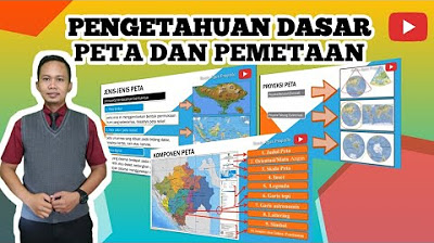
- 😀 Essential map components include the title, direction sign, legends, astronomical lines, map inset, year of manufacture, source, symbols, and scale.
- 😀 The map scale is a comparison between the map distance and the actual distance on Earth, typically expressed in centimeters.
- 😀 The colors used in maps indicate land elevations and water depths, with green and brown for land, and blue for water.
- 😀 Symbols on maps represent features like mountains, airports, rivers, and lakes, with specific color codes indicating different types of natural features.
- 😀 The scale on a map helps in calculating actual distances by applying the ratio (e.g., 1 cm = 500,000 cm), which can be converted into real-world units like kilometers.
Q & A
What is the primary purpose of a map as described in the transcript?
-A map is a representation of the Earth's surface displayed on a flat plane with a certain scale, designed to help us understand locations, distances, and features of the Earth.
What is the difference between a map and a globe?
-A globe is a 3D spherical model of the Earth, while a map is a 2D representation of the Earth's surface. A globe is used to describe locations and features in a realistic, spherical way, while a map is flat and can display information at a chosen scale.
What are some benefits of using a globe?
-A globe helps describe the location of latitude and longitude, determine time differences between places, explain the occurrence of day and night, demonstrate lunar and solar eclipses, and show the rotation of the Earth.
What is an atlas, and how does it differ from a map?
-An atlas is a book that contains a collection of maps, whereas a map is a single representation of a specific area. An atlas includes multiple maps, offering various perspectives and scales.
What are the main functions of a map?
-A map helps show the position or location of places, the distance between cities, the shape or dimension of geographical features like mountains or rivers, and it can collect and present data from an area.
What are the three types of maps based on shape mentioned in the transcript?
-The three types of maps based on shape are raised maps (3D), flat maps (2D), and digital maps (e.g., Google Maps).
What are the essential elements of a map?
-The key elements of a map include the title, direction sign (cardinal directions), legend (symbols), astronomical lines (latitude and longitude), inset map, year of manufacture, source of the map, map symbols, and the map scale.
How does the map scale work, and why is it important?
-The map scale is a ratio that compares the map's distance to the actual distance. It helps us calculate real-world distances from the map. For example, a scale of 1:500,000 means that 1 cm on the map equals 500,000 cm in reality.
How are map colors used to represent geographical features?
-In maps, colors are used to differentiate features. Green or brown represents land (with darker colors indicating higher elevations), while blue represents water bodies, with varying shades indicating depth.
What is the significance of the year a map was created?
-The year a map was made is crucial because it reflects the accuracy and relevance of the map's information. For example, maps from 1992 may show only 27 provinces in Indonesia, whereas maps from 2020 reflect the current 34 provinces.
Outlines

このセクションは有料ユーザー限定です。 アクセスするには、アップグレードをお願いします。
今すぐアップグレードMindmap

このセクションは有料ユーザー限定です。 アクセスするには、アップグレードをお願いします。
今すぐアップグレードKeywords

このセクションは有料ユーザー限定です。 アクセスするには、アップグレードをお願いします。
今すぐアップグレードHighlights

このセクションは有料ユーザー限定です。 アクセスするには、アップグレードをお願いします。
今すぐアップグレードTranscripts

このセクションは有料ユーザー限定です。 アクセスするには、アップグレードをお願いします。
今すぐアップグレード関連動画をさらに表示
Pengetahuan Dasar Peta , Peta dan Pemetaan - Materi Pembelajaran Geografi

Why every world map is wrong - Kayla Wolf

Mengenal Fungsi, Jenis, dan Unsur-unsur Peta | IPS | SayaBisa

ANG MAPA / ANO ANG MAPA? (ARALING PANLIPUNAN)

Geografi Kelas X (6) Pengertian, Jenis dan Fungsi Peta

Proyeksi Peta: Pengertian, Fungsi dan Jenisnya
5.0 / 5 (0 votes)
