V2 Maps with Markers
Summary
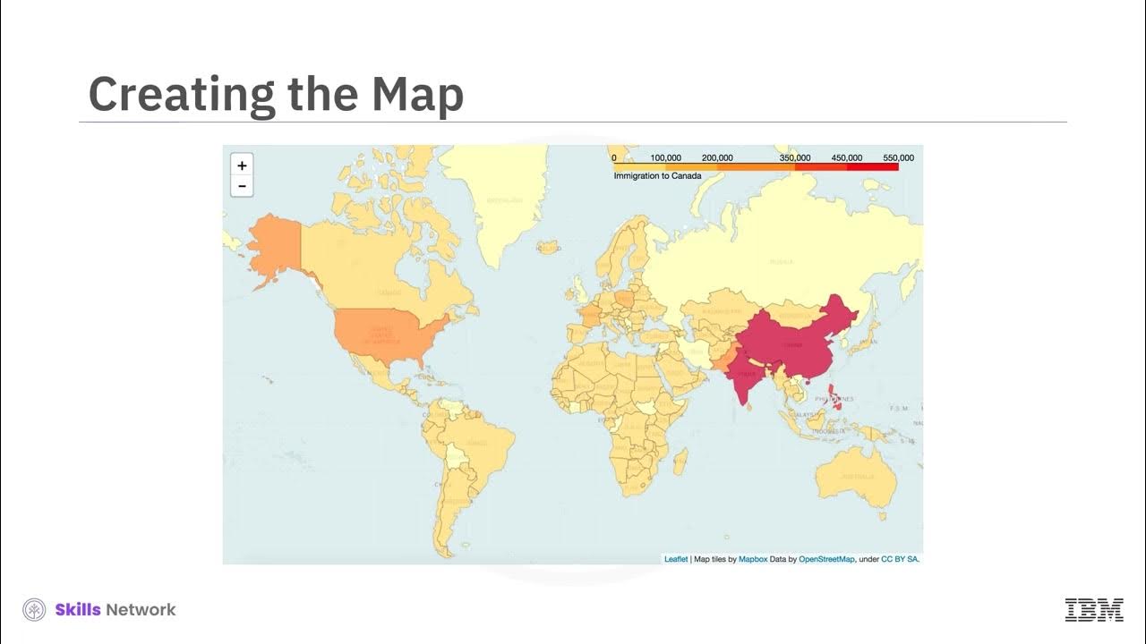
TLDRThis video tutorial introduces the Folium library for creating interactive maps, focusing on adding markers to enhance user engagement. Viewers learn to set up a world map centered on Canada and incorporate markers to highlight locations, such as Ontario. The tutorial explains how to use feature groups for organization and demonstrates marker clustering to maintain clarity on maps with multiple markers. By the end, users will understand how to effectively utilize Folium to create informative and visually appealing maps, with features that enrich the mapping experience.
Takeaways
- 🌍 Folium allows users to easily add markers to a map, enhancing interactivity and context.
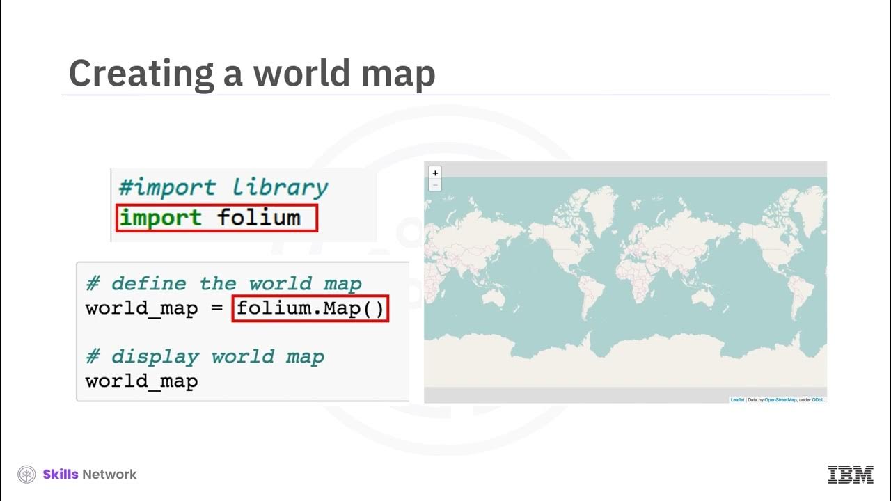
- 📍 To create a map with Folium, start by importing the library and specifying the location and zoom level.
- 🗺️ The location parameter determines the center point of the map using latitude and longitude coordinates.
- 🔍 Markers act as signposts on the map, highlighting important locations and providing additional information when clicked.
- 🇨🇦 Ontario is an example of a location where a marker can be added, representing its significance as Canada's most populous province.
- 🔴 A feature group can be created to manage multiple markers, allowing for organized marker display on the map.
- 💬 The popup parameter of a marker provides labels, enhancing user experience by indicating what the marker represents.
- 🚦 Clustering markers is essential when dealing with numerous points of interest, preventing map overcrowding.
- 🔄 To display multiple markers, create a list of locations and use a loop to pass them to the marker function.
- ✨ Using the marker cluster object intelligently groups nearby markers, improving the map's visual clarity.
Q & A
What is the primary purpose of the Folium library?
-Folium is used to create interactive maps in Python, allowing users to add various markers and features to enhance the visual presentation of data.
How do you create a map centered around a specific location using Folium?
-You can create a map by importing Folium and using the `folium.Map()` function, specifying the `location` parameter with latitude and longitude coordinates and the `zoom_start` parameter to set the initial zoom level.
What role do markers play in Folium maps?
-Markers represent specific locations or points of interest on a map, providing additional information through popups when clicked.
How can you add a marker for a specific location, such as Ontario, to a Folium map?
-You can add a marker by using `folium.Marker()`, specifying the `location` parameter with the coordinates of Ontario and setting the `popup` parameter to label the marker.
What is a feature group in Folium, and how is it used?
-A feature group in Folium is a way to organize multiple markers or other map elements into a single layer, allowing you to manage and display them collectively on the map.
What method is used to create a clustered view of markers on a Folium map?
-The `MarkerCluster` class from the Folium plugins can be used to cluster markers, which intelligently groups nearby markers to reduce visual clutter on the map.
How do you display a popup label when a marker is clicked?
-You can display a popup label by passing a string to the `popup` parameter when creating a marker with `folium.Marker()`.
What happens when you call the `add_to()` method on a marker in Folium?
-The `add_to()` method attaches the marker to a specified map object, ensuring it becomes part of that map's layers and will be displayed when the map is rendered.
How can multiple markers be added to a Folium map at once?
-You can create a list of all the locations and loop through this list, using `folium.Marker()` for each location and adding them to the map individually.
Why is it beneficial to use clustering when displaying many markers on a map?
-Clustering is beneficial because it prevents overcrowding on the map, enhancing clarity and ensuring that users can easily see and interact with nearby markers.
Outlines

このセクションは有料ユーザー限定です。 アクセスするには、アップグレードをお願いします。
今すぐアップグレードMindmap

このセクションは有料ユーザー限定です。 アクセスするには、アップグレードをお願いします。
今すぐアップグレードKeywords

このセクションは有料ユーザー限定です。 アクセスするには、アップグレードをお願いします。
今すぐアップグレードHighlights

このセクションは有料ユーザー限定です。 アクセスするには、アップグレードをお願いします。
今すぐアップグレードTranscripts

このセクションは有料ユーザー限定です。 アクセスするには、アップグレードをお願いします。
今すぐアップグレード


5.0 / 5 (0 votes)
