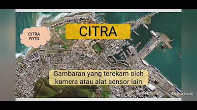
Penginderaan Jauh

CHANNEL BELAJAR GEO
9 Oct 202208:51

Summary

TLDRThis educational video script introduces remote sensing, a technology used to gather information about objects or phenomena without direct contact. It explains the components of remote sensing, including light sources, atmosphere, objects, vehicles carrying sensors, sensors, receivers, data management, and users. The script also covers the types of images produced by remote sensing, such as photo and non-photo images, and their classifications based on the electromagnetic spectrum. Examples of satellite images and their applications in weather forecasting and resource monitoring are provided, concluding with an encouragement to learn geography and aim for high scores.

Takeaways

  • 🌐 The script introduces remote sensing, also known as RS or Inderaja, as a science and art of obtaining information about objects, areas, or phenomena without direct contact.
  • 🔍 Remote sensing involves analyzing data obtained from satellites or other devices that capture images or readings from a distance.
  • 🌞 The process includes components such as energy sources (active or passive), the atmosphere, objects or phenomena on Earth, vehicles carrying sensors, sensors or cameras, receiving stations, data management, and users.
  • 📾 There are two types of images in remote sensing: photo images and non-photo images. Photo images are captured using cameras, while non-photo images are captured using electromagnetic waves.
  • 🌈 Photo images can be classified into five categories based on the electromagnetic spectrum: ultraviolet, orthochromatic, panchromatic, infrared, and modified infrared.
  • 📈 Non-photo images include thermal infrared, radar, and microwave images, and can be further classified based on the sensor type and platform used.
  • 🌍 Examples of satellite remote sensing include weather monitoring satellites like NOAA from the USA and Meteor from Russia, and resource monitoring satellites like Landsat from the USA, SPOT from France, and others.
  • đŸ“· The script explains different types of aerial photography based on the orientation of the camera, the type of camera, color, and the platform used (aircraft or satellite).
  • 🌳 Photo images can detect various features on Earth's surface, such as oil spills, coastlines, water depth, and the health of vegetation.
  • 🚀 The script highlights the importance of remote sensing in various applications, from weather forecasting to natural resource management and environmental monitoring.
  • 📚 The video script is part of an educational series on geography, aiming to teach and inspire students to learn more about the subject and achieve high grades.

Q & A

  • What is remote sensing?

    -Remote sensing is the science and art of obtaining information about objects, areas, or phenomena by analyzing data obtained without direct contact with the objects, areas, or phenomena being studied.

  • What are the various products of remote sensing?

    -Examples of remote sensing products include Google Earth and Google Maps, which are obtained from satellite images located far in space.

  • What are the components of remote sensing?

    -The components of remote sensing include the energy source, the atmosphere, the object, the vehicle, the sensor or camera, the ground receiving station, the data management resources, and the user.

  • How does the process of remote sensing work?

    -The process of remote sensing involves the energy source passing through the atmosphere to illuminate objects on the Earth's surface, the objects being recorded by a camera or sensor, the sensor or camera sending data to a ground receiving station, and the data being sent to data management or human resources, and finally to the user.

  • What are the two types of images in remote sensing?

    -The two types of images in remote sensing are photographic images and non-photographic images.

  • What is the difference between photographic and non-photographic images?

    -Photographic images are pictures of an object made with a camera, usually taken from aircraft, air balloons, etc. Non-photographic images are pictures of an object made with tools other than a camera, typically with the help of electromagnetic waves, usually taken from space satellites.

  • What are the five classifications of photographic images according to the electromagnetic spectrum?

    -The five classifications of photographic images according to the electromagnetic spectrum are ultraviolet, orthochromatic, panchromatic or conventional, infrared original, and infrared modified.

  • What are the different types of aerial photographs based on the orientation of the camera?

    -Aerial photographs can be classified into vertical aerial photographs, where the camera's axis is perpendicular to the Earth's surface, and oblique aerial photographs, where the camera's axis is between vertical and horizontal.

  • How are non-photographic images classified?

    -Non-photographic images are classified based on the electromagnetic spectrum into infrared thermal, radar, and microwave images.

  • What are the examples of satellite remote sensing for different purposes?

    -Examples of satellite remote sensing for different purposes include meteorological satellites like NOAA and Meteor, natural resource satellites like Landsat and SPOT, and ocean monitoring satellites like C-Save and MOS.

  • What is the importance of remote sensing in geography?

    -Remote sensing is important in geography as it allows for the study of the Earth's surface and phenomena without direct contact, which can be crucial for understanding geographical patterns and changes over time.

Outlines

00:00

🌏 Introduction to Remote Sensing

The paragraph introduces the concept of remote sensing, which is the science and art of obtaining information about objects, areas, or phenomena without direct contact. It explains that remote sensing is used to gather data through satellites like Google Earth and Google Maps. The components of remote sensing are detailed: the source of energy or light (active or passive), the atmosphere that carries the light to the Earth's surface, the objects or phenomena on the Earth's surface, the vehicles carrying sensors or cameras, the sensors or cameras themselves, the receiving stations on Earth, the human resources or data management, and the users or consumers of the data. The process of remote sensing is also outlined, starting from the light source illuminating objects on Earth, recording by cameras or sensors, transmitting data to receiving stations, managing data, and finally delivering it to users. The types of images produced by remote sensing are categorized into photographic (like aerial photos) and non-photographic images, which are created with the help of electromagnetic waves and typically captured by satellites.

05:01

📾 Types of Remote Sensing Images

This paragraph delves into the different types of images produced by remote sensing, focusing on photographic and non-photographic images. It explains that photographic images are created using cameras and can be taken from various platforms like aircraft or balloons. The images are further classified based on the spectrum of electromagnetic waves into ultraviolet, orthochromatic, panchromatic, and infrared images, each with specific detection capabilities. The paragraph also discusses the orientation of the camera in aerial photography, distinguishing between vertical, oblique, and highly oblique images. Additionally, it covers non-photographic images, which are categorized into thermal infrared, radar, and microwave images. The sensors used can be single or multispectral, and the platforms can be aircraft, balloons, or satellites. Examples of satellite imagery are provided, including those used for weather forecasting, natural resource monitoring, and marine surveillance.

Mindmap

Keywords

💡Remote Sensing

Remote sensing is a technique used to detect and classify objects and phenomena on Earth without physical contact. It involves capturing data from a distance using devices like satellites or aircraft. In the context of the video, remote sensing is the central theme, as it discusses how data is collected and analyzed to understand geographical features and phenomena. The script mentions tools like Google Earth and Google Maps, which are products of remote sensing technology.

💡Active and Passive Sensors

Active sensors emit their own energy, such as a radar, to receive information about an object, while passive sensors detect energy that is naturally emitted or reflected by the object, like a camera capturing sunlight. The video script explains that remote sensing uses both types of sensors to gather data about the Earth's surface and atmosphere.

💡Atmosphere

The atmosphere acts as a medium through which energy or light from a source travels to reach the Earth's surface. It plays a crucial role in remote sensing as it can affect the quality and type of data captured. The script mentions the atmosphere as part of the process where the source energy illuminates the objects on the Earth's surface.

💡Object

In remote sensing, an object refers to any phenomenon or feature on the Earth's surface, in the atmosphere, or underwater that can be detected and analyzed. The script discusses how different objects are recorded by sensors or cameras to gather data for analysis.

💡Platform

A platform in the context of remote sensing refers to the vehicle that carries the sensor or camera, such as an airplane, satellite, or balloon. The video script mentions various platforms, including satellites in space and aircraft, which are used to capture images and data about the Earth.

💡Sensor/Camera

A sensor or camera is a device that detects and records data about objects on Earth. The script explains that sensors or cameras send data back to Earth, which is then processed and analyzed. They are essential components of remote sensing technology.

💡Receiving Station

A receiving station on Earth is responsible for capturing the data transmitted from sensors or cameras on platforms. The script mentions that after objects are recorded by sensors or cameras, the data is sent to receiving stations on Earth for further processing.

💡Data Management

Data management involves the organization, storage, and analysis of the data collected through remote sensing. The script refers to the management of visual and digital data that is sent to human resources or data management teams for processing and analysis.

💡Image Classification

The script discusses the classification of images into photo and non-photo images. Photo images are created using cameras and can be further classified based on the spectrum of electromagnetic waves they capture. Non-photo images are created with devices other than cameras, often using electromagnetic waves, and are typically captured from space using satellites.

💡Electromagnetic Spectrum

The electromagnetic spectrum refers to the range of all possible frequencies of electromagnetic radiation. The script uses this term to classify different types of photo and non-photo images, explaining how they capture different wavelengths to detect various features and phenomena on Earth.

💡Satellite Imagery

Satellite imagery is a type of remote sensing data collected by satellites orbiting the Earth. The script provides examples of satellite imagery used for various purposes, such as weather monitoring and resource management, and mentions specific satellites like NOAA and Meteor.

Highlights

Introduction to remote sensing and its significance in geography.

Definition of remote sensing according to Lillesand and Kiefer.

Explanation of the components of remote sensing technology.

Role of the light source in remote sensing, including active and passive sources.

Importance of the atmosphere in the remote sensing process.

Description of the objects and phenomena observed on Earth's surface.

Details about the vehicles carrying sensors or cameras in remote sensing.

Functionality of sensors and cameras in capturing data.

Process of data transmission from sensors to ground receiving stations.

Role of human resources and data management in remote sensing.

Types of images produced by remote sensing: photo and non-photo images.

Classification of photo images into five categories based on the electromagnetic spectrum.

Explanation of UltraViolet, OrthoChromatic, Panchromatic, and Infrared photo images.

Differentiation between aerial and satellite photo images.

Classification of non-photo images into three categories based on the electromagnetic spectrum.

Examples of satellite remote sensing applications like weather forecasting.

Description of various types of remote sensing satellites and their functions.

Importance of remote sensing in monitoring natural resources on Earth's surface and subsurface.

Encouragement for continued learning in geography and the hope for high academic achievement.

Closing remarks with an apology for any shortcomings.

Transcripts

play00:01

Assalamualaikum warahmatullahi

play00:03

wabarakatuh Selamat datang kembali di

play00:05

channel belajar hiu lanjutan materi

play00:08

geografi fase kelas 10 pengantar ilmu

play00:11

geografi kurikulum merdeka pada video

play00:14

kali ini kita akan membahas penginderaan

play00:17

jauh namun sebelumnya jangan lupa like

play00:20

subscribe dan juga bunyikan tanda

play00:23

lonceng

play00:24

kita awali dari pengertian penginderaan

play00:27

jauh menurut lelizen dan giver

play00:30

penginderaan jauh yang Biasa disingkat

play00:33

PJ atau inderaja adalah ilmu dan seni

play00:37

untuk memperoleh informasi tentang objek

play00:40

wilayah atau gejala dengan cara

play00:43

menganalisis data yang diperoleh dengan

play00:46

menggunakan alat tanpa kontak langsung

play00:48

dengan objek wilayah atau gejala yang

play00:51

dikaji Dan inilah berbagai produk dari

play00:55

penginderaan jauh seperti Google Earth

play00:58

Google Map yang kesemuanya ini diperoleh

play01:00

atau didapat dari citra satelit yang

play01:03

berada jauh di ruang angkasa

play01:07

komponen penginderaan jauh nomor satu

play01:10

adalah sumber tenaga atau cahaya sumber

play01:14

tenaga atau cahaya ini ada dua yaitu

play01:17

sumber tenaga aktif berarti lampu atau

play01:20

cahaya itu berasal dari sensor atau

play01:23

kamera yang kedua adalah sumber tenaga

play01:25

pasif berarti cahaya berasal dari luar

play01:30

kamera yaitu berasal dari sinar matahari

play01:34

yang kedua adalah atmosfer atmosfer ini

play01:37

adalah media tempat sumber tenaga atau

play01:42

cahaya menuju ke permukaan bumi

play01:45

yang ketiga ini adalah objek yaitu

play01:48

berbagai fenomena gejala yang ada di

play01:51

permukaan bumi di atmosfer di hidrosfer

play01:55

dan di tempat lain yang keempat adalah

play01:59

wahana-wahana adalah kendaraan yang

play02:02

membawa

play02:03

sensor atau kamera

play02:05

yang kelima adalah sensor atau kamera

play02:10

yang keenam stasiun penerima di bumi dan

play02:16

yang ketujuh adalah bagian sumber daya

play02:20

manusia atau manajemen data serta yang

play02:23

ke-8 user atau pengguna Bagaimana cara

play02:27

atau tahapan kerja dari penginderaan

play02:31

jauh dicermati

play02:34

yang pertama sumber tenaga ini melalui

play02:37

atmosfer menerangi objek yang ada di

play02:40

permukaan bumi di atmosfer maupun

play02:42

hidrofit Kemudian yang kedua obyek

play02:47

direkam oleh kamera atau sensor

play02:51

selanjutnya yang ketiga

play02:53

sensor atau kamera Akan mengirim data ke

play02:57

stasiun penerima yang ada di bumi

play03:00

stasiun penerima yang ada di bumi ini

play03:03

selanjutnya mengirimkan data baik data

play03:05

visual maupun data digital menuju kepada

play03:09

bagian manajemen data atau sumber daya

play03:12

manusia selanjutnya data setelah jadi

play03:15

akan dikirim ke pengguna

play03:18

jenis-jenis Citra ada dua yaitu citra

play03:22

foto dan nonfoto Citra foto Nanti bisa

play03:26

kita kelompokkan menjadi 5 bagian

play03:28

klasifikasi dan Citra non foto menjadi 3

play03:33

bagian atau klasifikasi Apakah perbedaan

play03:36

citra foto dan Citra non foto dicermati

play03:40

perbedaan citra foto dan Citra non foto

play03:43

citra foto itu adalah gambar suatu objek

play03:46

yang dibuat dengan alat kamera biasanya

play03:51

citra foto ini diambil dari pesawat

play03:54

udara ground balon udara dan sebagainya

play03:57

hasilnya foto udara

play03:59

yang kedua adalah citra non foto yaitu

play04:03

gambar suatu objek yang dibuat dengan

play04:06

alat selain kamera yaitu biasanya adalah

play04:10

dengan bantuan gelombang elektromagnetik

play04:12

dan ini biasanya diambil dari ruang

play04:15

angkasa dengan satelit contohnya adalah

play04:18

foto satelit yang kalau di zoom juga

play04:21

tidak beda jauh dengan citra foto

play04:25

kita akan klasifikasikan macam-macam

play04:28

citra foto

play04:30

menurut spektrum elektromagnetik ada 5

play04:35

citra foto

play04:37

yang pertama adalah control

play04:40

UltraViolet foto ini memiliki

play04:44

gelombang elektromagnetik sebesar kurang

play04:46

dari

play04:48

0,29 mikrometer memiliki kemampuan

play04:51

deteksi mendeteksi tumpahan minyak di

play04:54

laut dalam aspal dan juga batuan kapur

play04:56

foto ortokromatik ini mampu mendeteksi

play05:00

pantai dan kedalaman laut sampai kurang

play05:03

lebih 20 meter

play05:05

yang ketiga adalah foto pankromatik atau

play05:08

foto konvensional dengan gelombang

play05:10

tampak atau sinar tampak ini mendeteksi

play05:13

semua objek yang ada di permukaan bumi

play05:15

seperti foto-foto yang kita lakukan

play05:17

kemudian foto inframerah asli adalah

play05:20

mendeteksi berbagai jenis tanaman yang

play05:21

sehat dan tanaman yang sakit dan foto

play05:24

inframerah modifikasi ini juga bisa

play05:26

mendeteksi berbagai tanaman

play05:31

berdasarkan sumbu Kameranya ada foto

play05:33

udara vertikal jika sumbu kameranya

play05:36

tegak lurus terhadap permukaan bumi atau

play05:39

toleransinya condongnya kurang dari 5%

play05:41

ini gambarnya sementara foto udara

play05:44

contoh itu bila sumbu kameranya terletak

play05:47

diantara bidang vertikal dan horizontal

play05:50

ada dua agak condong bila garis

play05:55

horizonnya tidak terlihat Garis horizon

play05:58

itu adalah garis yang membatasi antara

play06:00

permukaan bumi dengan lain langit ini

play06:02

yang gambar kanan dan ini termasuk foto

play06:05

sangat condong bila garis horizonnya

play06:08

terlihat

play06:10

berikutnya berdasarkan jenis kameranya

play06:13

itu dibagi dua foto udara tunggal itu

play06:16

juga dibuat dengan kamera tunggal

play06:18

seperti ini dan foto udara jamak bila

play06:21

dibuat dengan kamera lebih dari satu

play06:23

seperti ini

play06:25

yang keempat berdasarkan warna kameranya

play06:28

foto warna asli

play06:31

adalah foto warna yang sama dengan

play06:33

objeknya dan foto berwarna semu itu bila

play06:38

tidak sama atau sudah dimodifikasi

play06:41

kemudian yang kelima berdasarkan

play06:44

wahananya ada foto udara yaitu bila foto

play06:49

itu dibuat dari pesawat atau balon udara

play06:51

dan foto satelit bila foto itu dibuat

play06:55

dari satelit yang ada di luar angkasa

play07:00

selanjutnya adalah citra non foto

play07:04

menurut spektrum elektromagnetik ada 3

play07:07

Citra infra merah thermal Citra Radar

play07:11

dan Citra gelombang micro sementara

play07:14

berdasarkan sensornya sama seperti tadi

play07:16

ada Citra tunggal Citra Multi spektral

play07:19

tunggal berarti sensornya tinggal Citra

play07:23

multis spektral berarti sensornya lebih

play07:25

dari satu dan berdasarkan wahananya ada

play07:28

Citra itu dibuat dengan pesawat terbang

play07:32

balon udara dan lain sebagainya dan

play07:34

citra satelit bila dibuat dari satelit

play07:37

yang mengorbit atau mengelilingi bumi

play07:40

dan membidik gambar yang ada di

play07:42

permukaan bumi

play07:44

inilah beberapa contoh citra satelit

play07:47

yang sekarang kita bisa menikmatinya

play07:50

antara lain adalah

play07:52

satu adalah satelit pengindera planet

play07:55

contohnya satelit pengindera planet

play07:58

adalah

play08:00

Rusia 2 penginderaan cuaca contohnya

play08:04

adalah noaa seperti produknya adalah

play08:07

windy.com itu milik Amerika Serikat dan

play08:10

meteor milik Rusia kemudian 3

play08:13

penginderaan sumber daya alam yang ada

play08:15

di permukaan bumi ataupun di bawah

play08:17

permukaan bumi contohnya satelitnya

play08:19

lengset punya Amerika Serikat sous punya

play08:23

Rusia dan Spot milik Perancis kemudian

play08:26

pengindera laut contohnya adalah C save

play08:30

C satelit milik Amerika Serikat dan MOS

play08:33

ini nilai depan

play08:36

Terima kasih atas segala perhatiannya

play08:38

semangat terus untuk belajar ilmu

play08:41

geografi dan semoga nilai kalian bisa

play08:44

tinggi Terima kasih mohon maaf atas

play08:46

segala kekurangan Assalamualaikum

play08:47

warahmatullahi wabarakatuh

Rate This
★
★
★
★
★

5.0 / 5 (0 votes)

Étiquettes Connexes
Remote SensingGeographyEducationSatellite ImagesGoogle EarthAtmosphereData AnalysisGeoscienceSpace TechnologyGIS
Besoin d'un résumé en anglais ?