Press Briefing: Tropical Depression #GenerPH 11:30 AM Update September 17, 2024 - Tuesday
Summary
TLDRThe Philippine weather service reports Typhoon Hennar, currently near Benguet, with winds of 45 km/hr near the center, moving westward at 15 km/hr, and expected to exit the Philippine area within 48 hours. Tropical Depression Pulasan, 1,800 km east of Northern Luzon, is also monitored, with 65 km/hr winds near the center. Heavy to intense rains are anticipated in various regions, with warnings for high winds and potential flooding. Dam levels are closely monitored, with some releasing water to prevent overflow, affecting nearby areas. Residents in flood-prone and landslide-prone areas are advised to remain vigilant.
Takeaways
- 🌀 Bagyong Hener is currently monitored in the vicinity of Benguet, with winds of 45 km/h near the center and 55 km/h in the eye.
- 📍 Hener is moving westward at a speed of 15 km/h and is expected to exit the Philippine area of responsibility within 24 to 48 hours.
- 🔍 Signal number one is raised in several areas including Babuyan Islands, Isabela, Nueva Vizcaya, Apayao, Kalinga, Abra, Mountain Province, Benguet, Ilocos Norte, Ilocos Sur, La Union, Pangasinan, Zambales, Nueva Ecija, and Pampanga.
- 🌧️ Heavy to intense rainfall is expected in Cagayan, Apayao, Kalinga, Mountain Province, Ifugao, Ilocos Norte, Abra, Palawan, Occidental Mindoro, Aklan, Antique, and de los Occidental with 100 to 200 mm of rain.
- ☔ For the following day, heavy to intense rains are anticipated in Occidental Mindoro, Aklan, and Antique, with moderate to heavy rains in Ilocos Region, Cagayan Valley, Zambales, Bataan, Metro Manila, Calabarzon, Bicol, Central Visayas, and parts of MIMAROPA and Western Visayas.
- 🚨 Gale warning is in effect for Batanes, Cagayan including Babuyan Islands, Ilocos Norte, Occidental Mindoro, Palawan, Aklan, Antique, Iloilo, Negros Occidental, Negros Oriental, Cebu, Bohol, Southern Leyte, Dinagat Islands, Surigao del Norte, Camiguin, and Zamboanga del Norte.
- 🌪️ Bagyong Pulasan, with an international name, is also being monitored 1,800 km east of extreme Northern Luzon with winds of 65 km/h near the center and 80 km/h in the eye.
- 📉 Dam levels are being closely monitored with Angat Dam at 194.86 meters, Ipo Dam at 101.3 meters, and Pantabangan Dam at 197.5 meters, with releases affecting downstream areas.
- ⚠️ Flood advisory and hydrological situation reports are issued for the Agno and Magat Rivers due to the opening of gates in the Ambuklaw and Magat Dams, respectively.
Q & A
What is the current status of Typhoon Hener as of the morning of September 17, 2024?
-As of the morning of September 17, 2024, Typhoon Hener is in the vicinity of Kibungan, Benguet, with winds of 45 km per hour near the center and up to 55 km per hour in gusts. It is moving westward at a speed of 15 km per hour.
What is the highest tropical cyclone wind signal currently in effect due to Typhoon Hener?
-The highest tropical cyclone wind signal currently in effect is Signal Number One.
Which areas are under Signal Number One due to Typhoon Hener?
-Areas under Signal Number One include Babuyan Islands, Isabela, Quirino, Nueva Vizcaya, Apayao, Kalinga, Abra, Mountain Province, Benguet, Ilocos Norte, Ilocos Sur, La Union, Pangasinan, Zambales, Nueva Ecija, and Pampanga.
What is the expected rainfall for areas under the influence of Typhoon Hener and the Southwest monsoon?
-Heavy to intense rainfall is expected, ranging from 100 to 200 mm in areas such as Cagayan, Apayao, Kalinga, Mountain Province, Ifugao, Ilocos Norte, Abra, Palawan, Occidental Mindoro, Aklan, Antique, and others.
What is the forecast for Wednesday regarding the rain situation?
-For Wednesday, heavy to intense rains are expected in Occidental Mindoro, Aklan, and Antique, with moderate to heavy rains in Ilocos Region, Cagayan Valley, Zambales, Bataan, Metro Manila, Calabarzon, Bicol Central, Visayas, and parts of MIMAROPA and Western Visayas.
What areas are expected to experience heavy to intense rains on Thursday?
-On Thursday, heavy to intense rains are expected in Occidental Mindoro, while moderate to heavy rains are forecast for Metro Manila, La Union, Pangasinan, Zambales, Bataan, Cavite, Batangas, Aklan, Antique, and parts of MIMAROPA.
What is the current elevation of the Angat Dam as of 8:00 AM on September 17, 2024?
-The Angat Dam is at an elevation of 194.86 meters as of 8:00 AM on September 17, 2024.
What is the current situation with the Magat Dam and the potential areas that might be affected by water release?
-The Magat Dam is at an elevation of 197.5 meters due to an open gate. The water release could affect municipalities such as Dian, Isabela, Alonso, Santa Maria, Ramon, San Mateo, Aurora, Kabatuan, Luna, Luna, Reyna, Mercedes, Burgos, Naguilian, and Gamu.
What flood advisories are in place as a result of Typhoon Hener and the Southwest monsoon?
-Flood advisories are in place for the Bicol Region and the Cagayan River due to Typhoon Hener and the Southwest monsoon. The Magat Dam has released water, which will flow into the Magat River and then the Cagayan River.
What is the current status of Typhoon Pulasan, and what is expected of its movement?
-As of the script, Typhoon Pulasan is located 1,800 km east of extreme Northern Luzon with winds of 65 km per hour near the center and up to 80 km per hour in gusts. It is moving in a North-Northwest direction at a speed of 25 km per hour. It is expected to enter the Philippine area of responsibility and may be given a local name, possibly Helen.
What precautions are advised for mountainous and highly elevated areas due to the weather conditions?
-Residents in mountainous and highly elevated areas are advised to be cautious due to the possibility of higher rainfall forecasts and the risk of flash floods and landslides.
Outlines

Esta sección está disponible solo para usuarios con suscripción. Por favor, mejora tu plan para acceder a esta parte.
Mejorar ahoraMindmap

Esta sección está disponible solo para usuarios con suscripción. Por favor, mejora tu plan para acceder a esta parte.
Mejorar ahoraKeywords

Esta sección está disponible solo para usuarios con suscripción. Por favor, mejora tu plan para acceder a esta parte.
Mejorar ahoraHighlights

Esta sección está disponible solo para usuarios con suscripción. Por favor, mejora tu plan para acceder a esta parte.
Mejorar ahoraTranscripts

Esta sección está disponible solo para usuarios con suscripción. Por favor, mejora tu plan para acceder a esta parte.
Mejorar ahoraVer Más Videos Relacionados

PAGASA - Bagong Julian, posibleng maging super typhoon ngayong... | GMA Integrated News Bulletin

‘Julian’ intensifies into super typhoon as it slowly moves away from the Philippines

Today's Weather, 5 A.M. | Sept. 2, 2024

Public Weather Forecast issued at 4AM | November 9, 2024 - Saturday
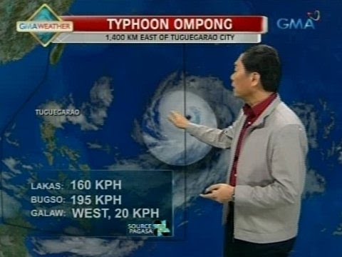
24 Oras: PAGASA: Bagyong Ompong, magtatagal sa loob ng PAR hanggang Biyernes

Public Weather Forecast issued at 4PM | September 13, 2024 - Friday
5.0 / 5 (0 votes)
