Cara Membuat Peta Potensi Air Tanah Menggunakan ArcGIS
Summary
TLDRIn this tutorial, viewers learn how to create a groundwater potential map using Landsat 8 imagery. The video guides users through the process of downloading the necessary data, applying raster calculations to calculate the difference between Bands 3 and 5, and clipping the data using an administrative boundary file. The resulting data is classified into five categories of groundwater potential: very high, high, medium, low, and very low, with a color ramp applied to visually distinguish the levels. The tutorial also covers basic map styling and layout tips for presentation.
Takeaways
- 😀 The tutorial teaches how to create a groundwater potential map using Landsat 8 imagery.
- 😀 The necessary data includes Landsat 8 Bands 3 and 5, and administrative shapefiles for the region of interest.
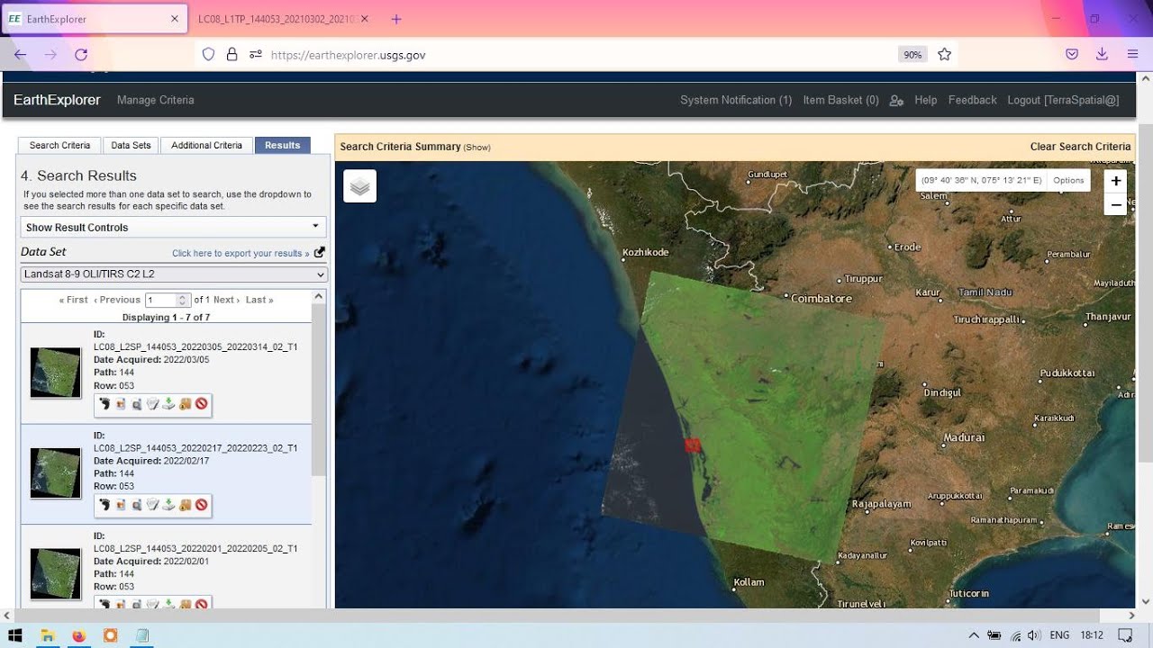
- 😀 Users need to first download Landsat 8 imagery from USGS and administrative shapefiles from the Indonesia GeoSpatial portal.
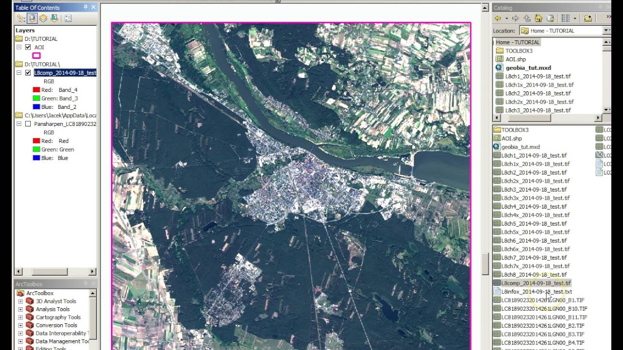
- 😀 To start the analysis, create a folder to store all the required files and input the Landsat 8 imagery into GIS software.
- 😀 The Raster Calculator tool is used to calculate the formula for groundwater potential: (Float Band 3 - Band 5) / (Float Band 3 + Band 5).
- 😀 The formula is used to process the satellite bands to assess variations in water and vegetation content for groundwater potential.
- 😀 After processing, use the 'Extract by Mask' tool to clip the data to the administrative boundary of Wonosobo Regency.
- 😀 Classify the groundwater potential into five categories: very high, high, moderate, low, and very low.
- 😀 Customize the color ramp to visually represent the groundwater potential, with darker blues indicating higher potential.
- 😀 The final result is a map that visualizes groundwater potential across the region, which can be further refined with layout options.
- 😀 Viewers are encouraged to ask questions in the comments, and to like, comment, and subscribe for more tutorials.
Q & A
What is the purpose of this video?
-The purpose of the video is to teach how to create a potential groundwater map using Landsat 8 imagery.
What was covered in the previous video before this one?
-The previous video covered how to download Landsat 8 imagery from USGS.
Which satellite bands are used in this process?
-Bands 3 and 5 from the Landsat 8 satellite imagery are used in this process.
Where can the administrative boundary files be downloaded from?
-The administrative boundary files can be downloaded from the Indonesia Geo-Spatial Portal or the Tanah Air website.
What software or application is being used to process the satellite imagery?
-The application used is not explicitly named, but it appears to be a GIS software that allows for raster calculation and spatial analysis.
What is the formula used for calculating the potential groundwater map?
-The formula is: Float(B3 - B5) / Float(B3 + B5), where B3 represents band 3 and B5 represents band 5 of the Landsat 8 imagery.
How are the administrative boundaries applied to the raster data?
-The administrative boundaries are applied by using the 'Extract by Mask' tool, which clips the raster data to match the boundary of the desired area.
What classification method is used for the groundwater potential map?
-The groundwater potential map is classified into 5 classes, which are very high, high, medium, low, and very low, based on the raster values.
How are colors assigned to the classification of groundwater potential?
-The classification is colored using a color ramp, with higher potential areas (such as reservoirs) shown in darker blue and lower potential areas in lighter blue.
What additional step is mentioned for creating a layout for the map?
-It is mentioned that if users want to create a layout, they can refer to another video on the channel for layout creation.
Outlines

Dieser Bereich ist nur für Premium-Benutzer verfügbar. Bitte führen Sie ein Upgrade durch, um auf diesen Abschnitt zuzugreifen.
Upgrade durchführenMindmap

Dieser Bereich ist nur für Premium-Benutzer verfügbar. Bitte führen Sie ein Upgrade durch, um auf diesen Abschnitt zuzugreifen.
Upgrade durchführenKeywords

Dieser Bereich ist nur für Premium-Benutzer verfügbar. Bitte führen Sie ein Upgrade durch, um auf diesen Abschnitt zuzugreifen.
Upgrade durchführenHighlights

Dieser Bereich ist nur für Premium-Benutzer verfügbar. Bitte führen Sie ein Upgrade durch, um auf diesen Abschnitt zuzugreifen.
Upgrade durchführenTranscripts

Dieser Bereich ist nur für Premium-Benutzer verfügbar. Bitte führen Sie ein Upgrade durch, um auf diesen Abschnitt zuzugreifen.
Upgrade durchführenWeitere ähnliche Videos ansehen


5.0 / 5 (0 votes)
