Konsep Dasar Sistem Informasi Geografi (SIG)
Summary
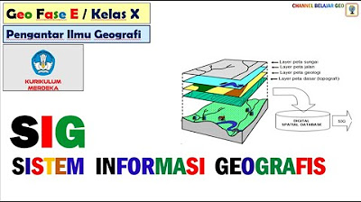
TLDRThis video explores the concept of Geographic Information Systems (GIS), explaining its definition, types, benefits, and components. GIS is a system that manages spatially referenced data, enabling users to visualize, analyze, and interpret geographic information. The video covers various formats such as points, lines, polygons, and surfaces, and discusses GIS applications in fields like urban planning, disaster management, and business. Key components of GIS include data, software, hardware, databases, and users, each playing a crucial role in its effectiveness. Overall, the video provides a comprehensive understanding of how GIS contributes to decision-making and problem-solving.
Takeaways
- 😀 GIS stands for Geographic Information Systems, which are used to manage spatially referenced data.
- 😀 GIS helps visualize geographic data and understand the spatial relationships between various elements in the physical or social environment.
- 😀 Geographic data types include points, lines, polygons, and surfaces, each representing different spatial characteristics like location, length, area, and height.
- 😀 GIS enables spatial data analysis, including tasks like identifying location patterns and distance measurements, to aid decision-making.
- 😀 GIS is beneficial in regional planning, such as land use, urban development, and infrastructure planning for sustainable growth.
- 😀 Natural disaster monitoring is another key benefit of GIS, as it helps in monitoring and mitigating disasters like floods and earthquakes.
- 😀 GIS is used in market analysis, business operations, and public service planning, such as determining locations for schools, health facilities, and police stations.
- 😀 In science and research, GIS is crucial for identifying complex spatial trends in fields like geography, ecology, and sociology.
- 😀 Navigation systems like Google Maps rely on GIS for providing directions, route optimization, and ensuring efficient transportation.
- 😀 GIS is also used for national security purposes, such as border monitoring, military analysis, and planning.
- 😀 The main components of GIS include geographic data, hardware/software devices, databases, analysis methods, and users, each playing an important role in data management and decision-making.
Q & A
What is the main focus of Geographic Information Systems (GIS)?
-The main focus of GIS is to manage, analyze, and visualize geographic data that is referenced to specific locations in space. It helps in understanding the spatial relationships between various elements in the physical or social environment.
What are the types of spatial data representations in GIS?
-GIS uses several types of spatial data representations, including points (single coordinates), lines (with starting and ending coordinates), polygons (with area and boundary coordinates), and surfaces (which involve vertical coordinates and areas with heights).
What are some examples of point, line, polygon, and surface formats in GIS?
-Examples of point formats include the locations of accidents or schools. Line formats can represent roads or rivers. Polygon formats could represent land plots or administrative boundaries. Surface formats can represent slope maps or multi-storey buildings.
How does GIS contribute to regional planning?
-GIS is crucial in regional planning, including land use planning, urban development, and infrastructure planning. It helps manage sustainable regional growth and allows for efficient decision-making in resource management.
What is the benefit of using GIS for natural disaster monitoring?
-GIS can be used for monitoring and mitigating natural disasters such as floods and earthquakes. It helps in rapid response and efficient evacuation by providing spatial data that can aid in decision-making during emergencies.
How is GIS used in business and market analysis?
-In business, GIS is used for market analysis, store location selection, and delivery route planning. It helps businesses improve operational efficiency by understanding geographic patterns and optimizing logistics.
What are the primary components of GIS?
-The primary components of GIS include geographic data, software or GIS devices, hardware, analysis methods, databases, and users. These components work together to collect, store, manage, and analyze spatial data.
What role does hardware play in GIS?
-Hardware in GIS includes devices like computers, GPS systems, scanners, printers, and plotters. It supports the collection, storage, analysis, and visualization of geographic data, particularly in large-scale applications.
Who are the users of GIS, and what are their roles?
-GIS users include data collectors, end-users, analysts, planners, and stakeholders. Data collectors contribute geographic data, end-users view maps and geographic information, analysts perform spatial and statistical analysis, and stakeholders use GIS for project planning and evaluation.
How does GIS assist in science and research?
-GIS helps in scientific research across various fields such as geography, geology, ecology, and sociology by identifying spatial trends and relationships, which is essential for understanding complex environmental and societal patterns.
Outlines

This section is available to paid users only. Please upgrade to access this part.
Upgrade NowMindmap

This section is available to paid users only. Please upgrade to access this part.
Upgrade NowKeywords

This section is available to paid users only. Please upgrade to access this part.
Upgrade NowHighlights

This section is available to paid users only. Please upgrade to access this part.
Upgrade NowTranscripts

This section is available to paid users only. Please upgrade to access this part.
Upgrade Now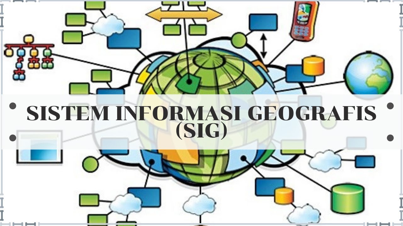


5.0 / 5 (0 votes)