Ruang Lingkup Wilayah NKRI
Summary
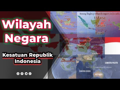
TLDRThis educational script for 7th-grade students focuses on the territorial boundaries of Indonesia, including land, sea, and air areas. It covers Indonesia's land mass, the number of islands, and its geographical coordinates. The script details various maritime zones like inland waters, territorial seas, exclusive economic zones, and the continental shelf. It also touches upon the country's airspace and outer space boundaries. Students are encouraged to engage with the material by creating a mind map to visually represent Indonesia's territorial divisions, with an emphasis on the importance of protecting the nation's sovereignty.
Takeaways
- 😀 The scope of Indonesia's territory includes land, sea, and airspace, each with distinct characteristics.
- 😀 Indonesia has 16,766 islands, with five major ones: Sumatra, Kalimantan, Java, Sulawesi, and Papua.
- 😀 The total land area of Indonesia is approximately 2.028 million square kilometers, making up 25% of the country's total area.
- 😀 Indonesia's coastline stretches about 81,000 kilometers and lies between 6 degrees North to 11 degrees South latitude, and 95 to 141 degrees East longitude.
- 😀 The water areas of Indonesia are divided into inland waters, archipelagic waters, territorial sea, additional zone, exclusive economic zone, and continental shelf.
- 😀 Inland waters are those located on the landward side of Indonesia's baseline, while archipelagic waters connect the outermost points of Indonesia's islands.
- 😀 Territorial sea extends up to 12 nautical miles from the baseline, while the additional zone is up to 24 nautical miles.
- 😀 The exclusive economic zone (EEZ) extends 200 nautical miles from the baseline, and the continental shelf covers the sea floor up to 200 miles from the territorial waters.
- 😀 The total water area of Indonesia spans 6.4 million square kilometers, with the inland and archipelagic waters covering 3.11 million square kilometers, and the territorial sea area reaching 290,000 square kilometers.
- 😀 Indonesia's airspace is defined up to an altitude of 110 kilometers above its land and sea territory, and its outer space territory covers 33,761 kilometers above its land and waters.
Q & A
What is the total land area of Indonesia?
-The total land area of Indonesia is 2,028,087 km², which is 25% of the total area of the country.
How many islands are there in Indonesia?
-As of 2021, Indonesia has a total of 16,766 islands.
What are the five major islands of Indonesia?
-The five major islands of Indonesia are Sumatra, Kalimantan, Java, Sulawesi, and Papua.
What is the length of Indonesia's coastline?
-Indonesia has a coastline that stretches approximately 81,000 km.
What are the geographical coordinates of Indonesia?
-Indonesia is located between 6°N and 11°S latitude and between 95° and 141°E longitude.
What is the definition of 'internal waters' in the context of Indonesia's territory?
-Internal waters are all the waters located on the landward side of the baseline, extending from the lowest point of the waterline at low tide.
What is the territorial sea of Indonesia?
-The territorial sea of Indonesia extends up to 12 nautical miles from the baseline, measured at low tide.
What is the Exclusive Economic Zone (EEZ) of Indonesia?
-The Exclusive Economic Zone (EEZ) of Indonesia extends up to 200 nautical miles from the baseline, allowing the country exclusive rights to exploit natural resources in this area.
How large is Indonesia's total water area?
-Indonesia's total water area is 6,400,000 km², which includes internal waters, archipelagic waters, territorial seas, EEZ, and the continental shelf.
What is the height limit of Indonesia's airspace?
-Indonesia's airspace extends from the surface of the land and waters up to a height of 110 km.
What is the significance of the territorial boundaries of Indonesia?
-The territorial boundaries of Indonesia, including land, water, and airspace, are crucial for defining the country's sovereignty, rights to natural resources, and security.
What is the task for students at the end of this lesson?
-At the end of the lesson, students are asked to create a mind map or concept map of Indonesia's territorial divisions, using materials like paper, pens, and markers. The best works will be presented to the class.
Outlines

This section is available to paid users only. Please upgrade to access this part.
Upgrade NowMindmap

This section is available to paid users only. Please upgrade to access this part.
Upgrade NowKeywords

This section is available to paid users only. Please upgrade to access this part.
Upgrade NowHighlights

This section is available to paid users only. Please upgrade to access this part.
Upgrade NowTranscripts

This section is available to paid users only. Please upgrade to access this part.
Upgrade Now


5.0 / 5 (0 votes)