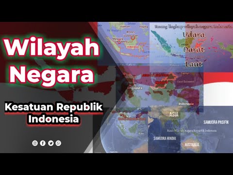
Materi Pendidikan Pancasila Kelas 7 BAB 5 Semester 2 || B Wilayah Negara Kesatuan Republik Indonesia
Summary
TLDRIn this video, the presenter discusses the territory of the Republic of Indonesia, focusing on its vast archipelago and territorial boundaries. The lesson explains the legal and geographical definition of Indonesia's territory, covering its land, water, and air space. The discussion touches on the historic debates around the nation's territorial definition and the decision to include regions such as Papua and Borneo. Additionally, the video elaborates on Indonesia's territorial waters, including internal waters, territorial seas, and exclusive economic zones. The session provides a comprehensive understanding of Indonesia's national borders and jurisdictional space.
Takeaways
- 😀 Indonesia is an archipelagic country with thousands of interconnected islands forming the Republic of Indonesia (NKRI).
- 😀 The goal of this lesson is to help students understand Indonesia's territorial boundaries and sovereignty.
- 😀 Indonesia's territorial boundaries are defined by Law No. 43/2008, which includes land, waters, and airspace.
- 😀 The BPUPK debate in 1945 led to three options for determining Indonesia's territorial boundaries, with the second option winning: Dutch East Indies plus Malaya, Northern Borneo, East Timor, and Papua.
- 😀 The Southern boundary of Indonesia is marked by maritime borders with Australia, particularly the Timor Sea and Arafura Sea.
- 😀 The Eastern boundary of Indonesia is defined by the island of Papua, bordering Papua New Guinea.
- 😀 Indonesia's Northern border is shared with the Philippines, Malaysia, and Singapore.
- 😀 The Western border of Indonesia includes maritime boundaries with India.
- 😀 Indonesia's territorial scope includes land, maritime, and airspace, with each having distinct features and regulations.
- 😀 Indonesia's maritime zones include internal waters, archipelagic waters, territorial seas, exclusive economic zones, and the continental shelf.
- 😀 The airspace of Indonesia extends from the land and maritime zones up to 110 km above the earth's surface, including space above its territory.
Q & A
What is the main topic of the video?
-The main topic of the video is the territorial scope and boundaries of the Unitary State of the Republic of Indonesia (NKRI), focusing on its geographical and legal definitions.
How is Indonesia's territory defined according to the law?
-Indonesia's territory is defined by Law No. 43 of 2008, which includes land territory, internal waters, archipelagic waters, territorial seas, the seabed, and the airspace above the country.
What historical decision influenced Indonesia's territorial boundaries?
-During the BPUPK sessions, a vote was held to decide Indonesia’s territorial boundaries, with the second option, which included all of Dutch East Indies plus Malaya, Northern Borneo, and Papua, being the majority choice.
What are the four main regions that Indonesia's territory borders?
-Indonesia's territory borders the southern region with Australia, the eastern region with Papua New Guinea, the northern region with the Philippines, Malaysia, and Singapore, and the western region with India.
What is the significance of the Exclusive Economic Zone (EEZ) for Indonesia?
-The EEZ extends 200 nautical miles from Indonesia’s baseline and allows the country exclusive rights to utilize and manage marine resources within that area, contributing to its economic and territorial security.
What is the role of internal waters in Indonesia’s territorial layout?
-Internal waters refer to bodies of water situated within Indonesia's coastline, including rivers, lakes, and other water bodies, all of which fall under the country’s sovereignty.
Can you explain what 'Archipelagic waters' means in the context of Indonesia?
-Archipelagic waters are the bodies of water that lie between the islands of Indonesia, connecting the outermost points of the country's islands, forming an integral part of its sovereign territory.
What is meant by 'territorial sea' in Indonesia's legal framework?
-The territorial sea of Indonesia is the sea area that extends up to 12 nautical miles from the baseline, which is considered part of the national territory and under Indonesia's jurisdiction.
What is the significance of the continental shelf in Indonesia’s territorial waters?
-The continental shelf refers to the underwater landmass extending beyond Indonesia's territorial seas, allowing the country rights to explore and exploit natural resources in the seabed and subsoil up to 200 nautical miles.
How high does Indonesia's airspace extend, and why is it important?
-Indonesia’s airspace extends up to 110 kilometers above its land and waters, encompassing not only the lower atmosphere but also the space above, which is essential for national sovereignty and security.
Outlines

This section is available to paid users only. Please upgrade to access this part.
Upgrade NowMindmap

This section is available to paid users only. Please upgrade to access this part.
Upgrade NowKeywords

This section is available to paid users only. Please upgrade to access this part.
Upgrade NowHighlights

This section is available to paid users only. Please upgrade to access this part.
Upgrade NowTranscripts

This section is available to paid users only. Please upgrade to access this part.
Upgrade NowBrowse More Related Video

What is the extent of our Philippine territory? (a prelude to the principle of territoriality)

Materi Pendidikan Pancasila Kelas 7 BAB 5 || A. Makna Negara dan Unsur-unsur Negara

Rangkuman Materi Pendidikan Pancasila Kelas 7 BAB 5 Wilayah Negara Kesatuan Republik Indonesia

Ilmu Negara - Unsur-unsur Negara
Wilayah Negara Kesatuan Republik Indonesia
How was Indonesia colonized by the Dutch?
5.0 / 5 (0 votes)