BAB 2 PENGINDRAAN JAUH | GEOGRAFI KELAS X| KURIKULUM MERDEKA
Summary
TLDRThis video provides an in-depth introduction to remote sensing in geography, explaining key concepts like the definition, components, and types of remote sensing systems. It covers both passive and active systems, sensors, and the importance of platforms such as satellites and aircraft. The video also explores how remote sensing images are interpreted using shape, size, texture, and other features, and highlights the application of remote sensing in fields like marine science, climate monitoring, disaster management, and environmental conservation.
Takeaways
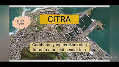
- 😀 Remote sensing is the technique of collecting data about objects from a distance without direct contact, often using sensors on satellites or aircraft.
- 😀 According to Kenichi Okamoto, remote sensing is the process of identifying, classifying, and gathering information using distant sensors.
- 😀 Remote sensing can be categorized as a science and art, where the goal is to acquire information about objects or phenomena without physical interaction, as stated by Lileson and Kever.
- 😀 The key components of remote sensing include an energy source (natural or artificial), the atmosphere, sensors, and platforms like satellites or aircraft.
- 😀 Sensors used in remote sensing can be photographic (film-based) or electronic (using electric energy to capture images).
- 😀 Platforms for remote sensing include low to high altitude aircraft and satellites, with varying ranges of coverage from 1,000 to 900,000 meters above Earth.
- 😀 Remote sensing data can be processed manually (e.g., using stereoscopes) or digitally (e.g., with computers).
- 😀 Remote sensing images can be categorized as photographic (e.g., pankromatik, ortoromatik, ultraviolet, and infrared) or non-photographic (e.g., multispectral and radar images).
- 😀 Key interpretation features of remote sensing images include shape, size, color, texture, pattern, shadow, site, and association, all of which help in identifying objects.
- 😀 The process of image interpretation involves detection, identification, analysis, and deduction to draw conclusions about the objects being observed.
- 😀 Remote sensing has numerous applications in fields such as oceanography (e.g., monitoring sea properties), climatology (e.g., studying climate conditions), and environmental monitoring (e.g., tracking land use, natural disasters, and mining).
Q & A
What is the definition of remote sensing according to Kenichi Okamoto?
-According to Kenichi Okamoto, remote sensing is a technique used to identify, classify, and determine objects, as well as to gather information using remote sensors.
How is remote sensing used to determine the location of the Aceh earthquake center in 2004?
-Remote sensing allows the identification of the location of the Aceh earthquake center in 2004 without physically visiting the site by using observation and data collection techniques from a distance.
What are the main components of remote sensing?
-The main components of remote sensing include the energy source, interaction between the energy and objects, sensors, and platforms (wahana). These elements work together to gather data and produce useful information.
What is the difference between passive and active remote sensing systems?
-Passive remote sensing systems use natural energy, such as sunlight, to detect and record reflected radiation from objects. Active systems, on the other hand, use artificial energy, like microwave waves, emitted from the sensor to detect objects.
What is the significance of spectral characteristics in remote sensing?
-Spectral characteristics refer to the way objects reflect or emit energy across different wavelengths. These characteristics, including color, shape, and time of capture, help identify and differentiate objects in remote sensing images.
What is the difference between photogrammetric and electronic sensors in remote sensing?
-Photogrammetric sensors use film to capture images and create aerial photos, while electronic sensors rely on electrical power to record data across a broad spectrum, producing digital images and multispectral data.
How do atmospheric conditions impact remote sensing?
-Atmospheric conditions affect remote sensing by determining which electromagnetic energy wavelengths can reach the Earth's surface and be recorded by sensors. Only certain wavelengths can pass through the atmosphere.
What are some examples of satellite-based remote sensing systems?
-Some examples of satellite-based remote sensing systems include NOAA and Meteor satellites for weather monitoring, Landsat and Spot satellites for Earth resource management, and Seasat for marine data collection.
What is image interpretation in remote sensing?
-Image interpretation involves analyzing aerial photos or remote sensing images to identify and assess the significance of objects. It includes recognizing features like shape, size, texture, and location of objects on the ground.
What are the main types of remote sensing images based on sensor characteristics?
-Remote sensing images are categorized into photographic and non-photographic types. Photographic images include panchromatic, orthophoto, ultraviolet, and infrared, while non-photographic images include thermal infrared, radar, and microwave.
Outlines

This section is available to paid users only. Please upgrade to access this part.
Upgrade NowMindmap

This section is available to paid users only. Please upgrade to access this part.
Upgrade NowKeywords

This section is available to paid users only. Please upgrade to access this part.
Upgrade NowHighlights

This section is available to paid users only. Please upgrade to access this part.
Upgrade NowTranscripts

This section is available to paid users only. Please upgrade to access this part.
Upgrade NowBrowse More Related Video
5.0 / 5 (0 votes)


