Wawancara Tema Bencana Alam "Erupsi Gunung Merapi 2010" || Proyek IPAS SMK N 2 Temanggung.
Summary
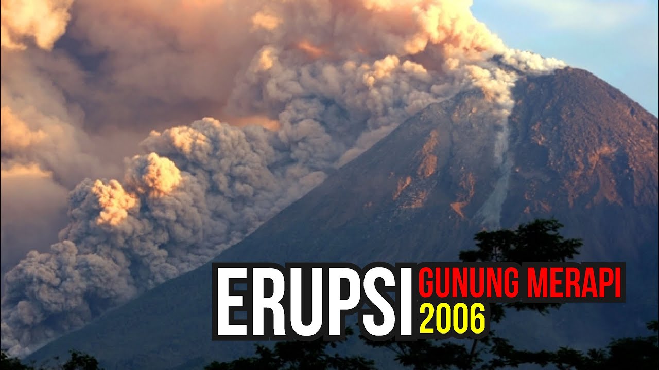
TLDRIn this informative broadcast, the host discusses the eruption of Mount Merapi in 2010, highlighting its causes linked to tectonic plate movements. The eruption began on October 29, 2010, and was characterized by over 100 explosive events, making it one of the most significant eruptions in Merapi's history. The surrounding areas, particularly Kinahrejo and Cangkringan, faced severe consequences, including loss of vegetation and reliance on government aid for several months. The discussion emphasizes the importance of providing timely information and conducting evacuations to protect local communities from future eruptions.
Takeaways
- 🌋 The 2010 eruption of Mount Merapi was caused by the friction between the Indian Ocean plate and the Eurasian plate, leading to magma buildup.
- 📅 The eruption occurred on October 29, 2010, and continued with daily eruptions for 18 consecutive days.
- 🔥 The 2010 eruption is considered the most significant in the history of Mount Merapi, with approximately 100 eruptions reported.
- 🏞️ The villages most affected by the eruption include Kinahrejo and Cangkringan, where many local residents lived.
- 🌱 The eruption caused severe environmental damage, killing all plants and trees within a 20-kilometer radius around Mount Merapi.
- 🚨 After the eruption, local communities relied on government aid for survival, as their crops were destroyed.
- 💔 An estimated number of casualties included around 300 fatalities and 1,000 to 3,000 injuries during the eruption.
- 👥 The government and volcanologists played a critical role in providing information and evacuation plans to protect local residents.
- ⚠️ During the eruption, Mount Merapi was placed at a danger level of 'alert,' prompting immediate response actions.
- 🤝 The community faced significant challenges, waiting months for logistical support due to the extensive destruction caused by the eruption.
Q & A
What caused the eruption of Mount Merapi in 2010?
-The eruption was caused by the friction between the Indian Ocean plate and the Asian plate, leading to the accumulation of magma in the Earth's crust.
When did the 2010 eruption of Mount Merapi occur?
-The main eruption occurred on October 29, 2010, with subsequent eruptions continuing for 18 days.
How significant was the 2010 eruption of Mount Merapi in terms of volcanic activity?
-The 2010 eruption was one of the most significant in the history of Mount Merapi, with approximately 100 eruptions recorded.
Which areas were directly affected by the 2010 eruption of Mount Merapi?
-The areas most affected included Kinahrejo and Cangkringan, particularly where Mbah Marijan, the guardian of Mount Merapi, resided.
What were the impacts of the 2010 eruption on the surrounding environment and communities?
-The eruption had severe impacts, with vegetation and trees within a 20-kilometer radius dying, forcing communities to rely on government aid for 3 to 4 months.
What was the estimated number of casualties from the 2010 Mount Merapi eruption?
-Approximately 3000 people were reported as casualties, with some suffering from severe injuries.
What actions were taken by the authorities in response to the eruption?
-Authorities focused on providing timely information to the public about the eruption's danger levels and conducted evacuations for those living near Mount Merapi.
How did the local population respond during the 2010 eruption?
-The local population experienced panic, and evacuation efforts were initiated to ensure their safety.
What role did volcanologists play during the eruption?
-Volcanologists monitored the eruption and provided crucial information to the community to minimize casualties.
What was the message shared by the speaker at the end of the report?
-The speaker expressed gratitude and concluded the report by summarizing the key points discussed regarding the eruption.
Outlines

This section is available to paid users only. Please upgrade to access this part.
Upgrade NowMindmap

This section is available to paid users only. Please upgrade to access this part.
Upgrade NowKeywords

This section is available to paid users only. Please upgrade to access this part.
Upgrade NowHighlights

This section is available to paid users only. Please upgrade to access this part.
Upgrade NowTranscripts

This section is available to paid users only. Please upgrade to access this part.
Upgrade Now


5.0 / 5 (0 votes)