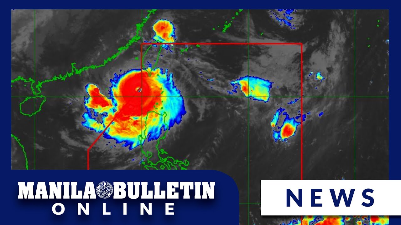
Press Briefing: Tropical Depression #GenerPH 11:30 AM Update September 17, 2024 - Tuesday

DOST-PAGASA Weather Report
16 Sept 202415:05

Summary

TLDRThe Philippine weather service reports Typhoon Hennar, currently near Benguet, with winds of 45 km/hr near the center, moving westward at 15 km/hr, and expected to exit the Philippine area within 48 hours. Tropical Depression Pulasan, 1,800 km east of Northern Luzon, is also monitored, with 65 km/hr winds near the center. Heavy to intense rains are anticipated in various regions, with warnings for high winds and potential flooding. Dam levels are closely monitored, with some releasing water to prevent overflow, affecting nearby areas. Residents in flood-prone and landslide-prone areas are advised to remain vigilant.

Takeaways

  • πŸŒ€ Bagyong Hener is currently monitored in the vicinity of Benguet, with winds of 45 km/h near the center and 55 km/h in the eye.
  • πŸ“ Hener is moving westward at a speed of 15 km/h and is expected to exit the Philippine area of responsibility within 24 to 48 hours.
  • πŸ” Signal number one is raised in several areas including Babuyan Islands, Isabela, Nueva Vizcaya, Apayao, Kalinga, Abra, Mountain Province, Benguet, Ilocos Norte, Ilocos Sur, La Union, Pangasinan, Zambales, Nueva Ecija, and Pampanga.
  • 🌧️ Heavy to intense rainfall is expected in Cagayan, Apayao, Kalinga, Mountain Province, Ifugao, Ilocos Norte, Abra, Palawan, Occidental Mindoro, Aklan, Antique, and de los Occidental with 100 to 200 mm of rain.
  • β˜” For the following day, heavy to intense rains are anticipated in Occidental Mindoro, Aklan, and Antique, with moderate to heavy rains in Ilocos Region, Cagayan Valley, Zambales, Bataan, Metro Manila, Calabarzon, Bicol, Central Visayas, and parts of MIMAROPA and Western Visayas.
  • 🚨 Gale warning is in effect for Batanes, Cagayan including Babuyan Islands, Ilocos Norte, Occidental Mindoro, Palawan, Aklan, Antique, Iloilo, Negros Occidental, Negros Oriental, Cebu, Bohol, Southern Leyte, Dinagat Islands, Surigao del Norte, Camiguin, and Zamboanga del Norte.
  • πŸŒͺ️ Bagyong Pulasan, with an international name, is also being monitored 1,800 km east of extreme Northern Luzon with winds of 65 km/h near the center and 80 km/h in the eye.
  • πŸ“‰ Dam levels are being closely monitored with Angat Dam at 194.86 meters, Ipo Dam at 101.3 meters, and Pantabangan Dam at 197.5 meters, with releases affecting downstream areas.
  • ⚠️ Flood advisory and hydrological situation reports are issued for the Agno and Magat Rivers due to the opening of gates in the Ambuklaw and Magat Dams, respectively.

Q & A

  • What is the current status of Typhoon Hener as of the morning of September 17, 2024?

    -As of the morning of September 17, 2024, Typhoon Hener is in the vicinity of Kibungan, Benguet, with winds of 45 km per hour near the center and up to 55 km per hour in gusts. It is moving westward at a speed of 15 km per hour.

  • What is the highest tropical cyclone wind signal currently in effect due to Typhoon Hener?

    -The highest tropical cyclone wind signal currently in effect is Signal Number One.

  • Which areas are under Signal Number One due to Typhoon Hener?

    -Areas under Signal Number One include Babuyan Islands, Isabela, Quirino, Nueva Vizcaya, Apayao, Kalinga, Abra, Mountain Province, Benguet, Ilocos Norte, Ilocos Sur, La Union, Pangasinan, Zambales, Nueva Ecija, and Pampanga.

  • What is the expected rainfall for areas under the influence of Typhoon Hener and the Southwest monsoon?

    -Heavy to intense rainfall is expected, ranging from 100 to 200 mm in areas such as Cagayan, Apayao, Kalinga, Mountain Province, Ifugao, Ilocos Norte, Abra, Palawan, Occidental Mindoro, Aklan, Antique, and others.

  • What is the forecast for Wednesday regarding the rain situation?

    -For Wednesday, heavy to intense rains are expected in Occidental Mindoro, Aklan, and Antique, with moderate to heavy rains in Ilocos Region, Cagayan Valley, Zambales, Bataan, Metro Manila, Calabarzon, Bicol Central, Visayas, and parts of MIMAROPA and Western Visayas.

  • What areas are expected to experience heavy to intense rains on Thursday?

    -On Thursday, heavy to intense rains are expected in Occidental Mindoro, while moderate to heavy rains are forecast for Metro Manila, La Union, Pangasinan, Zambales, Bataan, Cavite, Batangas, Aklan, Antique, and parts of MIMAROPA.

  • What is the current elevation of the Angat Dam as of 8:00 AM on September 17, 2024?

    -The Angat Dam is at an elevation of 194.86 meters as of 8:00 AM on September 17, 2024.

  • What is the current situation with the Magat Dam and the potential areas that might be affected by water release?

    -The Magat Dam is at an elevation of 197.5 meters due to an open gate. The water release could affect municipalities such as Dian, Isabela, Alonso, Santa Maria, Ramon, San Mateo, Aurora, Kabatuan, Luna, Luna, Reyna, Mercedes, Burgos, Naguilian, and Gamu.

  • What flood advisories are in place as a result of Typhoon Hener and the Southwest monsoon?

    -Flood advisories are in place for the Bicol Region and the Cagayan River due to Typhoon Hener and the Southwest monsoon. The Magat Dam has released water, which will flow into the Magat River and then the Cagayan River.

  • What is the current status of Typhoon Pulasan, and what is expected of its movement?

    -As of the script, Typhoon Pulasan is located 1,800 km east of extreme Northern Luzon with winds of 65 km per hour near the center and up to 80 km per hour in gusts. It is moving in a North-Northwest direction at a speed of 25 km per hour. It is expected to enter the Philippine area of responsibility and may be given a local name, possibly Helen.

  • What precautions are advised for mountainous and highly elevated areas due to the weather conditions?

    -Residents in mountainous and highly elevated areas are advised to be cautious due to the possibility of higher rainfall forecasts and the risk of flash floods and landslides.

Outlines

00:00

πŸŒ€ Typhoon Hener Update and Impact

The script provides an update on Typhoon Hener, located near the vicinity of Benguet with winds of 45 km/h near the center and gusts up to 55 km/h. It is moving westward at a speed of 15 km/h. The script discusses the current and forecasted path of the typhoon, including its potential exit from the Philippine area of responsibility. The highest tropical cyclone wind signal issued is Signal Number One, affecting areas such as Babuyan Islands, Isabela, Nueva Vizcaya, Apayao, Kalinga, Abra, Mountain Province, Benguet, Ilocos Norte, Ilocos Sur, La Union, Pangasinan, Zambales, Nueva Ecija, and Pampanga. The script also details the expected heavy to intense rainfall in various regions, with warnings about potential floods and landslides. It advises caution due to the enhanced southwest monsoon affecting the typhoon's movement and intensity.

05:00

πŸŒͺ Gale Warnings and Typhoon Pulasan Update

The script discusses the expected strong winds in various regions, including Batanes, MIMAROPA, Bicol Region, Visayas, and Mindanao, with specific warnings for Wednesday and Thursday. It also provides an update on Typhoon Pulasan, which is located 1,800 km east of extreme Northern Luzon with winds of 65 km/h near the center and gusts up to 80 km/h. The typhoon is moving northwest at a speed of 25 km/h and is expected to enter the Philippine area of responsibility, possibly being named Helen. The script outlines the potential path and impact of Typhoon Pulasan, including the possibility of it exiting the area and the associated weather warnings.

10:06

πŸ’§ Dam Water Levels and Flood Forecasts

The script details the current water levels of several dams in Luzon, including Angat, Ipo, La Mesa, Ambuklaw, and Pantabangan, with specific elevations and changes. It discusses the hydrological situation in the Magat River and the potential impact of water releases from the Magat Dam, affecting nearby municipalities. The script also mentions flood advisories for the Agno River and the Cagayan River due to the passage of Typhoon Hener and the release of water from dams. It outlines the regions under flood warnings and alerts for possible flash floods and landslides, emphasizing the need for precautionary measures and appropriate actions.

Mindmap

Keywords

πŸ’‘Bagyo

In the context of the video, 'Bagyo' refers to a tropical cyclone or typhoon, which is a large storm system characterized by low pressure and heavy rain, common in the Philippines. The video discusses the monitoring and tracking of Bagyo Hener and Bagyong Pulasan, emphasizing their potential impact on the region. It is a central theme as it directly relates to weather updates and warnings being provided.

πŸ’‘Philippine Area of Responsibility

This term refers to the geographical area in the Western Pacific where the Philippine Atmospheric, Geophysical, and Astronomical Services Administration (PAGASA) is responsible for monitoring and issuing warnings about tropical cyclones. The video mentions that Bagyong Pulasan is outside this area, indicating its position relative to the Philippines and the scope of PAGASA's monitoring.

πŸ’‘Tropical Cyclone Wind Signal

The video discusses the issuance of 'Tropical Cyclone Wind Signal Number One' for certain areas, which is a warning system used in the Philippines to alert the public about the expected strength of tropical cyclone winds. This signal is crucial for preparing communities for the potential hazards posed by the storm.

πŸ’‘Signal Number One

As part of the tropical cyclone warning system, 'Signal Number One' indicates the lowest level of threat from a storm, suggesting minor to no damage to infrastructure and posing minimal threat to life and property. The video uses this term to describe the current status of Bagyo Hener, highlighting the level of preparedness required in affected areas.

πŸ’‘Heavy to Intense Rainfall

The video forecasts 'heavy to intense rainfall' in various regions, which refers to a significant amount of precipitation that can lead to flooding and other hazards. This term is used to describe the expected weather conditions due to the enhanced southwest monsoon and the influence of the tropical cyclones, emphasizing the need for vigilance and preparedness.

πŸ’‘Landmass

The term 'landmass' is used in the video to describe the geographical features of the Philippines, particularly in relation to the path of the tropical cyclones. It is mentioned in the context of the cyclones moving away from the landmass, indicating the potential for reduced impact on the country.

πŸ’‘Gale Warning

A 'Gale Warning' is a type of marine weather warning issued for strong winds that can cause rough seas and high waves. The video mentions this warning for specific areas, indicating the potential danger for maritime activities and the need for caution in coastal regions.

πŸ’‘Hydrological Situation

The video discusses the 'hydrological situation' of various rivers and dams, which refers to the study of water in these bodies and the management of water resources. It is mentioned in the context of monitoring water levels and the potential for flooding due to the release of water from dams, highlighting the importance of water management in the face of extreme weather.

πŸ’‘Flood Advisory

A 'Flood Advisory' is a warning issued when flooding is possible or already occurring. The video mentions flood advisories for certain regions, indicating the need for residents to be alert and prepared for potential flooding due to the heavy rainfall associated with the tropical cyclones.

πŸ’‘Flash Floods and Landslides

The video warns of the potential for 'flash floods and landslides' in certain areas, which are sudden and rapid water flows that can occur with little warning, and landslides, which are the movement of earth down slopes. These terms are used to emphasize the serious risks associated with heavy rainfall and the importance of taking appropriate precautions.

Highlights

Bagyo Henner is currently monitored with strong winds of 45 km/h near the center, moving westward at 15 km/h.

Bagyo Henner is expected to be outside the Philippine Area of Responsibility after 24-48 hours.

Tropical Cyclone Wind Signal No. 1 is raised in several areas including Babuyan Islands, Isabela, and Ilocos Norte.

Heavy to intense rains are expected in Cagayan, Apayao, Kalinga, Mountain Province, Ifugao, Ilocos Norte, Abra, Palawan, Occidental Mindoro, Aklan, Antique, and degos Occidental.

Moderate to heavy rains are forecasted for the Cordillera Administrative Region, Cagayan Valley, Ilocos Region, Nueva Ecija, Bulacan, Quezon, Bicol, Region Zamboanga del Sur, Lanao del Norte, Lanao del Sur, Magindanao del Norte, Magindanao del Sur, MIMAROPA, Western Visayas, and Negros Island Region.

For Wednesday, heavy to intense rains are expected in Occidental Mindoro, Aklan, and Antique.

Thursday forecasts heavy to intense rains in Occidental Mindoro, with moderate to heavy rains in Metro Manila, La Union, Pangasinan, Zambales, Bataan, Cavite, Batangas, Aklan, Antique, and parts of MIMAROPA.

Gale warning is in place for Batanes, Cagayan including Babuyan Islands, Ilocos Norte, Occidental Mindoro, Palawan, Aklan, Antique, Iloilo, Negros Occidental, Negros Oriental, Cebu, Bohol, Southern Leyte, Dinagat Island, Surigao del Norte, Camiguin, and Zamboanga del Norte.

Bagyo Pulasan is being monitored 1,800 km East of extreme Northern Luzon with winds of 65 km/h near the center, moving North Northwest at 25 km/h.

Bagyo Pulasan is expected to enter the Philippine Area of Responsibility and may be named Helen, possibly entering tonight or tomorrow morning.

Upon entry, Bagyo Pulasan (Helen) is forecasted to move away from the landmass and may exit the country by tomorrow afternoon or early evening.

Dams in Luzon are being monitored for water levels, with Angat Dam at 194.86 m, Ipo Dam at 101.3 m, and others showing varying levels of rise and fall.

Flood advisory is issued for areas that may be affected by water release from Magat Dam, including several municipalities in Isabela and Aurora.

Hydrological situationers are issued for the Agno River due to the opening of Ambuklao Dam's gates, affecting areas in Benguet and Itogon.

Flash flood warnings and landslide alerts are issued for several regions, including Region 1, Ilocos Region, Region 2, Cagayan Valley, and Region 4B.

Precautionary measures are advised for Region 7, Central Visayas, and Region 8, Eastern Visayas.

Transcripts

play00:28

2 Magandang araw update na nga muna tayo

play00:31

sa mino-monitor nating bagyo na si hener

play00:35

so ito ang si hener kaninang 10 ng umaga

play00:39

nasa vicinity na ng kibungan Benguet ito

play00:42

ay nagdadala ng lakas na hangin na 45 km

play00:46

kada oras malapit sa sentro at bugso na

play00:48

aabot sa 55 km kada oras ito ay

play00:52

kumikilos sa direksyong kanluran sa

play00:54

bilis na 15 km kada oras and then aside

play00:58

nga dito kay henner meron din tayong

play01:00

mino-monitor na bagyo sa labas ng ating

play01:02

Philippine area of responsibility na si

play01:05

Bagyong pulasan international name yung

play01:08

pulasan and then Later on sa sa Later on

play01:11

part ng slides natin ay maglalabas nga

play01:13

tayo ng information about kay pulasan so

play01:17

tingnan naa muna natin itong track natin

play01:19

kay hener so nakikita natin itong yellow

play01:22

orange na circle ito yyung mga malalakas

play01:24

na hangin na pwedeng umabot ng 39 km per

play01:28

so usually kapag ganito yung yung area

play01:31

so pwedeng signal number one or signal

play01:32

number two Although for now ang

play01:34

pinakamataas na Signal natin ay signal

play01:36

number

play01:37

one so after 24 hours makikita nga natin

play01:41

na nasa labas na ng par or posibleng

play01:44

nasa labas na ng par itong si Bagyong

play01:47

hener 500 km kanluran ng Dagupan City

play01:51

Pangasinan and after 48 hours 925 km

play01:57

kanluran ng Northern Luzon so papalayo

play02:00

makikita natin papalayo na nga ito sa

play02:02

landmass ng ating bansa so dahil nga

play02:06

dito kay hener meron tayong nakataas na

play02:08

tropical cyclone wind signal

play02:10

pinakamataas nga kagaya ng nabanggit

play02:12

natin kanina Ay signal number one so

play02:14

signal number one sa may kagayan

play02:16

kabilang na ang Babuyan Islands sa may

play02:18

Isabela sa may kirino Nueva viscaya

play02:21

Apayao Kalinga sa may Abra sa may

play02:23

mountain province sa may benget pati na

play02:27

rin sa may Ilocos Norte Ilocos Sur sa

play02:30

may la unon sa may Pangasinan sa may

play02:32

Zambales sa may Nueva Ecija pati na rin

play02:35

sa may Pampanga so kapag naka-sign

play02:37

number one tayo minor or minimal to

play02:40

minor threat to life and property So may

play02:44

mga malalakas na pag-ulan nga din tayong

play02:47

inaasahan dahil sa habagat na na-enhance

play02:49

nitong si hener at pati na rin yung

play02:52

bagyo sa labas ng ating p so asahan nga

play02:55

natin yung mga malalakas na pag-ulan

play02:57

itong mga nakakulay blue ito ay dahil

play02:59

kay Tropical Depression hener at itong

play03:02

white Tex naman dahil sa habagat so for

play03:05

today heavy to intense range 100 to

play03:07

20000 mm sa may Cagayan Apayao Kalinga

play03:10

mountain province Ifugao Ilocos Norte

play03:13

Abra Palawan Occidental Mindoro Aklan

play03:16

Antique at degos Occidental so 50 to 100

play03:19

mm naman sa nalalabing bahagi ng

play03:22

Cordillera Administrative Region

play03:24

nalalabing bahagi ng Cagayan Valley

play03:25

nalalabing bahagi ng Ilocos region Nueva

play03:28

Ecija Bulacan Quezon riz Aurora Bicol

play03:31

Region Zamboanga del Sur Lanao del Norte

play03:33

Lanao del Sur magindanao del Norte

play03:35

magindanao del Sur nalalabing bahagi ng

play03:38

MIMAROPA Western Visayas at sa may

play03:41

Negros Island

play03:42

region so for tomorrow mapapansin nga

play03:45

natin mas konti na yung mga areas na may

play03:48

mga malalakas na pag-ulan pero kailangan

play03:50

pa rin nga mag-ingat kahit sa mga nasa

play03:52

50 to 100 mm of rain So bukas Wednesday

play03:56

heavy to intense rains 100 to 200 MM aan

play04:00

Occidental Mindoro Aklan at Antique

play04:02

moderate to heavy 50 to 100 mm Ilocos

play04:06

region kagen Valley car Zambales Bataan

play04:08

Metro Manila Calabarzon Bicol Central

play04:11

Visayas at nalalabing bahagi ng MIMAROPA

play04:14

Western Visayas at Negros Island region

play04:17

so Thursday meron pa nga rin tayong mga

play04:20

malalakas na pag-ulan na inaasahan heavy

play04:22

to intense 100 to 200 mm of rain sa

play04:25

Thursday sa may Occidental Mindoro

play04:27

samantalang moderate to heavy 50 to 100

play04:30

mm sa Metro Manila La Union Pangasinan

play04:33

Zambales Bataan Cavite Batangas Aklan

play04:36

Antique at nalalabing bahagi ng

play04:39

MIMAROPA so sa mga mountainous areas or

play04:42

highly elevated areas posibleng mas

play04:45

mataas yyung forecast rainfall so ingat

play04:48

sa ating mga kababayan din na nakatira

play04:50

sa mga flood prone at landslide prone

play04:52

area sa mga banta ng pagbaha o hindi

play04:54

kaya pagguho ng

play04:56

lupa itong Southwest monsoon may enhance

play05:00

pa nga rin ni hener at yung bagyo sa

play05:01

labas ng ating par so for today asahan

play05:05

natin yung bugso ng malalakas na hangin

play05:07

sa may Batanes MIMAROPA Bicol Region

play05:09

Visayas at Mindanao Wednesday naman sa

play05:12

may Zambales Bataan Pampanga Bulacan

play05:14

Metro Manila Calabarzon bimar Opa Bicol

play05:16

Region Visayas at Mindanao and sa may

play05:19

Thursday Isabela Aurora Pangasinan

play05:21

Zambales Bataan Metro Manila Calabarzon

play05:24

MIMAROPA Bicol Region at Western

play05:27

Visayas meron tayong Gale warning pa rin

play05:30

na naka rce This is as of 5 a.m. sa may

play05:33

Batanes sa may Cagayan kabilang na ang

play05:35

Babuyan Islands sa may Ilocos Norte sa

play05:37

may Occidental Mindoro sa may Palawan sa

play05:41

may Aklan Antique Iloilo sa may Negros

play05:43

Occidental Negros Oriental sor sa may

play05:47

cebu Bohol Southern Leyte Dinagat Island

play05:50

Surigao del Norte Camiguin at Zamboanga

play05:53

del Norte so mapanganib na pumalaot ung

play05:56

mga maliliit na sasakyang pandagat

play05:58

kabilang na ngarin ung yung mga motor

play06:01

bankas o naman yung inaasahan natin

play06:05

Magiging Outlook nitong si Bagyong hener

play06:07

so mag posible

play06:28

mag-emergency pa siya pero habang

play06:30

papalayo kasi siya papalayo naman kasi

play06:32

siya sa ating

play06:34

landmass and then Ito naman ung update

play06:37

sa isang binabantayan nating bagyo na si

play06:39

pulasan at Kanina nga ay nasa may 1,800

play06:43

km East of extreme Northern Luzon

play06:45

nagtataglay ng lakas na hangin na 65 km

play06:48

per malapit sa sentro at bugso naabot sa

play06:51

80 km per kumikilos sa direksyong North

play06:54

Northwest sa bilis na 25 km per h So

play06:58

inaasahan nga natin na pagpasok nito

play07:02

Bibigyan natin siya ng local name na

play07:04

Helen posibleng pumasok ng par tonight

play07:06

or tomorrow morning so Nakikita naman

play07:09

natin base sa forecast truck na malayo

play07:12

siya sa land mask ng ating bansa so

play07:15

pagkapasok niya tonight or tomorrow

play07:17

morning Pwede na rin siyang lumabas ng

play07:19

ating par tomorrow afternoon or early

play07:22

evening So kung papasok man siya dito sa

play07:24

may northeastern boundary ng par and

play07:28

then naasahan nga magre siya as Tropical

play07:31

storm pero kung hindi natin tinatanggal

play07:35

yung possibility na

play07:39

pag-a muna yung latest sa ating lagay ng

play07:42

panahon Veronica C Torres naguulat at

play07:44

next naman po ay ang

play07:50

hmd Okay na po gumalaw

play08:37

Okay good morning po ah dum update po

play08:40

tayo no as of ano 8 a.m. pa po to 8 a.m.

play08:47

September

play08:48

17

play08:50

2024 Ito po yyung mga elevation ng dams

play08:54

natin dito sa Luzon kung titignan po

play08:56

natin yung Angat Dam ng kung saan tayo

play08:59

ay kumukuha ng tubig dito sa Metro

play09:02

Manila kanina pong 8:00 ng umaga nasa

play09:06

1948 6 m bahagya po siyang umakyat ng 06

play09:11

m then ang iPod dam nasa

play09:15

10.13 m umakyat po ng 62 m then ang

play09:22

lamesa Nasa 79.4 7 m bahagyang bahagyang

play09:27

bumaba ng 03

play09:30

meters then ang ambuklaw nasa

play09:33

7514 m bumaba po ng ne 30 M at titigan

play09:40

po natin may nakabuka siyang dalawang

play09:42

gate na ang total opening niya is 1 m

play09:46

mga approximately mga

play09:49

100 10 cms ang lumalabas diyan ah 110

play09:55

cubic m per then ang ambuklaw kanina 8

play09:59

am nasa 573 point2 m bumaba rin po ng 1

play10:05

m at meron din po siyang nakabukas na

play10:08

one gate

play10:10

at 5 m ang estimated discharge po niyan

play10:14

yung mga nasa 60 cubic m per

play10:18

second then Ang sanroque dam nasa

play10:23

26.9 m umakyat po ng 54 m compare sa

play10:29

niya kahapon then ang Pantabangan Dam

play10:32

nasa 197.5

play11:02

dahil sa may nakabukas pong gate

play11:05

yung Magat Dam gumawa po tayo ng

play11:09

hydrological situationer sa Magat River

play11:12

at Ito po yung mga bayan na pwedeng

play11:15

maapektuhan nung paglabas ng tubig diyan

play11:18

sa Magat Dam Ito po yung mga lugar ng

play11:22

mga munisipyo Dian

play11:26

Isabela alonso lista Ito po yung nasa

play11:29

ipugaw at ang Ramon Yan po yung sa

play11:33

Isabela San Mateo Aurora kabatuan

play11:39

Luna Luna ah Luna reyna

play11:43

Mercedes Burgos naguilan and

play11:49

Gamu then Ito naman po

play11:52

yyung hydrological situationer sa Agno

play11:55

River dahil po nakabukas yung ang ang

play11:58

buk binga ngayon naglabas po tayo ng

play12:03

babala diyan sa may amb sa may Barangay

play12:06

ambuklao Diyan po sa may bukod benget at

play12:11

Diyan po sa may Bing dam dahil nakabukas

play12:14

din sa Barangay

play12:16

Dal dalupirit Pim

play12:21

and tinungan sa Itogon

play12:26

benget then dito po sa B region meron pa

play12:30

po tayong flood

play12:32

advisory na kung titignan po natin medyo

play12:36

unti-unti na siyang bumababa yung mga

play12:38

tubig diyan pero hindi pa rin po natin

play12:41

inaalis yung may

play12:43

mga pwedeng ah umulan ng mga malalakas

play12:48

diyan sa Bicol Region

play12:51

and also dito rin po sa Cagayan River

play12:54

dahil sa Diyan po dumaan si dadaan si

play12:59

bagong hener

play13:01

ah naglabas din po sila ng flood

play13:04

advisory and yung Magat Dam na

play13:08

nire-release na pupunta sa Magat River

play13:12

dadaan din po yan sa Cagayan River kaya

play13:16

naglabas po sila ng ah flood

play13:20

Bulletin then Ito naman po yung mga gfa

play13:24

na inissue kaninang

play13:27

umaga under the warning ng appropriate

play13:31

action ito pong car yung sa celera

play13:34

Administrative Region Region one sa

play13:37

Ilocos Region Region 2 sa cagan Valley

play13:40

sa region 4b may marop and region 6 sa

play13:44

may Western Visayas eh under the alert

play13:48

for possible flash floods and landslide

play13:50

nag-issue po sa region 3 sa Central

play13:53

Luzon sa region 4a calabar zone Region 5

play13:58

Bicol Region Region 9 Zamboanga

play14:01

Peninsula barn

play14:03

B bansamoro autonomous region in muslim

play14:07

mindanao and under the precautionary

play14:10

measures ito pong region 7 central

play14:14

visayas and Region 8 Eastern Visayas Yan

play14:17

lang po muna sa sa hydromet division sa

play14:21

flood forecasting warning section

play14:24

Magandang umaga po

play14:35

yung flash drive flash drive po

Rate This
β˜…
β˜…
β˜…
β˜…
β˜…

5.0 / 5 (0 votes)

Related Tags
Weather UpdatesTyphoon HenerBagyong PulasanFlood AdvisoryPhilippine StormsRainfall ForecastTropical CycloneDam ElevationStorm SignalWeather Alert