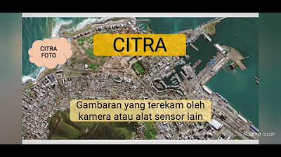
Pengindraan Jauh | Kelas X SMA
Summary
TLDRIn this video, the concept of remote sensing is explored, covering its definition, components, types of imagery, and various applications. Remote sensing involves analyzing Earth's surface from a distance using sensors on platforms like satellites and aircraft. The video explains different types of images, including photographic and non-photographic (digital) imagery, as well as how they are categorized based on electromagnetic spectrum and camera types. It also highlights the key principles of image interpretation, such as shape, size, and texture, and discusses the significant benefits of remote sensing in areas like environmental monitoring, agriculture, and disaster management.
Takeaways
- 😀 Remote sensing (penginderaan jauh) is the science of analyzing the Earth's surface from a distance using sensors and platforms such as satellites or aircraft.
- 😀 Sensors record data without direct contact with the objects being studied, capturing reflected light or other types of electromagnetic radiation.
- 😀 Remote sensing components include sunlight (which illuminates objects), sensors (which capture reflected light), and platforms (such as planes and satellites).
- 😀 There are two main types of remote sensing images: photo images (produced by cameras) and non-photo or digital images (produced by sensors like satellites).
- 😀 Remote sensing can be used to monitor and study various phenomena such as flood detection, coastal erosion, and land use changes.
- 😀 Remote sensing images can be categorized based on electromagnetic spectrum types, such as visible light, ultraviolet, infrared, and thermal radiation.
- 😀 The two types of remote sensing images are: aerial photographs (taken from aircraft or balloons) and satellite images (taken from space).
- 😀 There are several types of aerial photographs based on spectrum, camera axis, and camera type, including photos using ultraviolet, infrared, and other electromagnetic wavelengths.
- 😀 Non-photo or digital images use sensors that detect infrared, thermal, radar, and microwave radiation, and can capture data even without sunlight (passive system).
- 😀 Remote sensing data can be analyzed through various image interpretation techniques, such as analyzing object shape, size, texture, and association with surrounding objects.
Q & A
What is remote sensing, and how does it work?
-Remote sensing is the science of collecting data about the Earth's surface from a distance, typically using sensors mounted on aircraft or satellites. The process involves capturing reflected sunlight or electromagnetic waves from objects on the Earth's surface, which is then recorded and analyzed without direct contact with the objects.
What are the two main components involved in remote sensing?
-The two main components involved in remote sensing are sensors and platforms (wahana). The sensors record or capture the reflected light or radiation, while platforms such as aircraft or satellites carry these sensors.
What is the role of sunlight in remote sensing?
-Sunlight is crucial in remote sensing as it illuminates the objects on the Earth's surface. The objects then reflect this light, and the sensors capture the reflected light to create images or data for analysis.
What is the difference between photo and non-photo (digital) images in remote sensing?
-Photo images are produced using cameras on sensors and involve capturing visible light to produce images in natural colors. Non-photo (digital) images, on the other hand, are produced using other types of sensors, like satellites, and include different types of electromagnetic waves such as infrared and microwave.
How do photo images differ based on the electromagnetic spectrum?
-Photo images can be categorized based on the electromagnetic spectrum they capture, such as: 1) Panchromatic images (visible light), 2) Orthochromatic (blue and green wavelengths), 3) Ultraviolet images, 4) Infrared images, and 5) Modified infrared images.
What are the types of images based on the camera orientation in remote sensing?
-Images can be categorized based on the camera orientation into vertical photos (where the camera is perpendicular to the Earth's surface) and inclined (oblique) photos (where the camera is angled at an incline).
What are the differences between single and multi-spectral photos?
-Single-spectral photos are taken with a single camera and produce one image. Multi-spectral photos use multiple cameras or sensors to capture various wavelengths (such as infrared, visible, etc.), providing more detailed and varied data about the object or area being observed.
What is the difference between active and passive remote sensing systems?
-Active remote sensing systems emit their own signals (such as radar), which are then reflected back by the objects they detect. Passive systems, like optical and infrared sensors, rely on natural sunlight or thermal radiation from objects to capture data.
What is the importance of image resolution in remote sensing?
-Image resolution in remote sensing refers to the level of detail in an image, which can be spatial (clarity of objects), spectral (range of electromagnetic wavelengths), temporal (frequency of image capture), or radiometric (sensitivity to radiation). Higher resolution allows for more detailed analysis.
How do the interpretation techniques of remote sensing images work?
-Interpretation techniques in remote sensing involve analyzing image characteristics such as color, shape, size, texture, and patterns. These features help identify and classify objects and understand relationships between them, aiding in applications like urban planning or disaster management.
Outlines

Этот раздел доступен только подписчикам платных тарифов. Пожалуйста, перейдите на платный тариф для доступа.
Перейти на платный тарифMindmap

Этот раздел доступен только подписчикам платных тарифов. Пожалуйста, перейдите на платный тариф для доступа.
Перейти на платный тарифKeywords

Этот раздел доступен только подписчикам платных тарифов. Пожалуйста, перейдите на платный тариф для доступа.
Перейти на платный тарифHighlights

Этот раздел доступен только подписчикам платных тарифов. Пожалуйста, перейдите на платный тариф для доступа.
Перейти на платный тарифTranscripts

Этот раздел доступен только подписчикам платных тарифов. Пожалуйста, перейдите на платный тариф для доступа.
Перейти на платный тарифПосмотреть больше похожих видео
5.0 / 5 (0 votes)


