BAGYONG JULIAN POSIBLENG UMABOT SA SUPER TYPHOON CATEGORY ALAMIN! WEATHER UPDATE | SEPT. 29, 2024
Summary
TLDRThe Philippine Atmospheric, Geophysical, and Astronomical Services Administration (PAGASA) reports Tropical Depression Julian is intensifying and moving towards Northern Luzon, potentially reaching Typhoon or Super Typhoon status. Residents are warned of possible flooding and landslides. PAGASA also monitors Typhoon Jebi outside the Philippine area of responsibility. Expected heavy rains and strong winds are forecasted for several regions, with tropical cyclone wind signals raised in Batanes, Cagayan, and Babuyan Islands, among others.
Takeaways
- 🌪️ Tropical Depression Julian (Kraton) is approaching Northern Luzon, currently in the Philippine Sea east of Apari, Cagayan.
- 💨 Julian has winds of 75 km/h with gusts up to 80 km/h, expected to intensify and possibly reach typhoon or super typhoon strength by Sunday or Monday.
- ⚠️ Residents are advised to be cautious of flooding and landslides due to heavy rains.
- 🌊 There is a second tropical storm, Typhoon Jebi, currently outside the Philippine area of responsibility (PAR), with no direct impact expected on the country.
- ⏳ By September 30, Julian is forecasted to be 215 km east-northeast of Apari, Cagayan, and may reach typhoon strength, with a possible landfall by Monday or Tuesday.
- 📍 Typhoon signal warnings are in effect for areas including Batanes, Cagayan, Babuyan Islands, Isabela, and parts of the Cordillera region.
- 🌧️ Heavy to intense rainfall is expected across northern Luzon, especially in the Babuyan Islands and parts of Cagayan and Ilocos Norte.
- ⛅ Strong to gale-force winds are expected in several regions including Aurora, Calabarzon, Romblon, and the Bicol Region by Monday.
- 🌊 Rough sea conditions up to 6 meters are expected in the seaboards of Batanes and Babuyan Islands, with moderate to heavy seas around other parts of northern Luzon.
- 📢 DOST PAGASA continues to monitor the situation, urging vigilance as Tropical Depression Julian intensifies and approaches land.
Q & A
What is the current status of Tropical Depression Julian?
-Tropical Depression Julian is approaching Northern Luzon while still in the Philippine Sea, east of Aparri, Cagayan.
How strong are the winds associated with Tropical Depression Julian?
-Tropical Depression Julian has maximum sustained winds of 75 km/h near its center, with gusts reaching up to 80 km/h.
Is Tropical Depression Julian expected to intensify?
-Yes, Tropical Depression Julian is expected to intensify into a typhoon and could even reach super typhoon category by Sunday or Monday.
Which areas are advised to take precautions due to possible heavy rainfall and landslides?
-Residents in areas prone to flooding or landslides, especially in Northern Luzon, are advised to take precautions.
What is the forecasted track of Tropical Depression Julian?
-Tropical Depression Julian is expected to be 215 km east-northeast of Aparri, Cagayan by September 30, 2024, and will intensify to a severe tropical storm before approaching Batanes and Babuyan Islands by Monday or early Tuesday.
What is the significance of Tropical Cyclone Wind Signal No. 2 in relation to Tropical Depression Julian?
-Tropical Cyclone Wind Signal No. 2 has been raised in Batanes, Cagayan (including Babuyan Islands), Isabela, Abra, Apayao, Kalinga, and parts of Mountain Province, signaling that these areas may experience strong winds and heavy rainfall.
Are there any other tropical storms being monitored aside from Julian?
-Yes, PAGASA is also monitoring Tropical Storm Jebi, which is currently outside the Philippine Area of Responsibility and has no direct impact on the country.
What weather conditions are expected on Monday due to Tropical Depression Julian?
-Heavy to intense rainfall is expected in Babuyan Islands, while moderate to heavy rains are expected in Batanes, mainland Cagayan, Isabela, and Ilocos Norte.
What kind of sea conditions should be expected in affected areas?
-Rough sea conditions with waves up to 6 meters are expected along the seaboards of Batanes and Babuyan Islands, while waves up to 4 meters are expected in northern Cagayan and Ilocos Norte.
When is Tropical Depression Julian expected to make landfall or approach land?
-Tropical Depression Julian is forecast to either make landfall or closely approach Batanes and Babuyan Islands by Monday night or early Tuesday.
Outlines
🌀 Tropical Storm Julian and Typhoon Jebi Updates
The Philippine Atmospheric, Geophysical and Astronomical Services Administration (PAGASA) reports that Tropical Depression Julian, also known as Typhoon Julian, is approaching Northern Luzon. It is currently in the Philippine Sea and is expected to strengthen into a typhoon or even a super typhoon. Residents are warned of potential flooding and landslides due to heavy rainfall. As of the latest update, Julian is located 215 km East Northeast of Aparri, Cagayan, and is classified as a severe tropical storm. It is expected to reach typhoon status by September 30, with a possible landfall or close approach in Batanes and Babuyan Islands by Monday or Tuesday. Meanwhile, Tropical Storm Jebi is being monitored outside the Philippine area of responsibility and is not expected to have a direct impact on the country. PAGASA has issued a tropical cyclone wind signal number two for Batanes, Cagayan, and other areas, with expectations of strong to gale force winds and heavy to intense rainfall. Sea conditions are expected to be rough, with waves up to 6 meters high in certain areas.
🎵 Background Music
This paragraph contains background music, typically used to set the tone for the video or to provide a pause between updates.
Mindmap
Keywords
💡Tropical Depression
💡Typhoon
💡PAGASA
💡Signal Number Two
💡Philippine Sea
💡Super Typhoon
💡Landfall
💡Storm Surge
💡Heavy Rainfall
💡Rough Sea Conditions
Highlights
Tropical Depression Julian is moving closer to Northern Luzon.
Julian is currently in the Philippine Sea, east of Aparri, Cagayan.
The storm has winds of 75 km/h near its center with gusts of up to 80 km/h.
Julian is expected to strengthen and possibly reach Typhoon or even Super Typhoon status by Sunday or Monday.
Residents in flood-prone areas are advised to be cautious of possible flooding and landslides.
There is another tropical storm, Jebi, outside the Philippine Area of Responsibility (PAR) that is being monitored.
Julian was last spotted 380 km east of Aparri, Cagayan, moving west-northwest at 15 km/h.
By September 30, 2024, Julian is forecast to become a severe tropical storm, located near Itbayat, Batanes.
Landfall or a close approach to Batanes and Babuyan Islands is possible by Monday or early Tuesday.
By October 1, 2024, Julian will be 95 km northwest of Itbayat, Batanes, still categorized as a typhoon.
Heavy to intense rainfall is expected in Babuyan Islands and Batanes by Monday.
Moderate to heavy rainfall is expected in mainland Cagayan, Isabela, and Ilocos Norte until Monday afternoon.
Sea conditions will be rough, with waves up to 6 meters high around Batanes and Babuyan Islands.
Tropical Cyclone Wind Signal #2 is raised in Batanes, Cagayan, Babuyan Islands, and several provinces in Northern Luzon.
The heaviest rains are expected from Monday afternoon to Tuesday afternoon, especially in Batanes and Babuyan Islands.
Transcripts
ayon sa update ng Philippine atmospheric
geophysical and astronomical services
administration Patuloy ang paglapit ng
Tropical Depression Julian o kraton sa
Northern Luzon Habang nasa philippin sea
sa East apari Cagayan taglay nito Ang
lakas na hangin na aabot sa 75 km per
malapit sa gitna at pagbugsong aabot sa
80 km per patuloy rin daw na lalakas ang
bagyo at maaaaring umabot sa kategoryang
Typhoon at posible rin umabot sa super
typhoon category pagsapit ng Linggo o
Lunes pinag-iingat ang mga residente sa
mga lugar sa posibleng pagbaha o pagguho
ng lupa tuwing magkakaroon ng malalakas
na pag-ulan at sa kasalukuyan may isa
pang Tropical storm na binabantayan ang
PAGASA na si Bagyong jebi sa labas ng
Philippine area of responsibility narito
ang weather update mula sa weather
specialist ng
PAGASA ito pong si Jan ay huling
namataan sa laing 380 km East ng apari
Cagayan ito y may taglay na Lakas na
hangin na 75 km per malapit sa sentro at
pagbugso na 90 km per ito'y kumikilos
West Northwest ward sa bilis na 15 km
per Para naman sa magiging truck nitong
binabantayan nating bagyong si julan
asahan po natin ay ito'y huling nasa
layong 215 km East northeast ng apari
Cagayan at ito yung may category na na
severe Tropical storm by September 30
2024 Monday 2 pm over the Coastal waters
na siya ng itbayat Batanes at kung
makikita po natin isa na po siyang
typhoon category by September 30 dahil
sa forecast truck po natin nakikita
possible po ang landfall or close
approach By Monday hanggang madaling
araw ng Tuesday dito sa may Batanes at
Babuyan Islands by October 1 2024 2 pm
95 km na siya ng Northwest of itb
Batanes at typhoon category pa rin
October 2 2024 2 pm 340 km na siya ng
North northeast ng itbayat Batanes at
typhoon category pa din meron din tayong
bagyo dito sa labas ng ating Philippine
area of responsibility at ito isang
Tropical storm na si jebi kung makikita
naman po natin dito sa satellite imagery
po natin Masyado po itong malayo dito sa
ating kalupaan at wala po itong
direktang epekto sa anumang parte ng
ating bansa sa nakikita din po natin
mababa din po ang tansa nito na pumasok
mismo ng ating Philippine area of
responsibility dahil dito kay bagyong
hulyan meron tayong tropical cyclone
wind signal number two dito sa Batanes
Cagayan kasama na ang Babuyan Islands
Isabela Abra Apayao Kalinga eastern
portion ng mountain province eastern
portion ng ipugaw Ilocos Norte at
northern portion ng Aurora at Dito naman
po sa ating bagong si Julia ay nakikita
po natin ang pinakamataas natin na
tropical cyclone wind signal na itataas
ay number four Ano po ba ine-expect
natin ingil po dito sa magiging hangin
na dala po ni julan asahan po natin ang
strong to Gale force na bugso ng hangin
dito sa Aurora calabarson Romblon at
Bicol Region By Monday naman po dito sa
Aurora Pangasinan Zambales Bataan Metro
Manila calabarson Romblon at Bicol
Region asaha po natin ang heavy to
intense na pag-ulan dito sa may Babuyan
Islands moderate to heavy naman dito sa
Batanes mainland Cagayan Isabela at
Ilocos Norte Hanggang Monday afternoon
September 30 asahan din natin ang heavy
to intense sa Cagayan at Ilocos Norte
moderate to heavy naman sa Isabela
Batanes Apayao Abra Ilocos Sur La Union
at benget Monday afternoon to Tuesday
afternoon which is October 1 asahan na
natin ng intense to torrential range
dito sa Batanes at Babuyan Islands heavy
to intense naman sa Batanes mainland
Cagayan Apayao Abra at Ilocos Norte
moderate heavy naman sa Isabela
nalalabing bahagi ng Ilocos region at
Cordillera Administrative Region Ano
naman po ba yung maaasahan natin dito sa
ating mga karagatan asahan po natin ang
rough sea condition up to 6 m dito sa
seaboards ng Batanes at seaboards ng
Babuyan is lands asahan din natin ang
rap sea condition up to 4 Mers dito sa
northern seaboard ng mainland Cagayan
northern seaboard ng Ilocos Norte na
lalabing bahagi ng seaboard ng Cagayan
pati na rin sa seaboard ng Isabela at
northern portion ng Aurora moderate
naman asahan natin 2.5 m dito sa
nalalabing bahagi ng Ilocos Norte yan
muna ang ating weather update sa ngayon
maraming salamat sa DOST PAGASA sa
pagbabahagi ng kanilang mahal
A Panahon Mabuhay ang Pilipinas
[Musika]
Ver Más Videos Relacionados
‘Julian’ intensifies into super typhoon as it slowly moves away from the Philippines
Signal No. 2 up in parts of Batanes as Typhoon Carina slightly intensifies | INQToday
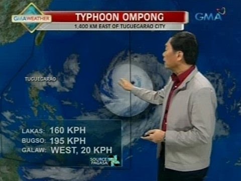
Storm trough, ‘habagat’ to bring rains across parts of the Philippines
PAGASA - Bagong Julian, posibleng maging super typhoon ngayong... | GMA Integrated News Bulletin
Press Briefing: Tropical Depression #GenerPH 11:30 AM Update September 17, 2024 - Tuesday
Public Weather Forecast issued at 4PM | September 13, 2024 - Friday
5.0 / 5 (0 votes)