What Are Glaciers? Crash Course Geography #26

CrashCourse
13 Sept 202111:11

Summary

TLDRThe video explores how glaciers have shaped Earth's landscapes and influenced climate. Glaciers, formed from compressed snow, move slowly and drastically reshape the land by eroding valleys and depositing rocks. They’ve created features like the Finger Lakes, Great Lakes, and the Alps' Matterhorn. Glaciers also act as time capsules, storing climate data from millions of years. As glaciers melt due to climate change, sea levels rise, threatening coastal populations. The video concludes by reflecting on humanity's relationship with glaciers and the potential future impacts of their continued melting.

Takeaways

  • 🌍 Glaciers have significantly shaped many of Earth's landscapes, including Ithaca, New York, which features a variety of terrains such as farms, forests, mountains, lakes, and waterfalls.
  • ❄️ Glaciers act as indicators of climate change, reflecting the Earth's climatic history and providing insights into its future.
  • 🏔️ There are two main types of glaciers: alpine or mountain glaciers, and continental glaciers or ice sheets, which cover about 10% of the Earth's land surface.
  • 🌞 Glaciers influence the global climate by reflecting a significant amount of solar radiation, helping to keep the Earth cool.
  • 💧 Glaciers contain the majority of the Earth's freshwater, and if they were to melt, sea levels would rise approximately 70 meters, drastically altering coastlines and affecting over 2.4 billion people.
  • 🏞️ The British Isles and North German Plains have geological features suggesting they were once covered by glaciers, indicating past global climate changes.
  • ⏳ We are currently in an ice age, specifically an interglacial period, which means we are between glacial periods.
  • 🗻 Glaciers form above the snowline where snow accumulation exceeds melting, and their movement is influenced by their own weight and gravity.
  • 🏗️ Glaciers can dramatically reshape landscapes through both erosion, creating features like the Finger Lakes, and deposition, leaving moraines and erratic boulders.
  • 🌿 The retreat of glaciers at the end of the Last Glacial Maximum left behind terminal moraines and influenced the development of cities like New York City.
  • 🌊 The potential collapse of glaciers like the Thwaites Glacier could have severe global consequences, including a significant rise in sea levels.

Q & A

  • What is the significance of glaciers in shaping Earth's landscapes?

    -Glaciers have been crucial in shaping Earth's landscapes by creating fertile soils and physical features such as valleys, moraines, and erratics. They also serve as frozen time capsules, recording Earth's climatic history and providing clues to its future.

  • What are the two main types of glaciers?

    -The two main types of glaciers are alpine or mountain glaciers, which are found in mountain ranges, and continental glaciers or ice sheets, which are unconfined masses of ice larger than 50,000 square kilometers.

  • How much of Earth's land surface is covered by ice?

    -In 2021, about 10 percent of Earth's land surface is covered by ice, primarily in the Greenland and Antarctic ice sheets.

  • How do glaciers influence global climate?

    -Glaciers influence the global climate by reflecting a significant amount of solar radiation due to their white color, which helps keep the Earth cool. They also play a role in heat transport systems between polar and equatorial regions.

  • What would be the impact if all the world's glaciers were to melt?

    -If all the world's glaciers were to melt, sea levels would rise about 70 meters, changing ocean circulation patterns and altering weather and climate in mid-latitudes. This would also lead to political, economic, and social upheaval, reshaping coastlines and affecting over 2.4 billion people living near coasts.

  • How do glaciers form?

    -Glaciers form above the snowline where the amount of snow that falls each year exceeds the amount lost through evaporation and melting. As layers of snow get buried and compacted, they turn into ice, and the weight of the glacier reshapes the ice crystals, making them harder and denser.

  • What is the difference between glaciations and interglaciations?

    -Glaciations are periods when temperatures drop, and ice sheets grow and spread, while interglaciations are milder periods. An ice age consists of alternating glaciations and interglaciations, lasting for millions of years.

  • What is a terminal moraine and how does it form?

    -A terminal moraine is a ridge of debris, such as gravel, sand, silt, and clay, left behind by a glacier as it melts and retreats. It forms at the most forward edge of a glacier and can stretch continuously across regions.

  • How did glaciers shape New York City?

    -Glaciers shaped New York City by creating waterways used for trade and commerce and ridges that became easy paths between villages. The city's layout, including Broadway, follows these natural features. The terminal moraine in areas like Brooklyn, Queens, and Staten Island influenced land use, leading to the development of parks and other green spaces.

  • What are some erosional features created by glaciers?

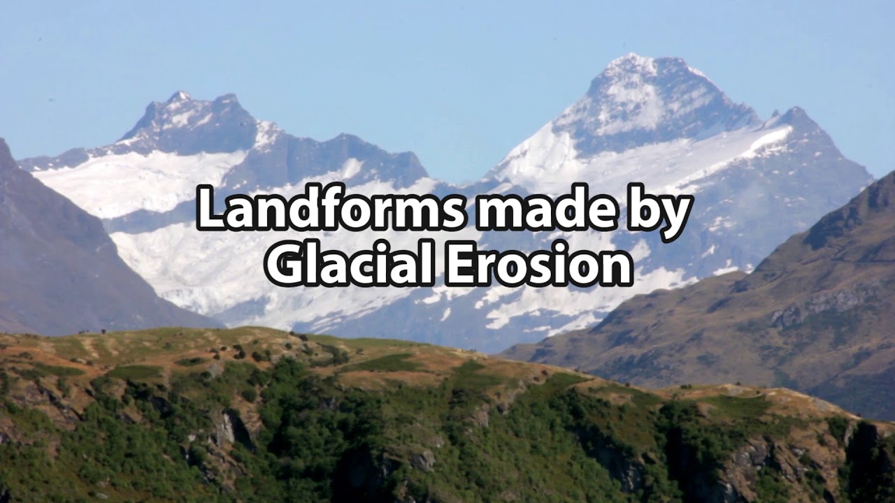
    -Glaciers create erosional features such as U-shaped valleys, cirques, aretes, and horns. They also deepen and broaden valleys, creating distinct landscape features like the Finger Lakes and the Great Lakes.

  • How do glaciers contribute to the formation of mountain peaks like the Matterhorn?

    -Glaciers contribute to the formation of mountain peaks like the Matterhorn through a process of glacial plucking and abrasion, which carves away at the mountain mass from different sides, creating a symmetrical spire with precipitous rock walls.

Outlines

00:00

🏔️ Glaciers: Shaping Earth's Landscapes

The paragraph discusses the influence of glaciers on Earth's landscapes, particularly in the speaker's hometown of Ithaca, New York. It explains that glaciers, both alpine and continental, have had a significant impact on shaping various landscapes worldwide. Glaciers act as indicators of climate change and contain historical data about Earth's climate. They also play a crucial role in the global climate by reflecting solar radiation and contributing to sea levels, which, if all glaciers were to melt, would raise sea levels by approximately 70 meters. The paragraph also touches on the historical evidence of past ice ages and how glaciers have shaped the physical features we see today.

05:01

🌍 Last Glacial Maximum and Its Impact

This section delves into the Last Glacial Maximum, a period around 20,000 years ago when vast ice sheets covered North America, Europe, and parts of South America. The retreat of these glaciers left behind terminal moraines and influenced the development of cities like New York. The paragraph explores how glaciers have physically altered the land, creating features such as moraines and erratics, and how these features continue to affect land use. It also discusses the erosive power of glaciers in creating features like the Finger Lakes and the Great Lakes, as well as the majestic landscapes of mountain ranges around the world, including the Matterhorn.

10:02

🌱 The Human Connection to Glacial History

The final paragraph connects the historical retreat of glaciers to the development of human societies, particularly the shift from nomadic to settled lifestyles that allowed agriculture to flourish. It suggests that the current melting of glaciers could预示着 another significant shift in human life. The paragraph concludes with a call to acknowledge the traditional and ongoing relationship of Indigenous peoples with the land and encourages learning about local histories and engaging with Indigenous communities.

Mindmap

Keywords

💡Glaciers

Glaciers are large masses of ice formed from compressed snow that move under their own weight due to gravity. In the video, they are described as key agents in shaping Earth’s landscapes and influencing global climate. For example, glaciers sculpted the Finger Lakes and created fertile soils. The video emphasizes their importance in the past and present, as glaciers also serve as indicators of climate change.

💡Ice Age

An Ice Age refers to periods in Earth's history when large portions of the planet's surface are covered by ice sheets and glaciers. The video mentions that we are currently living in an interglacial period of an ongoing Ice Age that started about 2.5 to 3 million years ago. Ice Ages alternate between glaciations, where ice expands, and interglaciations, where ice retreats.

💡Continental Glacier

A continental glacier, also known as an ice sheet, is a vast, continuous mass of ice that covers areas larger than 50,000 square kilometers. The Greenland and Antarctic ice sheets are examples mentioned in the video, and they currently cover 10% of the Earth's surface. These glaciers have a significant impact on global sea levels, which would rise dramatically if they melted.

💡Alpine Glacier

Alpine or mountain glaciers form in mountainous regions and move down slopes due to gravity. They carve out dramatic landscapes, including cirques and U-shaped valleys. The video describes how alpine glaciers sculpt famous landforms like the Matterhorn in the Alps, showcasing their ability to transform mountainous environments.

💡Moraine

Moraines are accumulations of dirt and rocks that have been transported and deposited by glaciers. The video references terminal moraines, which are ridges of debris left behind by retreating glaciers. In New York City, these moraines influenced the city’s landscape, with areas like Brooklyn and Staten Island having high ground due to these formations.

💡Erratic Boulders

Erratic boulders are large rocks transported by glaciers and deposited far from their original locations. The video highlights how Central Park in New York City is scattered with these erratics, which were left behind by the ice sheets that once covered the area. These boulders differ from the surrounding geology, providing clues to the glacier’s movement.

💡Sea Level Rise

Sea level rise refers to the increase in the global sea level due to the melting of glaciers and ice sheets. The video explains that if all the glaciers on Earth were to melt, sea levels could rise by about 70 meters, leading to significant changes in ocean circulation, climate, and potentially causing political, social, and economic upheaval.

💡Thwaites Glacier

The Thwaites Glacier, also known as the 'doomsday glacier,' is part of the West Antarctic Ice Sheet. The video discusses how this glacier is particularly vulnerable to climate change, and if it collapses, it could raise global sea levels by over half a meter. Its stability is critical in preventing further flooding of coastal regions around the world.

💡Cirque

A cirque is a bowl-shaped hollow eroded into a mountain by a glacier. The video describes how mountain glaciers pluck and erode rock to form these distinct landforms, which are often the starting points for glaciers. Cirques contribute to the creation of other features like arêtes and horns in mountain landscapes.

💡Interglaciation

Interglaciation refers to the warmer periods between glaciations when ice sheets retreat. The video emphasizes that we are currently in an interglacial period within a larger Ice Age. During interglacial times, glaciers shrink, and climates warm, which is why today's Earth has fewer glaciers than during the Last Glacial Maximum 20,000 years ago.

Highlights

Glaciers have shaped many of Earth's landscapes.

Glaciers act as indicators of climate change and sea level rise.

Glaciers contain records of Earth's climatic history and future.

Glaciers are large masses of ice that move due to gravity.

There are two main types of glaciers: alpine and continental.

In 2021, about 10% of Earth's land surface was covered in ice.

Glaciers influence global climate by reflecting solar radiation.

Most of Earth's freshwater is locked in glaciers.

Melting all glaciers would raise sea levels by about 70 meters.

Glaciers provide evidence of past global climate changes.

Glaciers form above the snowline where snow accumulation exceeds melting.

Glaciers flow slowly, moving like silly putty rather than sliding like a block.

Glaciers can be in dynamic equilibrium, neither growing nor retreating.

The Last Glacial Maximum occurred about 20,000 years ago.

Glaciers have shaped cities like New York City.

Erratics are boulders left by glaciers that are out of place and composition.

Glaciers can erode landscapes, creating features like the Finger Lakes.

Mountain glaciers create distinctive features like cirques and arêtes.

Glacial landscapes are used for agriculture, construction, and urban development.

The melting of glaciers is closely tied to human history and future.

The Thwaites Glacier, if it breaks, could significantly raise global sea levels.

Crash Course Geography acknowledges Indigenous peoples' relationship with the land.

Transcripts

play00:00

I grew up in Ithaca, New York in the US where there’s a huge variety of landscapes.

play00:04

There are farms and forests and mountains and lakes and massive waterfalls all within

play00:08

a pretty small region.

play00:10

But swimming in the Finger Lakes right in my backyard in the summer, or visiting New

play00:14

York City on field trips, I had no idea that the land I was walking on was actually shaped by glaciers.

play00:19

We’ll come back to New York later.

play00:21

But it won’t be our only example because actually many of the Earth’s landscapes

play00:24

were shaped by glaciers in some way or another millions of years ago.

play00:28

And today, they’re like icy, 21st century canaries in the coal mine warning us about

play00:32

the massive changes to our world that are coming as climates change and sea levels rise.

play00:37

These behemoth globs of compressed ice and snow moving across the land created fertile

play00:41

soils and physical features while also serving as frozen time capsules.

play00:45

They recorded both Earth’s climatic history over several million years and contain clues

play00:50

to its climatic future.

play00:51

I’m Alizé Carrère, and this is Crash Course Geography.

play00:54

INTRO

play01:02

Our journey through physical geography is almost over, and by now we definitely know

play01:06

the Earth is ever-changing.

play01:08

And glaciers have often been a crucial part of that change.

play01:10

Basically, a glacier is a large mass of ice that formed from compressed snow that moves

play01:15

thanks to its own weight and the pull of gravity.

play01:17

And there are actually two main types.

play01:19

When we find a glacier in a mountain range, it’s called an alpine or mountain glacier.

play01:23

And on a larger scale, a continuous mass of unconfined ice bigger than 50,000 square kilometers

play01:29

is called a continental glacier or ice sheet.

play01:31

In 2021, about 10 percent of the Earth’s land surface is ice.

play01:36

Most of that’s found in the Greenland and Antarctic ice sheets .

play01:38

And glaciers have a big influence on our global climate.

play01:41

Because glaciers covered in snow are so dazzlingly white, they reflect a lot of the solar radiation

play01:46

they get, keeping the Earth cool.

play01:48

And we saw in our weather episodes how the enormous temperature difference between the

play01:52

polar regions and the warm equatorial regions drives the system of heat transport around the world.

play01:57

And like we learned in our last episode on groundwater, only 2.8 % of the Earth’s water

play02:01

is freshwater.

play02:02

A tiny bit of that is in lakes and rivers, and almost a third is groundwater.

play02:07

But all the rest is locked in glaciers.

play02:09

So if all the world’s glaciers were to melt, sea levels would rise about 70 meters changing

play02:14

ocean circulation patterns, which would alter weather and climate in the mid-latitudes.

play02:18

Not to mention create political, economic, and social upheaval, dramatically reshaping

play02:22

coastlines and the lives of the over 2.4 billion people who live within 100 kilometers of a coast.

play02:28

Looking to the past, it was glaciers themselves that provided the first inkling there had

play02:31

been big changes in global climates throughout Earth’s history.

play02:34

Many naturalists -- and even a poet! -- during the early 19th century were struck by the

play02:39

fact that the British Isles and the North German Plains -- which are areas far from

play02:42

glaciers even today -- had deeply eroded U-shaped valleys, massive “erratic” boulders far

play02:48

from where they formed, and bedrock that was smooth like it’d been polished by abrasion.

play02:52

These features were similar to what was seen in the Alps where there were still glaciers,

play02:56

and they concluded that it was evidence the British Isles and North German Plains also

play03:00

had icy pasts.

play03:01

Today we know the most recent ice age is one of several ice ages that Earth has experienced

play03:05

in its long history.

play03:07

And it doesn't mean the Earth has to be entirely covered in ice.

play03:10

An ice age alternates between glaciations, or a period when temperatures drop and ice

play03:14

sheets grow and spread outwards over vast areas, and interglaciations when the climate is milder.

play03:20

And this back and forth between glaciations and interglaciations means an ice age can

play03:24

last for millions of years.

play03:26

Right now we’re actually still in an ice age.

play03:28

We’re just in the middle of an interglaciation.

play03:31

Evidence from deep sea sediments actually shows that our ice age started when glaciers

play03:34

started growing about 2.5 to 3.0 million years ago.

play03:37

Both ice sheets and mountain glaciers were forming at this time, but they have some specific requirements.

play03:43

They form above the snowline, or the lowest elevation where there’s ice and snow all year round.

play03:48

So where the amount of snow that falls each year is more than the annual ablation, or

play03:51

how much is lost by evaporation and melting.

play03:54

Then as layers of snow get buried and compacted into ice, the weight of the glacier reshapes

play03:58

and realigns the crystals, making them harder and denser.

play04:02

When the ice is about 30 meters deep, the millions of ice crystals in the bottom layers

play04:06

change form and become plasticky and can glide over each other.

play04:10

Which means that from this depth to its base, the glacier behaves more like silly putty

play04:14

and sort of stretches out, carrying the brittle ice on the surface.

play04:17

So, a glacier is not just a hard block of ice that slides down a slope.

play04:21

Glaciers usually flow slowly.

play04:24

Large ice sheets move a few centimeters per day and flow out in all directions, while

play04:28

active mountain glaciers can cover several meters each day as they’re pulled downhill

play04:31

by gravity.

play04:32

It’s really weird to think about, I know.

play04:34

But glaciers don’t flow like rivers.

play04:36

They move much slower but with tremendous energy, meaning they do a ton of work as they

play04:40

engulf and dramatically re-shape the landscape dragging everything in their wake.

play04:44

When a glacier stays more or less the same size, we say it’s in dynamic equilibrium

play04:48

because the amount of new snow is about equal to how much is melting.

play04:52

But when climates warm or there’s less snow, glaciers retreat and grow smaller.

play04:56

Ultimately, when there are very few or no glaciers on the planet we consider the ice age over.

play05:00

We’re not quite to that point yet, so we’re still technically in an ice age!

play05:04

Remember I said we’re in an interglacial period of this ice age, meaning there are

play05:08

a lot fewer and smaller ice sheets and glaciers on Earth compared to their greatest extent

play05:12

about 20,000 years ago, known as the Last Glacial Maximum.

play05:16

At that time, much of North America, Europe and southern South America were blanketed

play05:20

in extensive ice sheets and glaciers.

play05:23

Which got to be more than 3 kilometers thick in parts of Canada and the US.

play05:26

And when this sheet of frozen water began to melt and retreat quite rapidly some 15,000

play05:31

years ago, it left behind a ridge that was basically a jumbled heap of gravel, sand,

play05:36

silt, and clay called a terminal moraine.

play05:38

And it still stretches more or less continuously across North America from the Puget Sound

play05:43

in Washington state to its southern limits in Midwestern states like Missouri and Nebraska,

play05:48

all the way to Montauk Point on New York’s Long Island.

play05:50

The ice sheet even shaped New York City as we know it today.

play05:53

Original settlers of the area, the indigenous peoples of Algonquian-speaking languages,

play05:58

utilized features carved by glaciers much in the same way we do now: using the waterways

play06:02

for trade and commerce, and ridges as easy paths to walk between villages.

play06:06

In fact, if you've ever walked down Broadway, then you've walked one of these trade paths.

play06:11

In neighborhoods like Brooklyn, Queens, and Staten Island, terminal moraine forms the

play06:15

high ground.

play06:16

Initially, as the city grew these sites were ignored for homes and other buildings because

play06:20

they were stony and inaccessible and construction was difficult.

play06:23

Instead this land became parks, cemeteries, and golf courses.

play06:27

Even today these remain the more densely wooded and landscaped sections of these neighborhoods

play06:31

and are now some of the most attractive locations in these boroughs.

play06:34

But back to the ice.

play06:35

Like a giant bulldozer as the glacier moves forward it drags along everything in its path,

play06:40

picking up tiny pebbles or enormous boulders often the size of a school bus.

play06:44

When it melts, they’re left strewn across the landscape as though flung...by a giant

play06:48

playing marbles.

play06:50

And Central Park is full of these stray boulders called erratics because, well, they’re erratic.

play06:55

They’re far from where they would’ve originated and have different compositions from the surrounding,

play06:59

often younger, rocks.

play07:01

Boulders like these were what some of the naturalists were noticing over in Europe.

play07:04

Moraines and erratics are what we call depositional features, which are features formed from the

play07:08

debris carried by ice as glaciers melt, and they still influence how the land is used today.

play07:13

Like we saw here, in NYC!

play07:15

So glaciers can be like huge excavators hauling debris from one place to another, adding features

play07:20

to the landscape as they melted and retreated.

play07:22

But they also change the land through erosion as they advance.

play07:25

Like the Finger Lakes in central New York.

play07:27

Their distinct, elongated basins were eroded and deepened by ice sheets.

play07:31

And the Great Lakes are actually former river valleys that were greatly enlarged and gouged

play07:35

out by glacial erosion.

play07:37

The bedrock beneath each lake is covered in thick blankets of glacial deposits, which

play07:41

are the bits of rock fragments the ice picked up as it moved.

play07:44

And as the ice sheet retreated north, meltwater filled in the depressions, forming the Great Lakes.

play07:49

Mountain glaciers have also sculpted majestic landscapes in regions like the Himalayas,

play07:53

Sierra Nevadas, Rockies, Andes, and Alps.

play07:56

Like the Matterhorn on the Swiss-Italian border is the iconic image of the Alps.

play08:01

Its symmetrical spire with precipitous rock walls is a siren call for climbers everywhere

play08:05

-- and is the work of glaciers.

play08:07

To start out, we have a mountain glacier, slowly advancing down the mountain slope.

play08:11

As it moves, blocks of rock that have been loosened by weathering get removed or “plucked”

play08:15

out as part of glacial plucking.

play08:17

Partnered with abrasive rock debris sandpapering the landscape, this forms an armchair-shaped

play08:22

hollow in the side of the mountain called a cirque.

play08:24

When the ice in two adjacent cirques eats away at the ridge between them, it forms a

play08:28

sharp, often serrated ridge called an arête.

play08:31

And when three or more cirques carve away a mountain mass from different sides we eventually

play08:35

get a horn or pyramidal peak like on the Matterhorn.

play08:38

But the work of the mountain glacier isn’t done.

play08:40

As the ice grinds over uneven bedrock and the glacier is stretched as it flows over

play08:44

a convex slope, deep vertical cracks called crevasses open up on the brittle ice on the

play08:49

surface as a response to the stress.

play08:51

Debris that gets left behind can form ridges along the side of the glacier, which we call

play08:55

a lateral moraine.

play08:57

And where two glaciers join, their lateral moraines merge to form a medial moraine.

play09:02

Often moraines dam the foot of a cirque encasing small shimmering mountain lakes called tarns

play09:07

which are among the most popular destinations for backcountry hikers and campers.

play09:11

Further down, a glacier moving through a valley will usually erode the walls, and deepen and

play09:14

broaden the valley from a V-shape into a U-shaped profile.

play09:18

These glacial landscapes that have been left behind after the last warming are home to

play09:22

millions of people in Eurasia and North America.

play09:24

They’ve been ploughed to produce crops, dug into for sand and gravel, and paved over

play09:29

by concrete and tarmac.

play09:30

Lately when we hear about glaciers shaping the Earth, it’s because they’re breaking.

play09:34

Like in 2021 data from uncrewed submarines showed that warm water may be weakening critical

play09:39

stability points of the Thwaites Glacier -- which is also part of the West Antarctic Ice Sheet

play09:43

and known as the “doomsday glacier.”

play09:45

When it breaks it could raise global sea levels by over half a meter and potentially collapse

play09:49

the entire West Antarctic Ice Sheet which would flood lowlands and islands across the world.

play09:54

So the story of ice seems to be closely tied to our human story.

play09:58

Ice has advanced and retreated over time, but when the climate stabilized after the

play10:01

ice started melting 12 to 15000 years ago, agriculture flourished.

play10:06

And many nomadic groups shifted to more settled lifestyles, setting the scene for many of

play10:10

our societies today.

play10:12

And as the ice melts further, our lives could shift again.

play10:15

So as we contemplate that future, join us next time for a look at the geography of natural hazards.

play10:20

Many maps and borders represent modern geopolitical divisions that have often been decided without

play10:25

the consultation, permission, or recognition of the land's original inhabitants.

play10:29

Many geographical place names also don't reflect the Indigenous or Aboriginal peoples languages.

play10:34

So we at Crash Course want to acknowledge these peoples’ traditional and ongoing relationship

play10:37

with that land and all the physical and human geographical elements of it.

play10:41

We encourage you to learn about the history of the place you call home through resources

play10:44

like native-land.ca and by engaging with your local Indigenous and Aboriginal nations through

play10:49

the websites and resources they provide.

play10:50

Thanks for watching this episode of Crash Course Geography which is filmed at the Team

play10:54

Sandoval Pierce Studio and was made with the help of all these nice people.

play10:59

If you want to help keep all Crash Course free for everyone, forever, you can join our

play11:02

community on Patreon.

Rate This

5.0 / 5 (0 votes)

Etiquetas Relacionadas
GlaciersClimate ChangeGeographyLandscapeIce AgeErosionMeltwaterNatural HistoryEnvironmental ImpactCrash Course
¿Necesitas un resumen en inglés?