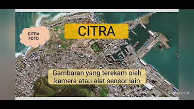
Pengertian dan Komponen Penginderaan jauh
Summary
TLDRThe video explains the concept of remote sensing, likening it to taking a selfie, where specialized sensors capture data from the Earth's surface without direct contact. It outlines key components of remote sensing, including energy sources (active and passive), the atmosphere, objects being observed, platforms (like satellites), sensors, data analysis, and users of the data. The lecture emphasizes the importance of understanding how these elements work together to gather valuable geographical and environmental information, showcasing remote sensing as a vital tool for various applications in monitoring and planning.
Takeaways
- 😀 Remote sensing (penginderaan jauh) allows us to gather information about the Earth's surface without direct contact.
- 📸 The concept of remote sensing can be likened to taking a selfie, where specific tools are used to capture information about the environment.
- 🌞 Remote sensing relies on energy sources that can be either active (man-made) or passive (natural), like sunlight.
- 🌌 The atmosphere plays a crucial role in filtering and influencing the electromagnetic waves that are essential for remote sensing.
- 🏞️ Objects on the Earth's surface, such as buildings, water bodies, and vegetation, are the targets of remote sensing data collection.
- 🚀 Platforms or 'wahana' are devices that carry sensors, including satellites and drones, which are essential for data acquisition.
- 📡 Sensors are critical components that capture visual images and numerical data from the environment.
- 📊 Data collected through remote sensing can be analyzed to provide insights into various geographical and environmental phenomena.
- 🌍 Remote sensing enables users to monitor and understand land use, environmental changes, and urban planning without physical exploration.
- 👥 Various stakeholders, including researchers and government agencies, utilize remote sensing data for applications like disaster management and environmental monitoring.
Q & A
What is remote sensing (penginderaan jauh)?
-Remote sensing is the science and art of obtaining information about objects or areas from a distance, typically through the use of sensors that do not require direct contact with the objects being studied.
How is remote sensing similar to taking a selfie?
-Taking a selfie involves using a device (like a smartphone) to capture an image of oneself, whereas remote sensing uses sensors to capture images or data about the Earth's surface without physically being there.
What are the main components of a remote sensing system?
-The main components include the energy source, the atmosphere, the object being observed, the platform (or vehicle) carrying the sensor, the sensor itself, data analysis, and the end users of the data.
What are the two types of energy sources used in remote sensing?
-The two types of energy sources are active and passive. Active sources are human-made (like radar systems), while passive sources rely on natural energy, such as sunlight.
What role does the atmosphere play in remote sensing?
-The atmosphere acts as a filter for electromagnetic waves. It absorbs some wavelengths and allows others to pass through, which can affect the quality of the data captured by sensors.
What is the significance of the 'window of the atmosphere'?
-The 'window of the atmosphere' refers to specific ranges of wavelengths of electromagnetic radiation that can pass through the atmosphere without being absorbed, allowing sensors to capture clearer data.
How do different materials affect remote sensing data?
-Different materials reflect or absorb electromagnetic waves differently. For example, water typically absorbs more light, making it appear darker in satellite images, while buildings may reflect more light, appearing brighter.
What is the difference between visual and digital data in remote sensing?
-Visual data refers to images that can be interpreted visually (like photographs), while digital data consists of numerical values that represent various properties of the observed objects or areas.
Who are the users of remote sensing data?
-Users of remote sensing data can include governmental agencies, researchers, environmental organizations, and anyone who needs spatial information for analysis or decision-making.
How can remote sensing contribute to understanding geographical features?
-Remote sensing allows for the analysis of large areas quickly, providing insights into geographical features such as forests, urban areas, water bodies, and more, without the need for on-the-ground surveys.
Outlines

Dieser Bereich ist nur für Premium-Benutzer verfügbar. Bitte führen Sie ein Upgrade durch, um auf diesen Abschnitt zuzugreifen.
Upgrade durchführenMindmap

Dieser Bereich ist nur für Premium-Benutzer verfügbar. Bitte führen Sie ein Upgrade durch, um auf diesen Abschnitt zuzugreifen.
Upgrade durchführenKeywords

Dieser Bereich ist nur für Premium-Benutzer verfügbar. Bitte führen Sie ein Upgrade durch, um auf diesen Abschnitt zuzugreifen.
Upgrade durchführenHighlights

Dieser Bereich ist nur für Premium-Benutzer verfügbar. Bitte führen Sie ein Upgrade durch, um auf diesen Abschnitt zuzugreifen.
Upgrade durchführenTranscripts

Dieser Bereich ist nur für Premium-Benutzer verfügbar. Bitte führen Sie ein Upgrade durch, um auf diesen Abschnitt zuzugreifen.
Upgrade durchführen5.0 / 5 (0 votes)


