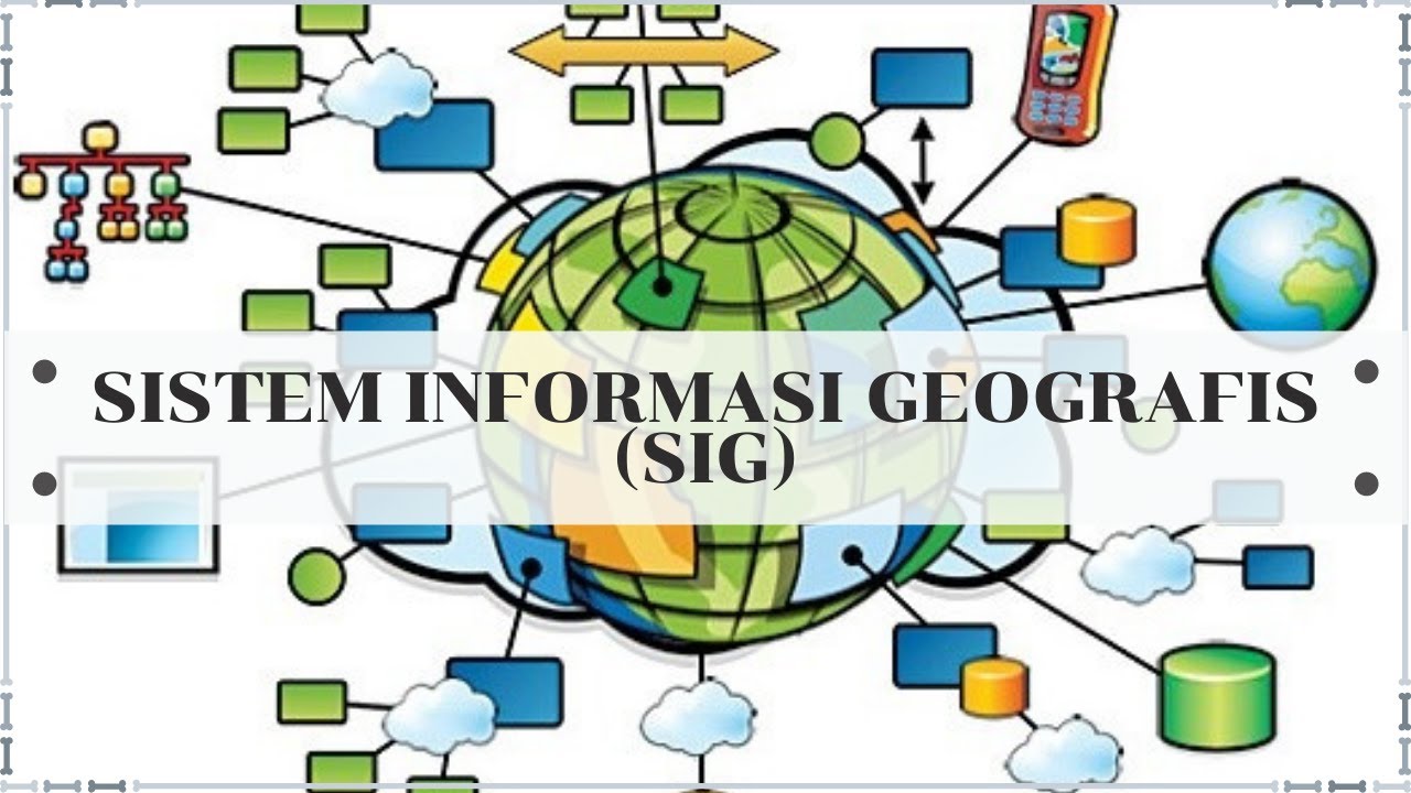
What Is GIS? A Guide to Geographic Information Systems
Summary
TLDRThis video offers a comprehensive introduction to Geographic Information Systems (GIS), a computer-based tool for analyzing spatial relationships and patterns in geography. It covers the four main functions of GIS: data management, visualization, geoprocessing for analysis, and data editing. The script also explores various GIS job roles and applications across industries, highlighting the growing importance of GIS in urban planning, environmental management, emergency response, and more. Current and future trends like mobile GIS, open data, cloud services, AI, and 3D visualization are discussed, showcasing the dynamic evolution of GIS technology.
Takeaways
- 🗺️ GIS stands for Geographic Information Systems and is a computer-based tool that examines spatial relationships, patterns, and trends in geography.
- 💾 GIS has four main functions: data management, visualization, geospatial analysis, and editing of geographic data.
- 📍 Data management in GIS involves organizing, storing, retrieving, and maintaining geographic and attribute data, with vectors and raster grids as the two primary data types.
- 🗺️ Visualization in GIS allows geographic data to be mapped, providing geographic context that tables of data alone can't achieve, using various types of maps like choropleth, heat, and isoline maps.
- 🔍 Geospatial analysis in GIS involves analyzing geographic relationships and patterns through geoprocessing, such as identifying routes, creating buffers, and overlaying data layers.
- ✏️ GIS editing involves creating new datasets or updating existing geographic data to ensure accuracy, relevance, and up-to-date information.
- 💼 GIS offers various career paths, including GIS technician, analyst, specialist, cartographer, and developer, each with distinct roles in the field.
- 🌍 GIS is used in many industries like urban planning, environmental management, emergency management, marketing, agriculture, and energy management, helping improve efficiency and decision-making.
- 📱 Mobile GIS, open data, and cloud-based GIS services are current trends in the GIS industry, providing flexibility, accessibility, and scalability.
- 🤖 The future of GIS includes the integration of big data, AI, machine learning, and 3D data visualization, enhancing the analysis and visualization of geospatial data.
Q & A
What does GIS stand for and what is its primary function?
-GIS stands for Geographic Information Systems. Its primary function is to examine spatial relationships, patterns, and trends in geography using computer-based tools to store, analyze, and visualize data for geographic positions on Earth's surface.
What are the four main functions of a GIS?
-The four main functions of a GIS are data management for storing geographic locations, visualization of geographic data typically using maps, analysis of spatial relationships and patterns using geoprocessing, and creating or editing data.
What are vector data and raster data in the context of GIS?
-Vector data in GIS are points, lines, and polygons with vertices, used to represent features like administrative boundaries or fire hydrants. Raster data, also known as grid data, is represented as rows and columns and includes types like satellite images, aerial photographs, and digital elevation models.
How does GIS visualization help in understanding geographic data?
-GIS visualization helps by mapping geographic data onto maps, providing geographic context that makes it easier to understand the locations of data points in the real world, as opposed to interpreting them from tables.
What are some common types of maps used in GIS for data visualization?
-Some common types of maps used in GIS include choropleth maps for representing data values with shading or color, heat maps for showing data intensity or density, and isoline maps that use contour lines to connect points with the same value.
What is geoprocessing and how is it used in GIS?
-Geoprocessing is a technique used in GIS to perform tasks that focus on extracting meaningful information from geographic data. It can be used for identifying the shortest route between points, creating buffers around features, overlaying data layers, and conducting statistical analysis.
What role does GIS editing play in the development of GIS applications?
-GIS editing is crucial for building new data sets or updating existing geographic data, ensuring that the data used is accurate, up-to-date, and relevant to the specific problem or application.
What are some common job roles in the field of GIS?
-Common job roles in GIS include GIS technician, involved in data editing and map production; GIS analyst or specialist, focused on geospatial analysis and data modeling; cartographer, specializing in creating visually appealing maps; and GIS developers, who work on code development for automating workflows or building customized scripts.
In which industries is GIS widely used and why?
-GIS is widely used in urban planning for modeling and analyzing land use and infrastructure, environmental management for monitoring natural resources, emergency management for disaster response, marketing for analyzing demographic data, agriculture for optimizing crop yields and managing land use, and energy management for optimizing energy distribution networks.
What are some current and future trends in the GIS industry?
-Current and future trends in GIS include the mainstream use of mobile GIS for field data collection and asset management, open data and open source GIS software for accessible geospatial data and tools, cloud-based GIS services for scalable and cost-effective data storage and processing, and the integration of AI and machine learning tools for analyzing big data. Additionally, 3D data and visualization tools are becoming more prevalent for realistic and immersive data analysis.
How does the increasing availability of AI and machine learning tools impact GIS?
-The increasing availability of AI and machine learning tools is transforming the way geospatial data is analyzed and visualized. These technologies help unlock insights from vast amounts of data, enhancing the efficiency and effectiveness of GIS applications.
Outlines
🗺️ Introduction to Geographic Information Systems (GIS)
This paragraph introduces the concept of Geographic Information Systems (GIS) as a computer-based tool for examining spatial relationships and trends in geography. It explains that GIS allows for the storage, analysis, and visualization of data for geographic positions on Earth's surface. The paragraph outlines the four main functions of a GIS: data management, visualization, geoprocessing for spatial analysis, and data editing. It also describes the types of data used in GIS, such as vector data (points, lines, and polygons) and raster data (satellite images, aerial photographs, and digital elevation models), and their respective applications. The importance of GIS in solving location problems and understanding the world better through spatial analysis is emphasized.
🌐 Applications and Trends in the GIS Industry
The second paragraph delves into the widespread applications of GIS across various industries, highlighting its use in urban planning, environmental management, emergency management, marketing, agriculture, and energy management. It showcases how GIS aids in making informed decisions by modeling and analyzing data relevant to each sector. The paragraph also discusses current and future trends in GIS, including the mainstream adoption of mobile GIS for field data collection and asset management, the rise of open data and open source GIS software like QGIS, cloud-based GIS services for scalable and cost-effective data storage and processing, and the integration of AI and machine learning tools to analyze and visualize big data. Additionally, it touches on the growing use of 3D data and visualization tools for a more realistic and immersive perspective on geospatial data analysis.
Mindmap
Keywords
💡GIS
💡Spatial Relationships
💡Data Management
💡Vector Data
💡Raster Data
💡Visualization
💡Geospatial Analysis
💡GIS Editing
💡Geoprocessing
💡Choropleth Maps
💡Heat Maps
💡Careers in GIS
Highlights
GIS stands for Geographic Information Systems, a computer-based tool for examining spatial relationships, patterns, and trends in geography.
GIS allows for the storage, analysis, and visualization of data for geographic positions on Earth's surface.
There are four main functions of GIS: data management, visualization, geoprocessing for spatial analysis, and data editing.
Data management in GIS involves organizing, storing, retrieving, and maintaining geographic and attribute data.
GIS data consists of vector data, such as points, lines, and polygons, and raster data, like satellite images and digital elevation models.
Visualization in GIS uses maps to provide geographic context and make data locations understandable in the real world.
Common types of maps in GIS include choropleth, heat maps, and isoline maps for various data representation methods.
Geospatial analysis with GIS focuses on extracting meaningful information from geographic data through tasks like finding the shortest route or creating buffers.
GIS editing is crucial for building new datasets or updating existing geographic data to ensure accuracy and relevance.
GIS jobs range from technicians handling data editing and map production to analysts, specialists, cartographers, and developers.
GIS is used in various industries such as urban planning, environmental management, emergency management, marketing, and agriculture.
Mobile GIS has become mainstream, allowing access and interaction with geospatial data through smartphones and tablets.
Open data and open source GIS software like QGIS provide access to geospatial data and tools at little or no cost.
Cloud-based GIS services offer scalable and cost-effective storage, processing, and access to geospatial data.
Big data, AI, and machine learning are transforming geospatial data analysis and visualization in the GIS industry.
3D data and visualization tools enable more realistic and immersive perspectives for data analysis.
GIS has steadily increased in demand and is becoming mainstream across various industries worldwide.
The video invites viewers to ask questions in the comments section and subscribe to the channel for more informative content.
Transcripts
in this video I'll provide you with a
thorough definition of GIS
from mapping to analysis you'll learn
how we use GIS to model the world around
us let's get started
GIS stands for geographic information
systems
it's a computer-based tool that examines
spatial relationships patterns and
Trends in geography
using a GIS allows you to store analyze
and visualize data for Geographic
positions on Earth's surface
there are four main functions of a GIS
first a GIS has a data management
component for storing Geographic
locations secondly a GIS visualizes
Geographic data typically using Maps
thirdly GIS software can analyze spatial
relationships and patterns using
geoprocessing and finally a GIS can
either create new data or edit existing
data let's take a look at each of these
four functions
at number one we're going to look at the
role of data management in GIS
data management in GIS is the process of
organizing storing retrieving and
maintaining Geographic and attribute
data GIS data consists of either Vector
data or raster grids first vectors are
points lines and polygons with vertices
for instance administrative boundaries
are often represented as polygons
whereas something simple like fire
hydrants is stored as points roads are a
good example of line data the other type
of data type is raster for example
satellite images aerial photographs and
digital elevation models are examples of
raster data we also call it grid data
because it's represented as rows and
columns we use these two data models
every day in GIS each type has its own
strengths and weaknesses and is better
suited to different kinds of spatial
data and Analysis
at number two we have visualization
let's say you have latitude and
longitude coordinates in a table I think
you can agree that it's really difficult
to know where those locations are but
once you show the data on a map it
provides Geographic context so you can
fully understand where these locations
are in the real world
GIS works with these physical locations
instead of tables
and we map it all out
here are some of the most common types
of maps
choropleth Maps use shading or color to
represent data values for different
regions or polygons such as visualizing
demographic or socioeconomic data heat
Maps use shading to represent the
intensity or density of data values in
an area
heat maps are often used for visualizing
spatial patterns and data such as crime
or traffic density an isoline map is a
type of map that uses contour lines to
represent data they connect points on a
map that have the same value such as
temperature elevation or rainfall
at number three we're going to look at
geospatial analysis
the purpose of GIS is to analyze
Geographic relationships and patterns
using geoprocessing geoprocessing can be
used to perform a variety of tasks with
a focus on extracting meaningful
information from Geographic data for
example a GIS can identify the shortest
route between two points or it could
create buffers around features
it can also overlay different data
layers to identify spatial relationships
and conduct statistical analysis on
Geographic data
they say you don't truly know your data
until you can visualize and analyze it
geographically
through spatial analysis you can solve
location problems to measure quantify
and understand our world better
and finally at number four we're going
to look at the role of GIS editing
GIS data is a key component in the
development of accurate and effective
applications because without geospatial
data the field of GIS wouldn't exist
editing involves building new data sets
from the ground up or updating existing
Geographic data it's important because
it ensures that the data being used is
accurate up-to-date and relevant to the
problem at hand
now that you have a bit of background on
what GIS is all about let's take a
closer look at some of the most common
types of GIS jobs if you're just
starting out in the field of GIS you'll
likely start as a GIS technician this
role involves most of the grunt work
like data editing and map production The
Next Step Above This level is either a
GIS analyst or specialist both types of
roles typically are heavily involved in
geospatial analysis and it may involve
data modeling and coding another common
job in the gis field is a cartographer
cartographers specialize in creating
visually appealing map products and
communicating this information finally
GIS developers strictly work at code
development
this might be for the purpose of
automating workflows of building
customized scripts that perform a
specific task
although it's seen its fair share of
twists and turns GIS has steadily
increased in demand and is becoming more
mainstream in various Industries around
the world
we use GIS in a wide variety of
applications across many different
Industries
here are some of the biggest users of
GIS
urban planners use GIS to model and
analyze Urban Land Use transportation
and infrastructure this helps planners
make informed decisions about
development and growth Environmental
Management leverages GIS to Monitor and
manage natural resources track species
habitats and predict the effects of
climate change
Emergency Management uses GIS to manage
and respond to natural disasters disease
outbreaks and other emergencies
marketers use it to help businesses
Target their marketing efforts by
analyzing demographic data and consumer
Behavior patterns in agriculture GIS can
optimize crop yields manage land use and
monitor soil and water quality in energy
management we use GIS to manage and
optimize energy distribution networks
monitor energy usage and identify
opportunities for energy conservation
there are countless ways where we are
using GIS to improve efficiency and make
a difference in the world
as technology evolves so does the entire
industry of GIS
here are some of its current and future
trends
mobile GIS has really been mainstream
for a long time already
because of the increasing use of
smartphones and tablets mobile GIS
enables users to access and interact
with geospatial data from anywhere using
mobile devices this is leading to new
applications in areas such as field data
collection asset management and
emergency response open data and open
source GIS software are also mainstream
now open source software like qgis
provides access to a wealth of
geospatial data and tools at little or
no cost in addition to open source
software we are seeing more open data
portals which are common in all levels
of government
cloud-based GIS Services allow users to
store process and access geospatial data
in a highly scalable and cost-effective
manner
cloud-based platforms offer flexible
Computing resources and easy access to a
wide range of geospatial data
with the explosion of big data and GIS
and the increasing availability of AI
and machine learning tools are
transforming the way we analyze and
visualize geospatial data
these Technologies are helping to unlock
insights from vast amounts of geospatial
data
finally we have 3D data with the
increasing availability of 3D data and
visualization tools it enables users to
visualize and analyze data in a more
realistic and immersive perspective
all right there you have it that was our
definition of geographic information
systems now we'd love to hear from you
any questions you might have in the
comments section below also please don't
forget to like And subscribe to our
channel for more great videos see you
next time
浏览更多相关视频
Apa perbedaan SaIG dan SIG? | SAIG2B
KU 538 - Lecture 5
Storing & Tracking Your Life Using GIS Technology | Cheryl Hanewicz | TEDxUVU
How Tech is Revolutionizing Environmental Science! Crazy GeoMapping, Data, & More!
The Digital Twin of Dubai | GIS Center Dubai | Dubai Municipality
Belajar Bersama, Bab 2 Dasar-dasar Pemetaan, Penginderaan Jauh dan Sistem Informasi Geografi Kelas X
5.0 / 5 (0 votes)