Região Sudeste do Brasil/Animação
Summary
TLDRThis video discusses the Southeast region of Brazil, composed of four states: Minas Gerais, Espírito Santo, São Paulo, and Rio de Janeiro. It highlights the region's economic significance, being the most industrialized area in Latin America, with major cities, universities, and industries. The video traces the region's development back to the 18th century gold rush and coffee cultivation, which spurred infrastructure growth. It also touches on current trends, including industrial decentralization and migration to medium-sized cities. Natural features and climates of the region are briefly covered, from plateaus to coastal plains and various vegetation zones.
Takeaways
- 🌍 The Southeast region of Brazil is composed of four states: Minas Gerais, Espírito Santo, São Paulo, and Rio de Janeiro.
- 🏙️ It is the richest region in the country, housing Brazil's largest industrial park, major cities, communication networks, universities, and medical centers.
- 💡 This region is responsible for more than 50% of Brazil's economic production and has about 15% of the country's population.
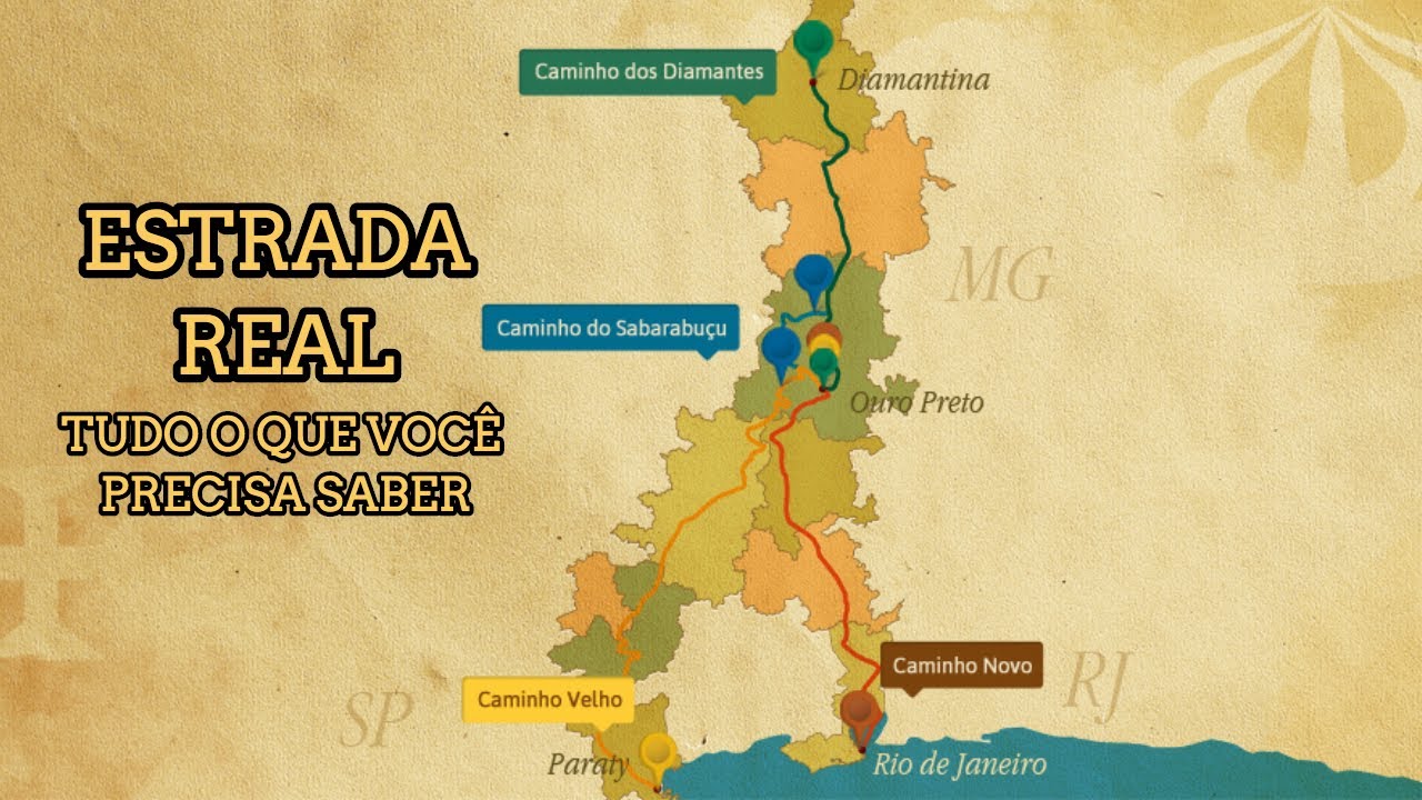
- ⛏️ The economic growth of the Southeast is linked to the gold rush of the 18th century, which shifted the capital from Salvador to Rio de Janeiro.
- ☕ Coffee production became the region's most significant export in the 19th and 20th centuries, with São Paulo and Rio de Janeiro leading the way.
- 🚂 The wealth generated from coffee production led to investments in infrastructure such as railroads, banks, and factories, as well as the encouragement of European immigration.
- 🏭 Industrialization flourished in the Southeast, laying the foundation for urban and economic development, but now the region is experiencing industrial decentralization.
- 🌾 The natural landscape includes plateaus, coastal plains, and the Serra da Mantiqueira mountain range, with varying climates like semi-arid, tropical, and subtropical.
- 🌧️ The region’s climatic diversity influences its vegetation, including the Atlantic Forest, Caatinga, and Cerrado biomes.
- 💧 The majority of rivers in the Southeast are plateau-based, with waterfalls that make them ideal for hydroelectric energy production.
Q & A
What are the four states that make up the Southeast region of Brazil?
-The four states in the Southeast region of Brazil are Minas Gerais, Espírito Santo, São Paulo, and Rio de Janeiro.
Why is the Southeast region considered the richest in Brazil?
-The Southeast region is the richest due to its significant industrial base, major cities like São Paulo and Rio de Janeiro, large media networks, top universities, medical centers, and productive agriculture, particularly in oil and coffee production.
How much of Brazil’s population lives in the Southeast region?
-The Southeast region accounts for around 15% of Brazil's total population.
What historical event boosted the Southeast’s prominence in the 18th century?
-The discovery of gold in Minas Gerais in the 18th century significantly boosted the region's prominence, leading to the transfer of the capital from Salvador to Rio de Janeiro.
What role did coffee play in the economic development of the Southeast region?
-Coffee, often referred to as 'black gold,' became Brazil’s most exported product in the 19th and 20th centuries. The coffee industry led to the development of infrastructure like banks, railroads, and factories, and encouraged European immigration.
Why did many European immigrants come to the Southeast region of Brazil?
-European immigrants, particularly Italians and Germans, came to the Southeast to work in agriculture and industry, especially as the end of slavery approached and the need for labor increased.
What is industrial decentralization, and why is it happening in the Southeast region?
-Industrial decentralization refers to the movement of industries away from large cities in the Southeast due to saturation, heavy traffic, rising violence, and unemployment. Industries are now moving to medium-sized cities with greater growth potential.
What are the main types of landscapes and climates found in the Southeast region?
-The Southeast has landscapes of plateaus, mountains like the Serra da Mantiqueira, coastal plains, and various climates: semi-arid in northern Minas Gerais, tropical, subtropical, and tropical humid along the coast.
How does the climate in the Southeast affect its vegetation?
-Different climates in the Southeast lead to a variety of vegetation, including caatinga in semi-arid areas, cerrado in tropical regions, araucarias (pine trees) in subtropical areas, and remnants of the Atlantic Forest in higher altitudes and coastal areas.
What natural resource is abundant in the Southeast, helping in energy production?
-The Southeast region has many rivers with waterfalls, making them ideal for hydroelectric power production.
Outlines
🏙️ The Southeast Region of Brazil: An Economic Powerhouse
This paragraph introduces the Southeast region of Brazil, which consists of four states: Minas Gerais, Espírito Santo, São Paulo, and Rio de Janeiro. It highlights the region as the richest in the country, hosting the largest industrial park in Latin America, major cities like São Paulo and Rio de Janeiro, leading communication networks, prestigious universities, medical centers, and productive agriculture. The region is home to 15% of Brazil’s population and accounts for more than 50% of its economic output. The historical reasons for the region’s growth are traced back to the Gold Cycle in the 18th century, when Brazil’s capital was moved to Rio de Janeiro, aligning with the Portuguese crown’s interest in being near gold and diamond routes. The paragraph also emphasizes the shift from the Northeast being the wealthiest region to the Southeast’s rise in importance.
☕ Coffee: The 'Black Gold' and Southeast Brazil’s Infrastructure Boom
This paragraph delves into the role of coffee, often referred to as 'black gold,' in boosting the Southeast region's economic development. Coffee began to be widely planted in the 19th and 20th centuries, particularly in São Paulo and Rio de Janeiro. The lucrative coffee trade spurred investments in infrastructure like railroads, banks, electricity, and factories, while also encouraging the immigration of Italians and Germans, who brought industrial expertise. With the abolition of slavery in Brazil, a new wage-earning population emerged, further driving internal production and industrialization. The paragraph highlights how these developments laid the foundations for the Southeast's urban and industrial growth.
🚜 Industrial Decentralization and Urban Saturation
Here, the focus shifts to modern-day challenges faced by the Southeast region. Despite being the most industrialized part of Brazil, large cities like São Paulo and Rio de Janeiro have become overcrowded, dealing with issues such as chaotic traffic, rising violence, and unemployment. As a result, industrial and population growth has shifted toward medium-sized cities with higher growth potential. The paragraph points out that these factors contribute to a trend of industrial decentralization, as the larger cities no longer attract the same influx of people and industries as before.
🏞️ Natural Beauty and Climate Diversity of the Southeast Region
This paragraph explores the natural landscapes and diverse climates of the Southeast region. It describes the region’s geography as predominantly made up of plateaus and hills, such as the Serra da Mantiqueira in São Paulo, and coastal plains found in Rio de Janeiro and Espírito Santo. The paragraph details the variety of climates, from the semi-arid north of Minas Gerais with its Caatinga vegetation, to the tropical and subtropical zones of São Paulo and Minas Gerais, which feature cerrado and araucaria forests. It also highlights the tropical humid climate along the coast, known for heavy rainfall and the remnants of the once-vast Atlantic Forest.
💧 Water Resources: Powering Southeast Brazil
The final paragraph focuses on the region's water resources, particularly its rivers, which are mostly located in plateaus and feature numerous waterfalls. These characteristics make the rivers ideal for hydroelectric power production. The paragraph concludes by summarizing how the region’s natural features and resources contribute to its overall significance. The video ends with a farewell to the viewers.
Mindmap
Keywords
💡Southeast region of Brazil
💡Industrialization
💡Coffee economy
💡Gold cycle
💡Migration
💡Urbanization
💡Economic concentration
💡Decentralization
💡Natural geography of the Southeast
💡Hydroelectric power
Highlights
The Southeast region of Brazil consists of four states: Minas Gerais, Espírito Santo, São Paulo, and Rio de Janeiro.
The Southeast is the richest region in Brazil, housing the largest industrial park in Latin America, major cities like São Paulo and Rio de Janeiro, and significant infrastructure.
This region is responsible for over 50% of the country's economic output, while it hosts around 15% of Brazil's total population.
The Southeast's progress is historically tied to the 18th-century Gold Cycle, which shifted Brazil's capital from Salvador to Rio de Janeiro due to proximity to gold and diamond routes.
The discovery of gold in Minas Gerais, Goiás, and Mato Grosso marked a turning point, shifting economic power from the Northeast to the Southeast.
In the 19th and 20th centuries, coffee (known as 'Black Gold') became Brazil's most exported product, with its production concentrated in São Paulo and Rio de Janeiro.
Coffee production boosted infrastructure, leading to the establishment of banks, railroads, electricity, and factories, creating an industrial base in the Southeast.
The end of slavery in Brazil led to the immigration of Italians and Germans, who brought industrial expertise to the region.
The economic growth from coffee and immigration stimulated internal production and industrialization, further enhancing the Southeast’s development.
Today, despite being the most industrialized region in Brazil, the Southeast is experiencing industrial deconcentration, as large cities face overcrowding, traffic, unemployment, and violence.
This deconcentration has led to a population shift towards medium-sized cities with high growth potential.
The natural geography of the Southeast includes plateaus and coastal plains, with notable areas like the Serra da Mantiqueira in São Paulo.
The climate in the Southeast is diverse, ranging from semi-arid in northern Minas Gerais to tropical and subtropical climates in other parts, influencing the region's varied vegetation.
The tropical humid climate dominates the coast, contributing to lush vegetation and significant rainfall, supported by the proximity to the ocean.
Most rivers in the Southeast are plateau rivers with many waterfalls, making them ideal for hydroelectric power generation.
Transcripts
o
Olá seja bem-vindo ao canal eu sou da
tia Reis e o assunto de hoje é a região
Sudeste do Brasil Então vamos lá Essa
região é formada por Quatro estados que
são Minas Gerais Espírito Santo São
Paulo e o Rio de Janeiro você
provavelmente já ouviu falar que esta é
a região mais rica do país é nela que
está presente o maior parque industrial
não só do Brasil mas de toda América
Latina as maiores cidades A exemplo de
São Paulo e do Rio de Janeiro as maiores
redes de comunicação as maiores
universidades e centros de pesquisa os
maiores centros de atendimento
médico-hospitalar os maiores shoppings
Center is uma agropecuária
altamente produtiva e compõem a maior
produtora de petróleo do país claro que
tudo isto está atrelado ao fato de a
maior parcela da população brasileira se
concentrar nesta região pois conta com
cerca de 15 por cento do total de
habitantes e é responsável por mais de
cinquenta por cento da produção
econômica do país Mas quais razões
explicam todo o progresso dessa região
bem esse Progresso está relacionado com
o ciclo do Ouro pois a região sudeste
ganhou destaque no século 18 quando a
capital que antes era em Salvador e
transferida para o Rio de Janeiro pois a
coroa portuguesa e interesse em
permanecer próxima as rotas de passagem
do ouro e diamante assim a região
Nordeste que era a mais rica do
território brasileiro pede Esse posto
com a descoberta do ouro em Minas Gerais
Goiás e Mato Grosso além do Ouro que foi
a atividade econômica mais importante do
Brasil no século 18 as mudas de café
começaram a ser plantadas e já no século
19 e 20 este produto torna-se o mais
exportado do país e por conta a e do Sol
favorável suas Áreas produtores de maior
destaque estavam concentradas em São
Paulo e no Rio de Janeiro o café
conhecido como Ouro Negro criou uma
série de benefícios para a região
sudeste pois visando a lucratividade os
fazendeiros produtores investiram em
infraestrutura na instalação de bancos e
estradas de ferro eletricidade fábricas
de empacotamento além de incentivar a
imigração de italianos e alemães que já
tinham experiência com a indústria
quando se aproximava o fim da escravidão
no Brasil isso ampliou as necessidades
de consumo da população que agora era
assalariada o que acabou por estimular a
produção interna e mercadorias EA
industrialização com isso você já pode
perceber que foi na região sudeste que
se criaram as bases para o
desenvolvimento industrial e urbano
processo a essenciais para promover o
maior desenvolvimento econômico
Vale destacar que todo esse
desdobramento irá também atrair
camponeses Imigrantes de outras regiões
do país buscando melhores oportunidades
de vida hoje apesar dessa região terá
mais industrializada do país está
ocorrendo o fenômeno da desconcentração
industrial pois como as grandes cidades
desta região estão saturadas ou seja
inchadas ela já não atrai mais tanto
fluxo populacional como antes e
decorrência do trânsito caótico
violência crescente e ampliação do
Desemprego por isso as imigrações
atualmente estão se direcionando para as
cidades médias com potencial de
crescimento elevado quanto aos aspectos
naturais da região sudeste é
caracterizada por possuir um beleza
formado principalmente por planaltos que
formam uma paisagem a vida como mais de
morros é o caso da Serra da Mantiqueira
em São Paulo e por planícies costeiras
no Rio de Janeiro e Espírito Santo os
climas dessa região são o semiárido
presente no norte de Minas Gerais sendo
um clima mais seco é responsável pela
vegetação do tipo Caatinga o Tropical
típico presente principalmente no Oeste
de Minas Gerais e em áreas centrais do
Estado de São Paulo e está atrelado a
vegetação típica de cerrado o clima
subtropical presente no sul de São Paulo
possuindo as menores temperaturas já que
está em no limite com o trópico de
Capricórnio portanto apresenta uma
vegetação típica de Araucárias ou seja
Pinheiros clima tropical de altitude é
bem como nas áreas mais altas da região
onde Originalmente era marcada pela
presença da Mata Atlântica que já foi
amplamente devastada e o clima tropical
úmido no litoral da região que é o mais
chuvoso em e da maritimidade onde além
da vegetação litorânea também há a
presença da Mata Atlântica por fim os
rios são em sua maioria planálticos com
muitas quedas d'água ideais para a
produção de energia elétrica espero ter
ajudado até a próxima e tchau tchau
浏览更多相关视频
Migrações internas - Brasil Escola
Paglaganap ng Tao Sa Timog Silangang Asya (Peopling of Mainland Southeast Asia) Quarter 1 Week 5
ARALING PANLIPUNAN 7 (AP7) Q1 Week 6-2 Peopling of Mainland Southeast Asia with PowerPoint and DLL
Heograpiya ng Timog Silangang Asya Quarter 1 Week 1 Matatag Curriculum
Olhar Regional - Nordeste
Paglaganap ng Tao sa Timog Silangang (Sinaunang Kasaysayan ng Timog Silangang Asya) Quarter 1 Week 4
5.0 / 5 (0 votes)