Yuk, Mengenal Peta
Summary
TLDRThis video explores the various types of maps, their uses, and how to read them. It introduces base maps and thematic maps, emphasizing key elements like map titles, direction indicators, scale, legends, and borders. It also highlights the role of cartographers in creating maps, including the use of modern technologies like remote sensing, drones, and satellites. The video touches on the significance of the Geospatial Information Agency in Indonesia, its work in producing the Indonesian Topographic Map, and the importance of the One Map Policy for national development. It concludes with a call for public support in improving map knowledge and national organization.
Takeaways
- 😀 Maps serve various purposes and can be categorized into base maps and thematic maps.
- 😀 Base maps are used for general purposes, while thematic maps provide specific information.
- 😀 A map typically includes elements such as a title, direction indicator (north arrow), scale, legends, borders, and inset maps.
- 😀 The map title is usually placed at the top, giving a clear indication of the map's focus.
- 😀 A direction indicator (north arrow) helps users identify the orientation of the map.
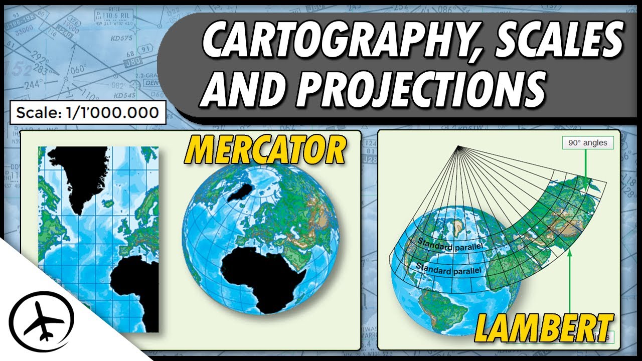
- 😀 The scale on a map compares the distance between conditions on the map to actual conditions in real life.
- 😀 Map legends are essential for understanding the symbols and colors used in the map.
- 😀 Borders provide information about the map's coordinates, while inset maps show a location on a larger scale.
- 😀 Cartographers are professionals who create maps, choosing scale, area size, and symbols to convey information.
- 😀 Cartographers rely on spatial data, which can be collected through advanced technologies such as remote sensing, drones, and satellites.
- 😀 The Indonesian Geospatial Information Agency (BIG) produces maps like the Indonesian Topographic Map (LB Map) and works on the national map policy to support national development.
Q & A
What are the two main types of maps mentioned in the script?
-The two main types of maps are base maps and thematic maps. Base maps are used for general purposes, while thematic maps focus on specific information.
Why is it important to know how to read a map correctly?
-Knowing how to read a map correctly is essential to understand the information it provides. Maps include elements such as titles, direction indicators, scale, and legends to help users interpret the data accurately.
What are the key elements found in most maps?
-Key elements found in most maps include the map title, direction indicator (such as a north arrow), scale, map legends (symbols and colors), borders with coordinates, and inset maps showing general locations at larger scales.
What role do cartographers play in map-making?
-Cartographers are map makers who select the scale, determine the area to be covered, and decide on the symbols, lines, patterns, and colors to use. They combine science and art to create readable and informative maps.
What is spatial data, and why is it important for map-making?
-Spatial data is information about the location and characteristics of features on Earth. It is crucial for map-making as it helps create accurate representations of geographic areas.
How has technology influenced the collection of map data?
-The development of sophisticated technologies, such as satellites, drones, and remote sensing, has made it possible to gather accurate geographic data from remote locations without the need for on-site work. This has greatly increased accuracy and efficiency in map-making.
What is remote sensing, and how is it used in map-making?
-Remote sensing is the process of collecting data from a distance using technologies like satellites and drones. It allows map-makers to gather geographical information from areas that are difficult to access, providing valuable data for creating maps.
Who is responsible for creating the base map of Indonesia?
-The Geospatial Information Agency (Badan Informasi Geospasial or BIG) is responsible for creating the base map of Indonesia, including topographic and geographic information.
What is the Indonesian Topographic Map (LBI), and what does it contain?
-The Indonesian Topographic Map (LBI) is a comprehensive map produced by BIG. It includes detailed information about Indonesia's marine and coastal environments and is categorized as a base map.
What is the 'one national map' policy, and why is it important?
-The 'one national map' policy is an initiative that aims to create a unified national map with a single geospatial reference, standard, database, and geoportal. This policy helps streamline the use of maps for national development and promotes consistency across various governmental efforts.
Outlines

This section is available to paid users only. Please upgrade to access this part.
Upgrade NowMindmap

This section is available to paid users only. Please upgrade to access this part.
Upgrade NowKeywords

This section is available to paid users only. Please upgrade to access this part.
Upgrade NowHighlights

This section is available to paid users only. Please upgrade to access this part.
Upgrade NowTranscripts

This section is available to paid users only. Please upgrade to access this part.
Upgrade Now


5.0 / 5 (0 votes)