Tata Koordinat Ekuatorial
Summary
TLDRIn this video, the presenter explains the concept of the equatorial coordinate system in astronomy, which is used to describe the position of celestial objects. The video covers topics such as the celestial poles, the celestial equator, and key points like Aries. It also discusses the relationship between right ascension, declination, and hour angle, explaining how these parameters help locate stars and other objects in the sky. The viewer learns how to apply these concepts using a star map and the Stellarium application, including examples like the position of the star Fomalhaut.
Takeaways
- 😀 Equatorial coordinate system is used to locate celestial objects based on their right ascension (RA) and declination (δ).
- 😀 The celestial poles (North and South) depend on the observer's latitude and are crucial for understanding the celestial sphere.
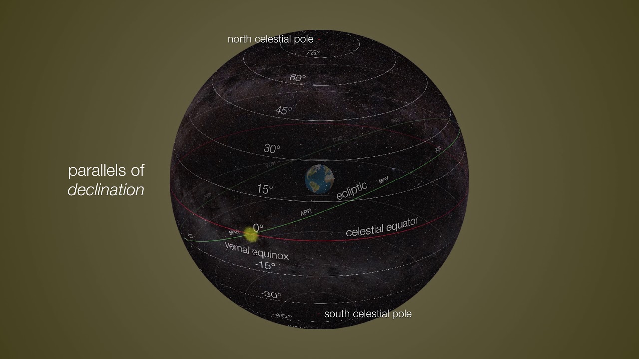
- 😀 The celestial equator is at a 90° distance from both celestial poles, forming the basis of the equatorial coordinate system.
- 😀 The Aries point marks the intersection of the celestial equator and the ecliptic plane, and is used as a reference for measuring right ascension.
- 😀 Right ascension (RA) is measured from the Aries point along the celestial equator and is usually denoted by the Greek letter α.
- 😀 Declination (δ) is analogous to latitude on Earth, but is measured from the celestial equator towards the celestial poles.
- 😀 The local sidereal time (LST) is an essential concept in the equatorial coordinate system, helping to locate stars and celestial objects.
- 😀 The hour angle (HA) is the angle between an observer’s local meridian and the position of a celestial object.
- 😀 The period of the sidereal day (the time it takes for the Earth to complete one rotation relative to the stars) is 23 hours and 56 minutes.
- 😀 The equatorial coordinate system helps to calculate the position of stars using either RA/Declination or HA/Declination based on the observer’s location and the time.
- 😀 The relationship between RA, HA, and LST is important for tracking celestial objects and determining their position at any given time.
Q & A
What is the equatorial coordinate system used for in astronomy?
-The equatorial coordinate system is used to map the positions of celestial objects on the celestial sphere. It helps astronomers locate stars and other astronomical objects with two primary coordinates: right ascension (RA) and declination (Decl.)
How does the height of the celestial poles vary depending on the observer's latitude?
-The height of the celestial poles is equal to the observer's latitude. For example, at a latitude of 45° South, the altitude of the celestial South Pole would be 45°, and at a latitude of 30° North, the altitude of the celestial North Pole would be 30°.
What is the role of the celestial equator in the equatorial coordinate system?
-The celestial equator is a great circle that divides the celestial sphere into two hemispheres: the Northern and Southern Hemispheres. It is positioned 90° from the celestial poles and serves as a reference for measuring declination and right ascension.
What is the significance of the Aries Point in the equatorial coordinate system?
-The Aries Point is the point where the celestial equator intersects the ecliptic. It is used as a reference for measuring right ascension, with the value of right ascension increasing towards the East from this point.
How is right ascension measured in the equatorial coordinate system?
-Right ascension (RA) is measured in degrees, minutes, and seconds along the celestial equator, starting from the Aries Point and moving eastward. It corresponds to the celestial equivalent of longitude on Earth.
What is declination in the equatorial coordinate system?
-Declination is the angular distance of a celestial object north or south of the celestial equator. It is analogous to latitude on Earth and is measured in degrees, with positive values indicating objects in the Northern Hemisphere and negative values indicating objects in the Southern Hemisphere.
What is the relationship between local sidereal time (LST) and right ascension?
-Local Sidereal Time (LST) is used to track the position of the stars relative to the observer's location on Earth. LST can be calculated by adding the hour angle (HA) of a star to its right ascension (RA). The resulting equation is LST = HA + RA.
How is the hour angle (HA) measured in the equatorial coordinate system?
-The hour angle is the angular distance measured along the celestial equator from the observer's local meridian to the celestial object's projected position on the equator. It is typically expressed in hours, with 1 hour equaling 15° of angle.
What is the difference between the 24-hour period of solar time and the sidereal day?
-A solar day is 24 hours, based on the Earth's rotation relative to the Sun. A sidereal day, however, is about 23 hours and 56 minutes, based on the Earth's rotation relative to distant stars, specifically the Aries Point.
How can we determine the position of a star like Fomalhaut using the equatorial coordinate system?
-The position of a star like Fomalhaut can be determined by measuring its right ascension and declination. These coordinates can be translated into an hour angle and declination for accurate location tracking in the sky.
Outlines

This section is available to paid users only. Please upgrade to access this part.
Upgrade NowMindmap

This section is available to paid users only. Please upgrade to access this part.
Upgrade NowKeywords

This section is available to paid users only. Please upgrade to access this part.
Upgrade NowHighlights

This section is available to paid users only. Please upgrade to access this part.
Upgrade NowTranscripts

This section is available to paid users only. Please upgrade to access this part.
Upgrade NowBrowse More Related Video
Equatorial Coordinate System Explained: How Astronomers Navigate the Celestial Sphere

Where is it? Celestial coordinates explained

Celestial Sphere Celestial Navigation - Basics | Merchant Navy knowledge
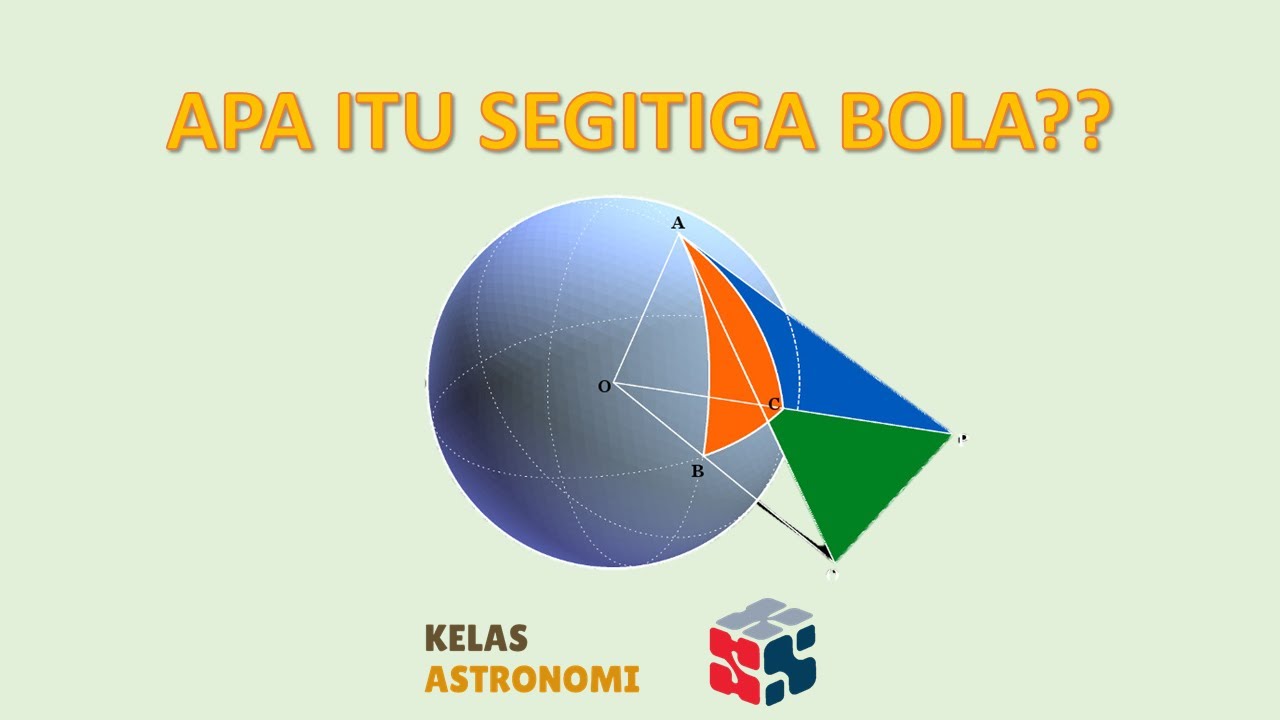
Segitiga Bola Definisi

Edexcel GCSE (9-1) Astronomy, Topic 1: The Earth (summary)

Lecture 15: Robot Kinematics (Contd.)
5.0 / 5 (0 votes)