031 viz2
Summary
TLDRThis tutorial demonstrates how to create interactive maps using R, focusing on the visualization of public school locations, median rent changes, and migration flows in Puerto Rico. The video covers the use of R packages like `tidycensus`, `mapview`, and `mapdeck` to process and display data from the U.S. Census. It includes steps to analyze rent changes between 2012 and 2022, visualize 5-star schools, and map migration trends, providing a hands-on guide for users to build customizable, data-driven maps.
Takeaways
- 😀 Data analysis in the video focuses on creating interactive maps using census data, specifically for visualizing public school information and median rent changes in Puerto Rico.
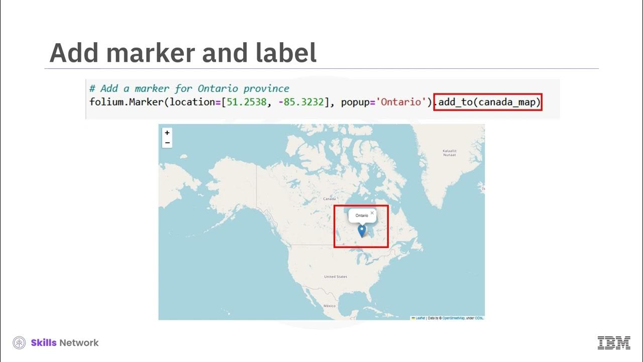
- 😀 The video highlights the difference between static and interactive maps, emphasizing the use of tools like `mapview` and `mapdeck` for creating dynamic visualizations.
- 😀 Users are instructed to use the `tidycensus` and `Tigris` R packages to load and manipulate census data, including geographic information and demographic variables.
- 😀 A key example in the video involves analyzing median rent changes between two periods: 2012-2017 and 2018-2022, and comparing how the median rent in Puerto Rico has shifted across municipalities.
- 😀 The video demonstrates how to calculate the percentage difference in median rent between the two periods and visualize it on an interactive map.
- 😀 Data cleaning techniques, such as removing unwanted variables and merging datasets, are emphasized to ensure accurate mapping of census data to geographical locations.
- 😀 The video shows how to apply color-coding to map regions based on specific data attributes, such as school ratings or rent price increases, making the map more informative and visually appealing.
- 😀 There is a demonstration of adding multiple map layers, such as school ratings (five-star schools) and municipality boundaries, for a more detailed and interactive user experience.
- 😀 Migration flow data is analyzed by visualizing people leaving Puerto Rico from San Juan to other U.S. locations, with the help of migration data available through the census.
- 😀 The video introduces the concept of using interactive maps in presentations (e.g., with `Quarto`) to make maps more dynamic and engaging in academic or professional settings.
Q & A
What is the main focus of the video tutorial?
-The video tutorial primarily focuses on creating interactive maps using U.S. Census data, specifically analyzing median rent changes and migration flows in Puerto Rico between 2012 and 2022.
What are the primary tools and libraries used for creating the maps?
-The main tools and libraries used in the tutorial include `tigris` for geographic data handling, `leaflet` and `mapview` for interactive maps, and `mapdeck` for advanced migration flow visualizations.
How is the data cleaned and prepared for mapping?
-The data is fetched using the `tidycensus` package, cleaned by removing unnecessary variables or geometries, and then merged with shapefiles of Puerto Rico using the `Tigris` library to georeference it for mapping.
What types of data are used for the analysis in the tutorial?
-The data used in the tutorial includes public school data, ACS data for median rent (for the years 2012 and 2022), and migration flow data (showing movement from Puerto Rico to the U.S.).
What is the significance of the ACS data for the analysis?
-The ACS data provides insights into the changes in median rent in different municipalities of Puerto Rico over two periods: 2012-2018 and 2018-2022. This helps analyze areas with significant rent increases or decreases.
What type of map is primarily used in the tutorial?
-The tutorial emphasizes the use of interactive maps created with `leaflet` for general visualization and `mapdeck` for migration flow visualizations. Interactive maps allow users to explore data in more detail.
What can viewers learn from the migration flow visualization?
-Viewers can learn about the migration patterns of people leaving Puerto Rico, specifically focusing on movement from San Juan to various U.S. states, based on 2020 Census migration flow data.
How are rent changes in Puerto Rico analyzed and visualized?
-Rent changes are analyzed by comparing the median rents of 2012 and 2022, visualized using color-coded maps that highlight areas with significant increases or decreases in rent. The tutorial also discusses how environmental events, such as hurricanes, may have influenced these changes.
How does the tutorial demonstrate the use of Quarto in presenting maps?
-The tutorial shows how to embed interactive maps into presentations created with Quarto, allowing users to integrate dynamic visualizations directly into reports or slideshows, enhancing presentation effectiveness.
What insights does the analysis provide regarding areas with declining rent?
-The analysis highlights areas like Guayama and Guanica, which have seen declines in rent, possibly due to natural disasters (like Hurricane María) or population loss, affecting demand and property values.
Outlines

This section is available to paid users only. Please upgrade to access this part.
Upgrade NowMindmap

This section is available to paid users only. Please upgrade to access this part.
Upgrade NowKeywords

This section is available to paid users only. Please upgrade to access this part.
Upgrade NowHighlights

This section is available to paid users only. Please upgrade to access this part.
Upgrade NowTranscripts

This section is available to paid users only. Please upgrade to access this part.
Upgrade Now5.0 / 5 (0 votes)


