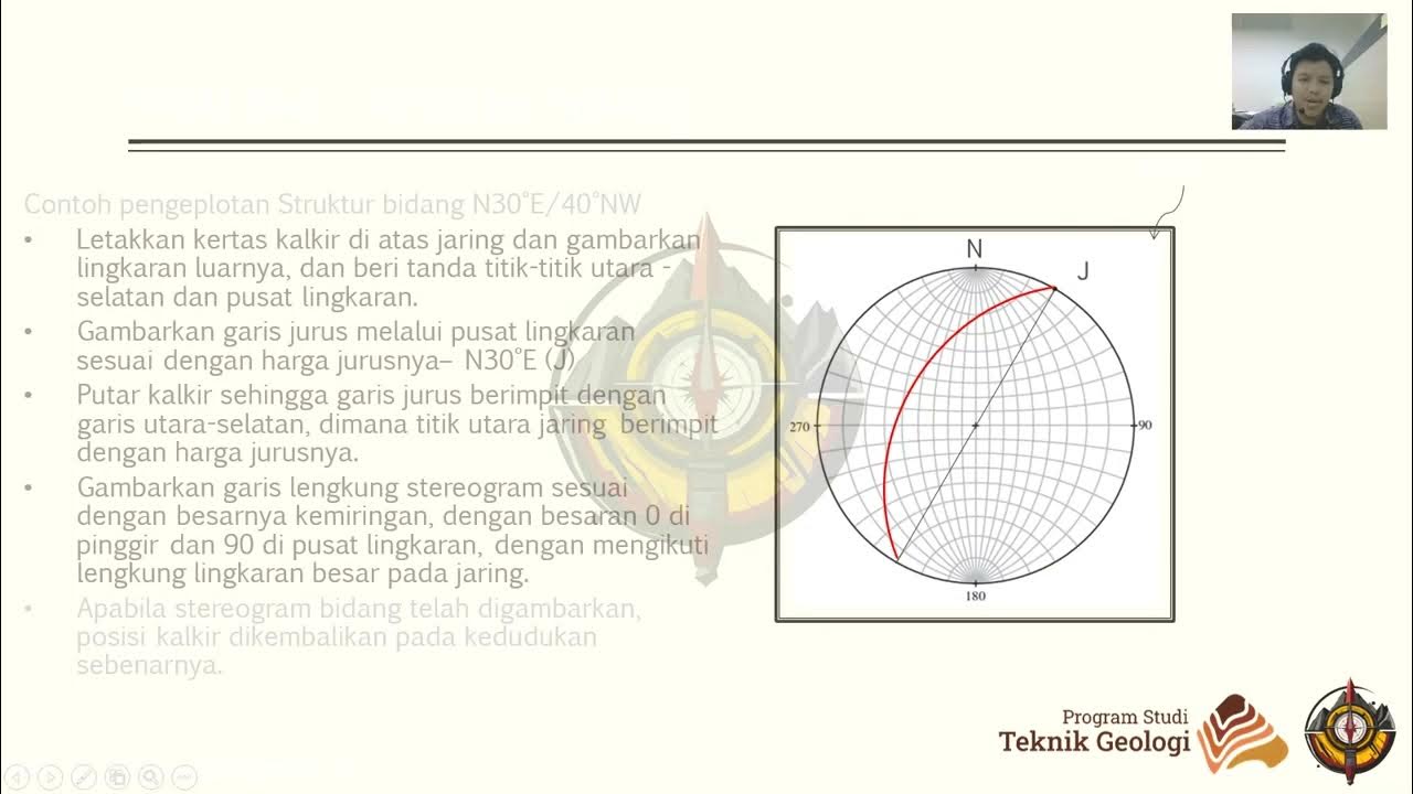
Physical Geology: Structure, strike and dip
Summary
TLDRIn this engaging lecture, the instructor introduces key geological concepts: strike and dip. Strike refers to the compass direction of rock layers, visualized from a map view, while dip indicates the angle from horizontal in a cross-section view. Using a lasagna analogy, the speaker clarifies these terms, emphasizing their importance in understanding geological structures. The symbols representing strike and dip on maps are also explained, illustrating how they convey the orientation of rock beds. This foundational knowledge is crucial for further exploration of rock behavior under stress.
Takeaways
- 🗺️ Strike refers to the compass direction in which a bed of rock runs, measured in map view.
- 📏 Dip represents the angle from horizontal that the rock bed sits in cross-section view.
- 🧊 The surface of the Earth in a diagram is referred to as map view, similar to looking down from a helicopter.
- 🔪 A cross-section view shows layers of rock, like a slice of lasagna revealing noodles, meat, and cheese.
- ⚖️ It's crucial to distinguish between strike (measured in map view) and dip (measured in cross-section).
- 📈 Strike and dip are represented on maps using specific symbols: a long line for strike and a short line for dip.
- 🔄 The direction of the strike line is parallel to the bed's running direction, while the dip line points to the direction of dip.
- 📉 If a symbol has a number above it, like 45, it indicates the angle of dip (e.g., 45 degrees).
- 🔍 Understanding strike and dip is essential for analyzing rock structures and their behavior under stress.
- 🧠 The speaker will frequently reference strike and dip in discussing different geological structures.
Q & A
What is the main focus of the video transcript?
-The main focus is on understanding the concepts of strike and dip in relation to geological structures and how these measurements relate to the behavior of rocks under stress.
How is 'strike' defined in the context of geology?
-'Strike' is defined as the compass direction in which a geological bed runs, measured in map view.
What is 'dip' and how is it measured?
-'Dip' is the angle from horizontal at which a geological bed sits, measured in cross-section view.
What are the two different views described in the video?
-The two views are 'map view,' which shows the Earth's surface from above, and 'cross-section view,' which provides a sliced perspective revealing internal layers.
How can the analogy of lasagna be used to explain geological views?
-The lasagna analogy illustrates that the map view represents the surface layer (the cheese on top), while the cross-section view shows the internal layers (noodles, meat, and cheese) when a slice is taken out.
What symbols are used to represent strike and dip on geological diagrams?
-On geological diagrams, a long line represents strike, and a short line or hash mark represents dip, with the latter pointing in the direction of the bed's inclination.
What is the significance of correctly understanding strike and dip?
-Correctly understanding strike and dip is crucial for accurately describing and analyzing geological structures, which helps in understanding the Earth's processes and formations.
What does a 45-degree angle indicate when shown on a dip symbol?
-A 45-degree angle above a dip symbol indicates that the geological beds are dipping to the right at an angle of 45 degrees.
Why is it important to differentiate between map view and cross-section view?
-Differentiating between map view and cross-section view is important because it helps geologists understand the orientation and layering of rocks more clearly, which is vital for geological assessments.
How does the video emphasize the importance of strike and dip in future discussions?
-The video emphasizes that a clear understanding of strike and dip will be essential for explaining various geological structures that will be discussed later.
Outlines

This section is available to paid users only. Please upgrade to access this part.
Upgrade NowMindmap

This section is available to paid users only. Please upgrade to access this part.
Upgrade NowKeywords

This section is available to paid users only. Please upgrade to access this part.
Upgrade NowHighlights

This section is available to paid users only. Please upgrade to access this part.
Upgrade NowTranscripts

This section is available to paid users only. Please upgrade to access this part.
Upgrade NowBrowse More Related Video

Praktikum Geologi Struktur 2024 - Modul 1. Pendahuluan Modul Geologi Struktur - 2. Pengukuran Data

Folds, Dip and Strike

Praktikum Geologi Struktur 2024 - Modul 3. Proyeksi Stereografi - 3. Pengenalan Dips

Trend and Plunge : Gores Garis Pada Sesar

Mengukur Dip & strike menggunakan Kompas Geologi

Praktikum Geologi Struktur 2024 - Modul 10. Prediksi Singkapan - 2. Penggambaran Struktur Geologi
5.0 / 5 (0 votes)