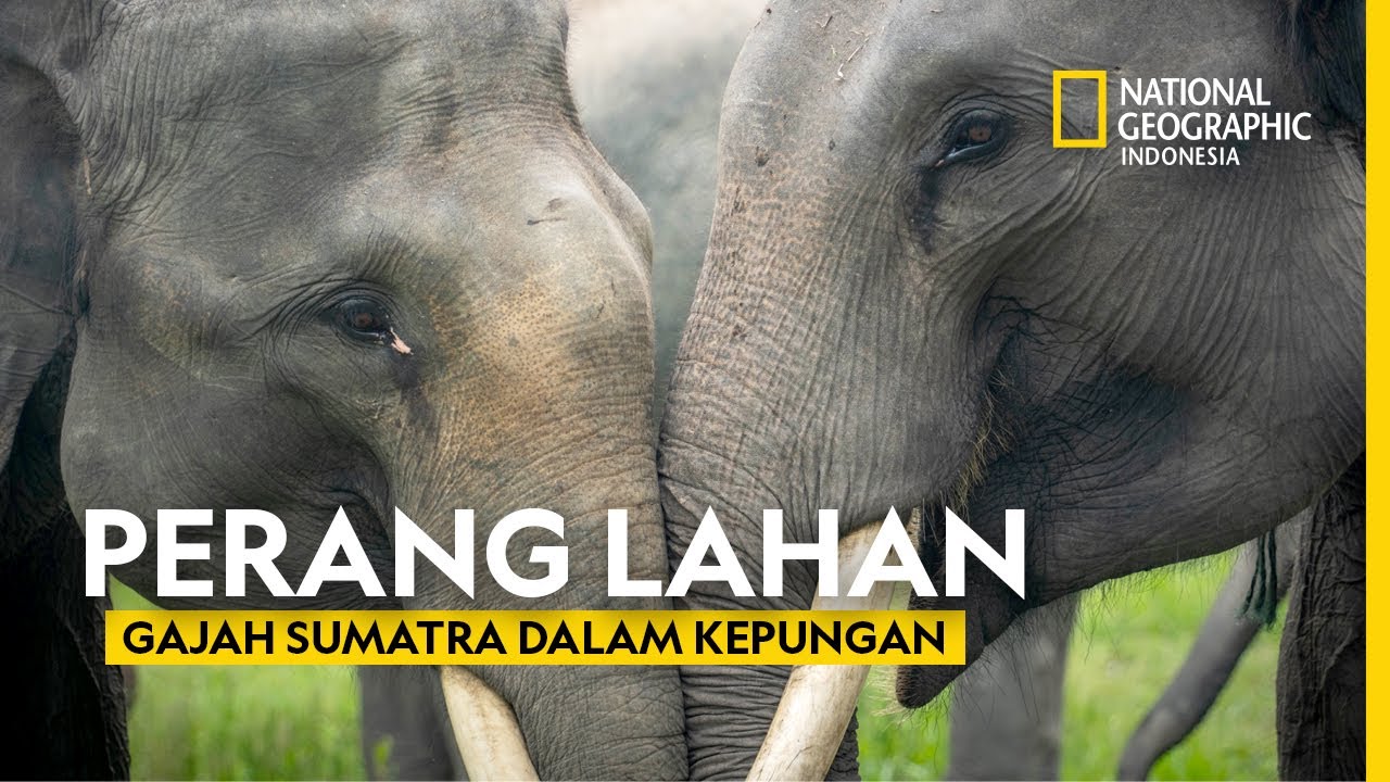
PEMASANGAN GPS COLLAR GAJAH SUMATERA
Summary
TLDRThis video focuses on efforts to mitigate human-elephant conflicts in Indonesia through the use of GPS collars. These collars serve as an early warning system, allowing authorities to track the movements of wild elephants and prevent their interaction with human settlements and farms. The GPS data helps monitor elephant behavior, and the collars can provide real-time location updates, enabling teams to intervene before conflicts occur. The video also discusses the challenges faced in the field and the steps taken to reduce such conflicts, such as creating barriers and implementing preventive measures.
Takeaways
- 😀 GPS collars are used as part of an early warning system to minimize negative interactions between elephants and humans.
- 😀 The elephants in the forest appear healthy, with no visible signs of illness or infections, though some have old wounds that have been treated.
- 😀 GPS collar data helps track elephant movements, providing crucial information on their location and behavior.
- 😀 One of the main challenges in handling elephant conflicts is the need for trained captive elephants to assist in managing wild elephants in conflict zones.
- 😀 Conflict has been a recurring issue in the Gayo region for several years, prompting the use of advanced measures to prevent escalation.
- 😀 The weight of an elephant is estimated by measuring chest circumference and shoulder height, with some individuals weighing over 4 tons.
- 😀 The GPS collar system enables real-time tracking, helping prevent elephant groups from approaching farms or settlements.
- 😀 The system provides data via satellite to a server, which can be accessed by authorized personnel using computers or mobile devices.
- 😀 Though the installation of GPS collars doesn’t eliminate conflicts entirely, it significantly aids in managing them by providing timely data to field teams.
- 😀 Various methods have been implemented, such as building barriers, to reduce elephant-human conflicts and prevent damage to crops or property.
Q & A
What is the purpose of the GPS collar installation on elephants?
-The GPS collar installation is part of an early warning system aimed at minimizing negative interactions between elephants and humans by tracking elephant movement and preventing conflicts.
What type of condition were the elephants in when encountered in the forest?
-The elephants appeared to be in good health, with no signs of illness or infection. However, there was a minor old wound that had become infected, which was treated during the procedure.
How does the GPS collar help in reducing elephant-human conflicts?
-The GPS collar helps by tracking the location of elephant groups and sending their position data to a server. This allows field teams to anticipate and prevent conflicts by taking action before the elephants approach agricultural or human settlements.
What is the weight estimation method used for the elephants?
-The weight of the elephants is estimated using their chest circumference and shoulder height, which are input into a formula to calculate their approximate weight.
How does the GPS collar relay data?
-The GPS collar sends positional data via satellite to a server at set intervals. This data can be accessed by authorized personnel via computers or Android devices.
How does the early warning system benefit local communities?
-The system helps local communities by allowing authorities to track elephant movements and warn them in advance if elephants are approaching areas where they might cause damage or pose a risk, enabling preventive measures to be taken.
What has been done to address the elephant-human conflict in the region?
-Several strategies have been implemented, including the installation of GPS collars, the use of barriers, and the introduction of tame elephants to manage and reduce conflicts between elephants and humans in areas like Gayo.
How do the field teams prepare for elephant movements detected by the GPS collars?
-The field teams use the data from the GPS collars to track the elephants and, based on their location, deploy preventative measures to reduce the risk of conflict, such as guiding elephants away from settlements or agricultural land.
What technological tools are used to monitor the GPS collar data?
-The GPS collar data can be monitored via computers or Android devices, enabling field teams and relevant authorities to access real-time information about elephant movements.
What kind of conflicts have been common between elephants and humans in the region?
-Elephant-human conflicts in the region have often involved elephants approaching agricultural fields or human settlements, causing damage to crops or posing a risk to human safety, particularly in areas like Gayo.
Outlines

Этот раздел доступен только подписчикам платных тарифов. Пожалуйста, перейдите на платный тариф для доступа.
Перейти на платный тарифMindmap

Этот раздел доступен только подписчикам платных тарифов. Пожалуйста, перейдите на платный тариф для доступа.
Перейти на платный тарифKeywords

Этот раздел доступен только подписчикам платных тарифов. Пожалуйста, перейдите на платный тариф для доступа.
Перейти на платный тарифHighlights

Этот раздел доступен только подписчикам платных тарифов. Пожалуйста, перейдите на платный тариф для доступа.
Перейти на платный тарифTranscripts

Этот раздел доступен только подписчикам платных тарифов. Пожалуйста, перейдите на платный тариф для доступа.
Перейти на платный тарифПосмотреть больше похожих видео

Populasi Gajah Sumatera di Riau Ter4ncam Punah
Krisis Habitat: Gajah dan Manusia dalam Pertarungan di Sumatra - National Geographic Indonesia

GAJAH LAMPUNG | PELESTARI

Populasi Gajah Sumatera Terus Menurun Akibat Perburuan oleh Manusia

PKn Diskusi P.10 (Kesmas68)

Reforma Agraria Gagal Kurangi Konflik Pertanahan
5.0 / 5 (0 votes)
