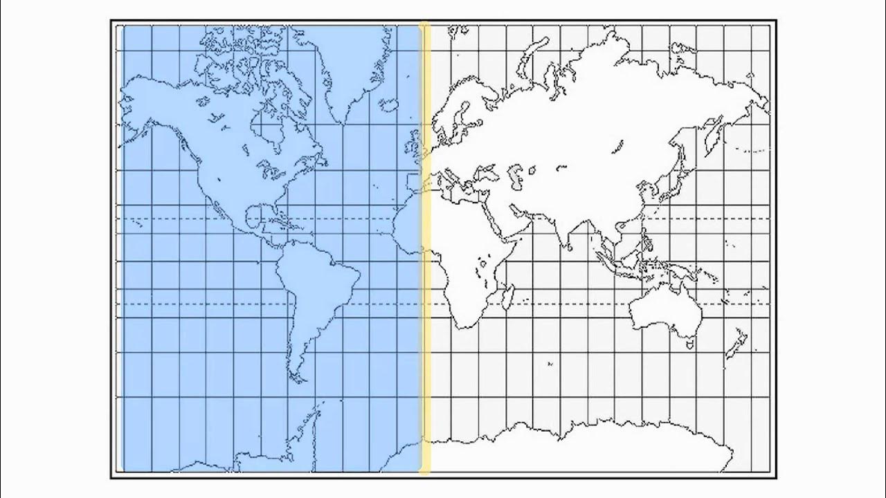
Understanding Latitude and Longitude and Using Degrees Minutes and Seconds on Maps
Summary
TLDRThis video provides a comprehensive overview of latitude and longitude, focusing on their definitions and significance in geographic positioning. It explains how latitude measures distance from the equator and longitude from the prime meridian, detailing the conversion of degrees into minutes and seconds. Additionally, the video demonstrates practical examples of calculating midpoints for coordinates, emphasizing the importance of understanding these concepts for navigation and mapping. By comparing the time system to geographic coordinates, the explanation becomes more relatable, aiding students in grasping these essential geographical principles.
Takeaways
- 😀 Latitude measures the distance from the equator, ranging from 0 degrees at the equator to 90 degrees at the poles.
- 😀 Longitude measures the distance from the prime meridian, also ranging from 0 degrees to 180 degrees east and west.
- 😀 The equator is a crucial reference point, designated as 0 degrees latitude.
- 😀 The prime meridian serves as the reference for 0 degrees longitude and helps define east and west.
- 😀 Latitude lines run horizontally on a map, while longitude lines run vertically.
- 😀 Degrees, minutes, and seconds are used to provide precise geographical coordinates.
- 😀 1 degree equals 60 minutes, and 1 minute equals 60 seconds, similar to how time is measured.
- 😀 When calculating coordinates, the positive and negative signs indicate north/south for latitude and east/west for longitude.
- 😀 Midpoint calculations between two coordinates involve averaging the values while managing overflow in minutes and seconds.
- 😀 Understanding latitude and longitude is essential for accurately locating places on a map and navigating the globe.
Q & A
What are latitude and longitude used for?
-Latitude and longitude are used to describe the location of points on the Earth's surface.
What is the significance of the equator in latitude?
-The equator is considered zero degrees latitude, serving as the reference point for measuring how far north or south a location is.
How is latitude measured?
-Latitude is measured in degrees, ranging from 0 degrees at the equator to 90 degrees at the poles, with values increasing as one moves away from the equator.
What does the prime meridian represent?
-The prime meridian is the line of longitude defined as 0 degrees, serving as the starting point for measuring longitude east and west.
How are degrees, minutes, and seconds structured in the context of latitude and longitude?
-One degree is divided into 60 minutes, and one minute is further divided into 60 seconds, similar to how time is divided.
How can latitude and longitude be expressed using positive and negative signs?
-North of the equator and east of the prime meridian are considered positive, while south of the equator and west of the prime meridian are considered negative.
What is the purpose of finding a midpoint in latitude and longitude calculations?
-Finding a midpoint helps in determining the average position between two sets of coordinates, which can be essential in navigation and mapping.
How does one convert minutes and seconds when calculating a midpoint?
-When adding minutes and seconds, if the total seconds exceed 60 or total minutes exceed 60, you convert accordingly by carrying over to the next unit.
What is a common misconception about the representation of longitude?
-Many people may confuse the representation of longitude with latitude; understanding the vertical and horizontal lines helps clarify this distinction.
What are some examples of real-world applications of latitude and longitude?
-Latitude and longitude are essential in GPS navigation, mapping, surveying, and geographical information systems (GIS).
Outlines

Этот раздел доступен только подписчикам платных тарифов. Пожалуйста, перейдите на платный тариф для доступа.
Перейти на платный тарифMindmap

Этот раздел доступен только подписчикам платных тарифов. Пожалуйста, перейдите на платный тариф для доступа.
Перейти на платный тарифKeywords

Этот раздел доступен только подписчикам платных тарифов. Пожалуйста, перейдите на платный тариф для доступа.
Перейти на платный тарифHighlights

Этот раздел доступен только подписчикам платных тарифов. Пожалуйста, перейдите на платный тариф для доступа.
Перейти на платный тарифTranscripts

Этот раздел доступен только подписчикам платных тарифов. Пожалуйста, перейдите на платный тариф для доступа.
Перейти на платный тарифПосмотреть больше похожих видео
5.0 / 5 (0 votes)


