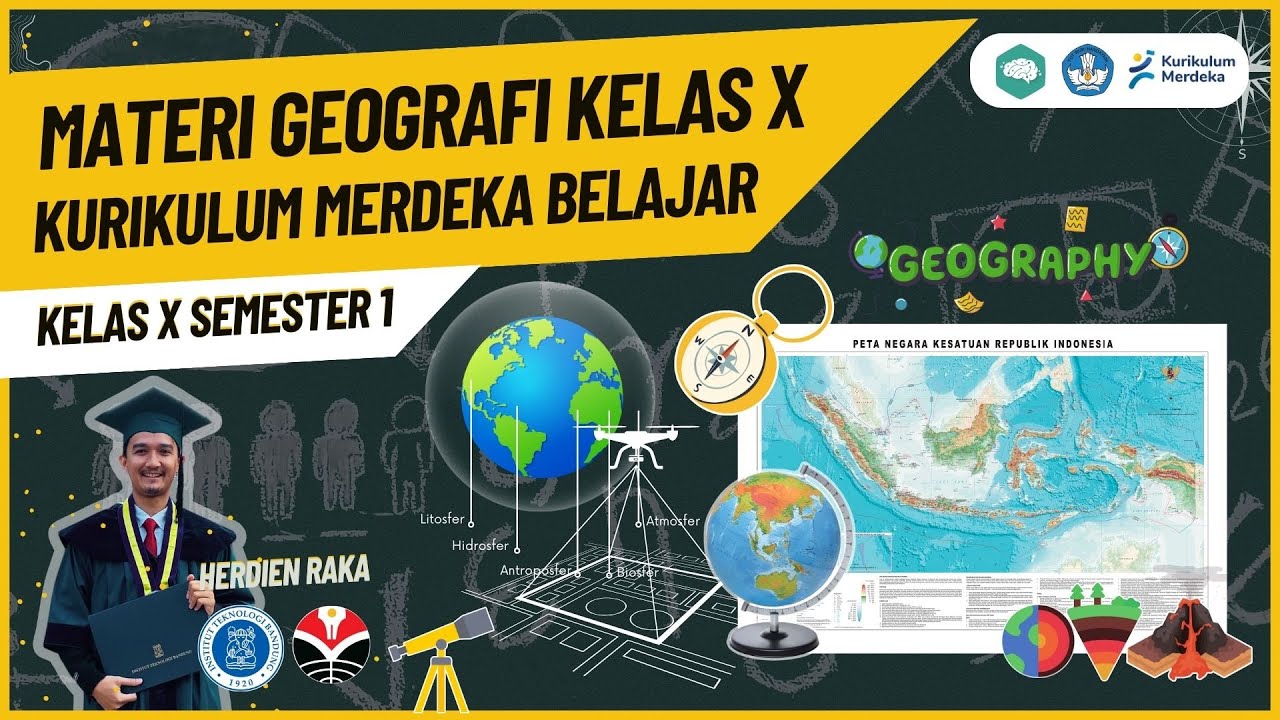
SISTEM INFORMASI GEOGRAFIS (SIG) #geography #education #kurikulummerdeka
Summary
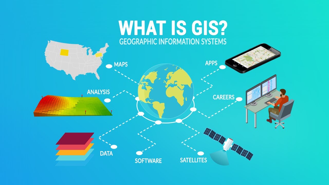
TLDRThis video provides a comprehensive overview of Geographic Information Systems (GIS) for 10th grade geography students. It covers the definition of GIS, which is a computer system for collecting, analyzing, and displaying spatial data related to the Earth's surface. The video also explains GIS functions, including data input, processing, management, and output. Key components of GIS—such as hardware, software, data, and brainware (human operators)—are discussed, alongside types of spatial and attribute data, and GIS applications across fields like resource management, urban planning, education, and healthcare.
Takeaways
- 📍 The video discusses the topic of Geographic Information Systems (GIS) in Geography class 10 for the first semester.
- 💡 GIS is defined as a computer system used to collect, analyze, and display spatial data related to the Earth's surface.
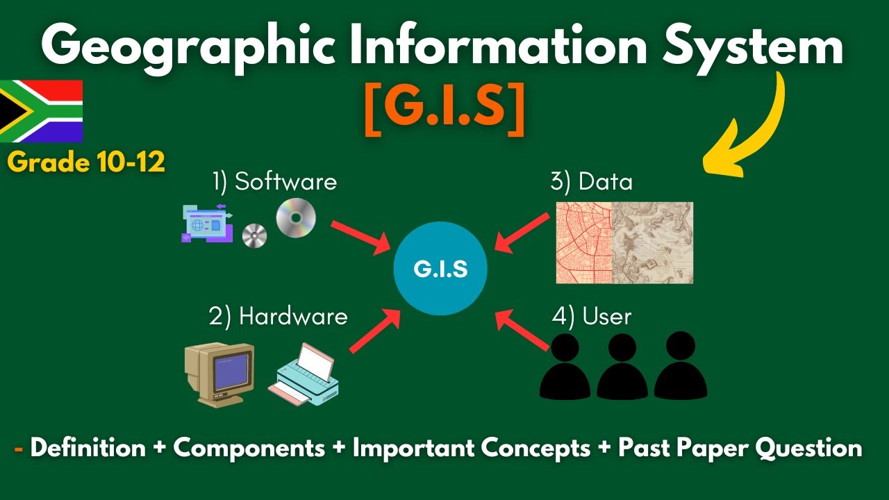
- 🖥️ The components of GIS include data, hardware, software, and brainware (the human component).
- 🌍 GIS data is classified into two types: spatial data (which includes raster and vector data) and attribute data (which includes nominal, ordinal, interval, and ratio types).
- 🖼️ Raster data represents geographic objects using grids, while vector data uses points, lines, and polygons.
- 🔎 The four main functions of GIS are data input, processing, manipulation/analysis, and output/display of spatial data.
- 📊 Attribute data provides additional information about geographic objects, which may include numbers, tables, or graphs related to spatial data.
- 🔧 Hardware components such as scanners and digitizers are essential for inputting data into GIS, while CPUs and SSDs handle data processing.
- 🗺️ Software like ArcGIS, MapInfo, and Quantum GIS are used for managing and processing GIS data.
- 🌐 GIS has applications in many fields, including natural resource management, spatial planning, education, and healthcare for disease mapping.
Q & A
What is the definition of Geographic Information System (GIS) according to Lindan in 1987?
-According to Lindan in 1987, GIS is a system used to manage, store, process, analyze, and display spatial data related to the Earth's surface.
What are the main components of Geographic Information System (GIS)?
-The main components of GIS are data, hardware, software, and brainware (human operators).
What types of data are included in GIS, and how are they categorized?
-GIS data is categorized into spatial data (raster and vector) and attribute data. Spatial data includes geographic references, while attribute data provides additional information such as numbers or descriptions.
What is raster data, and how is it represented in GIS?
-Raster data in GIS is digital data represented by a grid. It is generated by remote sensing systems and is suitable for representing geographic objects with gradual boundaries, using pixels that correspond to real-world distances.
How does vector data differ from raster data in GIS?
-Vector data represents geographic objects using points, lines, or polygons, whereas raster data uses a grid of pixels. Vector data is better suited for precise boundaries, while raster data is more appropriate for continuous surfaces.
What is attribute data in GIS, and how does it relate to spatial data?
-Attribute data in GIS is data that describes the characteristics of spatial data, often in the form of numbers, tables, or graphs. It provides additional information about geographic features, such as names, quantities, or other descriptive attributes.
What are the primary functions of Geographic Information System (GIS)?
-The primary functions of GIS are inputting, processing, managing, analyzing, and presenting spatial data. These functions help to visualize and understand geographic information effectively.
What is the role of hardware in a Geographic Information System (GIS)?
-Hardware in GIS plays a key role in providing computational power and data access. It includes devices for inputting data, such as scanners and digitizers, as well as processing and output devices like CPUs, hard drives, printers, and plotters.
What are some common software applications used in GIS?
-Common GIS software applications include ArcGIS, MapInfo, and Quantum GIS. These software tools are used to input, manage, and analyze spatial data within GIS systems.
What are the subsystems of GIS, and what role do they play?
-The subsystems of GIS include data input, data management, data manipulation and analysis, and data output. These subsystems facilitate the process of collecting, organizing, analyzing, and presenting geographic information.
Outlines

Этот раздел доступен только подписчикам платных тарифов. Пожалуйста, перейдите на платный тариф для доступа.
Перейти на платный тарифMindmap

Этот раздел доступен только подписчикам платных тарифов. Пожалуйста, перейдите на платный тариф для доступа.
Перейти на платный тарифKeywords

Этот раздел доступен только подписчикам платных тарифов. Пожалуйста, перейдите на платный тариф для доступа.
Перейти на платный тарифHighlights

Этот раздел доступен только подписчикам платных тарифов. Пожалуйста, перейдите на платный тариф для доступа.
Перейти на платный тарифTranscripts

Этот раздел доступен только подписчикам платных тарифов. Пожалуйста, перейдите на платный тариф для доступа.
Перейти на платный тарифПосмотреть больше похожих видео
RANGKUMAN METERI GEOGRAFI KELAS X SMA SEMESTER 1 KURIKULUM MERDEKA

What is GIS?
What Is GIS? A Guide to Geographic Information Systems

Sistema de Informação Geográfica (SIG)

Apa perbedaan SaIG dan SIG? | SAIG2B
G.I.S (Geographic Information Systems)- Concepts, Components, Advantages + Past Paper | Grade 10-12.
5.0 / 5 (0 votes)
