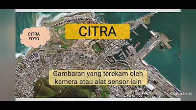
Definisi dan Komponen Penginderaan Jauh (Remote Sensing)

Sadidan Ikhwanussafa
25 Dec 202206:36

Summary

TLDRThis educational video delves into the concept and components of remote sensing, a field that involves gathering information about objects or phenomena without direct contact. It highlights the use of satellite imagery and aerial vehicles, such as drones, each with distinct features and purposes. The video explains the roles of natural and artificial energy sources, the atmosphere's impact on electromagnetic radiation, and object-energy interactions. It also covers the detection methods, the importance of platforms and sensors, and the diverse applications of remote sensing data in various fields like geology, forestry, and marine studies.

Takeaways

  • 📚 Remote sensing is defined as the science and art of acquiring information about objects or phenomena without direct contact.
  • 🌐 Examples of remote sensing outcomes include satellite images and aerial photography, each with distinct characteristics and functions.
  • 🛰️ Landsat 8 is a United States satellite launched in 2013, a collaboration between NASA and USGS, offering free image downloads from the Earth Explorer website.
  • 🤖 Unmanned Aerial Vehicles (UAVs), or drones, come in various types such as quadcopters and fixed-wing drones, each serving different functions and purposes.
  • 🌞 The energy source for remote sensing is divided into natural sources like the sun and artificial sources created by humans to enhance electromagnetic waves.
  • 🌁 The atmosphere is composed of gases and molecules that can absorb, reflect, and transmit electromagnetic radiation, affecting remote sensing data.
  • 🌈 Interaction between objects and energy is seen through the colors produced, with each object having unique characteristics to reflect or emit energy to sensors.
  • 📊 Reflectance spectral curves illustrate the relationship between wavelength and the amount of reflected power, showing differences in reflectance between various surfaces like dry grass and asphalt.
  • 🛰️ The platform in remote sensing is the hardware that carries the sensor or recording device, serving to transport the sensor into the air.
  • 🔍 Sensors can be photographic, recording objects through chemical processes, or electronic, working electrically across a broad spectrum to produce images.
  • 💾 Data processing in remote sensing involves manual interpretation using tools like stereoscopes for 3D effects and numerical data obtained through specialized software.
  • 🌐 The applications of remote sensing data span across various fields including geology, forestry, population studies, and marine sciences.

Q & A

  • What is remote sensing?

    -Remote sensing is a science and art of acquiring information about objects or phenomena without direct contact by analyzing data obtained using instruments.

  • What are some examples of remote sensing outputs?

    -Examples of remote sensing outputs include satellite images such as Landsat 8 and aerial photographs taken by UAVs or drones.

  • When was the Landsat 8 satellite launched?

    -The Landsat 8 satellite was launched on February 11, 2013.

  • What is the collaboration behind the Landsat 8 satellite?

    -Landsat 8 is a collaboration between NASA and the United States Geological Survey (USGS).

  • How can one access images from the Landsat 8 satellite?

    -Images from the Landsat 8 satellite can be downloaded for free from the Earth Explorer website.

  • What are the different types of drones mentioned in the script?

    -The script mentions quadcopter drones, GPS drones, and fixed-wing drones as examples of aerial vehicles.

  • What are the two types of energy sources in remote sensing?

    -The two types of energy sources in remote sensing are natural energy sources, such as sunlight, and artificial energy sources created by humans.

  • What is the role of the atmosphere in remote sensing?

    -The atmosphere consists of various gases and molecules that can absorb, reflect, and transmit electromagnetic radiation, affecting the remote sensing process.

  • How does the interaction between objects and energy manifest in remote sensing?

    -The interaction can be seen in the colors produced by objects, which have different characteristics for reflecting or emitting energy to sensors.

  • What is the concept of spectral reflectance mentioned in the script?

    -Spectral reflectance refers to the ratio of reflected energy to incident energy at different wavelengths, which can be used to analyze the properties of objects.

  • What is the role of the platform in remote sensing?

    -The platform, or vehicle, is the hardware that carries the sensor or recording device in remote sensing, serving to transport the sensor into the air.

  • What are the two types of sensors used in remote sensing?

    -The two types of sensors are photographic sensors, which record objects through a chemical process, and electronic sensors, which work electrically across a broader spectrum from X-rays to radio waves.

  • How is data from remote sensing processed?

    -Data from remote sensing is processed into manual data, which involves interpreting images using tools like stereoscopes for 3D effects, and numerical data, which is obtained through specialized remote sensing software.

  • What are some fields where remote sensing data can be applied?

    -Remote sensing data can be used in various fields including geology, forestry, population studies, oceanography, and other areas.

Outlines

00:00

🌏 Understanding Remote Sensing and Its Components

This paragraph introduces the concept of remote sensing, defined as the science and art of acquiring information about objects or phenomena without direct contact. It discusses the historical perspective from a 1979 graduate and outlines various remote sensing tools such as satellite images and aerial vehicles like drones. The paragraph specifically mentions the Landsat 8 satellite, a collaborative effort between NASA and the United States Geological Survey (USGS), launched in 2013, and the availability of its imagery on the Earth Explorer website. It also touches on the different types of drones and their unique functions and purposes. The paragraph then delves into the components of remote sensing, starting with the source of energy, which is divided into natural (like sunlight) and artificial sources. It continues with the role of the atmosphere in remote sensing, explaining how it interacts with electromagnetic radiation. The interaction between objects and energy is also discussed, highlighting how different objects reflect light and how this is represented in spectral reflectance curves. The paragraph concludes with an introduction to the use of laser technology for distance measurement, known as LIDAR.

05:02

📸 Components and Applications of Remote Sensing

The second paragraph elaborates on the remaining components of remote sensing, starting with the platform, which is the hardware that carries the sensors. It then describes sensors, which are monitoring devices mounted on platforms and are categorized into photographic and electronic sensors. Photographic sensors produce images that can be seen with the naked eye, similar to regular photographs, while electronic sensors operate electrically and cover a broader spectrum, from X-rays to radio waves, producing imagery. The paragraph also addresses data processing in remote sensing, distinguishing between manual data, which involves interpreting images using tools like stereoscopes for 3D effects, and numeric data, which is obtained through specialized software. Lastly, it mentions the various applications of remote sensing data across different fields such as geology, forestry, population studies, and marine sciences. The paragraph concludes with a note of gratitude and a request for forgiveness for any errors, ending with a traditional greeting.

Mindmap

Keywords

💡Remote Sensing

Remote sensing is a scientific technique used to acquire information about objects or phenomena without direct contact. In the context of the video, it refers to the process of collecting data about the Earth's surface using satellites or aerial vehicles. The script mentions various tools such as satellite images and aerial vehicles like drones, which are used to capture imagery for analysis.

💡Landsat 8

Landsat 8 is an Earth observation satellite owned by the United States government and was launched on February 11, 2013. It is a collaboration between NASA and the United States Geological Survey (USGS). The video script uses Landsat 8 as an example of a satellite that provides satellite imagery, which can be downloaded for free from the Earth Explorer website, illustrating its application in remote sensing.

💡Drone

A drone, also known as an unmanned aerial vehicle (UAV), is a type of aircraft that is piloted remotely or flies autonomously. The script mentions drones as tools for remote sensing, highlighting different types such as quadcopter, GPS drones, and fixed-wing drones, each with specific functions and purposes in capturing imagery or data.

💡Energy Source

The energy source in remote sensing is divided into natural and artificial sources. Natural sources, such as the sun, provide light necessary for remote sensing, while artificial sources are created by humans to enhance the electromagnetic waves used in data collection. The video script explains that these energy sources are essential for the functioning of remote sensing technologies.

💡Atmosphere

The atmosphere is the layer of gases surrounding the Earth, which can absorb, reflect, and transmit electromagnetic radiation. In the video, the atmosphere is mentioned as a component that interacts with the energy used in remote sensing, affecting how data is collected and interpreted from the Earth's surface.

💡Interaction

Interaction in the context of remote sensing refers to how objects on Earth's surface interact with the energy from the energy source. This interaction can be observed through the reflection of light, with different objects having unique characteristics for reflecting or emitting energy to the sensor. The video script uses the example of a reflectance spectral curve to illustrate how different materials reflect different amounts of energy.

💡Spectral Reflectance Curve

A spectral reflectance curve is a graphical representation that shows the relationship between wavelength and the reflectance of an object. The video script discusses how this curve can be used to differentiate between various materials based on their reflectance properties, such as dry grass reflecting more energy compared to asphalt or water bodies.

💡Platform

In remote sensing, the platform refers to the hardware device that carries the sensor or recording equipment. The video mentions that platforms can be satellites or other airborne devices like drones, which are used to carry sensors into the air for data collection.

💡Sensor

A sensor in remote sensing is a device that detects and records information from the environment. The script differentiates between photographic sensors, which produce images through chemical processes, and electronic sensors, which work electrically across a broader spectrum to produce images. Sensors are crucial for capturing the data used in remote sensing.

💡Data Processing

Data processing in remote sensing involves the analysis and interpretation of the data collected by sensors. The video script mentions two types of data: manual data, which comes from interpreting images using tools like stereoscopes, and numeric data, which is obtained through specialized software. This step is essential for turning raw data into useful information.

💡Application of Remote Sensing Data

The application of remote sensing data refers to the various fields where the data collected through remote sensing can be utilized. The video script lists fields such as geology, forestry, population studies, and marine studies, indicating the broad range of uses for remote sensing data in different sectors.

Highlights

Introduction to remote sensing and its components

Definition of remote sensing as a science and art to gather information about objects or phenomena without direct contact

Examples of remote sensing outcomes include satellite images and aerial photographs

Launch of the Landsat 8 satellite by NASA and USGS on February 11, 2013

Landsat 8 images can be downloaded for free from the Earth Explorer website

Description of unmanned aerial vehicles (UAVs), commonly known as drones

Types of drones include quadcopter, GPS drones, and fixed-wing drones, each with specific functions and purposes

Components of remote sensing include the energy source, which is divided into natural and artificial sources

The atmosphere as a component that affects the transmission of electromagnetic radiation

Interaction between objects and energy, observable through the colors produced by the photo air

Graphical representation of spectral reflectance curves for different objects

Technique of lidar for measuring the distance of objects on the Earth's surface using laser principles

Platform as a component that houses the sensor or recording device of the remote sensing system

Sensors are categorized into photographic and electronic sensors based on their recording processes

Photographic sensors record objects through a chemical process, producing images visible to the naked eye

Electronic sensors operate electrically, capturing signals across a broad spectrum from X-rays to radio waves

Data processing in remote sensing involves manual interpretation and numerical data analysis

Application of remote sensing data in various fields such as geology, forestry, population studies, and marine science

Closing remarks, inviting feedback and corrections, and expressing gratitude for watching

Transcripts

play00:00

Assalamualaikum warahmatullahi

play00:01

wabarakatuh Selamat datang di video

play00:04

pembelajaran perpetaan dan sistem

play00:06

informasi geografis pada video kali ini

play00:08

saya akan menjelaskan mengenai

play00:10

pengertian dan juga komponen-komponen

play00:12

dari penginderaan jauh atau remote

play00:14

sensing Selamat menyaksikan

play00:18

menurut lulusan dan kiper pada Tahun

play00:21

1979 penginderaan jauh adalah ilmu dan

play00:24

seni untuk memperoleh informasi tentang

play00:26

objek daerah atau gejala dengan cara

play00:30

menganalisis data yang diperoleh dengan

play00:31

menggunakan alat tanpa kontak langsung

play00:34

terhadap objek daerah atau gejala yang

play00:37

dikaji tersebut

play00:40

beberapa contoh hasil penginderaan jauh

play00:42

diantaranya adalah citra satelit 8 dan

play00:46

juga Citra USB atau ant-man aerial

play00:49

vehicle dan setiap perangkat ini

play00:51

Tentunya menghasilkan gambar dengan ciri

play00:54

khas dan fungsi masing-masing

play00:57

lansa 8 sendiri adalah sebuah satelit

play01:00

observasi bumi milik Amerika Serikat

play01:03

yang diluncurkan pada tanggal 11

play01:05

Februari 2013

play01:08

satelit ini merupakan hasil kolaborasi

play01:10

antara NASA dan juga United States

play01:13

survei atau usgs dan contoh citra

play01:18

satelit ini bisa kita unduh secara

play01:20

gratis di website Earth explorer.us.go

play01:28

selanjutnya adalah ant-man aerial

play01:31

vehicles atau uap yang lebih populer

play01:33

dengan istilah Drone ada berbagai jenis

play01:36

Drone seperti quadcopter Drone GPS Drone

play01:40

fixwing dan lain sebagainya dan tentunya

play01:43

setiap ground ini memiliki fungsi dan

play01:46

tujuan masing-masing

play01:52

selanjutnya Mari kita mengenal

play01:55

komponen-komponen dari penginderaan jauh

play02:02

komponen yang pertama adalah sumber

play02:04

energi sumber energi sendiri terbagi ke

play02:07

dalam dua bagian yaitu sumber energi

play02:09

alami dan sumber energi buatan sumber

play02:12

energi alami atau matahari tentunya

play02:14

merupakan penghasil cahaya yang

play02:16

memungkinkan kita untuk melakukan

play02:18

penginderaan jauh dan sumber energi

play02:21

buatan dibuat oleh manusia contohnya

play02:23

adalah dari yang berfungsi untuk

play02:25

memperkuat gelombang

play02:29

komponen penginderaan jauh yang kedua

play02:31

adalah atmosfer atau lapisan udara yang

play02:34

terdiri dari berbagai jenis gas

play02:37

molekul-molekul gas yang terdapat pada

play02:39

atmosfer ini dapat menyerap memantulkan

play02:42

dan melewatkan radiasi elektromagnetik

play02:49

komponen yang ketiga adalah interaksi

play02:52

antara objek dan energi interaksi ini

play02:55

dapat dilihat dari warna yang dihasilkan

play02:58

oleh foto udara setiap objek memiliki

play03:01

karakteristik yang berbeda untuk

play03:02

mencerminkan atau mengirimkan daya ke

play03:05

sensor

play03:09

Berikut ini adalah grafik kurva pantulan

play03:12

spektral pada grafik sebelah kiri kita

play03:15

bisa melihat perbandingan antara panjang

play03:17

gelombang dan juga daya pantul setiap

play03:19

objek dan bisa dilihat bahwa daya pantul

play03:23

rumput kering itu jauh lebih tinggi jika

play03:25

dibandingkan dengan jalanan aspal batu

play03:29

bata bebatuan dan juga air laut dan bisa

play03:33

kita lihat pada grafik sebelah kanan

play03:35

bahwa daya pantul dari vegetasi dan juga

play03:37

tanah kering yang terdiri dari 5% air

play03:40

itu jauh lebih tinggi dibandingkan

play03:42

dengan tanah basah kemudian air danau

play03:46

dan juga air sungai

play03:50

Adapun suatu metode pendeteksian objek

play03:52

yang menggunakan prinsip pantulan sinar

play03:55

laser untuk mengukur jarak objek yang

play03:57

ada di permukaan bumi yaitu teknik

play03:59

slider atau like distance and range

play04:03

slider ini melakukan penghitungan cara

play04:05

dengan cara mengeluarkan sinar dari

play04:08

laser transmitter ke suatu permukaan

play04:10

kemudian menghitung berapa lama waktu

play04:13

yang dibutuhkan sinar laser tersebut

play04:14

untuk kembali ke reseptor

play04:19

komponen yang keempat adalah Wahana

play04:22

yaitu perangkat keras yang menyimpan

play04:25

sensor atau alat perekam dari sistem

play04:27

penginderaan jauh fungsi Wahana dalam

play04:30

penginderaan jauh adalah alat untuk

play04:32

membawa sensor ke udara

play04:37

komponen yang kelima adalah sensor yaitu

play04:41

alat pemantau yang dipasang pada Wahana

play04:44

berdasarkan proses perekamannya sensor

play04:47

dapat dibedakan menjadi dua yaitu sensor

play04:51

fotografi dan sensor elektronik

play04:56

sensor yang pertama yaitu sensor

play04:58

fotografi sensor ini merekam objek

play05:01

melalui proses kimiawi yang dapat

play05:04

dipasang pada pesawat udara maupun

play05:06

satelit sensor fotografi menghasilkan

play05:09

foto yang bisa kita lihat seperti foto

play05:11

pada umumnya dan tentunya bisa kita

play05:14

lihat dengan mata normal

play05:19

sensor yang kedua yaitu sensor

play05:22

elektronik sensor ini bekerja secara

play05:24

elektrik dalam bentuk sinyal pada

play05:26

spektrum yang lebih luas yaitu dari

play05:29

sinar X sampai gelombang radio yang

play05:31

menghasilkan Citra

play05:33

komponen yang keenam adalah pengolahan

play05:35

data data dari penginderaan jauh ini

play05:38

terdiri dari data manual dan juga data

play05:40

numerik data manual adalah data dari

play05:43

hasil interpretasi Citra dengan

play05:45

menggunakan stereoskop yaitu suatu alat

play05:49

untuk melihat kesan 3 dimensi pada foto

play05:51

udara dan data numerik adalah data yang

play05:54

diperoleh melalui penggunaan software

play05:57

khusus untuk penginderaan jauh

play06:02

lalu komponen yang terakhir adalah

play06:04

penggunaan data hasil dari penginderaan

play06:08

jauh ini bisa digunakan di berbagai

play06:10

bidang diantaranya bidang geologi bidang

play06:13

kehutanan bidang kependudukan bidang

play06:16

Kelautan dan bidang lainnya

play06:22

demikianlah video pembelajaran terkait

play06:25

penginderaan jauh mudah-mudahan apa yang

play06:27

saya sampaikan ini bisa bermanfaat mohon

play06:30

maaf apabila ada kesalahan

play06:32

wassalamualaikum warahmatullahi

play06:33

wabarakatuh

Rate This

5.0 / 5 (0 votes)

Связанные теги
Remote SensingGeographic InformationSatellite ImageryDronesData ProcessingAtmospheric InteractionSensor TechnologyEarth ObservationGIS ApplicationsEnvironmental Analysis
Вам нужно краткое изложение на английском?