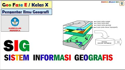
Sistem Informasi Geografi (SIG) bagian 1
Summary
TLDRIn this informative session on Geographic Information Systems (GIS), the instructor outlines the essential components and functionalities of GIS, emphasizing its role in managing and analyzing spatial data. Key concepts such as the differences between spatial and textual data, the importance of trained personnel, and the various data structures are discussed. The lesson highlights the practical applications of GIS in real-world scenarios, including tools like Google Maps, showcasing how GIS enhances decision-making in urban planning and resource management.
Takeaways
- 😀 GIS is a system for capturing, storing, and analyzing geospatial data to aid decision-making.
- 🌍 The main components of GIS include hardware, software, data, human resources, and methods.
- 📊 GIS differentiates between spatial data (maps, images) and attribute data (descriptions).
- ⚙️ Spatial data can be represented in vector (points, lines, polygons) or raster (grid) formats.
- 💡 GIS improves data retrieval speed and efficiency compared to traditional methods.
- 🔄 Regular updates and maintenance of GIS data enhance its accuracy and usability.
- 📈 Visualization in GIS allows for better interpretation and analysis of complex datasets.
- 🏙️ Applications of GIS span urban planning, environmental management, and transportation.
- 🔍 The integration of GIS technology facilitates better resource management and urban development.
- 🗣️ Engagement with students is encouraged for questions and deeper understanding of GIS concepts.
Q & A
What is the main focus of the lesson discussed in the transcript?
-The lesson focuses on Geographic Information Systems (GIS), covering its basic concepts, subsystems, components, and data structures.
What does the acronym GIS stand for?
-GIS stands for Geographic Information Systems.
What are the primary objectives of this GIS lesson?
-The objectives include understanding the basic concepts of GIS, its subsystems, components, and data structures.
Why is spatial data considered more effective than textual data?
-Spatial data is more engaging and easier to interpret visually, as it can convey complex information more effectively than textual descriptions.
What are the main components of a Geographic Information System?
-The main components include hardware, software, data, procedures, and human resources.
How does the lesson differentiate between manual and digital data processing?
-Digital processing is faster, more systematic, and allows for easier data retrieval and analysis compared to manual processing, which is slower and more labor-intensive.
What is meant by 'data input' in the context of GIS?
-Data input refers to the collection and entry of various types of data into the GIS for processing and analysis.
What are the two types of data structures mentioned in GIS?
-The two types of data structures are spatial data (representing geographical features) and attribute data (providing descriptive information about these features).
What role do human resources play in GIS?
-Human resources are essential for operating the system, processing data, and making decisions based on the analyzed information.
What is the significance of understanding GIS in modern applications?
-Understanding GIS is crucial for effective planning and management in areas like urban development, natural resource management, and environmental protection.
Outlines

このセクションは有料ユーザー限定です。 アクセスするには、アップグレードをお願いします。
今すぐアップグレードMindmap

このセクションは有料ユーザー限定です。 アクセスするには、アップグレードをお願いします。
今すぐアップグレードKeywords

このセクションは有料ユーザー限定です。 アクセスするには、アップグレードをお願いします。
今すぐアップグレードHighlights

このセクションは有料ユーザー限定です。 アクセスするには、アップグレードをお願いします。
今すぐアップグレードTranscripts

このセクションは有料ユーザー限定です。 アクセスするには、アップグレードをお願いします。
今すぐアップグレード5.0 / 5 (0 votes)


