Penginderaan Jauh
Summary
TLDRThis educational video script introduces remote sensing, a technology used to gather information about objects or phenomena without direct contact. It explains the components of remote sensing, including light sources, atmosphere, objects, vehicles carrying sensors, sensors, receivers, data management, and users. The script also covers the types of images produced by remote sensing, such as photo and non-photo images, and their classifications based on the electromagnetic spectrum. Examples of satellite images and their applications in weather forecasting and resource monitoring are provided, concluding with an encouragement to learn geography and aim for high scores.
Takeaways
- 🌐 The script introduces remote sensing, also known as RS or Inderaja, as a science and art of obtaining information about objects, areas, or phenomena without direct contact.
- 🔍 Remote sensing involves analyzing data obtained from satellites or other devices that capture images or readings from a distance.
- 🌞 The process includes components such as energy sources (active or passive), the atmosphere, objects or phenomena on Earth, vehicles carrying sensors, sensors or cameras, receiving stations, data management, and users.
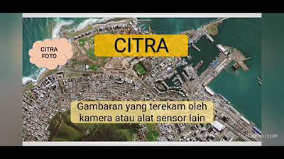
- 📸 There are two types of images in remote sensing: photo images and non-photo images. Photo images are captured using cameras, while non-photo images are captured using electromagnetic waves.
- 🌈 Photo images can be classified into five categories based on the electromagnetic spectrum: ultraviolet, orthochromatic, panchromatic, infrared, and modified infrared.
- 📈 Non-photo images include thermal infrared, radar, and microwave images, and can be further classified based on the sensor type and platform used.
- 🌍 Examples of satellite remote sensing include weather monitoring satellites like NOAA from the USA and Meteor from Russia, and resource monitoring satellites like Landsat from the USA, SPOT from France, and others.
- 📷 The script explains different types of aerial photography based on the orientation of the camera, the type of camera, color, and the platform used (aircraft or satellite).
- 🌳 Photo images can detect various features on Earth's surface, such as oil spills, coastlines, water depth, and the health of vegetation.
- 🚀 The script highlights the importance of remote sensing in various applications, from weather forecasting to natural resource management and environmental monitoring.
- 📚 The video script is part of an educational series on geography, aiming to teach and inspire students to learn more about the subject and achieve high grades.
Q & A
What is remote sensing?
-Remote sensing is the science and art of obtaining information about objects, areas, or phenomena by analyzing data obtained without direct contact with the objects, areas, or phenomena being studied.
What are the various products of remote sensing?
-Examples of remote sensing products include Google Earth and Google Maps, which are obtained from satellite images located far in space.
What are the components of remote sensing?
-The components of remote sensing include the energy source, the atmosphere, the object, the vehicle, the sensor or camera, the ground receiving station, the data management resources, and the user.
How does the process of remote sensing work?
-The process of remote sensing involves the energy source passing through the atmosphere to illuminate objects on the Earth's surface, the objects being recorded by a camera or sensor, the sensor or camera sending data to a ground receiving station, and the data being sent to data management or human resources, and finally to the user.
What are the two types of images in remote sensing?
-The two types of images in remote sensing are photographic images and non-photographic images.
What is the difference between photographic and non-photographic images?
-Photographic images are pictures of an object made with a camera, usually taken from aircraft, air balloons, etc. Non-photographic images are pictures of an object made with tools other than a camera, typically with the help of electromagnetic waves, usually taken from space satellites.
What are the five classifications of photographic images according to the electromagnetic spectrum?
-The five classifications of photographic images according to the electromagnetic spectrum are ultraviolet, orthochromatic, panchromatic or conventional, infrared original, and infrared modified.
What are the different types of aerial photographs based on the orientation of the camera?
-Aerial photographs can be classified into vertical aerial photographs, where the camera's axis is perpendicular to the Earth's surface, and oblique aerial photographs, where the camera's axis is between vertical and horizontal.
How are non-photographic images classified?
-Non-photographic images are classified based on the electromagnetic spectrum into infrared thermal, radar, and microwave images.
What are the examples of satellite remote sensing for different purposes?
-Examples of satellite remote sensing for different purposes include meteorological satellites like NOAA and Meteor, natural resource satellites like Landsat and SPOT, and ocean monitoring satellites like C-Save and MOS.
What is the importance of remote sensing in geography?
-Remote sensing is important in geography as it allows for the study of the Earth's surface and phenomena without direct contact, which can be crucial for understanding geographical patterns and changes over time.
Outlines

このセクションは有料ユーザー限定です。 アクセスするには、アップグレードをお願いします。
今すぐアップグレードMindmap

このセクションは有料ユーザー限定です。 アクセスするには、アップグレードをお願いします。
今すぐアップグレードKeywords

このセクションは有料ユーザー限定です。 アクセスするには、アップグレードをお願いします。
今すぐアップグレードHighlights

このセクションは有料ユーザー限定です。 アクセスするには、アップグレードをお願いします。
今すぐアップグレードTranscripts

このセクションは有料ユーザー限定です。 アクセスするには、アップグレードをお願いします。
今すぐアップグレード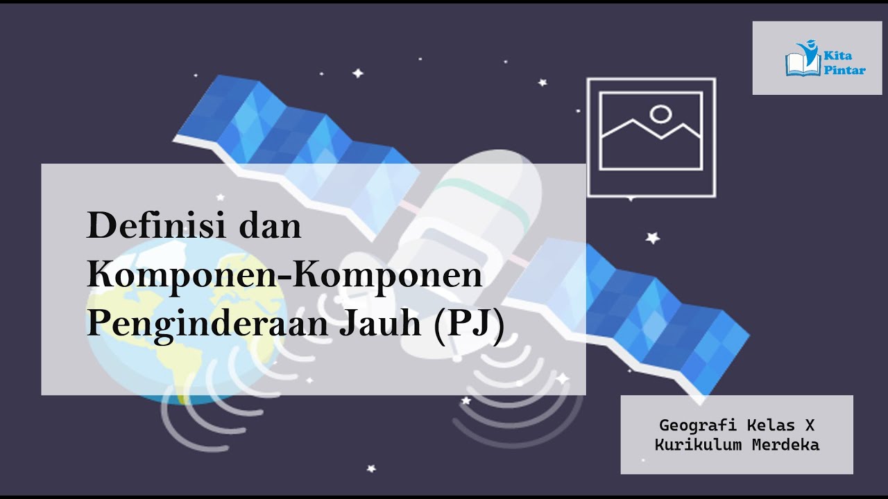


5.0 / 5 (0 votes)
