Public Weather Forecast issued at 4AM | September 15, 2024 - Sunday
Summary
TLDRThe weather update for September 15, 2024, indicates no current low-pressure areas within the Philippines' area of responsibility, but monitoring is ongoing for cloud clusters in Luzon and the Southern Luzon Visayas area. These could develop into low-pressure areas, potentially bringing rain to Northern Luzon. Continuous heavy rain is expected in Southern Luzon and the Visayas due to the Southwest Monsoon. Metro Manila and nearby areas can expect scattered rain and thunderstorms. For safety, residents are advised to be vigilant against floods and landslides, and fishermen are warned against sailing due to the Southwest Monsoon's effects. PAGASA advises continuous monitoring for updates and urges the public to stay informed through their website.
Takeaways
- ☀️ The current date is September 15, 2024, and the weather update is for the next 24 hours.
- 🌧️ No typhoon or low-pressure area is currently affecting the area of responsibility, but cloud clusters are being monitored.
- 🌤️ Cloud clusters in the eastern part of Luzon and Southern Luzon Visayas area may develop circulation within 24 to 48 hours.
- 🌦️ If these clusters become a low-pressure area, they could bring rain to the eastern part of Northern Luzon.
- 🌧️ The majority of the country is still experiencing rain due to the southwest monsoon.
- 🌨️ The western section of Southern Luzon and Visayas continues to experience heavy and continuous rain.
- 🌪️ The southwest monsoon is expected to continue affecting the weather, potentially causing flooding and landslides.
- 🌈 In Metro Manila and Calabarzon, the weather will be partly cloudy with a chance of rain.
- 🌡️ Temperatures in Metro Manila range from 25 to 30°C, while in the Visayas and Mindanao, temperatures are slightly higher.
- ⚠️ There are high tide warnings due to the southwest monsoon, particularly in Western Visayas and other coastal areas.
- 🌊 Fishermen and those with small fishing boats are advised not to venture out to sea due to the dangerous conditions.
Q & A
What is the current date mentioned in the weather update?
-The current date mentioned in the weather update is September 15, 2024.
Is there any low pressure area or weather disturbance within the area of responsibility?
-As of the current update, there is no low pressure area or weather disturbance within the area of responsibility.
What are the areas being monitored for cloud clusters?
-The areas being monitored for cloud clusters are the eastern part of Luzon and the eastern part of Southern Luzon and Visayas.
What is the potential development of the cloud clusters in the next 24 to 48 hours?
-The cloud clusters may develop circulation within 24 to 48 hours, and if they become a full low pressure area, they could bring rain to the western parts of Northern Luzon.
Which areas are expected to experience continuous rain?
-The western section of Southern Luzon and Visayas are expected to experience continuous heavy rain due to the southwest monsoon.
What is the weather forecast for Metro Manila and nearby areas?
-Metro Manila and nearby areas like Zambales, Bataan, and Calabarzon can expect partly cloudy to cloudy skies with a chance of moderate to heavy rain.
What is the temperature range in Metro Manila?
-The temperature in Metro Manila ranges from 25 to 30 degrees Celsius.
Are there any areas with a high risk of flooding or landslides?
-Yes, areas in the northern part of Palawan, Occidental Mindoro, and parts of MIMAROPA, Albay, Masbate, and Sorsogon are at risk of flooding and landslides.
What is the weather outlook for the Visayas and Mindanao regions?
-The Visayas and Mindanao regions, particularly Aklan, Antique, and Negros Occidental, can expect continuous heavy rain due to the southwest monsoon.
What is the weather advisory for the next few days?
-The weather advisory indicates heavy to intense rain in the northern part of Palawan, Occidental Mindoro, Aklan, Antique, and Negros Occidental, with moderate to heavy rain in Batangas, Albay, Sorsogon, Masbate, and other parts of MIMAROPA, Western Visayas, and the Negros Island region.
What is the Gil warning level and which areas does it affect?
-The Gil warning level is high due to the southwest monsoon, affecting areas such as Occidental Mindoro, Palawan, Romblon, Western Visayas, and the Negros Island region, among others.
Outlines

このセクションは有料ユーザー限定です。 アクセスするには、アップグレードをお願いします。
今すぐアップグレードMindmap

このセクションは有料ユーザー限定です。 アクセスするには、アップグレードをお願いします。
今すぐアップグレードKeywords

このセクションは有料ユーザー限定です。 アクセスするには、アップグレードをお願いします。
今すぐアップグレードHighlights

このセクションは有料ユーザー限定です。 アクセスするには、アップグレードをお願いします。
今すぐアップグレードTranscripts

このセクションは有料ユーザー限定です。 アクセスするには、アップグレードをお願いします。
今すぐアップグレード関連動画をさらに表示
Public Weather Forecast issued at 4PM | September 23, 2024 - Monday
Public Weather Forecast issued at 4AM | November 9, 2024 - Saturday

Pagasa Weather Update Today October 15, 2024 | Ulat Sa Panahon Today | Bagyo Update Today
Public Weather Forecast issued at 4AM | September 24, 2024 - Tuesday

Today's Weather 4 A.M. | Oct. 9, 2024
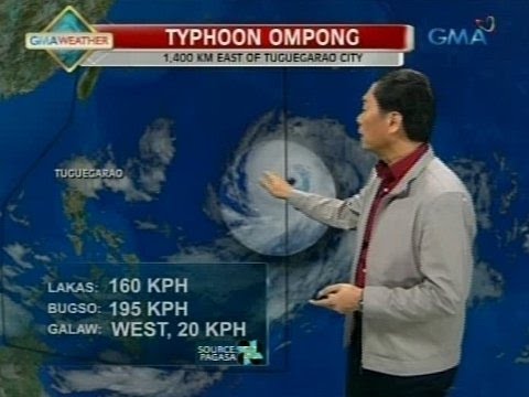
24 Oras: PAGASA: Bagyong Ompong, magtatagal sa loob ng PAR hanggang Biyernes
5.0 / 5 (0 votes)
