How to read Latitude and Longitude Coordinates
Summary
TLDRThe video script explores the latitude and longitude coordinate system, essential for pinpointing any location on Earth. Originated by Greek astronomer Hipparchus, it's now integral to GPS and GIS. The Earth is sectioned into horizontal latitude lines and vertical longitude lines, with the equator as the zero-degree reference. Key points include the North and South Poles at 90 degrees, the Tropic of Cancer and Capricorn at 23.5 degrees, and the Arctic and Antarctic circles at 66.5 degrees. The Prime Meridian, near London, serves as the zero longitude reference. Coordinates are precised into degrees, minutes, and seconds, exemplified by the Great Pyramid of Giza's location. The tutorial invites viewers to locate coordinates of iconic places like the Sydney Opera House, Uluru, and Mount Cook.
Takeaways
- 🌐 Latitude and Longitude is a coordinate system for pinpointing any location on Earth.
- 📜 The concept was first devised by Greek astronomer Hipparchus.
- 🌍 It's essential for global positioning and geographical information systems.
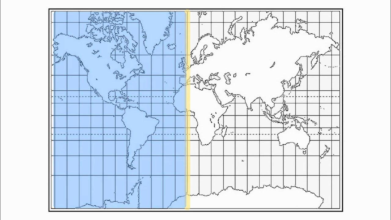
- 📏 The Earth is divided into horizontal lines of latitude and vertical lines of longitude.
- 🔢 Latitude is measured from 0° at the equator to 90° at the poles, with north and south designations.
- 🌞 The Tropic of Cancer and Tropic of Capricorn are at 23°26′11.9″ N and S, respectively.
- ❄️ The Arctic and Antarctic Circles are at 66°33′44″ N and S, marking the boundaries of the temperate zones.
- 📍 Longitude starts from the Prime Meridian near the Royal Observatory in Greenwich, UK.
- 🌐 The Antipodal Meridian of Greenwich is 180°W and 180°E, dividing the Earth into Western and Eastern Hemispheres.
- 🕒 Latitude and longitude are further divided into minutes and seconds for precision, with 60 minutes in a degree and 60 seconds in a minute.
- 🏺 Coordinates are written with degrees, minutes, and seconds, such as the Great Pyramid of Giza at 29°58′45.03″ N, 31°08′03.69″ E.
Q & A
What is the Latitude and Longitude coordinate system used for?
-The Latitude and Longitude coordinate system is used for locating any place on the globe.
Who is credited with devising the first system for locating geographical positions by means of latitudes and longitudes?
-The first system for locating geographical positions by means of latitudes and longitudes was devised by Greek astronomer Hipparchus.
How is the Earth divided in terms of latitude and longitude?
-The Earth is divided into horizontal lines of latitude and vertical lines of longitude.
What are the lines of latitude also known as, and how are they read?
-Lines of latitude are also known as parallels and are read in terms of north and south of the equator.
What are the coordinates of the North and South Poles in terms of latitude?
-The North Pole is at 90 degrees latitude north of the Equator, and the South Pole is at 90 degrees latitude south of the Equator.
What is the significance of the Tropic of Cancer and Tropic Capricorn in terms of latitude?
-The Tropic of Cancer is at 23°26′11.9″ N and the Tropic Capricorn is at 23°26′11.9″ S, marking the boundaries of the tropics.
What are the Arctic and Antarctic circles, and where are they located in terms of latitude?
-The Arctic and Antarctic circles are located at 66 degrees 33 minutes 44 seconds north and south of the Equator, respectively.
What is the starting point for reading longitude, and why was it chosen?
-The starting point for reading longitude is the Prime Meridian, which passes near the Royal Observatory in Greenwich, London. It was chosen as the international zero longitude reference line by an international conference in 1884.
How are degrees of latitude and longitude further divided for more precise location?
-Degrees of latitude and longitude are further divided into minutes and seconds, with 60 minutes in each degree and each minute divided into 60 seconds.
Can you provide an example of how to read the coordinates of a precise point using latitude and longitude?
-The coordinates for the Great Pyramid of Giza are written as 29 degrees 58 minutes 45.03 seconds north, 31 degrees 08 minutes and 03.69 seconds east.
What is the process for reading the minutes and seconds on a latitude or longitude line?
-Right on the line it is 00 minutes, then it goes to 01, 02, 03 and so on, up to 59 minutes before clicking to the next degree, where the minutes would be reset to 00.
Outlines

このセクションは有料ユーザー限定です。 アクセスするには、アップグレードをお願いします。
今すぐアップグレードMindmap

このセクションは有料ユーザー限定です。 アクセスするには、アップグレードをお願いします。
今すぐアップグレードKeywords

このセクションは有料ユーザー限定です。 アクセスするには、アップグレードをお願いします。
今すぐアップグレードHighlights

このセクションは有料ユーザー限定です。 アクセスするには、アップグレードをお願いします。
今すぐアップグレードTranscripts

このセクションは有料ユーザー限定です。 アクセスするには、アップグレードをお願いします。
今すぐアップグレード関連動画をさらに表示

Latitude and Longitude-Hommocks Earth Science Department

Latitude and Longitude

Equatorial Coordinate System Explained: How Astronomers Navigate the Celestial Sphere

COORDENADA GEOGRÁFICA: Paralelos, Meridianos, Latitudes e Longitudes

Edexcel GCSE (9-1) Astronomy, Topic 1: The Earth (summary)

GEOMETRI ELLIPSOID DAN ELLIPSOIDA REFERENSI BUMI SERTA KOORDINAT PADA ELLIPSOIDA (BUMI) Bagian 2
5.0 / 5 (0 votes)
