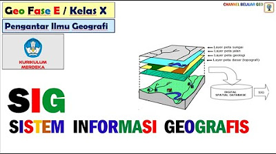
KOMPONEN SISTEM INFORMASI GEOGRAFIS (SIG)
Summary
TLDRThis video explains the key components of a Geographic Information System (GIS), including spatial data (raster and vector models) and attribute data. It covers the hardware, software, and human elements (brainware) essential for GIS operations. The video highlights how spatial data is represented in different formats, how hardware supports GIS tasks, and the software tools used for data analysis and presentation. The importance of human expertise in managing and analyzing geographic data is emphasized, making this an essential overview for understanding GIS technology and its applications.
Takeaways
- 😀 GIS (Geographic Information System) integrates computer hardware, software, and geographic data for analysis and display.
- 😀 GIS data is categorized into two types: spatial data (geographical coordinates) and attribute data (descriptive values).
- 😀 Spatial data can be represented in two main models: Raster (pixel-based grid) and Vector (point, line, and polygon).
- 😀 Raster data model uses a matrix of pixels to represent spatial data, ideal for continuous data like temperature or elevation.
- 😀 The Vector data model uses points, lines, and polygons to represent discrete geographical objects like roads or lakes.
- 😀 Point data represents simple locations (e.g., health centers or facilities), while line data represents features like rivers and roads.
- 😀 Polygon data represents areas, like lakes, land boundaries, or administrative zones.
- 😀 Attribute data provides additional information about spatial features and is usually stored in tables (e.g., name of a school or condition of a road).
- 😀 Computer hardware for GIS includes input devices (scanners, digitizers), processing units (CPU), and output devices (printers, plotters).
- 😀 GIS software tools like ArcGIS, ERMapper, and Quantum GIS (QGIS) are used to process, analyze, and visualize spatial data.
- 😀 Brainware refers to human operators who manage the GIS system, requiring expertise in technology, data analysis, and geographic science.
Q & A
What are the main components of a Geographic Information System (GIS)?
-The main components of a GIS include data, geographic information, computer systems, and brainware (human involvement).
What is the difference between spatial data and attribute data in GIS?
-Spatial data refers to the geographical location or coordinates of an object on the Earth's surface, whereas attribute data provides information about the characteristics or properties of the spatial data.
What are the two types of spatial data models in GIS?
-The two types of spatial data models in GIS are raster data and vector data.
How is raster data presented in GIS?
-Raster data is presented using a matrix structure composed of pixels, where each pixel represents a specific data value in a grid format.
How is vector data represented in GIS?
-Vector data is represented using points, lines, and polygons, which describe spatial features such as locations, roads, or land boundaries.
What are the three types of vector data in GIS?
-The three types of vector data in GIS are points, lines, and polygons. Points represent simple locations, lines represent linear features like roads, and polygons represent area features like lakes or land boundaries.
What is attribute data in GIS and how is it stored?
-Attribute data stores descriptive information about spatial features, such as the name or status of a road. It is typically stored in tabular form, such as spreadsheets or databases.
What role does hardware play in a GIS system?
-Hardware in a GIS system includes computer components that support spatial data processing and analysis, such as input devices (e.g., scanners), processors (e.g., CPUs), and output devices (e.g., printers).
What is the importance of software in GIS?
-GIS software is crucial for processing, analyzing, and displaying spatial data. Examples include programs like ArcGIS, ERMapper, and Quantum GIS, which are used to manipulate geographic information.
What is the role of brainware in GIS?
-Brainware refers to the human element in a GIS system. Individuals involved in GIS operations are responsible for managing, analyzing, and presenting geographic data. Their expertise and technological knowledge are essential for the effective functioning of the system.
Outlines

Cette section est réservée aux utilisateurs payants. Améliorez votre compte pour accéder à cette section.
Améliorer maintenantMindmap

Cette section est réservée aux utilisateurs payants. Améliorez votre compte pour accéder à cette section.
Améliorer maintenantKeywords

Cette section est réservée aux utilisateurs payants. Améliorez votre compte pour accéder à cette section.
Améliorer maintenantHighlights

Cette section est réservée aux utilisateurs payants. Améliorez votre compte pour accéder à cette section.
Améliorer maintenantTranscripts

Cette section est réservée aux utilisateurs payants. Améliorez votre compte pour accéder à cette section.
Améliorer maintenant5.0 / 5 (0 votes)


