Where is it? Celestial coordinates explained
Summary
TLDRThis video script explores various coordinate systems, starting with the Earth's latitude and longitude, which use the equator and prime meridian as references. It then delves into celestial coordinates, highlighting the equatorial system with right ascension and declination, and the historical ecliptic system. The script also introduces the horizontal coordinate system (Alt-Az), which is based on local observations relative to the horizon and north. The presenter, Nico Carver, simplifies complex astronomical concepts and mentions tools like GO-TO systems and planetarium apps that aid in understanding these systems, promising a future discussion on the apparent size of celestial objects.
Takeaways
- đ A typical coordinate system uses reference planes to define positions, like latitude and longitude on Earth.
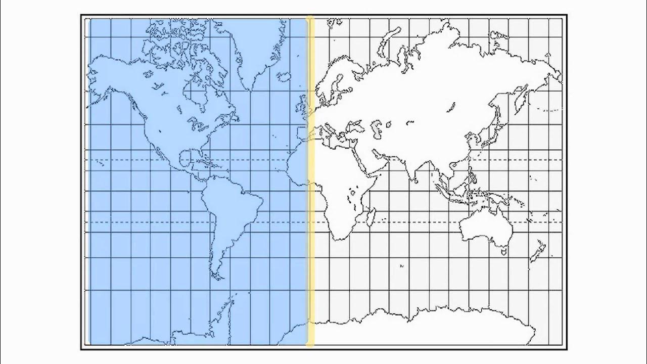
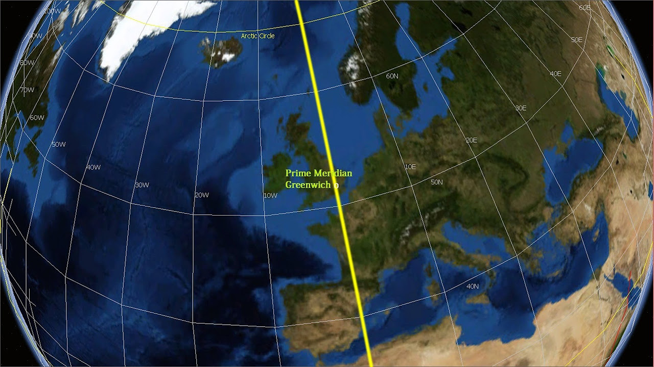
- đ Latitude measures the angular distance north or south from the equator, while longitude measures east or west from the prime meridian in Greenwich, England.
- đ In celestial coordinates, the equatorial system uses the Earth's equator as a reference plane extended into space.
- đ° Right ascension, part of equatorial coordinates, is measured eastward from the sun's position at the vernal equinox and is often expressed in hours, minutes, and seconds.
- đĄ Declination in the equatorial system is similar to latitude, measuring up or down from the celestial equator, and is expressed in degrees.
- đ The equatorial mount's 'GPS', or GO-TO system, uses location and time data to automatically point a telescope at celestial objects.
- đ The horizontal coordinate system, or Alt-Az, uses the observer's local north and horizon as reference planes, varying with time and location.
- đ± Planetarium software and apps can convert equatorial coordinates to horizontal coordinates, simplifying astronomical observations.
- đ The book 'Longitude' by Dava Sobel provides a detailed history of why Greenwich was chosen as the prime meridian reference.
- đ The vernal equinox's significance in astronomy is its use as a fixed point for measuring right ascension in the celestial coordinate system.
Q & A
What are the two reference planes in a typical coordinate system?
-In a typical coordinate system, the two reference planes are used to define any location as the distance from these planes.
What is the significance of the equator and the prime meridian in the context of latitude and longitude?
-The equator serves as the reference plane for measuring latitude, which is the angular distance north or south from the equator. The prime meridian in Greenwich, England, is the reference for measuring longitude, which is the angular distance east or west from Greenwich.
Why do we measure longitude from the Royal Observatory in Greenwich, England?
-The script does not provide the reason in this context, but it suggests reading 'Longitude' by Dava Sobel for a detailed explanation.
What is the ecliptic and how does it relate to the zodiac constellations?
-The ecliptic is the path that the sun appears to follow over the course of a year, and it is the basis for the positions of the zodiac constellations.
How does the equatorial coordinate system differ from the ecliptic system?
-The equatorial coordinate system uses the Earth's equator as a reference plane extended into space, unlike the ecliptic system which is based on the sun's path.
What are the two components of equatorial coordinates for the night sky?
-The two components are right ascension, measured eastward from the sun's position on the vernal equinox, and declination, measured from the Earth's equator projected into space.
Why is right ascension commonly measured in hours, minutes, and seconds instead of degrees?
-Right ascension is measured in hours, minutes, and seconds to divide the celestial sphere into 24 parts, analogous to the hours on a clock, rather than 360 degrees.
What is a GO-TO system in the context of equatorial mounts for telescopes?
-A GO-TO system is an automated feature that uses the observer's location, time, and date to calculate and point the telescope to specific celestial objects.
What is the horizontal coordinate system, also known as Alt-Az, and how does it differ from equatorial coordinates?
-The horizontal coordinate system, or Alt-Az, uses the observer's local north and the horizon as reference planes, providing coordinates that are specific to the time and location of the observation. It differs from equatorial coordinates which are constant regardless of the observer's location and time.
Why are horizontal coordinates (Alt-Az) easier to understand for observers?
-Horizontal coordinates are easier to understand because they relate directly to the observer's local environment, with altitude indicating height above the horizon and azimuth indicating direction from north.
How can the apparent position of celestial objects change when switching from equatorial to horizontal coordinates?
-The apparent position of celestial objects can change when switching from equatorial to horizontal coordinates because the latter is dependent on the observer's location and the time of observation, while the former is a fixed reference frame.
Outlines
đ Understanding Coordinate Systems
This paragraph introduces the concept of coordinate systems, explaining that any location can be defined by distances from reference planes. The example of latitude and longitude is used, with the equator and the prime meridian in Greenwich, England, serving as reference planes. Latitude measures the angular distance north or south from the equator, while longitude measures east or west from Greenwich. The speaker's current coordinates are given as 42 degrees north and 71 degrees west, illustrating the concept. The paragraph also touches on the historical choice of Greenwich as the starting point for longitude measurements, suggesting further reading in Dava Sobel's book 'Longitude'. The discussion then shifts to celestial coordinate systems, highlighting the ecliptic and equatorial systems. The equatorial system uses the Earth's equator as a reference plane and introduces the concept of right ascension and declination, which are used to locate stars in the night sky. Right ascension is measured eastward from the sun's position during the vernal equinox, while declination is measured from the Earth's equator projected into space. The paragraph concludes with a mention of the equatorial coordinate system's practical application in astronomy, including the use of star charts and equatorial mounts for telescopes.
Mindmap
Keywords
đĄCoordinate System
đĄLatitude
đĄLongitude
đĄEquatorial Coordinate System
đĄRight Ascension
đĄDeclination
đĄCelestial Sphere
đĄVernal Equinox
đĄHorizontal Coordinate System
đĄAltitude and Azimuth
đĄZenith
Highlights
A typical coordinate system uses at least two reference planes to define any location.
Latitude/longitude uses the equator and the prime meridian in Greenwich as reference planes.
Latitude measures angular distance north or south from the equator.
Longitude measures angular distance east or west from Greenwich.
The reason for starting longitude measurement from Greenwich is detailed in Dava Sobel's book 'Longitude'.
The ecliptic, the sun's path throughout the year, is an ancient celestial coordinate system reference plane.
The equatorial coordinate system uses the earth's equator as a reference plane extended into space.
The celestial coordinate system's second reference plane is based on the sun's position at the vernal equinox.
Right ascension in equatorial coordinates is measured eastward from the vernal equinox point.
Declination in equatorial coordinates is measured from the earth's equator projected into space.
Declination is measured in degrees, similar to latitude.
Right ascension is commonly measured in hours, minutes, and seconds, dividing the celestial sphere into 24 hours like a clock.
Equatorial mounts with GO-TO systems automate telescope pointing based on location, time, and date.
Horizontal coordinate system (Alt-Az) uses the observer's local north and horizon as reference planes.
Alt-Az coordinates change with time of day but are easier to understand for immediate observation.
Azimuth in Alt-Az is the angular distance from north, with 90 degrees indicating due east.
Altitude in Alt-Az is the angular distance from the horizon, with 90 degrees indicating straight up at the zenith.
Modern software like Stellarium can convert equatorial to horizontal coordinates automatically.
Upcoming discussion will cover the apparent size of space objects and how field of view affects deep sky object viewing.
Transcripts
In a typical coordinate system you have at least two reference planes and then any location
can be explained as the distance from those planes.
So, for example, for latitude/longitude, the two reference planes are the equator and the
prime meridian in Greenwich, england.
Latitude is your angular distance either north or south from the equator and longitude is
your angular distance east or west from Greenwich.
So when I say my coordinates right now are 42 degrees north by 71 degrees west.
That means Iâm 42 degrees north of the equator, and 71 degrees west of the British Royal Observatory
in Greenwich, England.
Now you may have never considered why do we start measuring Longitude from that specific
place in Greenwich.
I wonât answer that in this video, but I will point you to a great book by Dava Sobel
called Longitude for the whole story there.
Now, letâs move on to the stars in what we call a celestial coordinate system.
There are lots of possible reference planes for making a celestial coordinate system and
one of the earliest used by ancient people was the ecliptic which is the path that the
sun moves throughout the year and is where the zodiac constellations come from.
The more common coordinate system today though is equatorial which as the name suggests uses
the earthâs equator as a reference plane, basically just imagine the equator of the
earth going out into space forever.
The other reference plane is a bit more complex to wrap your head around as itâs both a
time and a location.
The reason it has to be both a time and a location is we are both rotating around our
own axis, but also rotating around the sun, which is why there are different constellations
up in the summer compared to the winter, because we are literally facing a different part of
the milky way.
So the other reference plane is where the sun is located in the night sky at the time
of the vernal equinox in March, we then measure where the stars are located eastward from
that plane and call this right ascension.
So to review: the two parts that make up equatorial coordinates for the night sky are first right
ascension which is measured eastward from where the sun is in the night sky on the vernal
equinox, and then declination which is measured from the earthâs equator projected out into
space, up or down, with the equator being 0 degrees.
Now to make this just a bit more confusing.
Declination like latitude is measured in degrees.
Right ascension could be measured in degrees and sometimes is, but more commonly is measured
in hours, minutes and seconds.
So instead of breaking the celestial sphere into 360 parts we call degrees, we break it
into 24 parts we call hours like a clock.
Okay, so thatâs the equatorial coordinate system, you can use a star chart and what
are called setting circles on an equatorial mount if you want to go full manual.
What I think of as the âGPSâ of equatorial mounts is a GO-TO system where you tell the
system where on earth you are located and the precise time and date, and then it translates
where the stars should be in the sky, and automates the pointing of the telescope.
Now the last thing I want to talk about is another kind of coordinate system we use all
the time in astronomy called a horizontal coordinate system, also known simply as Alt-Az.
Which is short for altitude and azimuth.
With alt-az the two reference planes are North and the horizon at the actual time and location
of where you are observing.
Itâs called a horizontal coordinate system, but another way Iâd think of it is just
a local coordinate system thatâs just for that moment.
The coordinates donât really mean anything outside of that context.
You can see if I change my time of day in stellarium, the alt/az keep changing, but
the Ra/dec stay consistent.
BUT the reason we use alt/az all the time is they are a lot more easy to understand.
For instance if I pull up Alberio here and see the azimuth is 90 degrees I know that
is due east, and if itâs altitude is 45 degrees I know thatâs halfway up from the
horizon to the zenith.
The Zenith means straight up, which is 90 degrees.
Now there are some fancy formulas for converting equatorial coordinates to horizontal coordinates,
but luckily we live in an age where all of that info is included in free software like
stellarium or any number of free or low cost planetarium apps on your smartphone.
Next week Iâll be talking about the apparent size of objects in space, and how calculating
your field of view can tell you what kinds of deep sky objects will work best for your
gear.
Till then, this has been Nico Carver from Nebula Photos.
Clear skies!
Voir Plus de Vidéos Connexes
Equatorial Coordinate System Explained: How Astronomers Navigate the Celestial Sphere
How to read Latitude and Longitude Coordinates
Geographic Grid : Latitudes and Longitudes ICSE Class 9 | @sirtarunrupani
Basics of Astronomy: The Celestial Sphere
LOCATING PLACES USING COORDINATE SYSTEM I LATITUDE AND LONGITUDE I SCIENCE 7 QUARTER 4 WEEK 1
Latitude and Longitude
5.0 / 5 (0 votes)