How to read Latitude and Longitude Coordinates

Mr Gedge's Geography Channel
13 Sept 201204:07

Summary

TLDRThe video script explores the latitude and longitude coordinate system, essential for pinpointing any location on Earth. Originated by Greek astronomer Hipparchus, it's now integral to GPS and GIS. The Earth is sectioned into horizontal latitude lines and vertical longitude lines, with the equator as the zero-degree reference. Key points include the North and South Poles at 90 degrees, the Tropic of Cancer and Capricorn at 23.5 degrees, and the Arctic and Antarctic circles at 66.5 degrees. The Prime Meridian, near London, serves as the zero longitude reference. Coordinates are precised into degrees, minutes, and seconds, exemplified by the Great Pyramid of Giza's location. The tutorial invites viewers to locate coordinates of iconic places like the Sydney Opera House, Uluru, and Mount Cook.

Takeaways

  • 🌐 Latitude and Longitude is a coordinate system for pinpointing any location on Earth.
  • 📜 The concept was first devised by Greek astronomer Hipparchus.
  • 🌍 It's essential for global positioning and geographical information systems.
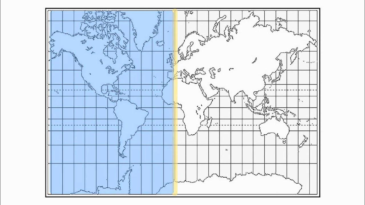
  • 📏 The Earth is divided into horizontal lines of latitude and vertical lines of longitude.
  • 🔢 Latitude is measured from 0° at the equator to 90° at the poles, with north and south designations.
  • 🌞 The Tropic of Cancer and Tropic of Capricorn are at 23°26′11.9″ N and S, respectively.
  • ❄️ The Arctic and Antarctic Circles are at 66°33′44″ N and S, marking the boundaries of the temperate zones.
  • 📍 Longitude starts from the Prime Meridian near the Royal Observatory in Greenwich, UK.
  • 🌐 The Antipodal Meridian of Greenwich is 180°W and 180°E, dividing the Earth into Western and Eastern Hemispheres.
  • 🕒 Latitude and longitude are further divided into minutes and seconds for precision, with 60 minutes in a degree and 60 seconds in a minute.
  • 🏺 Coordinates are written with degrees, minutes, and seconds, such as the Great Pyramid of Giza at 29°58′45.03″ N, 31°08′03.69″ E.

Q & A

  • What is the Latitude and Longitude coordinate system used for?

    -The Latitude and Longitude coordinate system is used for locating any place on the globe.

  • Who is credited with devising the first system for locating geographical positions by means of latitudes and longitudes?

    -The first system for locating geographical positions by means of latitudes and longitudes was devised by Greek astronomer Hipparchus.

  • How is the Earth divided in terms of latitude and longitude?

    -The Earth is divided into horizontal lines of latitude and vertical lines of longitude.

  • What are the lines of latitude also known as, and how are they read?

    -Lines of latitude are also known as parallels and are read in terms of north and south of the equator.

  • What are the coordinates of the North and South Poles in terms of latitude?

    -The North Pole is at 90 degrees latitude north of the Equator, and the South Pole is at 90 degrees latitude south of the Equator.

  • What is the significance of the Tropic of Cancer and Tropic Capricorn in terms of latitude?

    -The Tropic of Cancer is at 23°26′11.9″ N and the Tropic Capricorn is at 23°26′11.9″ S, marking the boundaries of the tropics.

  • What are the Arctic and Antarctic circles, and where are they located in terms of latitude?

    -The Arctic and Antarctic circles are located at 66 degrees 33 minutes 44 seconds north and south of the Equator, respectively.

  • What is the starting point for reading longitude, and why was it chosen?

    -The starting point for reading longitude is the Prime Meridian, which passes near the Royal Observatory in Greenwich, London. It was chosen as the international zero longitude reference line by an international conference in 1884.

  • How are degrees of latitude and longitude further divided for more precise location?

    -Degrees of latitude and longitude are further divided into minutes and seconds, with 60 minutes in each degree and each minute divided into 60 seconds.

  • Can you provide an example of how to read the coordinates of a precise point using latitude and longitude?

    -The coordinates for the Great Pyramid of Giza are written as 29 degrees 58 minutes 45.03 seconds north, 31 degrees 08 minutes and 03.69 seconds east.

  • What is the process for reading the minutes and seconds on a latitude or longitude line?

    -Right on the line it is 00 minutes, then it goes to 01, 02, 03 and so on, up to 59 minutes before clicking to the next degree, where the minutes would be reset to 00.

Outlines

00:00

🌐 Introduction to Latitude and Longitude

This paragraph introduces the concept of latitude and longitude, a coordinate system used for pinpointing locations on Earth. It was first developed by the Greek astronomer Hipparchus and is now integral to global positioning and geographical information systems. The Earth is divided into horizontal lines of latitude and vertical lines of longitude. Latitude is measured from the equator (0 degrees) to the poles (90 degrees North and South), with the Tropic of Cancer and Capricorn marking the boundaries of the tropics. The Arctic and Antarctic Circles define the temperate zone. Longitude, measured from the Prime Meridian near Greenwich, UK, extends 180 degrees east and west. The system uses degrees, minutes, and seconds for precision, with 60 minutes in a degree and 60 seconds in a minute. The paragraph concludes with an invitation to locate the coordinates of three famous landmarks: the Sydney Opera House, Uluru (Ayers Rock), and Mount Cook.

Mindmap

Keywords

💡Latitude and Longitude

Latitude and Longitude is a coordinate system used to pinpoint any location on Earth. It is foundational to the video's theme as it sets the stage for understanding how geographical positions are determined. Latitude lines run horizontally and are measured in degrees north or south of the equator, while longitude lines, known as meridians, run vertically and are measured east or west from the Prime Meridian. The script uses this concept to explain how the Earth is divided into grids for navigation and location purposes.

💡Hipparchus

Hipparchus was a Greek astronomer who is credited with devising the first system for locating geographical positions using latitudes and longitudes. His contribution is significant to the video's narrative as it provides historical context to the coordinate system's origins, highlighting the long-standing importance of this method in geographical studies and navigation.

💡Global Positioning System (GPS)

GPS is a system that uses satellite signals to determine the precise location of a receiver on Earth. In the video, GPS is mentioned as a modern application of the latitude and longitude system, showcasing how ancient concepts have been adapted into cutting-edge technology for navigation and location services.

💡Geographical Information Systems (GIS)

GIS refers to systems designed for capturing, storing, analyzing, and managing data related to positions on Earth. The video mentions GIS to illustrate a contemporary use of the latitude and longitude system, emphasizing its relevance in managing and analyzing spatial data for various applications.

💡Equator

The Equator is the imaginary line on the Earth's surface at 0 degrees latitude, dividing the planet into the Northern and Southern Hemispheres. The video uses the Equator as a reference point to explain the concept of latitude, noting that it is the starting line from which degrees of latitude are measured.

💡North Pole and South Pole

The North Pole and South Pole are the northernmost and southernmost points on Earth, respectively, each at 90 degrees latitude. The video mentions these poles to describe the extreme points of latitude, highlighting the division of the Earth into hemispheres and the significance of latitude in defining global positions.

💡Tropic of Cancer and Tropic of Capricorn

The Tropic of Cancer and Tropic of Capricorn are the most northerly and southerly circles of latitude at which the sun can be directly overhead. In the video, these lines are used to demonstrate how specific latitudes mark significant climatic zones, with the tropics lying between these lines and experiencing a warm climate year-round.

💡Arctic and Antarctic Circles

The Arctic and Antarctic Circles are the northern and southern latitudes at approximately 66 degrees 33 minutes 44 seconds, respectively. The video discusses these circles to define the boundaries of the temperate and polar zones, explaining how latitude influences climate and environmental conditions.

💡Meridians

Meridians, also known as lines of longitude, are the vertical lines that run from the North Pole to the South Pole and are used to measure east-west position. The video explains that meridians are crucial for determining precise locations on Earth, with the Prime Meridian serving as the reference point for all other longitudes.

💡Prime Meridian

The Prime Meridian is the zero degrees longitude line that passes through the Royal Observatory in Greenwich, London. The video highlights the Prime Meridian's role as the reference line for all other longitudes, emphasizing its historical and geographical significance in global navigation and timekeeping.

💡Minutes and Seconds in Coordinates

In the context of latitude and longitude, minutes and seconds are subdivisions of a degree used to specify a location more precisely. The video explains that each degree is divided into 60 minutes, and each minute into 60 seconds, allowing for very specific geographical positioning. This concept is crucial for understanding how coordinates can pinpoint locations with high accuracy.

Highlights

Latitude and Longitude is a coordinate system for global positioning.

Hipparchus, a Greek astronomer, devised the first system for geographical positions.

The system is integral to GPS and GIS technologies.

The Earth is divided into horizontal lines of latitude and vertical lines of longitude.

Latitude is measured north and south from the equator, starting at zero degrees.

90 degrees north is the North Pole, and 90 degrees south is the South Pole.

The poles are at a 90-degree angle from the equator.

The Tropic of Cancer is at 23°26′11.9″ N, and the Tropic of Capricorn at 23°26′11.9″ S.

The area between the tropics is known as the tropical zone.

The Arctic and Antarctic circles are at 66 degrees 33 minutes 44 seconds north and south.

The temperate zone lies between the tropics and the polar circles.

Lines of longitude, or meridians, start at the Prime Meridian near Greenwich, UK.

The Prime Meridian is the international zero longitude reference line.

Longitude is measured east and west from the Prime Meridian, up to 180 degrees.

Degrees of latitude and longitude are further divided into minutes and seconds for precision.

There are 60 minutes in a degree, and each minute is divided into 60 seconds.

Coordinates are written with degrees, minutes, and seconds for exact location.

The Great Pyramid of Giza's coordinates are given as an example.

Mount Ngaruhoe in New Zealand is used to demonstrate reading coordinates.

The transcript challenges viewers to find coordinates for three famous locations.

Thank you for watching concludes the educational presentation.

Transcripts

play00:01

Latitude and Longitude is a coordinate system that is used for locating any

play00:06

place on the globe. The first ever system for locating geographical positions by

play00:12

means of latitudes and longitudes was devised by Greek astronomer named

play00:17

Hipparchus. Today it is widely used in global positioning systems and in

play00:23

geographical information systems. The earth is divided up into horizontal

play00:29

lines of latitude and vertical lines of longitude. Latitude is read first,

play00:34

longitude second. Lines of latitude also known as parallels are read in terms of

play00:41

north and south of the equator. The starting point is the equator which is

play00:46

zero degrees latitude. 90 degrees latitude north of the Equator is the

play00:51

North Pole. 90 degrees south of the Equator is the South Pole. Note that the

play00:58

poles are at a 90 degree angle from the equator.

play01:01

North of the equator is the northern hemisphere.

play01:05

South of the equator is the southern hemisphere.

play01:08

North of the Equator (23°26′11.9″ N) we have the Tropic of Cancer

play01:12

South of the Equator is the Tropic Capricorn. ( 23°26′11.9″ S)

play01:16

Between these lines are the tropics.

play01:20

At 66 degrees 33 minutes 44 seconds north and south of the Equator

play01:24

are have Arctic and Antarctic circles.

play01:29

Between here and the tropics is the temperate zone.

play01:33

Lines of longitude are also known as Meridians.

play01:37

The starting point for reading longitude is the Prime Meridian

play01:41

which is a line passing near the Royal Observatory in Greenwich near London in the United Kingdom.

play01:47

This site was chosen as the international zero longitude reference line by an international conference in 1884.

play01:55

The Antipodal Meridian of Greenwich is both 180 degrees west and 180 east.

play02:03

West of the Prime Meridian is the Western Hemisphere.

play02:07

East of the prime meridian is Eastern Hemisphere.

play02:12

To locate a precise point on the Earth's surface,

play02:16

degrees of latitude and longitude have been divided into minutes and seconds.

play02:21

There are 60 minutes in each degree and each minute is divided into 60 seconds.

play02:29

For example, the coordinates for the Great Pyramid of Giza is written as 29 degrees 58 minutes 45.03 seconds north,

play02:44

31 degrees 08 minutes and 03.69 seconds east.

play02:55

Now to show you how to read the coordinates of a precise point.

play02:58

The first example I will use is Mount Ngaruhoe in the North Island of New Zealand.

play03:04

As mentioned earlier between each degree of latitude or longitude there is a division of 60 seconds.

play03:11

Right on the line it is 00 minutes

play03:15

then it goes to 01, 02, 03 and so on.

play03:21

At the halfway point it would be 30 minutes followed by 31 minutes and so on

play03:26

until we get to 59 minutes before clicking to the next degree of latitude or longitude,

play03:33

where the minutes would be returned back to 00.

play03:36

Now that I've shown you how to read latitude and longitude,

play03:40

get a map and find the coordinates for these three locations:

play03:45

The Sydney Opera House,

play03:48

Uluru also known as Ayers Rock, in Australia

play03:53

and Mount Cook, New Zealand's highest peak.

play03:58

Thank you for watching.

Rate This

5.0 / 5 (0 votes)

Étiquettes Connexes
Geographical SystemsNavigationHipparchusGlobal PositioningCoordinate SystemLatitudeLongitudeGeographical InformationEarth's HemispheresMeridiansTropics
Besoin d'un résumé en anglais ?